That, my friends, is a lot of W’s. We are going to trek through the Great Lakes right in the middle of winter. Does this mean Lake effect snow? Maybe! There is only one way o find out, I suppose. Our drive till take one long day, covering 606 miles, bogged down by the Windy City, which will let us move at a nearly glacial pace of 62mph. We’ll get there. Sometime.
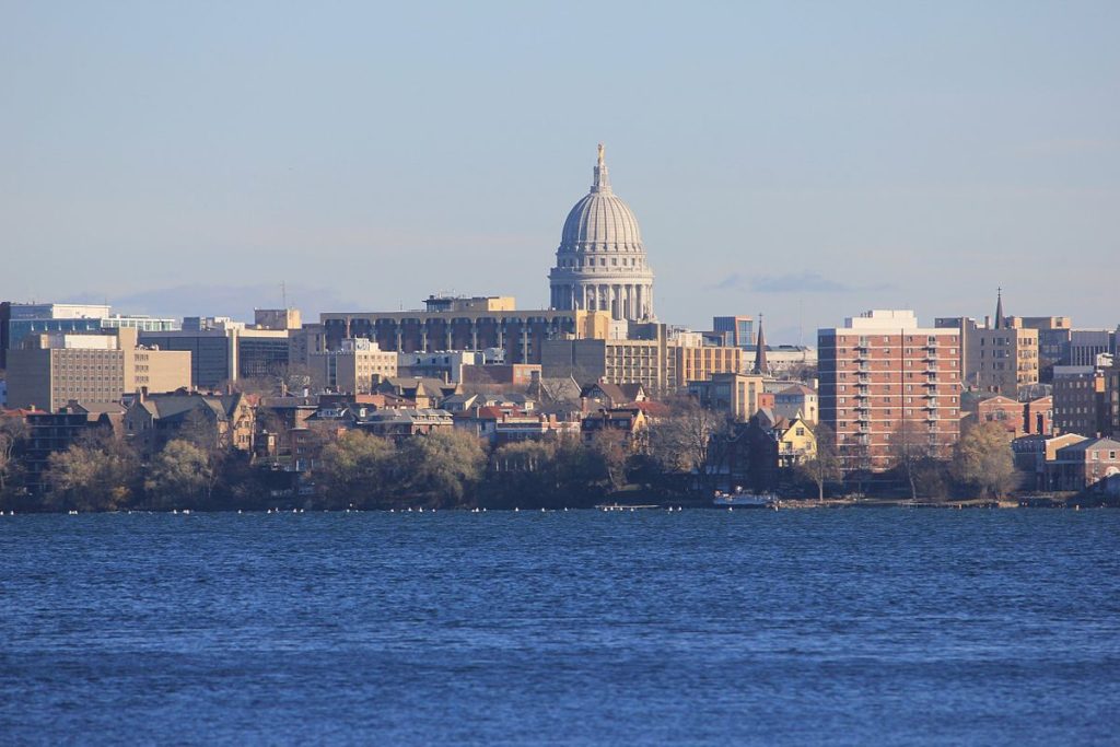
Madison, Wisconsin
It’s not Lake effect snow that will be the problem on our Saturday drive, but rather just standard, regular back side of an area of low pressure snow that will be an issue. It’s not going to be heavy, save, perhaps for the stretch of northern Indiana downwind of Lake Michigan. the snow will be wet, too, and well trafficked roads might not even ice over with the snow. But any snow, especially in a metropolitan area like Chicago, is going to really slow down travel. Snow will still be possible across Ohio, but it will be a misty, flaky brand of snow that won’t accumulate and will be tough to wipe off your windshield without the help of washer fluid. Weirton awaits, whether or not you can get the grime off your windshield.
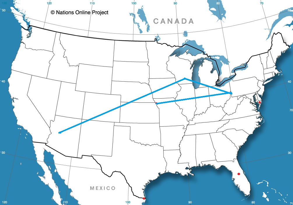
I think this might be the first road trip of the year, right? It will be a 3 day trip through the heart of the country, covering 1689 miles at a pace of about 65mph. That will mean the first two days will be complete after just short of 520 miles on days 1 and 2, with a 10 hour day coming on Sunday. 2020, here we come!
DAY ONE (Friday)
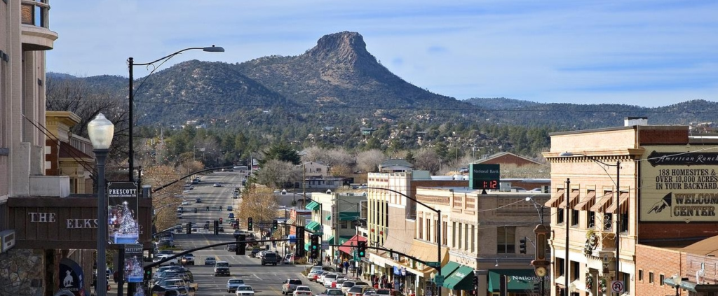
Prescott, Arizona
We are headed for a trip through the southern Rockies at the right time. Atmospheric instability is confined to the central Plains for the most part, with a dose in the northern Rockies, leaving Arizona and New Mexico fairly unperturbed. We’ll check in on Flagstaff and Albuquerque on our eastward journey, stopping west of Santa Rosa, New Mexico to end our day and our work week.
DAY TWO (Saturday) As we continue to the east, we’ll slice through a couple of Panhandles before spending the rest of the day in southern Kansas. I don’t recall ever spending much time in this part of the world on a road trip, and I especially don’t remember cutting through Wichita to get anywhere. Usually, it’s just a bypass on I-35. Not this time! Instead, we will enjoy an increasingly warm day, free of any atmospheric interference before we reach El Dorado, where we will end our day. Along the way, appreciate Greensburg, a city that has had to completely rebuild after a devastating tornado in 2007.
DAY THREE (Sunday) Sure, this day will be the longest, and it will also be the gloomiest, with clouds becoming much more likely thanks to a combination of general troughiness* over the Plains, and the melting snow north of Kansas City leading to clouds and fog along most of the route. On the other hand, at least the car won’t be unbearably hot because of the penetrative sun, and we will get to see Des Moines! And Dubuque! Both are very nice towns. So is Madison, for those unaware.
There are a lot of reasons that storm systems or wet weather don’t ever reach a location. Rather than coming up with the explanation on a per occasion basis, a lot of people just say that there was a force field around a city. Sure, there was the system moving through the Tennessee Valley towards the coast towards Hinesville last week, but I think we can just say it didn’t rain there because of a force field. earned victory. Actuals: Tuesday (14th) – High 79, Low 60 Wednesday (15th) – High 77, Low 62
Prescott is the sweet spot of Arizona. Not as hot as Phoenix in the summer, not as snowy as Flagstaff in the winter. Sweet.
At 753PM, MT, Prescott was reporting clear skies with a temperature of 40 degrees. Clear skies have moved across Arizona in the wake of a fairly wet week across the state. A high amplitude but somewhat shortwave trough is rolling through the western US, allowing for surface high pressure across the Intermountain West. Expect continued zonal flow across Arizona, which should mean a few scattered clouds in Prescott. Tomorrow – Partly cloudy, High 62, Low 27 Monday – Mostly cloudy, High 59, Low 32
TWC: Tomorrow – Mostly sunny skies. High 60, Low 29 Monday -Cloudy. High 59, Low 33
AW: Tomorrow – Mostly sunny High 60, Low 27 Monday – Mostly cloudy High 60, Low 30
NWS: Tomorrow Sunny, High 57, Low 29 Monday – Mostly cloudy High 57, Low 35
WB: Tomorrow – Mostly sunny in the morning, then becoming partly cloudy, High 59, Low 30 Monday – Mostly cloudy, High 57, Low 34
WN: Tomorrow – Mostly sunny, High 57, Low 29 Monday – Mostly cloudy, High 57, Low 34
FIO: Tomorrow – Clear throughout the day, High 59, Low 30 Monday – Overcast throughout the day. High 59, Low 34
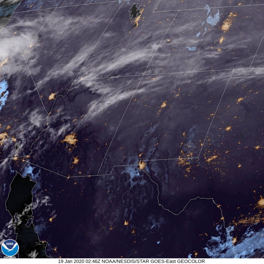
Well, that’s about it. Pretty easy breezy, if I’m being honest. Take a look at this fairly tranquil satellite imagery. I can see Phoenix!
In the next several days, I’m really going to have put on my forecast pants. with a trio of road trips, and a quartet of forecasts to challenge myself with.
Road Trip from Prescott, Arizona to Madison, Wisconsin
Road Trip from Madison to Weirton, West Virginia
St. Joseph, Missouri Road Trip from Weirton to St. Joseph
This year, there was a grand cluster of similarly competent forecasters. 5 Outlets were matched pretty well, but then there was one outlet that was very bad (sorry, Forecast.io) and one that was really good, but it took until December to realize how dominant they had been. Victoria-Weather won the month of December, while the ultimate winner for the year tied for second…. and that was all it took to finish well above the runner up this year. Congratulations to the Forecaster of the Year,
THE WEATHER CHANNEL!
For completeness, here is the chart of individual forecast wins. It shows that The Weather Channel didn’t necessarily have the highest peaks, but they were able to stay steady all year. Here’s to a wonderful 2020!
Sure, we started the year in Florida, but we made sure to follow up our forecasting with the notoriously difficult Billings. Indeed, with a lingering disturbance during the forecast period last Thursday, and another stronger system moving in from the west, there was a lot that could have gone with the forecast, and plenty did. There wasn’t much fresh snow, just a bit on Friday, and a strange combination of strong winds and clouds kept temperatures from dropping off on Saturday morning. I guess the bad news I was talking about in the title belonged to forecasters, who universally had some troubles with the temperatures, especially the lows, and only a couple outlets hit on the correct precipitations forecast. In the end, the Weather Service and WeatherNation snagged the top spots. Actuals: Friday, trace of snow, High 26, Low 2 Saturday: High 35, Low 26>
The current pattern as it stands features a broad trough that doesn’t want to move. The exit arm has roughly been in the area of the Appalachians, give or take a few miles, which has meant an active start to the year in the southeast, and fairly warm January for a lot of people. Will those trends continue this week in Hinesville?
At 1256PM, ET, Hinesville was reporting a temperature of 78 degrees with mostly cloudy skies. A feature tucked from the southern Appalachians west-southwest towards the Mississippi Valley was drawing a moisture rich flow across already rain soaked lands, and overcast was common in Georgia, but parts of the coast have broken out, and temperatures in the region were 10 degrees or so warmer than interior parts of the state. The instability derives from jets converging in the southern Appalachians, rather than from the tail of an advancing boundary, the light to moderate rain will remain in place over the interior southeast for the next couple of days. While no significant rain is in the forecast, the continued moisture filled flow across the region will lend itself to some early morning fog and low clouds, with a stray, isolated shower or thunderstorm in the afternoon for each of the next two days. Tomorrow – Mostly cloudy, especially early, High 79, low 60 Wednesday – Mostly cloudy with a chance of some drizzle before sunrise, High 80, Low 60
TWC: Tomorrow – Cloudy skies. High 80, Low 63 Wednesday – Sunshine and clouds mixed. High 81, Low 60
AW: Tomorrow – Areas of fog in the morning; otherwise, mainly cloudy and very warm, High 80, Low 64 Wednesday- Considerable cloudiness and very warm High 80, Low 61
NWS: Tomorrow – Areas of dense fog before 11am. Otherwise, mostly cloudy High 79, Low 62 Wednesday – Partly sunny, High 80, Low 61
WB: Tomorrow – Areas of dense fog in the morning. Mostly cloudy. Visibility of a quarter mile or less at times in the morning. High 79, low 63 Wednesday – Partly sunny, High 79, low 62
WN: Tomorrow – Mostly cloudy, high 79, low 62 Wednesday – Partly cloudy, High 80, low 61
FIO: Tomorrow – Overcast throughout the day. High 81, Low 62 Wednesday – Partly cloudy throughout the day. High 80, Low 61
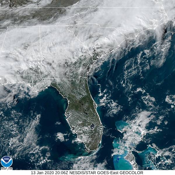
Not often that I am the most skeptical of an areas chances at staying dry. If they see anything, it will just be a spritz, and barely noticeable, but with this much moisture in the region, it’s hard to rule out. Take a look at the local satellite, which is showing quite a bit of cloud cover.
There was a nasty storm system that battered the country late last week and into the weekend. This verification isn’t about that system. It’s about the weaker wave that moved through just as 2020 came into being. We were looking at Deltona, Florida for our first forecast of the year. A cold front was forecast to sweep into the region, though it wasn’t expected to carry a lot of rain or severe weather with it, if you were to judge by what the models suggested. When cold fronts move through Florida, they have ready access to a healthy supply of moisture, and as the cold air blows in, it is enencumbered by frictional drag, and winds can howl, even in weaker systems. They are a real pain in the butt. This time, when the front moved through, the Deltona area saw 45mph gusts around lunch on the 4th, and nearly half an inch of rain. Victoria-Weather, which has a lot of recent experience with the Sunshine State, started 2020 off with a victory. Actuals: January 3rd – High 83, Low 63 january 4th – .41 inches of rain, High 79, Low 59
I’m really doing it! here is a look at the weather in Billings. It’s usually a challenging endeavor, forecasting in Billings, but will the weather be even more uncooperative than usual?
At 1153AM, MT, Billings was reporting cloudy skies with a temperature of 19 degrees. High pressure had filtered into the high Plains and was smushing a bunch of clouds and moisture into the Front Range. There were a few flurries southeast of town headed towards Wyoming, but a weak lee perturbation would ensure the chance for some light snow through the early morning hours tomorrow. There is a winter weather advisory for the region. A vast area of low pressure, as opposed the the wave n the region right now, will shift from the Pacific Northwest, where it will do considerable damage as a snowmaker, however it will not make as much hay on the other side of the Rockies. Models indicate that Billings will be in a rain — or snow — shadow through most of the day on Saturday, even as low pressure rematerializes as the upper trough makes it’s way through the Rockies. The low will redevelop over Wyoming and colorado, however, which means Billings will be getting colder, whether or not it gets any snow. Tomorrow – Mostly cloudy with an early flurry, High 25, low 8 Saturday – Increasing clouds, warmer with a chance for an early flake, High 40, Low 18
TWC: Tomorrow – A few passing clouds, otherwise generally sunny. (Early snow High 33, Low 13 Saturday – A few passing clouds, otherwise generally sunny. High 40, Low 22
AW: Tomorrow – A couple of snow showers in the morning; otherwise, cold with partial sunshine High 31, low 9 Saturday – Mainly cloudy with snow showers, accumulating a coating to an inch High 28, Low 22
NWS: Tomorrow – A 20 percent chance of snow before 8am. Mostly sunny High 26, Low 6 Saturday – A 20 percent chance of snow before 11am. Mostly cloudy High 36, Low 20
WB: Tomorrow – Mostly sunny, High 29, Low 11 Saturday – Mostly cloudy, high 37, Low 22
WN: Tomorrow – Partly cloudy with a slight chance of snow, High 26, Low 6 Saturday – Mostly cloudy with a slight chance of light snow, High 36, Low 20
FIO: Tomorrow – Clear throughout the day High 32, low 11 Saturday – Mostly cloudy throughout the day. High 39, low 22
Take a look at local affiliate KTVQ’s forecast for the city. I’m surprised how similar the national affiliates were. What do the locals say?