Last week was a warm one. It stood out in a summer of record heat across the world, and particularly in the Great Lakes region. Fond du Lac, our forecast city on Monday night, saw temperatures launch all the way into the low 70s on Tuesday, which even exceeded the expectations of our forecast outlets. Naturally, warmer forecasts had better scores, but curiously, the clouds were clear enough to allow for chilly overnight lows. As has often been the case this year, it was The Weather Channel who collected the top forecast. Actuals: Tuesday High 71, Low 42 Wednesday – High 67, Low 31
It’s been delightful here in Minnesota today, and I can’t imagine it’s been much different over in the Fox Valley.
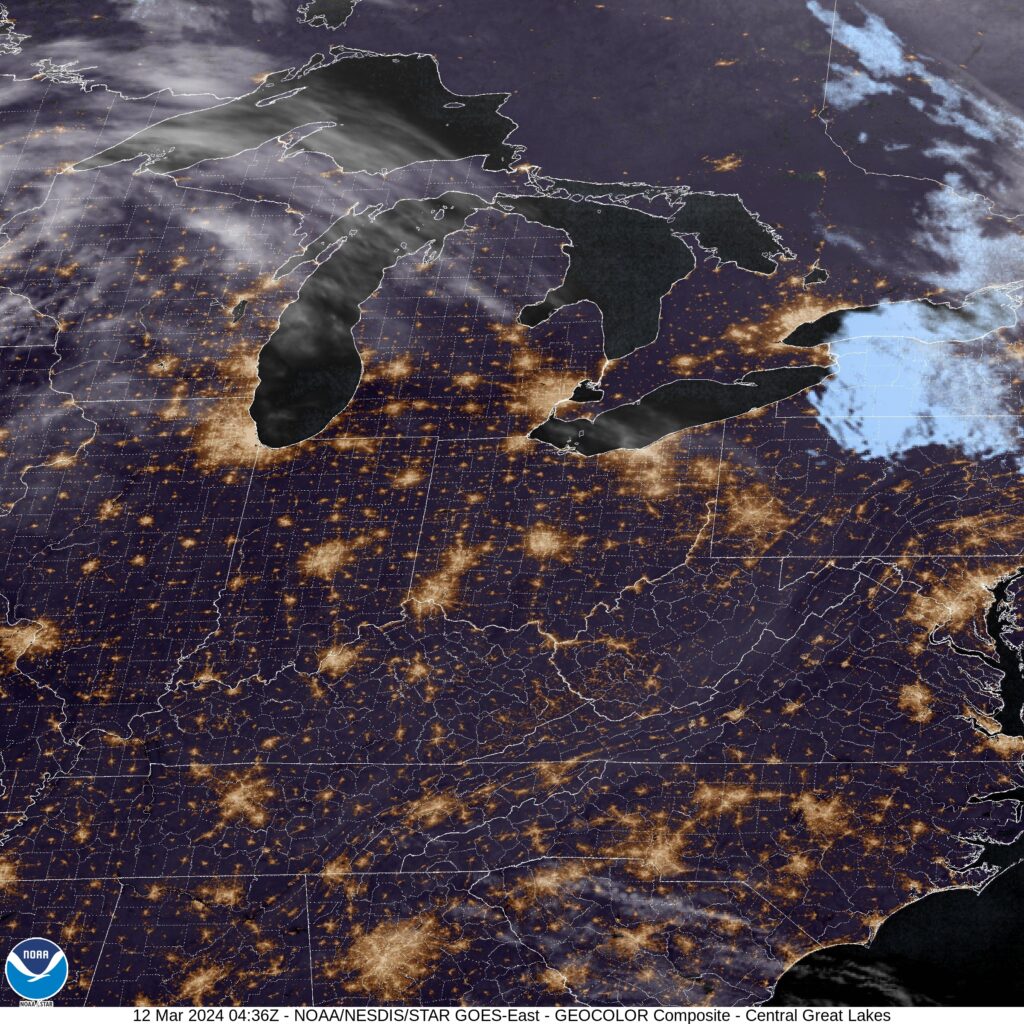
At 1053PM, CT, Fond du Lac was reporting a temperature of 41 degrees with clear skies. Temperatures are going to continue cooling off this evening thanks to the clear skies and dew points down in the 30s. A thermal ridge is parked over the middle of the country, so the cool down will be quickly forgotten after sunrise tomorrow. A very week wave is going to ripple through the region tomorrow. It will take temperatures away from the record highs seen today, and provide a few clouds, but expect a dry day in Fond du Lac. A strong trough is bringing more mountain snow to the northern Rockies will continue to progress and develop rapidly into a strong area of low pressure in the southern High Plains. A warm front will become evident in the mid-Mississippi Valley, but it will not be an issue in Fond du Lac on Wednesday. Moisture coming into the region will lead to some additional clouds for Fond du Lac, but the rain will wait until Thursday. Tomorrow – Partly cloudy, High 66, Low 44 Wednesday – Mostly cloudy and cooler, High 60, Low 38
TWC: Tomorrow – Partly cloudy skies. High 69, Low 43 Wednesday – Partly cloudy skies High 62, Low 37
AW: Tomorrow – Breezy and warm; sun and areas of high clouds in the morning, then mostly cloudy in the afternoon High 68, Low 45 Wednesday – Sun through high clouds and remaining warm High 62, Low 39
NWS: Tomorrow – Mostly sunny, High 69, Low 45 Wednesday – Partly sunny, High 60, Low 39
WB: Tomorrow – Partly sunny in the evening then clearing, High 65, Low 48 Wednesday – Partly sunny, High 57, Low 43
WN: Tomorrow – Partly cloudy, High 69, Low 46 Wednesday – Partly cloudy, High 59, Low 40
CLI: Tomorrow – Partly cloudy, High 66, Low 45 Wednesday – Mostly cloudy, High 61, Low 37
It’s going to be busy aloft, but not much is actually going to go on in the city of Fond du Lac. Not until Thursday, anyway.
Fond du Lac was seeing the last few flakes of a weak snow system when we issued their forecast a week and a half ago. It snows in March, that’s not unusual. In fact, March is one of the snowiest months of the year for the north central US. What was unusual was that on Tuesday, temperatures dropped down to single digits, well below normal. Victoria-Weather had a chilly outlook, securing the victory for the home team. Actuals: March 13th, .07 inches of liquid in snow, High 29, Low 19| March 14th, High 31, Low 7
We’re going to start the week with what should be a pretty quick jaunt. It won’t be, because we will be navigating the Chicagoland region, but it definitely SHOULD be. The drive will be nearly 3 1/2 hours, at a glacial pace of 63mph.
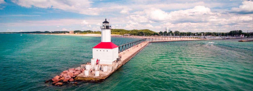
Michigan City, Indiana
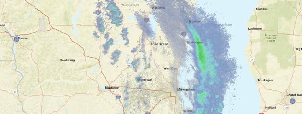
A weak little wave is moving through the Great Lakes this evening, and it will generally be in the central and eastern Great Lakes before the drive begins on Monday. I don’t think there will be much in the way of flurry activity south of Lake Michigan, though it can’t be ruled out, especially in Michigan City and Laporte. I would expect some dryer skies through Chicago proper, but as we approach Waukegon and north through Milwaukee, I would expect flurries to pick up again. This weak little feature is wrapping in a considerable amount of light snow that just doesn’t want to cut out, so I have to believe it will still be snowing in Fond du Lac when we arrive. Nothing accumulating, but it will be happening.
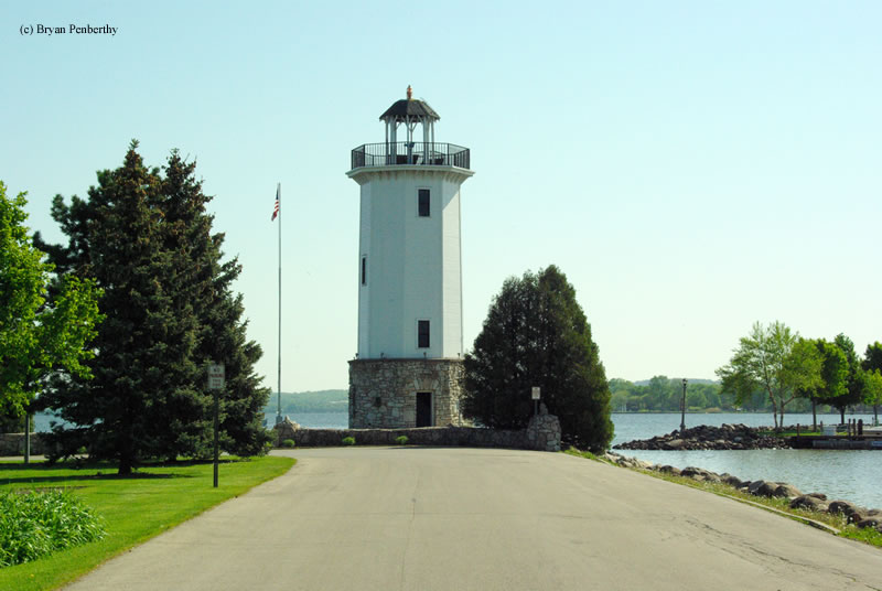
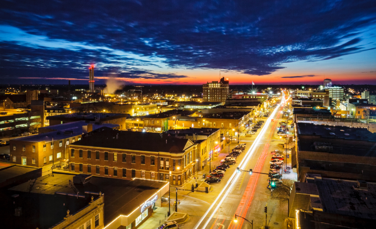
We’re headed to eastern Wisconsin for our forecast this afternoon. Eastern Wisconsin is a well populated region, but Fond du Lac is interesting in that it is offset from Lake Michigan, along with Appleton, on Lake Winnebago. The weather is bound to be different than Green Bay or Milwaukee.
At 253PM, CT, Fond du Lac was reporting a temperature of 36 degrees with overcast skies. A lingering winter weather advisory was still out for Fond Du Lac, but the thrust of the precipitation was already falling over Lake Michigan. Circulation associated with this system was centered just to the west of Wausau, and though the bulk of the snow is out of the region, light flurries are expected to persist in America’s Dairyland overnight and into the wee hours tomorrow morning. After that, the short wave leading to the snow in the area today will continue towards the easter Great Lakes, and a narrow but stout ridge of high pressure will set up in the Upper Midwest and move east into Wisconsin. As a result, Monday afternoon and the day on Tuesday will be seasonably pleasant. Tomorrow – Snow early, then clearing and cooling, High 29, Low 20 Tuesday – Sunny, High 31, Low 11
TWC: Tomorrow – Cloudy (early snow), High 29, Low 22 Tuesday – Mostly sunny, High 29, Low 10
AW: Tomorrow – Mostly cloudy with flurries; breezy in the morning, then becoming chilly High 31, Low 22 Tuesday – Plenty of sunshine, but chilly High 32, Low 11
NWS: Tomorrow – Snow likely, mainly before 7am, then a chance of flurries after 2pm. Mostly cloudy, High 29, Low 21 Tuesday – Sunny High 29, Low 10
WB: Tomorrow – Mostly cloudy. Chance of light snow in the morning, then chance of flurries in the afternoon, High 29, Low 24 Tuesday- Sunny, High 29, Low 14
WN: Tomorrow – Mostly cloudy with light snow showers, High 29, Low 20 Tuesday – Mostly sunny, High 29, Low 10
CLI: Tomorrow – Light snow showers, High 28, Low 19 Tuesday – Sunny, High 28, Low 12
The threat for snow is going to be more of the nuisance variety, but it will be persistent. The threat of this forecast is the pending cold to start the week.
If you know any thing about me, know that I love it that we take road trips that are a bit different The trip, just shy of 8 hours, makes it’s biggest turn at Cedar Rapids. Has that ever happened? I don’t think so! It’s a 491 mile trek, covering 3 states at a pace of about 62mph. And we get to see Cedar Rapids!
Columbia, Missouri
Low pressure spinning over the mountains is going to sink deeper to the southern Plains. The light rain showers that are threatening the Upper Midwest are going to be drawn south to the more organized region of instability in Texas by the time we would depart tomorrow. The weather will get less cloudy and potentially a few degrees warmer as we head to eastern Wisconsin.
Today’s journey takes us along I-65, one of my old favorite arteries, running from Chicago to Montgomery, but we will end up both north and south of that highway by the time all is said and done. It’s a 2 day trek covering 931 miles. The first day will be longer, concluding after about 502 miles. We’re going to see some weather, so hopefully we make good time outside of the storms.
DAY ONE (Thursday)
Auburn, Alabama
The weather is going to be nice in Alabama tomorrow morning, as warm Gulf air is drawn northward, taking the edge off of the autumn by just a little bit. Nice! Of course, the reason it is going to move to the north is a massive, nasty cold front at the leading edge of a strong ridge of high pressure sinking into the Great Lakes. The resulting boundary will be in our path, starting with a few rogue showers and thunderstorms north of Birmingham, with heavy rain and wind, perhaps even severe, in Tennessee and southern Kentucky. The trailing air mass is going to be cold an dense, so the cut off from rain to clear air will be abrupt. Expect a change in wardrobe if we need to stop anywhere north of Bowling Green, Kentucky, The night will be clear when we call it a night in Scottsburg, Indiana, north of Louisville.
DAY TWO (Friday) While the rain we see on Thursday is going to be a pain in the butt, it will come with a good navigational consequences, Sure, Indiana, Illinois and Wisconsin will be awfully chilly, they will also be sunny and dry. With a fresh bit of snow in Wisconsin, keep those sunglasses at the ready.