A busy weather week before a quiet Christmas week

There were two remarkable weather stories this week, one for the raw statistics, and one for the incredible imagery.

Last weekend, a strong late season storm swept through the Lower Mississippi Valley, unleashing a tornado outbreak from Louisiana to Alabama that was unusual for mid-December, but not altogether unheard of.

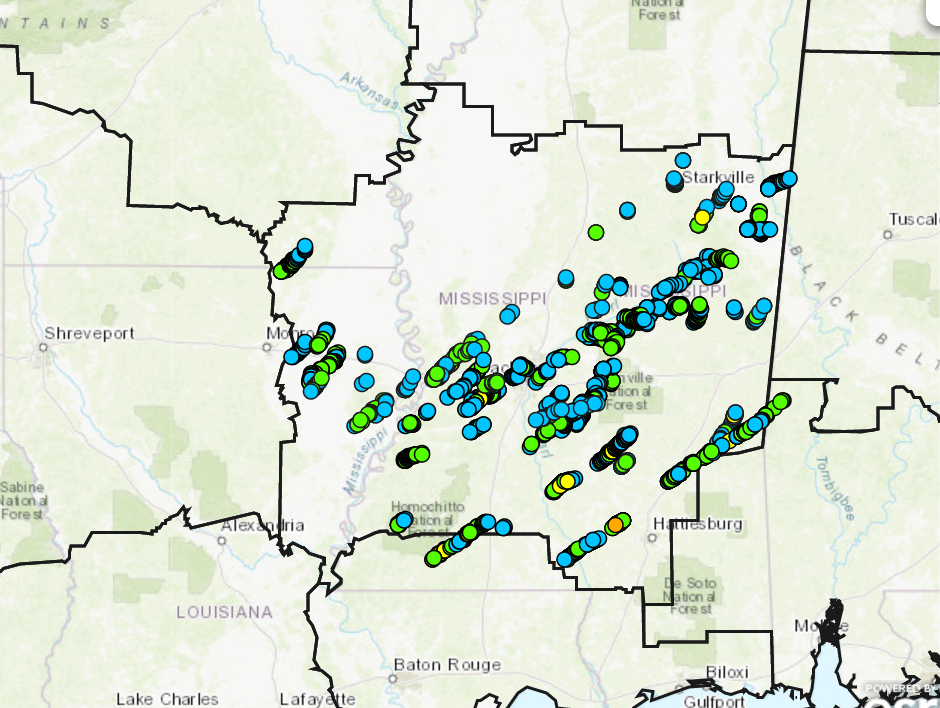
Mississippi was struck by nearly a dozen twisters, while two people were killed in northern Alabama. The most eye-popping number from the outbreak was the 64 mile tornado track in central Louisiana. The largest town clipped by this tornado was Alexandria, where there was extensive damage, but no deaths. There was one storm related fatality in Louisiana, however.

Take a look at the map the Jackson WFO put out, showing the tornado coverage there (unfortunately, there isn’t a good map that I’ve seen from Louisiana or Alabama with the tornado tracks), and find more details from NPR on the storm.

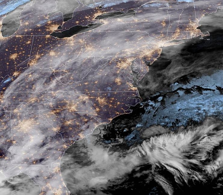
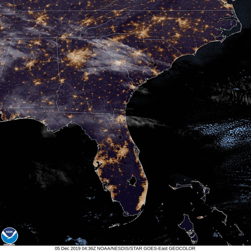
Also in the last week, a virulent but quick moving system brought a profundity of snow squall warnings through the mid-Atlantic and southern New England. Snow squall warnings are equivalent to severe thunderstorms, inasmuch as they move quickly, and bring about strong if short lived winds, even if they don’t bring a lot of accumulation.

Check out this clip of the storm consuming Manhattan

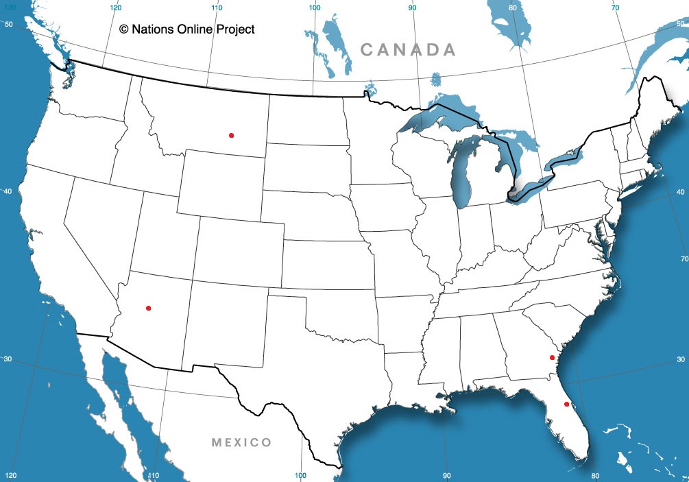
This all lead to very good news for Christmas travelers, however. The holiday week was fairly benign, unless you were trying to traverse the northern Rockies, where snow was falling. Throughout the Upper Midwest, temperatures climbed well above normal, and melted away the white Christmas millions of people were expecting.

The year looks to conclude with a bang, however, as a significant system will bring snow to the northern High Plains this weekend, as well s another chance for severe weather in the Lower Mississippi Valley.

November Forecaster of the Month

November was a busy month, replete with forecasts from across the country, and one outlet had a thumb on the scales. With 8 forecasts in the month, Weatherbug won half of them, and ultimately won the month rather easily.

OutletMonth wins
Weatherbug4
Victoria-Weather1.5
Forecast.io1
The Weather Channel0.5
WeatherNation0.5
National Weather Service0.5
Accuweather

OutletMonth winsyear wins
Victoria-Weather1.516.98
Weatherbug416.41
The Weather Channel0.513.03
Forecast.io19.45
WeatherNation0.58.64
Accuweather8.64
National Weather Service0.58.31

Springfield, Massachusetts

Only a fortnight left of shopping until Christmas! What will the weather be like in Springfield, MA as we head into the weekend to get those gifts?

At 1156pm EST, the temperature at Springfield, MA was 20 degrees under fair skies. High pressure is found over New England currently, but the next couple of days will see conditions deteriorate rapidly. An area of low pressure is developing in the Southeast and will scoot its way up the Eastern Seaboard throughout the day Friday. Rain showers will shift into the area by the evening hours, and increase in intensity overnight into Saturday as the low draws closer to the region. Some heavy rains are expected Saturday morning and should finally taper off some during the afternoon and early evening hours as the low shifts through New England. Winds are expected to pick up late Saturday as well, making for a rather miserable start to the weekend.

Friday: Increasing evening showers. High 40, Low 21.
Saturday: Heavy morning rains, becoming lighter in evening. High 52, Low 40.

TWC: Friday: Afternoon rain showers. High 39, Low 20.
Saturday: Rain. High 52, Low 37.

AW: Friday: A bit of afternoon rain. High 37, Low 21.
Saturday: Heavy rain tapering off. High 50, Low 35.

NWS: Friday: Mostly cloudy then chance of wintry mix. High 35, Low 20.
Saturday: Heavy rain, areas of fog. High 42, Low 35.

WB: Friday: Chance of rain showers. High 38, Low 20.
Saturday: Rain. High 53, Low 38.

WN: Friday: Cloudy with light showers likely. High 38, Low 20.
Saturday: Cloudy with light rain. High 50, Low 35.

FIO: Friday: Light rain starting in afternoon. High 43, Low 23.
Saturday: Rain until evening. High 56, Low 42.

Some high clouds are streaming over the area currently, but the system taking shape in the Southeast is what will bring our weekend rains.

Pittsburgh, Pennsylvania

Whoops! This was supposed to be posted on Monday evening. However, something from Real Life Inc. interfered and even though the data had already been gathered, I forgot to disperse it to our faithful readers! Apologies! I’ll understand if I get one fewer present under the tree.

At 951pm EST, the temperature at Pittsburgh, PA (KPIT) was 56 degrees with light rain falling. As a cold front is pushing through the region, a few straggling showers are expected over the area early Tuesday morning, but then conditions clear out by midday as high pressure works in behind the system. Wednesday should be dry, but much colder as high pressure shifts overhead.

Tuesday: A few morning showers. High 53, Low 27.
Wednesday: Clearing and colder. High 34, Low 21.

TWC: Tuesday: Cloudy, chance of morning showers. High 57, Low 31.
Wednesday: Mostly sunny. High 34, Low 20.

AW: Tuesday: Cooler, a shower in the morning. High 54, Low 30.
Wednesday: Partly sunny and colder. High 35, Low 22.

NWS: Tuesday: Chance of morning rain showers. High 55, Low 30.
Wednesday: Mostly sunny. High 32, Low 20.

WB: Tuesday: Chance of morning rain showers. High 55, Low 30.
Wednesday: Mostly sunny. High 32, Low 24.

WN: Tuesday: A few morning showers. High 54, Low 29.
Wednesday: Mostly sunny. High 33, Low 21.

FIO: Tuesday: Light rain in the morning. High 58, Low 30.
Wednesday: Clear throughout the day. High 33, Low 24.

Punta Gorda, Florida

We’re crossing the Sunshine State today, from the southeastern coast to the west coast. Of course, everyone calls it the Gulf Coast, but we’re not here for a geography lesson. (unless you are, and then I’m sorry for the confusion)

At 453PM, ET, Punta Gorda was reporting a temperature of 78 degrees with fair skies. Nearby spots, like Fort Myers were popping up into the low 80s as the region was encompassed by high pressure ahead of a cold front advancing through the southeastern US.
As the boundary moves closer to the coast, moisture will become entrained across the Florida Peninsula. The boundary itself won’t ever arrive in Punta Gorda, but the more aggressive breezes across the area, from southwest to northeast, will be conducive to a few isolated showers and storms. The activity will largely be in the middle of the state, but it’s never a bad idea to include thunderstorms in a Floridian forecast.
Tomorrow – Mostly sunny, warm, High 86, Low 63
Wednesday – Isolated thunderstorms, High 85, Low 65

TWC: Tomorrow – Partly cloudy skies. High 85, Low 62
Wednesday – Intervals of clouds and sunshine. High 84, Low 66

AW: Tomorrow – Sunny to partly cloudy and pleasant High 81, Low 66
Wednesday – Partly sunny, very warm and more humid with a shower in places in the afternoon High 86, Low 61

NWS: Tomorrow – Partly sunny, High 80, Low 66
Wednesday – A 30 percent chance of showers, mainly after 1pm. Mostly sunny, High 80, Low 69

WB: Tomorrow – Mostly cloudy High 84, Low 63
Wednesday – Partly cloudy. A slight chance of showers in the afternoon. High 83, Low 66

WN: Tomorrow – Partly cloudy High 82, Low 65
Wednesday – Partly cloudy with scattered showers, High 82, Low 68

FIO: Tomorrow – Clear throughout the day. High 84, Low 63
Wednesday – Partly cloudy throughout the day. High 83. Low 67

Here is a look at the forecast for the next few days from Fox 4 in Fort Myers, just down the road from Punta Gorda.

Surprisingly dry

I think a lot of people would look at the recent weather in Miami and would easily note the temperatures, which were cooler than one would stereotypically expect from Miami. The thing that struck me, however, was how low the dew points were. Residents accustomed to Miami’s climate probably needed to bust out the moisturizer as dew points dipped all the way into the low 40s. Accuweather had the best temperature forecast, and for our purposes, had the best forecast of the day.
Actuals: Tbursday, High 72, Low 59
Friday – High 78, Low 61

Grade: B-C

Miami, Florida to Hattiesburg, Mississippi

It seems like these two towns should be nearer to one another, but in fact, it’s a day and a half drive between Miami, way at the south end of Florida, and Hattiesburg. To give you an idea of how big Florida is, our drive covers 817 miles in total, and probably 3/4ths of it are in the Sunshine State. We will do 2/3rds of the driving on day one, which will account for 542 miles at the Floridian pace of 67.8mph, It’s a long ways from Miami to any other state, so be patient.

DAY ONE (Saturday)

Miami, Florida

A long, dangling front extends from a low over Newfoundland. If that gives you any idea, by the time the front has reached north Florida, it is quite weak, and as we drive north, it may only bring a few clouds over Orlando. North and west from the Ocala and Gainesville area, however, we will probably note a change in the air. Somewhat cooler air is possible, but more significantly, it will feel drier than Miami. We’ll make it to Grand Ridge in the Panhandle to call our day complete.

DAY TWO (Sunday)
High pressure is developing over the East Coast this weekend, and guidance is suggesting that the return flow will be strongest in the Mobile area. There might be some light rain showers as a result, but more likely, it will just be some puffy cumulus clouds. Hattiesburg won’t have to deal with any of that, but the afternoon will be getting warmer and soupier after we arrive.

Hattiesburg, Mississippi

Not so bad

I am impressed. The forecast for Jackson was locked and loaded to be very difficult. A massive blob of uncomfortable low pressure moving through the Great Lakes was going to manipulate precipitation types and drive temperatures steadily downward… except for when there was an intrusion of warm air as the low passed by on Saturday. It was a recipe for a difficult forecast, and by jove, this forecast was knocked out of the park. Weatherbug, in fact, only had 1 degree of error in their entire forecast. the only real loser was the city of Jackson, who had to deal with the rain, thunderstorm and snow chaser.
Actuals: Sunday – .64 inches of rain, High 42, Low 34
Monday – Snow reported, not measured, High 34, Low 28

Grade: A – B

Miami, Florida

Miami isn’t the largest city in Florida, nor is it the capital, but it is probably the most famous (and surely has the largest metro area).

At 1053PM, Miami was reporting fair skies with a temperature of 66 degrees. The state of Florida was enjoying a pleasant evening across the board, as the subtropical jet lies safely over the Tennessee Valley.
High pressure is safely entrenched over the southeast, though a short wave is forecast to develop over the lower Mississippi Valley late in the week. Because of the weak rotation in the region, expect a little bit more moisture to be entrained across Florida by Friday afternoon. bringing in some clouds.
Tomorrow – Mostly sunny, fairly cool, High 75, Low 58
Friday – Partly cloudy, more humid, High 77, Low 63

TWC: Tomorrow – Mostly sunny skies. High 74, Low 55
Friday – Intervals of clouds and sunshine. High 78, Low 58

AW: Tomorrow – Partly sunny and nice High 74, Low 57
Friday – Nice with sunshine and patchy cloud High 78, Low 63

NWS: Tomorrow – Sunny, High 73, Low 60
Friday – Mostly sunny, High 76, High 65

WB: Tomorrow – Sunny, High 73, Low 56
Friday – Mostly sunny, High 77, Low 59

WN: Tomorrow – Mostly sunny, High 73, Low 60
Friday – Partly cloudy, High 76, Low 65

FIO: Tomorrow – Mostly sunny, High 78, Low 62
Friday – Clear throughout the day. HIgh 80, Low 63

This is the kind of weather you want when you visit Florida, right? Not too hot, a lot of sun and absolutely not a flake of snow.