Wow, what a short trip! We are going from New Jersey to northern California, on a journey that is 2 full days shorter than the last one. We will cover 2,946 miles over 5 1/2 days at a pace of about 67 miles an hour, or 535.6 miles a day. Really, this is going to be a piece of cake, gang.
DAY ONE (Wednesday)

Driving from Atlantic City to Santa Rosa is a job that seems like it should be done in a convertible. Probably yellow. All to say that a winters drive along this route seems cruel. It’s going to start very chilly as we depart from the Jersey Shore and cut through Pennsylvania. The major storm now on its way out of town is bringing strong northerly winds to the eastern Great Lakes. That is typically a good recipe for Lake effect snows, and sure enough, we will probably encounter some bands of heavy snow around the west Cleveland suburbs to Lorain. It will lighten up, but not disappear as we head on into Sandusky.
DAY TWO (Thursday)
Winds will taper off and so too will any lingering snow threat around Sandusky, giving us a clean start for the day. Still too chilly for that yellow convertable, though. We’ll head west through northern Indiana and Illinois, and will be between Cedar Rapids and Des Moines as our Thursday wraps in Brooklyn, Iowa. A weak clipper spiraling through the Upper Midwest will bring a threat for snow as we sleep.
DAY THREE (Friday)
The clipper won’t do much for accumulation, and will essentially leave southern Nebraska alone. As we get going on Friday, there might be extra traffic in Des Moines, but not enough to ruin our day. The sky will be clear, but the clipper will have brought in another batch of cold air. Expect our stops to be chilly, but will start to be a bit warmer when we stop for the night in Brule, Nebraska, in the first reaches of the Panhandle.
DAY FOUR (Saturday)
Another batch of disturbed weather will be arriving in the northern Rockies over the weekend. This feature is coming from the Gulf of Alaska, so will have spent a good deal of moisture before it arrives on the scene. Snow will probably still make an appearance throughout Wyoming, particularly on the western and northern faces of terrain, with plenty of clear air to appreciate as well. The mountain snow, valley dry pattern will continue into Utah, where we will stop at Emory, which lies in the Wasatch east of Salt Lake City.
DAY FIVE (Sunday)
We will leave the snow behind in the Rockies, because the Great Basin is going to be quite dry, and quite sunny. It will still be brisk, but we should drive through Nevada with no weather related concerns, though obviously one may need to contend with gambling temptations. Especially after leaving Atlantic City. Our day will end in Fernley, which lies just outside of Reno.
DAY SIX (Monday)
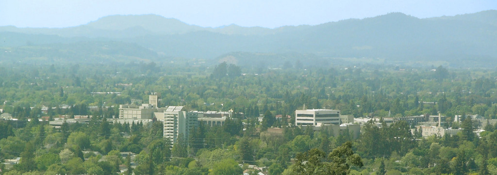
It can be dicey this time of year, passing Truckee, as you never know when you are going to get an 8 foot snow storm, but that won’t be a concern on Monday. We’ll be able to head closer to the Bay Area, and with the sun, we might be tempted to crack a window. It will be in the upper 50s or low 60s when we finally reach Santa Rosa.