Louisville, Kentucky to Cumberland, Maryland

All right, let’s take a trip! It’s only going to be a 7 hour trip through the mountains of eastern Kentucky and West Virginia between our two end points on this Sunday journey. I can definitely say that these 472 miles would have been a lot more interesting today or yesterday, but alas, we try to avoid thunderstorms when driving.

Louisville, Kentucky

Low pressure has really figured itself out in the Gulf Stream, and the cold front associated with it left a healthy stripe of wind damage reports from the Delmarva to the Smokey Mountains. Already today, the heaviest weather has remained south of our route, and northerly flow will remain in place on Sunday over the area surrounding West Virginia. The feature is strong enough, and the atmosphere is rich enough that there might be a few stray showers riding those north winds as we head towards western Maryland, but the most pleasant weather the region has seen in a while with only passing clouds will define the majority of the day.

Cumberland, Maryland

Louisville, Kentucky

Louisville has a greater impact on the United States than you might expect. It’s home to Yum! Brands and UPS, and was the cihildhood home of Muhammed Ali and Diane Sawyer. The city is pretty proud of their history, so remember that next time you hear about the Kentucky Derby or Louisville Sluggers.

At 1058AM, CT, Louisville was reporting a temperature of 82 degrees and mostly cloudy skies. There is a weak trough moving through Kentucky this morning that is producing a band of cumulus from about Jackson, Ohio to Kentucky Lake. There may be a few showers associated with this this afternoon, but they will keep south of Louisville.
A narrow trough over the Great Lakes is the parent of this trough, but the ridge of hot weather that most of the nation is experiencing will force that boundary and any hospitable air back to the northeast. There may be a passing shower on Tuesday as this air mass transition takes place, but by Wednesday, this dome of hot air will take hold and suppress any convective activity. Record highs are possible.
Tomorrow – Isolated showers and storms, High 93, Low 71
Wednesday – Hot and humid, mostly sunny, High 96, Low 74

TWC: Tomorrow – Intervals of clouds and sunshine High 91, Low 69
Wednesday – Sunshine and clouds mixed (morning storms). High 95, Low 73

AW: Tomorrow – Humid with sun and some clouds; a thunderstorm in spots in the afternoon High 90, Low 69
Wednesday -Intervals of clouds and sunshine High 92, Low 73

NWS: Tomorrow – Isolated showers and thunderstorms after 2pm. Mostly sunny, High 89, Low 68
Wednesday – Mostly sunny, High 90, Low 73

WB: Mostly sunny with isolated thunderstorms, High 89, Low 71
Wednesday – Mostly sunny, High 92, Low 70

WN: Tomorrow – Partly cloudy with isolated thunderstorms, High 89, Low 68
Wednesday – Partly cloudy with light rain showers, High 90, Low 73

CLI: Tomorrow – Light rain showers, High 90, Low 72
Wednesday – Partly cloudy, High 95, Low 73

The most interesting part of this forecast for me is that WeatherNation has the same temperatures but a different precipitation forecast than the Weather Service. Take a look at the satellite imagery below, showing that band of clouds south of Louisville.

Louisville

A dose of spring

One of the consistent complaints about spring is that it is all too short. It seems, in the minds of many people, that we often jump right from winter to summer with little transition. Late last week in Louisville, spring had come. Temperatures reached the low 60s under a pleasant sunny sky — the perfect spring time weather. Forecasts were all very similar (there was a 4 way tie in 3rd place) but two outlets had morning lows forecast to be a little bit warmer, and they were in the top two spots. Victoria-Weather came in second, but Weatherbug had a nearly perfect forecast to attain victory.
Actuals: Thursday – High 60, Low 43
Friday – High 65, Low 42

Grade: A-C

Louisville, Kentucky to Elizabethtown, Kentucky

It takes less than an hour to get from Louisville to Elizabethtown. The real intrigue is whether or not you want to take a more westerly tact through Fort Knox, but really, it’s just a 44.6 mile drive at a pace of, as I’m sure you guessed, just over 60mph. Let’s knock out this commute.

Louisville Kentucky

By tomorrow morning, a lost batch of moisture in the Ohio Valley may or may not touch off some showers in western Kentucky. That’s only if the GFS gets it right, because other outlets are pretty dry. We’ll respect the venerable GFS though, and suggest clouds will be possible on the drive down to Elizabethtown.

Elizabethtown, Kentucky

Louisville, Kentucky

It’s time for a forecast, dear friends, so lets head on down to the Ohio Valley.

At 756PM, Louisville was reporting mostly clear skies with a temperature of 54 degrees. Parts of the region that saw a little bit of the sun before it set popped to nearly 60, but eastern Kentucky is still socked in, and sits in the upper 40s, with Louisville straddling the line. A deeply occluded low in the Great Lakes was tied to a slow moving low in the Appalachians, and the combination of the two was responsible for the cloud deck slowly departing the Louisville area.
The low is wrapping in additional mid level moisture that, within the colder air behind the system, is more inclined to produce some cloud cover. This is the regime that Louisville will find itself within for the remainder of the work week, with passing midlevel clouds passing in front of a seasonably cool sunshine. A perturbation moving through the southern Plains, riding the northern edge of a jet streak will approach late on Friday, but rain will hold off until the weekend.
Tomorrow – Partly cloudy, High 60, Low 42
Friday – Partly to mostly cloudy, High 64, Low 42

TWC: Tomorrow – Except for a few afternoon clouds, mainly sunny. High 61, Low 41
Friday – Partly cloudy skies. High 66, Low 39

AW: Tomorrow – Intervals of clouds and sunshine High 61, Low 41
Friday – Sun followed by clouds High 66, Low 39

NWS: Tomorrow – Sun followed by clouds High 60, Low 41
Friday – Mostly sunny High 63, Low 39

WB: Tomorrow – Mostly sunny, High 60, Low 44
Friday – Partly cloudy, High 65, Low 42

WN: Tomorrow – Mostly sunny, High 60, Low 41
Friday – Partly cloudy, High 63, Low 39

FIO: Tomorrow – Partly cloudy throughout the day. High 58, Low 40
Friday – Mostly cloudy throughout the day. High 62, Low 38

When there are no changes in air mass, and the sun is more or less out for the day, you end up with some pretty similar forecasts. Here is the satellite imagery, showing the last of the significant clouds and snow to Louisville’s southeast, and some less ominous clouds closer to Lake Michigan.

Lukewarm for Louisville

The Ohio Valley was afflicted by a low level perturbation as August wound down. This affliction was felt by our forecasters looking at Louisville. Generally, everyone was in the right ball park, but the temperatures didn’t trend in a particular direction or another to give any outlet in particular an advantage. Cloudy skies, especially overnight, kept low temperatures from getting too low, but the high minimums and just enough sunshine allowed the highs to trend into the high end of the outlook. Weathernation took home the victory, though not by much.
Actuals – 8/30 – High 81, Low 68
8/31 – .1 inches of rain, High 84, Low 69

Grade: C

Louisville, Kentucky

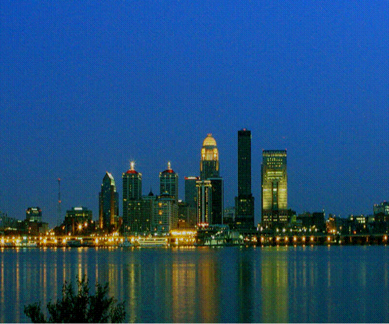
Louisville, Kentucky, is one of the first places I ever went on a road trip to just for the sake of having done it. It holds a place in my heart, I guess is what I’m saying.

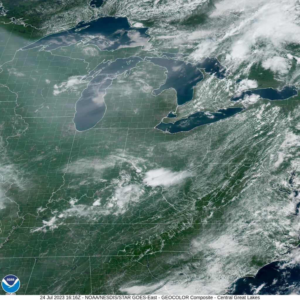
At 328PM, ET, Louisville was reporting a temperature of 88 degrees with fair skies. The dew points were in the low 70s, but as near as Bloomington, Indiana, the dew point was 10 degrees cooler. A strong early autumnal system which has absorbed the remnants of Laura is presently forcing a cold front through Kentucky. A line of thunderstorms lay through southern Kentucky, while the back edge of clouds is in the south Louisville metro, and the change in airmass is just north of the Ohio. Continued improvement is expected for Louisville today.
The jet structure still remains in Canada, and so the refreshment behind this cold front isn’t likely to last long. A surface perturbation is forecast to move from the western Gulf Coast to the east north east Sunday night, bringing rain to the area through early Monday afternoon. Some thunder is possible on Sunday night, with a dreary morning on Monday, though it should clear up later in the day.
Tomorrow – Late showers and thunderstorms, High 83, Low 63
Monday – Cloudy with some early sprinkles, High 80, Low 66

TWC: Tomorrow – Considerable cloudiness. (Evening rain) High 80, Low 64
Monday – Rain showers early with some sunshine later in the day. High 82, Low 66

AW: Tomorrow – Partly sunny, evening storms, High 79, Low 64
Monday – Mostly cloudy and humid with widely separated thunderstorms High 81, Low 65

NWS: Tomorrow – A 30 percent chance of showers and thunderstorms after 3pm. Partly sunny, High 80, Low 63
Monday – Showers and thunderstorms likely, mainly before 9am. Mostly cloudy, High 82, Low 66

WB: Tomorrow – Partly cloudy with a 30% chance of showers and thunderstorms, High 78, Low 69
Monday – Mostly cloudy with a 40% chance of showers and thunderstorms, High 79, Low 70

WN: Tomorrow – Partly cloudy with scattered storms, High 80, Low 65
Monday – Partly cloudy with thunderstorms likely, High 82, Low 66

FIO: Tomorrow – Mostly cloudy throughout the day. High 81, Low 63
Monday – Rain overnight and in the morning. High 83, Low 65

We’re all hovering in the low 80s for the next couple of days, but I’m going in a different direction, I guess. Make sure to take a look at what WAVE-NBC’s meteorologists have to say, and then check out the radar on their site for a pretty discernible line of storms in the southern part of the state.