We made it through what is historically the stormiest month of the year, and made it without many devastating headlines. Now we just need to tackle fire and hurricane season with so little bad news. This month, the best news for a forecaster belongs to The Weather Channel, who always seem to do well in the spring storm season. Kudos to them. Here is the look at the total wins for the year to date:
Most of the severe weather last week came to the High Plains, but it didn’t have a monopoly on all the thunderstorms across the US last week. A weak cold front entered the mid Atlantic late in the weekend, and Monday night saw a few rumbles of thunder sweep through Raleigh, bringing over a third of an inch of rain to town, along with a few reports of gusty winds in the mid Atlantic. It also brought a joint victory for Accuweather and the National Weather Service, who leapt into the lead for being among the forecaster group that called for rain. Actuals: Sunday, High 90, Low 64 Monday: .38″ of rain, High 90, Low 65
There has bee quite a bit of severe weather in the last week, but it hasn’t really been a story in the news. Strong storms did a good job of avoiding large population centers, and never really threatened to move somewhere moer ominous. Any weather outbreak looks as though it will have to come at another time, as the severe weather in the Plains is going to wear itself out.
Tornadoes are common this time of year, and in the High Plains, thanks to the changing of the season, and the topographic advantages of the region. The flat, generally low density population of the region makes it popular with storm chasers, both of the academic, researching variety, and the thrill seeking tourist kind. The availability of weather data to the public has meant that May in the Plains can be thick with chasers, especially when the weather is busy. Such was the case over the last week, when tornadic activity was seen over many days from the Texas Panhandle to southwestern Nebraska.
Many videos were taken and twisters spotted, all without much harm to life or property. Call it a pretty successful chase season for all involved (except those who justifiably are a bit miffed by the idea of disaster tourism, especially in their home area).
The region, as I said, is a topographically perfect partner for storm chasing. The pattern this week set itself up nicely, and was long lived enough to encourage chasers to make the trek. There weren’t big areas of low pressure that dived into the region to make for dangerous outbreaks, like we see in the southeast or Ohio Valley when outbreaks occur there.
The Omega block over the eastern US allowed for warm, moist air to pump north on the western flank of the ridge, priming the pump for strong storms. In this environment, the tightly spinning lee troughs developing in the leeward side of the Rocky Mountains were able to trigger thunderstorms that were often well organized enough to drop tornadoes, often big, nasty photogenic ones that could be filmed from a distance.
In this case, they didn’t find any population centers, which is what everyone wants. With any luck, important information was collected. At the very least, cool images were taken.
Showers and storms streamed up the western flank of the high pressure system that was parked over the eastern US earlier in the week. They were always going to be a threat for Des Moines, but they were bopped a little bit harder by a storm last Thursday. Smaller spots of rain drifted through throughout the rest of the forecast period, resulting in .5 inches of rain falling through the 2 day period. Weatherbug continued a good month, and netted the top forecast. Actuals: Thursday – .45 inches of rain, High 73, Low 64 Friday – .05 inches of rain High 79, Low 68
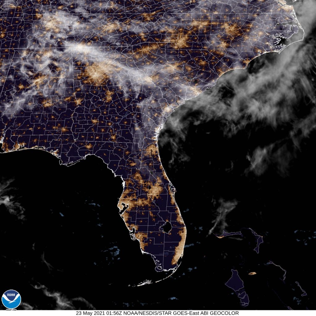
We are headed to the Carolinas for our forecast today. The Atlantic Hurricane Season threatened to get off to an early start, as Tropical Storm Ana popped up near Bermuda today. Will any other exciting incidents take place this weekend?
At 853PM, ET, Raleigh was reporting fair skies, calm winds and a temperature of 76. There was a little pocket of clouds in Raleigh, but otherwise, high pressure is the predominant feature across over the eastern US. The Omega block that has parented this long lasting ridge is going to see the beginning of its end through the beginning of the week. An area of low pressure is riding over the top of the ridge, through Canada, and the blocking low over the Atlantic will begin to lift north to intercept the low to the north, and allow the associated cold front to sink south into the US, with some showers and potentially an embedded thunderstorm arriving late on Monday. Tomorrow – Mostly sunny, High 92, Low 66 Monday – Partly cloudy with some showers late, High 88, Low 68
TWC: Tomorrow – Partly cloudy. Hot. High 92, Low 67 Monday – A mix of clouds and sun in the morning followed by cloudy skies during the afternoon. A stray shower or thunderstorm is possible. High 90, Low 69
AW: Tomorrow – Very warm with sunshine and patchy clouds High 91, Low 67 Monday – Very warm with clouds and sun; a thunderstorm around in the afternoon High 90, Low 69
NWS: Tomorrow – Mostly sunny, High 93, Low 66 Monday – A slight chance of showers and thunderstorms after 2pm. Mostly sunny, High 91, Low 67
WB: Tomorrow – Mostly sunny, High 89, Low 67 Monday – Partly sunny, High 87, Low 69
WN: Tomorrow – Mostly sunny, High 93, Low 64 Monday – Partly cloudy, High 91, Low 67
FIO: Tomorrow – Partly cloudy throughout the day. High 91, Low 71 Monday – Mostly cloudy throughout the day. High 90, Low 70.
Boy, did new model data come out as I wrote this up? Half way through the forecasting, outlets stopped calling for rain. Interesting. Here is the satellite image, which isn’t really full of information.
The forecasts for Fairbanks weren’t exceptionally bad, honestly, but I would say that an important lesson learned is that forecasting in Alaska is s very specific skill that is best honed by living there and forecasting the area all the time. It’s a different animal than the continental US. As one might imagine with this preamble, The National Weather Service collected victory. They were close on temperatures, and properly anticipated some showers coming down out of the mountains, which was not a thing that happened for everyone. So congrats, NWS, and we will see you in the CONUS. Actuals: Monday, .02 inches of rain, High 59, Low 43 Tuesday – High 61, Low 41
As we head into the end of May and beginning of June, we can focus on the weather around the country, because we don’t have a lot of targeted forecasts on the horizon.
Road trip from Rochester, New York to Wichita Falls, Texas
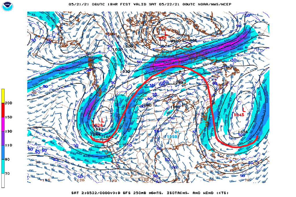
In the past several years, some long standing meteorological terms have filtered out into the masses, and have exploded as buzz phrases, and often help to drive ratings and induce a mild hysteria. Think of how often you now hear the terms “polar vortex” or “bomb cyclone” for example. Right now, many meteorologists are talking about an “Omega block,” which is definitely much more innocuous than it sounds.
For those that are familiar with the Greek alphabet, you may know that the letter Omega is the last letter. This lends the Omega block terminology a bit of gravitas. Is it some sort of apocalyptical signal? Is it the end? No, assuredly not. The name is actually a reference to the shape of the Omega: Ω. The upper level jet features a ridge, bracketed by two sharp, potentially cut off areas of low pressure. This is the case today, and will be for a while.
Ridges in general are tough to dislodge, and having a immobile trough, as is the case off shore, in front of it, and even undercutting it, slows things down even more. This is why it is called a “block”. For a while, the upper level pattern is going to be unable to progress.
There isn’t a lot of danger in the pattern, especially at it’s current location. A little further east or west, the coasts could be in for a fairly rainy week, or the Plains could be in line for a major severe weather stretch, with low pressure unable to move our of the region. Instead, it will be dry from the Mississippi Valley to the East Coast, with just a few showers riding the western side of the ridge, a persistent but not terribly worrisome threat (despite a few tornadoes dipping down over southern Minnesota earlier in the week. )
This Omega will be in place through the weekend before it slowly starts to shuffle off to the Atlantic.
Des Moines is the destination for today’s forecast. I was just there for Easter, so I feel like I should have their forecast pretty well locked down.
At 936AM, CT, Des Moines was reporting a temperature of 68 degrees with overcast skies. While there was no rain presently seen in the Des Moines area, a batch of activity was moving through the Omaha area, and overcast riding over the top of a tropical airmass was shifting north behind a warm front, and smothered most of the Upper Midwest, particularly east of the Missouri. There was a strong ridge over the eastern 3/4ths of the US, but a weak undercutting trough was providing for some rough weather in the south central US, and the exit arm of the trough was helping usher in the soupier air mass across Iowa. The undercutting trough is expected to fold back into the primary jet, while the surface ridge should start to retrograde a little over the next 24 hours. This will strengthen the return flow, and only stand to make Iowa more humid. A Canadian trough will dangle a cold front into Minnesota, but it won’t be strong enough to organize much convective activity in Iowa, however the latent moisture of the area, along with the brisk flow on the back end of the ridge in the Eastern United States will be enough to provide for garden variety showers and isolated storms through the day tomorrow and into the early afternoon on Friday. The ridge will build in at a more fortunate angle to dissuade more moisture from driving into Iowa, and it should switch off the threat for storms by nightfall. Tomorrow – Scattered showers and thunderstorms, otherwise stuffy and partly cloudy, High 75, Low 63 Friday – Showers and storms early, then clearing but still muggy, High 80, Low 65
TWC: Tomorrow – Mixed clouds and sun with scattered thunderstorms High 76, Low 65 Friday – Scattered thunderstorms, especially in the afternoon. High 80, Low 66
AW: Tomorrow – Cloudy; a couple of morning thunderstorms followed by a shower in the afternoon High 74, Low 64 Friday – Remaining cloudy with a couple of thunderstorms High 81, Low 66
NWS: Tomorrow – A chance of showers and thunderstorms, then showers likely and possibly a thunderstorm after 2pm. Cloudy, High 76, Low 64 Friday – A 40 percent chance of showers and thunderstorms, mainly before 2pm. Partly sunny, High 82, Low 66
WB: Tomorrow – Showers likely and a chance of thunderstorms. High 73, Low 64 Friday – Partly sunny with a 40 percent chance of thunderstorms, High 78, Low 66
WN: Tomorrow – Mostly cloudy with light showers likely, High 76, Low 64 Friday – Partly cloudy, High 81, Low 68
FIO: Tomorrow – Possible light rain until afternoon. High 77, Low 65 Friday – Mostly cloudy throughout the day. High 79, Low 67
This is a real summer time pattern. An open flow from the Gulf, but no real organization to do anything with it. It’s early in the season, so it seems glum, but it should warm up pretty quick when the sun comes out.
In the midst of a cool start to May, there were certainly some dry days which the sun even peeked out across the north central US. Kalamazoo had such a pair of days at the beginning of last week, but under a cooler regime only managed to reach the mid 50s for highs. There was a near consensus on the forecast, and it was a pretty accurate assessment. In the end, The Weather Channel and Weatherbug emerged with slightly better forecasts than all the rest. Actuals: Monday, May 10th, High 54, Low 36 Tuesday, May 11th, High 55, Low 32