Nice Job, Good Game, Better Luck Next Time

Was our forecast for Kennewick the worst we have ever done? No, I wouldn’t say that. This is a solid D effort all around, and consistently so, across the board. D- though. Ahead of a cold front, upslope flow socked Kennewick in last Monday, keeping temperatures nestled in the mid to upper 30s, with nary a chance to escape. Then, when the front came, to the shock of all participants, the moisture did “traverse the Cascades” and brought a little bit of light rain to the area. When the cloud cover cleared, and the sun came out on Tuesday, all while the upslope turned to downslope, temperatures were even allowed to leap all the way into the mid 50s, which is not what anyone had in mind. The top forecast was issued by the trio of The Weather Channel, Weatherbug and Forecast.io, but everyone was within 2 points of one another. That isn’t a good thing.
Actuals: Monday – High 38, Low 36
Tuesday 06 inches of rain, High 55, Low 31

Grade: D

Atlantic City, New Jersey to San Antonio, Texas

November is coming to a close, and we are reaching the final month of 2021. We’ll welcome the month with a 3 day road tri from the Garden State to the Lone Star State. It’s going to be a 1790 mile journey, at a 66mph pace, or for 530 miles on days one and two, with a long drive through the heart of Texas on Friday.

DAY ONE (Wednesday)

Atlantic City, New Jersey

The train of systems moving through the country right now is following a Canadian track. There are little lobes of low pressure swinging south towards the Great Lakes, bringing rain and snow there, but that moisture doesn’t appear likely to traverse the Poconos, and we will head through the Mid-Atlantic with some high cloud cover, but it won’t be a bad day by any stretch of the imagination. We’ll make it to southwestern Virginia after our fist day, stopping in Chilhowie, which is about half an hour from the Tennessee border.

DAY TWO (Thursday)
Low pressure will continue to barrel through Canada but is getting stronger and more well organized, preparing to doink New England just before the weekend. Some moisture will continue to dangle as far south as the high terrain of West Virginia and Virginia, but it should be ok in Chilhowie. As we traverse Tennessee the long way, we will enjoy good driving conditions and a lot of sun. We’ll end up in te northern suburbs of Memphis to end the day.

DAY THREE (Friday)
As warm high pressure moves into the southeastern US, we are looking at a positive start to our Friday drive. The ridge moving east will bring about some return flow on the west side of the ridge. This moisture rich flow will probably not result in showers or storms, but that is a possibility that can’t be discounted south of Hillsboro and into San Antonio. Expect some haze and fog overnight when we reach San Anotnio, and the soupy atmosphere I think we all thought we left behind.

San Antonio, Texas

San Antonio, Texas

Every time I think of San Antonio, I find it is in a much further south location than I remember. It’s a big city that is totally different than any of the other big Texas towns.

At 951PM, CT, San Antonio was reporting overcast skies with a temperature of 51 degrees. Dew points were nearly 50 degrees across the region as well, and some early fog was settling into the region. Low pressure had become established just offshore from Texas, and was helping to generate heavy rain in East Texas, with something resembling a feeder band arcing around towards Amarillo and Lubbock. The low was developed near the right entrance of a jet streak, and at the tail of a surface trough, and is not tropical in nature.
As the jet shifts away, the low will disintegrate into the Gulf, while high pressure develops in the southern US. The surface pressure ridge will be transient, though upper level support will remain in place. Westerly flow across the southern Rockies will allow some additional warmth to spread across the region to begin the work week.
Tomorrow – Morning clouds and fog, followed by a nice afternoon, High 68, Low 48
Monday – Sunny, High 73, Low 44

TWC: Tomorrow – Sunshine and clouds mixed High 71, Low 46
Monday – Sunny skies. High 72, Low 44

AW: Tomorrow – Warmer with times of clouds and sun; ideal weather for one of the busiest travel days of the year High 70, Low 46
Monday – Comfortable with plenty of sunshine High 72, Low 43

NWS: Tomorrow – Mostly sunny, High 68, low 47
Monday – Sunny High 70, Low 44

WB: Tomorrow – Not as cool, Partly cloudy, High 67, low 46
Monday – Sunny, High 70, Low 43

WN: Tomorrow – Partly cloudy, High 68, Low 47
Monday – Mostly sunny, High 70, Low 44

FIO: Tomorrow – Partly cloudy throughout the day. High 69, Low 46
Monday – Clear throughout the day. High 72, Low 43

Quite a bit of rain is showing up on radar, but none of it looms for San Antonio.

Overnight delivery

It sure got cold for the holiday week, didn’t it? All that started with a cold front that arrived over the weekend, and clipped Terre Haute just after midnight on Sunday morning. After nearly a half inch of rain on before midday on Sunday, temperatures peaked in the early afternoon, and dropped precipitously, reaching the mid-30s before Sunday turned to Monday. The forecast was actually pretty solid all the way around, with the top forecast going to the National Weather Service and Forecast.io, but weren’t markedly better than everyone else.
Actuals: Saturday – High 52, Low 31
Sunday – .4 inches of rain, High 51, Low 37

Grade: A-B

Coming Soon…

We are in the Holiday season now, friends, and forecasts become a little bit more important this time, to a lot more people.

San Antonio, Texas
Road Trip from Atlantic City, New Jersey to San Antonio

Oklahoma City, Oklahoma

Asheville, North Carolina

Road Trip from Asheville to Jacksonville, North Carolina

Lynchburg, Virginia

Grand Rapids, Michigan
Road Trip from Lynchburg to Grand Rapids

Kennewick, Washington

The western US tends to get left behind in the weather coverage, unless it’s fire season. That has changed in the past couple of weeks, with the so called atmospheric river emptying on the Pacific Northwest. Are more headlines in the future?

At 706PM, PT, Kennewick was reporting mostly cloudy skies with a temperature of 33 degrees. The overcast was thanks to a bit of upslope on the eastern exposure of the Cascades, with flow being drawn northward towards the latest system which has arrived over British Columbia. The Pacific Northwest is in the warm sector of this feature, and if the clouds erode early tomorrow, things should warm up decently tomorrow in Kennewick.
The low will move northward, and delay the arrival of the associated cold front. Kennewick may be cloudy tomorrow morning, but ultimately it will be dry tomorrow. The front will arrive Monday evening on the coast, but moisture will fail to traverse the Cascades. There will be a warm up ahead of the arrival, even without any frontal passage, at least not until Tuesday.
Tomorrow – Cloudy early, becoming sunnier, High 40, Low 30
Monday – Sunnier and a bit warmer, High 43, Low 28

TWC: Tomorrow – Mostly cloudy skies. High 41, Low 29
Monday – Some clouds in the morning will give way to mainly sunny skies for the afternoon. High 45, Low 29

AW: Tomorrow – Partly sunny High 38, Low 28
Monday – Partly sunny; quiet weather for early holiday travelers High 42, Low 28

NWS: Tomorrow – Patchy fog before 10am. Otherwise, mostly cloudy High 40, Low 30
Monday – Patchy fog before 10am. Patchy freezing fog before 7am High 42, Low 29

WB: Tomorrow – Partly sunny. Areas of freezing fog and patchy fog in the morning, High 39, Low 30
Monday – Partly sunny, areas of fog and patchy freezing fog, High 42, Low 29

WN: Tomorrow – Mostly cloudy, High 40, Low 30
Monday – Partly cloudy, High 42, Low 29

FIO: Tomorrow – Mostly cloudy throughout the day. High 41, Low 31
Monday – Partly cloudy throughout the day. High 44, Low 28

Between kids that don’t want to sleep tonight and just general attenton span issues, it took 4 hours to write this bad boy. Yikes. Here is the imagery of the region. Look at how narrow the patch of clouds is in south central Washington, just enough to mess with Kennewick.

Brunswick, Georgia to Terre Haute, Indiana

It’s time to start thinking about holiday travel, and this weekend is about as good a weekend to do it, especially if you are trying to get some where to spend Thanksgiving week with some family. It will take a day and a half to get from Brunswick to Terre Haute, covering 778 miles. We will hit some pretty large cities on the way, but at least it will be over a weekend. Even so, the pace of our drive will be a sluggish 63.5mph, which means that first day will only be through after 508 miles.

DAY ONE (Saturday)

Brunswick, Georgia

A nice cool seaside day in Georgia, and we have decided to leave and go north? That’s not my first instinct. It will be a very good day for a drive, though, and we will enjoy tranquil high pressure. We might need to crack a window with the sun shinning on us just to let in a bit of cool air. Clouds might start building in a bit towards the end of the day as a cold front starts to develop in the Great Lakes. Our drive will end in the south suburbs of Nashville, in La Vergne.

DAY TWO (Sunday)
That boundary will start to fill in overnight from Saturday to Sunday morning, and will be heaviest as we travel through Kentucky, but even then, it won’t be terribly heavy. There will be a bit of lingering rain in southern Indiana, but it will be on its way out of town, and dry skies are a reasonable expectation north of Vincennes. Terre Haute my be a bit gloomy on arrival, but it will start looking better pretty shortly thereafter. Well, it will look good from inside somewhere with a fireplace.

Terre Haute, Indiana

Terre Haute, Indiana

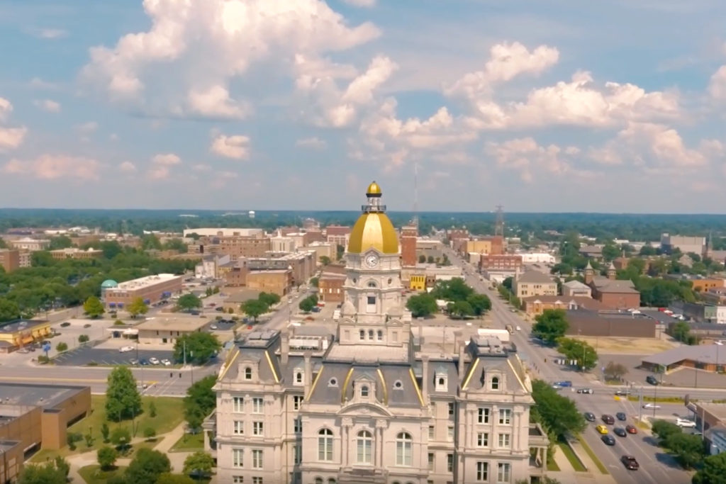
Last week, my alma mater, the Purdue Boilermakers, defeated the local school from Terre Haute, the Indiana State Sycamores. As a consolation prize, let’s give them a forecast.

At 1053AM, ET, Terre Haute was reporting clear skies with a temperature of 35 degrees. High pressure is lodged in the middle of the country, and while a westerly flow of the Lake was leading to some snow to the north, Terre Haute itself was well outside the lake effect fetch.
The subtropical jet is running through the southern part of the Continental US, assisting the ridge in the eastern part of the country, but the Arctic jet is strengthening, and a troughal exit region will develop over the Upper Mississippi Valley, as a cold front emerges at the surface. This is tied to an area of low pressure shifting through the Yukon and Northwest Territories. Showers, to be chased out by chilly air will develop on Sunday morning, with the late afternoon becoming clearer. High pressure will build in again for the holiday week.
Tomorrow – Sunny, High 50, Low 30
Sunday – Some clouds with a little rain in the morning, High 49, Low 36

TWC: Tomorrow – Cloudy skies early, then partly cloudy in the afternoon High 51, Low 31
Sunday – Cloudy and damp with rain in the morning…then becoming partly cloudy. High 53, Low 40

AW: Tomorrow – Periods of clouds and sun High 50, Low 30
Sunday – Cloudy in the morning with a bit of rain, then intervals of clouds and sunshine in the afternoon High 52, Low 38

NWS: Tomorrow – Mostly cloudy, High 51, Low 31
Sunday – A 30 percent chance of showers before 1pm. Mostly cloudy, High 54, Low 37

WB: Tomorrow – Mostly cloudy, High 49, Low 31
Sunday – Mostly cloudy with a 40 percent chance of rain showers in the morning then partly cloudy in the afternoon, High 50, Low 36

WN: Tomorrow – Mostly cloudy, high 51, Low 31
Sunday – Mostly cloudy with light rain showers, High 54, Low 42

FIO: Tomorrow – Overcast throughout the day. High 52, Low 31
Sunday – Rain in the morning and afternoon. High 53, Low 35

A lot of cold air north of Terre Haute is leading to clouds, but there isn’t actually a lot going on up there.

October Forecaster of the Month

I’m not sure it’s happened in a while, but we get to talk about the Forecaster of the Month without having to touch on a major storm cruising through some part of the country. Of course, there is flooding rain in Bellingham, Washington today, so perhaps I should hold my tongue.

There isn’t much to say this month, except that The Weather Channel dominated the month in forecasting, winning easily over any of the competition. They hold a commanding lead for the monthly forecast titles for the year, even though they trail Weatherbug in individual forecast wins.

OutletForecast Wins (year)
Weatherbug13.66
The Weather Channel10.33
Victoria-Weather9
Accuweather7.83
Forecast.io7.33
National Weather Service5.16
WeatherNation1.66

Chilly mornings in Weirton

It seems like a trend of late, where we keep getting these forecasts that bust because morning lows are cooler than expected. This is what happened in Weirton as well on Thursday and Friday, with morning lows settling in about 5 degrees cooler than expected. The rain that the city saw wasn’t a hang up, and the high temperatures were pretty well in line, but those pesky lows…. Ultimately, the rain was a hang up for Weathernation, who lost out on the top spot because they didn’t have it for Friday, but Accuweather and the National Weather Service did, and were able to overtake WeatherNation to secure a victory.
Actuals: Thursday – .1″ of rain, High 72, Low 39
Friday – .16″ of rain, High 56, Low 40

Grade: C-D