For as heavily as the northeast has been impacted by the weather this year, and all the talk we get every winter of nor’easters and what not, the little round of showers that passed through on early Wednesday morning is almost mythological. The 5 hundredths of an inch that came to Portland on Wednesday morning before the sun was up registered only in the observations at the airport. For the first time in November, the win didn’t go to Victoria-Weather, but rather to Weatherbug. The big differentiator was the low temperature forecasts, as the low temperatures were much cooler than expected. Actuals: Tuesday – High 66, Low 32 Wednesday – .05 inches of rain, High 56, Low 38
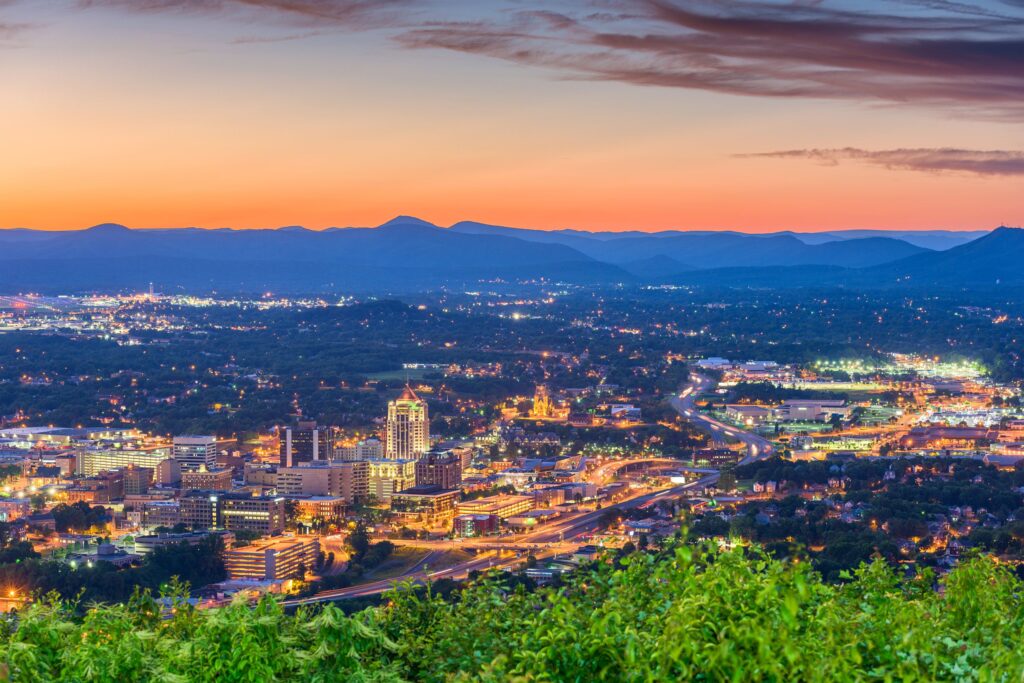
One thing I definitely remember about college was going to the early afternoon football games. It was cool, with highs only in the 60s, and the sun would be shining. Purdue would win more than they lost in those years, and I would get home happy…. until I realized I was completely sunburnt. That was the vibe I was getting from the forecast for Roanoke, which warmed to the mid-60s on Sunday, with help from the dry atmosphere in the mid-Atlantic. Especially after a cloudier day with a high of 53 on Saturday, I am sure the 66 degrees left a lot of people outside, getting more sunburnt than they would have guessed. My skin care discipline is not the best, but Victoria-Weather was able to collect the top forecast for the day. Actuals: Saturday – High 53, Low 29 Sunday – High 66, Low 32
We are getting way up in the West Virginia Panhandle for tonight’s forecast. There is a nasty autumnal storm moving through the Plains, which will only bring the same for the Ohio Valley this week. But how nasty might it get?
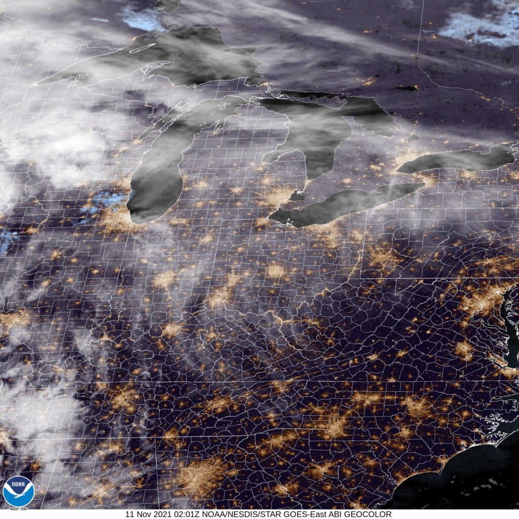
At 953PM, ET, the Weirton area was reporting a temperature of 53 degrees with clear skies. The eastern US is under high pressure, but an active area of low pressure threatens to change the pattern. This feature is in the early part of it’s life cycle, existing as an elongated pressure trough centered from Minnesota to eastern Oklahoma. The jet exit region of the trough fostering this low will strengthen and course the system to occlude and take on the more typical comma shape of strong transitional season systems. Already, the system is ejecting some high cirrus that is nearing northern West Virginia, and that will ensure that gray skies are the order of the day tomorrow, even before precipitation arrives. By tomorrow evening, the system will be mature and the first spots of rain will arrive. The front associated with this system will arrive with gusto between about 8 and 10pm, with rain and breezy conditions likely. The precipitation will clear out fairly quickly and with a shot of crisper air. Friday will be cooler but with more sun. Tomorrow – Cloudy, with rain, and maybe an isolated rumble of thunder late, High 68, Low 47 Friday – Rain early, then cool, High 55, Low 45
TWC: Tomorrow – Cloudy. Slight chance of a rain shower. High 71, Low 46 Friday – Except for a few afternoon clouds, mainly sunny (early rain). High 58, Low 45
AW: Tomorrow – Warm; sun and areas of high clouds in the morning, becoming cloudy in the afternoon with a passing shower High 69, Low 43 Friday – Some sun, then turning cloudy, breezy and cooler (Early rain) High 57, Low 45
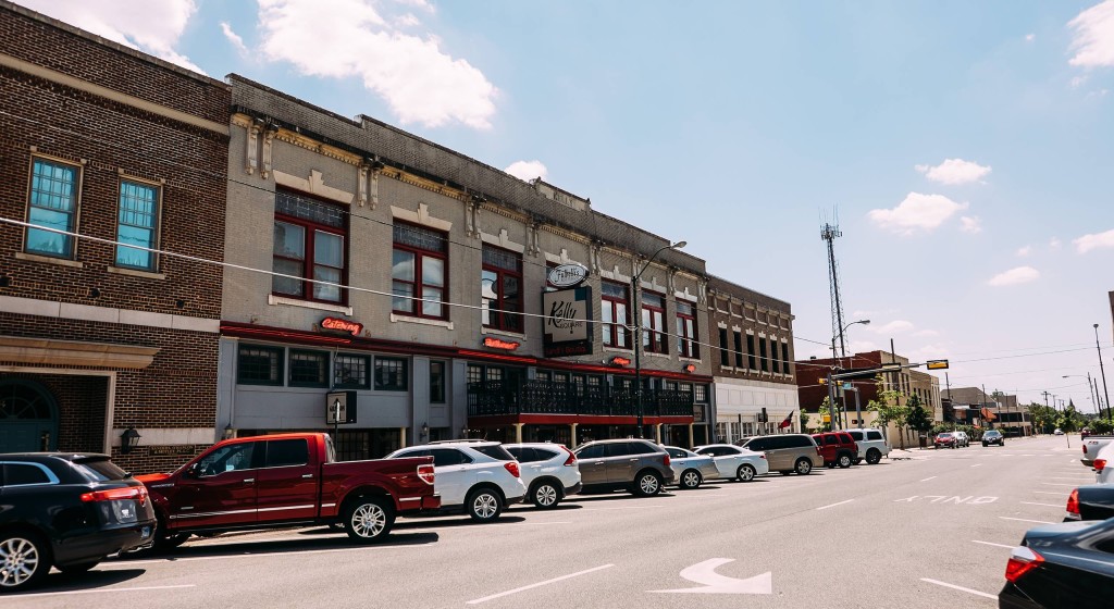
Forecasts across the board forecast for light rain on the morning on Wednesday the third in Sherman, Texas. The remnants of a system were on their way out of town, and a it appeared as though the worst of the night had long since passed by Tuesday evening’s forecast. Overnight, some of the trailing precipitation caught a little bit of extra energy, and before mid morning, Sherman saw another inch of rain. That’s definitely not just light showers. The temperature forecasts were decent, and we all did forecast for rain, so the forecast scores are pretty decent, but that doesn’t reflect just how sloppy things ended up after our forecast. Victoria-Weather took the top prize in Texas. Actuals: Wednesday – 1.07, High 47, Low 44 Thursday – High 54, Low 37
We are forecasting for Portland, Maine mere days after verifying a forecast for Portland, Oregon. I have nothing to add to that, but felt as though I needed to acknowledge it.
At 751PM, ET, Portland was reporting a temperature of 42 degrees with clear skies. In what can only be described as an upset victory, New England was entirely under clear skies on this early November evening. The most recent Gulf Stream storm was well off the coast, and actually helping to inhibit moisture for the next system working its way across Hudson Bay. That feature over Hudson Bay, while limited in potential precipitation, is still backed by good upper level support and substantial surface reflection in terms of temperature and lack of moisture. Tonight will ultimately be a foggy one for Portland and most of coastal Maine, however the cold front will bring first a spot of light rain overnight Tuesday to Wednesday, with a chance for cooler crisper air after the morning low clouds clear out on Wednesday. Tomorrow – AM fog, then mostly sunny, Light rain possible rain before midnight High 58, Low 37 Wednesday – Light rain through the morning, becoming sunny, High 57, Low 38
TWC: Tomorrow – Plentiful sunshine. High 60, Low 37 Wednesday – Showers in the morning, then partly cloudy in the afternoon. High 55, Low 42
AW: Tomorrow – Mostly sunny; great day to be outside High 57, Low 35 Wednesday – Clouds breaking, a shower possible High 55, Low 41
NWS: Tomorrow – Sunny High 60, Low 40 Wednesday – Cloudy through mid morning, then gradual clearing, High 55, Low 40
WB: Tomorrow – Mostly cloudy, High 59, Low 32 Wednesday – Mostly cloudy in the morning, then clearing (rain early) High 53, Low 39
WN: Tomorrow – Mostly sunny, High 60, Low 41 Wednesday – Partly cloudy with isolated showers, High 55, Low 45
FIO: Tomorrow – Clear throughout the day. High 60, Low 39 Wednesday – Light rain overnight and in the morning. High 57, Low 46
It’s going to be a nice couple of days in Portland, and the rain will even have the decency to come overnight. Look how beautiful New England is tonight.
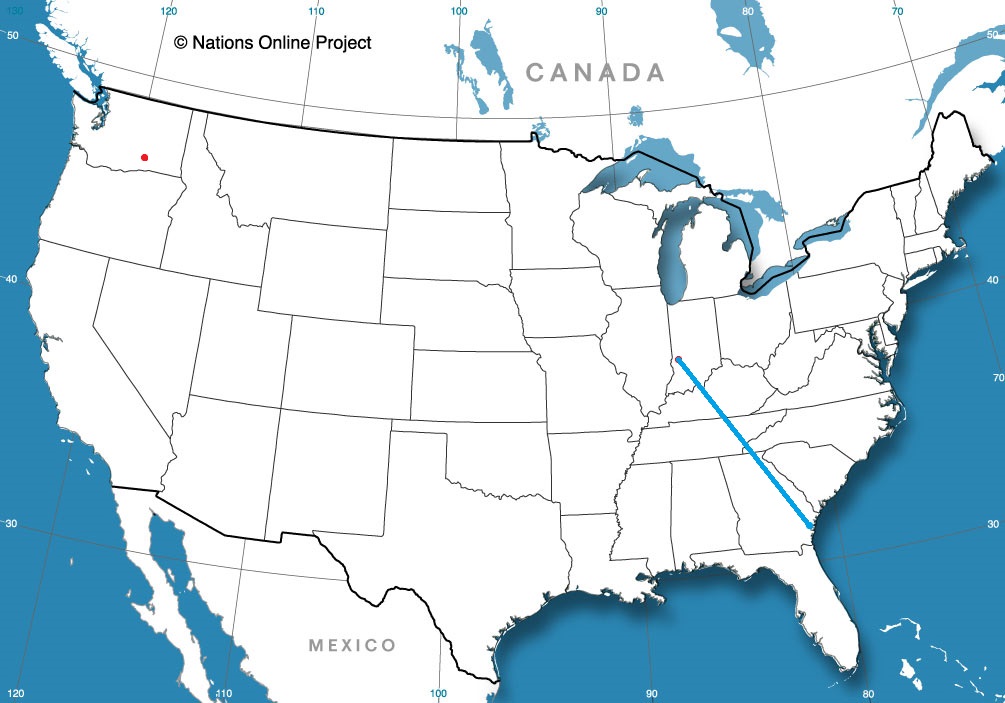
Tonight, we take a trip through what should be some nice weather. It’s a two day trek from Sherman to Roanoke, and will cover 1080 miles. That means a pace of 67.8 mph, and that will ultimately mean about 543 miles on the first day, which is a nice even split of the trip into two days.
DAY ONE (Sunday)
Sherman, Texas
High pressure is in charge east of the Mississippi, and an emerging low in the Plains is helping direct some southerly flow to the region. Our drive will be in the sun, in warmer air than the region has seen for a couple of days. We’re going to make it through Arkansas and into Tennessee. Parkers Crossing, Tennessee will be the destination. The town is just northeast of Jackson.
DAY TWO (Monday) That high pressure is just going to hang on in the eastern US. Even the drive through the Smokey Mountains and astride of the Appalachians will be devoid of the fog and haze that can be persistent in that area. Roanoke will be nice for the autumn.
Good evening! Let’s get this weekend forecast off the ground, shall we?
At 1254AM, ET, Roanoke was reporting clear skies and a temperature of 36 degrees. With clear skies and dew points sub freezing, frost is a foregone conclusion tomorrow morning. A sharp trough moving into the area is bringing cold air to he region, but more significantly outside of Roanoke, will aid in the development of a low in the Bight of Georgia, which will prove impactful later this weekend. As the system develops this weekend, it will reinforce the chilly air invading the Roanoke area. There may be a few scattered clouds thanks to the flow over the Appalachians, but there is no threat of the feature moving onshore far enough to bring rain or snow to Roanoke. Expect cool temperatures but generally sunny skies through the weekend, but rain, potentially flooding rain and high surf in Georgia and South Carolina, not that far away. The trough will flatten a bit on Sunday, allowing some warmer temperatures to conclude the weekend. Tomorrow – Partly cloudy, High 53, Low 30 Sunday – Partly cloudy, cool and crisp, High 61, Low 34
TWC: Tomorrow – A mix of clouds and sun early, then becoming cloudy later in the day. High 55, Low 30 Sunday – Mostly cloudy skies early, then partly cloudy in the afternoon. High 62, Low 36
AW: Tomorrow – Times of sun and clouds High 54, Low 34 Sunday – Partly sunny High 62, Low 38
NWS: Tomorrow – Mostly sunny High 54, Low 29 Sunday – Mostly cloudy, then gradually becoming sunny, High 62, Low 38
WB: Tomorrow – Mostly sunny, High 54, Low 33 Sunday – Mostly sunny, High 62, Low 35
WN: Tomorrow – Partly cloudy, High 54, Low 29 Sunday – Partly cloudy, High 62, Low 38
FIO: Tomorrow – Mostly cloudy throughout the day. High 55, Low 30 Sunday – Mostly cloudy throughout the day. High 62, Low 34
The pattern is unkind specifically to Charleston lately. Persistent troughing and development of low pressure over the Bight of Georgia will continue through the early part of the week. Sheesh.
Portland certainly did not miss the rainfall last week, which makes it fairly impressive, in a way, that our forecast fell between the blasts of bomb cyclone and atmospheric river. In fact, on the days of October 27th and 28th, there was only a combined .03 inches of rain. The cloud cover kept temperatures from ranging a whole lot on the 27th, but then, with significantly less activity on the 28th,they really blossomed, hitting 69 degrees. Accuweather did a good job figuring all of this out ahead of time, successfully winning this forecast, notably with the warmest high temperatures on the 28th. Actuals: October 27th – .03 inches of rain, High 58, Low 52 October 28th, Trace of rain, High 69, Low 53
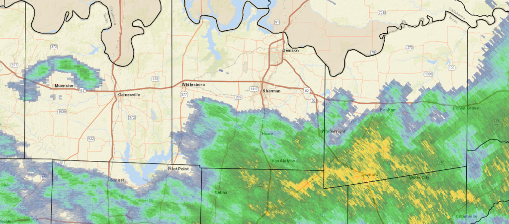
Happy Election Day, and Happy November everyone. We’re going to mosey just south of the Red River and check out Sherman.
At 815PM, CT, Sherman was reporting a temperature of 49 degrees with overcast conditions. A swath of rain was falling just to the south, between Sherman-Denison and I-30, and generally drifting eastward. Scattered showers extended as far to the west as Wichita Falls, so even though the heaviest rain is probably over for the night, more rain is likely on the way tonight. An upper level trough is represented by a notch within a surface ridge, with the ridging expected to overtake the disturbance through the day tomorrow. The rain tonight will continue through late morning, perhaps, but a clear, cool afternoon is anticipated. With high pressure reestablished under an early winter trough, Sherman should see some tastes of normal to slightly below normal temperatures for the season. Tomorrow – Light showers early, then clearing and cool, High 50, Low 45 Thursday – Partly cloudy and chilly in the morning, high 56, Low 40
TWC: Tomorrow – Showers in the morning, then cloudy in the afternoon High 48, Low 45 Thursday – Mostly cloudy skies early will become partly cloudy later in the day. High 57, Low 42
AW: Tomorrow – Cool with occasional rain and drizzle High 51, Low 47 Thursday – Clouds giving way to some sun and cool High 57, Low 42
NWS: Tomorrow – Showers and possibly a thunderstorm before 1pm, then a slight chance of showers between 1pm and 3pm. High 49, Low 47 Thursday – Partly sunny, High 55, Low 43
WB: Tomorrow – Showers and perhaps a thunderstorm in the morning, then a slight chance of showers in the afternoon, High 49, Low 47 Thursday – Mostly cloudy in the morning, then becoming partly sunny, High 56, Low 42
WN: Tomorrow – Cloudy with light showers and isolated thunderstorms, High 49, Low 47 Thursday – Partly cloudy, High 55, Low 43
FIO: Tomorrow – Rain until afternoon. High 52, Low 47 Thursday – Partly cloudy throughout the day. High 57, Low 41
I’m drier and clearer than the rest, and it shows in my temperature forecasts. It looks a little damp tonight.