We looked at Longview in the middle of the month, when east Texas was in the midst of a stormy pattern. We expected that pattern to continue, and for a bit of cooler air to funnel into the region. At the very least, it seemed like overcast skies would conspire to keep it cooler. Not so much. In fact, the day with the most rain, Saturday the 20th, was also the day with the warmest temperatures. Temperature forecasts were not great, overall, but they were passable. The real differentiator, though, was the spot of rain seen early on Sunday. The top spot belonged to a trio, Victoria-Weather, Accuweather and Clime. I did forget to add the forecast for WeatherNation, so they get the consensus numbers. Sorry, WeatherNation. Actuals: June 20th, .55″of rain in thunderstorms, High 89, Low 74 June 21st, .01″ of rain, High 87, Low 75
We are going to the top left corner of your map of the United States tonight. I assume your map is like mine, and has Alaska with Hawai’i in their own insets at the bottom of the page.
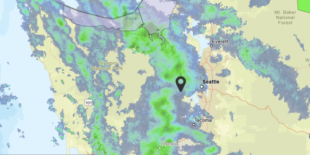
At 1156AM, PT, Bremerton was reporting a temperature of 57 degrees with overcast skies. Temperatures were kept in check by the cloudy skies. A strong jet curled around Vancouver Island into the Pacific Northwest, leading to regionwide instability. As the jet curls inland, steady bands of rain will continue across the Olympic Peninsula and Puget Sound, particularly through tomorrow. Surface organization is always murky in the Pacific Northwest, so the best indicator of the future precipitation in the region will be the upper level flow. As the jet moves inland, it will weekend rather than successfully advect eastward. Whatever surface circulation lingers will move a bit inland by Sunday, with light shower activity continuing to spin back into the terrain of the Cascades and Olympic Mountains, resulting in ongoing fog and clouds, with intermittent drizzle for Bremerton. Tomorrow – Scattered showers through the day, High 67, Low 51 Sunday – Isolated showers, with overcast skies and haze, High 66, Low 52
TWC: Tomorrow – Mostly cloudy. High 68, Low 50 Sunday – Overcast. High 69, Low 50
AW: Tomorrow – Mostly cloudy with a couple of showers High 67, Low 51 Sunday – Mostly cloudy High 69, Low 51
NWS: Tomorrow – A 40 percent chance of rain, mainly between noon and 4pm. Partly sunny, High 64, Low 51 Sunday – Mostly cloudy, High 66, Low 51
WB: Tomorrow – Partly sunny. A chance of rain in the morning then a slight chance of rain late in the morning. A chance of rain in the afternoon High 66, Low 51 Sunday – Mostly cloudy. High 67, Low 52
WN: Tomorrow – Partly cloudy with scattered showers, High 65, Low 51 Sunday – Mostly cloudy, High 67, Low 51
CLI: Tomorrow – Rain Showers, High 66, Low 47 Sunday – Light rain showers, High 67, Low 47
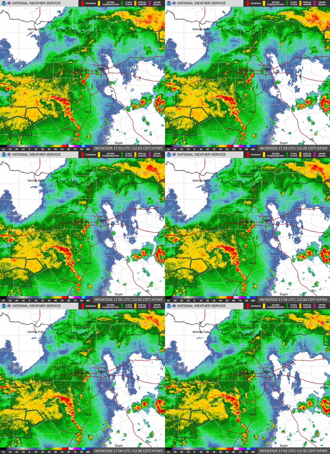
This will be interesting, as Bremerton doesn’t do a great job of reporting rain in their observations. Let’s see how it all plays out! Check this out: I started writing this last night and grabbed a still of the radar then. Not much changed!
Minneapolis is a near and dear to my heart. Most of my life, I’ve lived within the town’s orbit, and it’s always a fun occasion to be able to assemble a forecast for the Mill City.
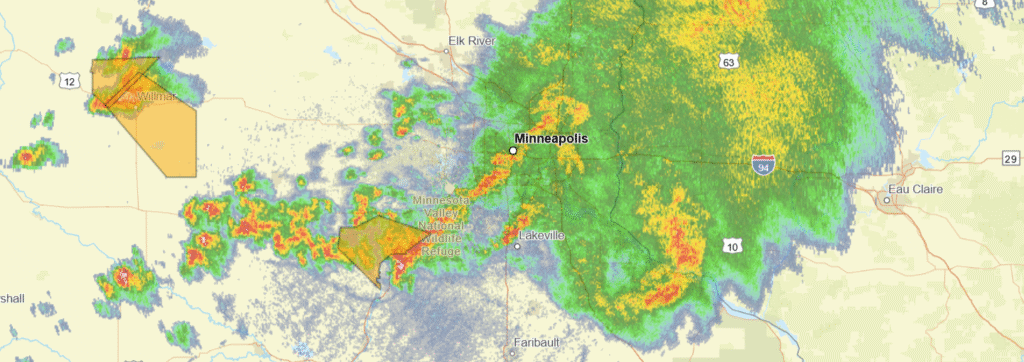
At 415PM, Minneapolis was reporting heavy thunderstorms and a temperature of 63 degrees. A batch of showers and storms has followed a warm front through the day from North Dakota, and is now battering the Twin Cities with heavy rain and some convection. West of this batch of storm activity, more storms were developing underneath the warm front, and ahead of a cold front that was chasing the warm front. These storms have a history of being severe, however given the air modification currently being performed by the complex moving through, they won’t be severe, if they can even hold together, when they reach Minneapolis. The low pressure moving in the Upper Midwest is backed by a bit of upper level support, however the most kinetic action is related to heat and lee troughing in the High Plains. This will cause the system to dawdle as it moves towards Lake Superior, and redirected moisture towards low pressure in the Plains will sap precipitation potential as the week wears on. Don’t be surprised by a mostly cloudy week, even with rain generally north and east from town. Tomorrow – Rain ending before sunrise, mostly cloudy, a bit breezy, High 77, Low 60 Thursday – Partly to mostly cloudy, High 73, Low 58
TWC: Tomorrow – Intervals of clouds and sunshine. A stray shower or thunderstorm is possible. High 75, Low 61 Thursday – Cloudy. High 78, Low 56
AW: Tomorrow – Variable clouds with a couple of showers and a thunderstorm High 77, Low 60 Thursday – Considerable cloudiness High 75, Low 54
NWS: Tomorrow – A 30 percent chance of showers and thunderstorms, mainly between 1pm and 3pm. Partly sunny, High 76, Low 60 Thursday – Mostly sunny, High 75, Low 55
WB: Tomorrow – Partly sunny. A 20 percent chance of thunderstorms in the afternoon. High 77, Low 60 Thursday – Mostly sunny. High 74, Low 58
WN: Tomorrow – Partly cloudy with showers and chance of storms, High 76, Low 60 Thursday – Partly cloudy, High 75, Low 55
CLI: Tomorrow – Light rain showers, High 74, Low 60 Thursday – Overcast, High 74, Low 56
A stormy night that is expected to continue for a while. It’s pretty messy on radar this evening in Minneapolis!
9:46PM: It’s the longest day of the year, which for our purposes means more heat of the day to touch off air mass thunderstorms. A lee trough is bringing weather to the Front Wave, but even with the extra sun, it’s pretty quiet in the middle of the country. Storms, for sure, but the only warning east of Colorado at the moment is in southeast Virginia.
It’s been a stormy June, and even now, it remains stormy between the Ohio Valley and Great Lakes. We had a forecast last week for South Bend, which looked like a couple of days that were going to be stormy. In the end, only Thursday saw storms (though rainfall was not quantified through our monitoring station) that had nearly severe winds. Accuweather had the only correct rain forecast, which lined up with a top temperature forecast. Temperatures on Thursday were held in check by the stormy activity, which kept scores down. Actuals: Wednesday, June 10th, High 90, Low 71 Thursday, June 11th, High 84, Low 65
12:20AM: Like I said earlier, happy Father’s Day! If you are looking for information on our most recent forecast city, I can tell you that things are going extremely quietly for Longview, as east Texas is completely unbothered by showers or storms. Will that hold? Not for the whole region, but maybe in Longview, specifically!
10:57PM: The current round of severe weather, while intense, is certainly in a safer place than it has been lately. As storms continue to the east, they will slide further south than storms that we saw last week, and with a lot less vigor. Happy Fathers Day!
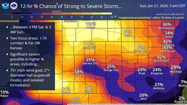
9:23PM: Today was a bit calmer across the country, but business will pick up again in the central Plains tomorrow. Here is a graphic I’ve not seen before, but it promises a busy day in Kansas and Nebraska
10:53PM: This is a mild version of what I expect eastern Texas to look like tomorrow. Stronger activity, maybe a little convection, but not organized, not scary.
The middle of the week has been rife with severe weather. There is more in the mid-Atlantic, but things are finally beginning to look a bit more relaxed. How relaxed in east Texas?
At 1153AM, CT, Longview was reporting mostly cloudy skies and a temperature of 73. The lingering boundary that has been a significant weather maker in the southeast this week now lay from Jacksonville, Florida to a secondary surface feature southeast of Texarkana. A band of showers and storms has slid southeast of Longview, but a batch of showers continues near Dallas, and a dry afternoon is unlikely. There is a low level perturbation seated over southern Missouri that is going to continue to enhance shower and storm activity through the day tomorrow. The more significant jet streak is shifting to the east, with a weak ridge snuffing out the weak low in the south central US. Further bringing about some stability to east Texas is a surface system developing in the Front Range late Saturday, shifting into central Plains on Sunday. This will lead to rising heat and humidity, but clearer conditions, with only a couple of pop up thunderstorms. Tomorrow – Scattered showers and storms, High 83, Low 73 Sunday – Clearing and warmer with isolated showers, High 90, Low 75
TWC: Tomorrow – Scattered thunderstorms in the morning. Cloudy skies late. High 83, Low 72 Sunday – Partly to mostly cloudy. High 88, Low 73
AW: Tomorrow – Humid with intervals of clouds and sunshine High 83, Low 73 Sunday – Humid with sunshine and some clouds; a thunderstorm in spots in the afternoon High 90, Low 75
NWS: Tomorrow – Showers likely and possibly a thunderstorm before 7am, then a chance of showers and thunderstorms after 7am. Cloudy, then gradually becoming mostly sunny High 90, Low 74 Sunday – Mostly sunny, High 93, Low 75
WB: Tomorrow – Mostly cloudy with a chance of showers and thunderstorms. High 83, Low 75 Sunday – Mostly cloudy in the morning then becoming partly cloudy High 89, Low 74
CLI: Tomorrow – Thunderstorm High 83, Low 75 Sunday – Thunderstorm High 90, Low 75
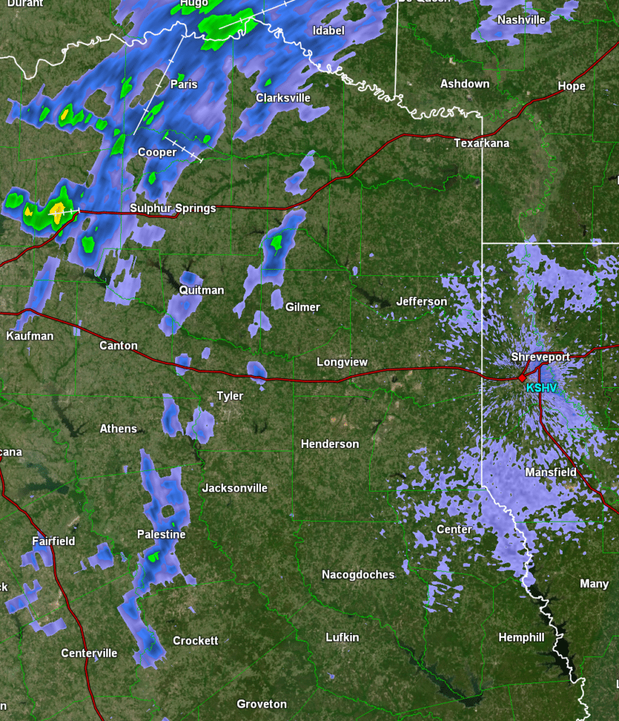
Undersold is that with the low pressure developing to the north, it will also be fairly breezy in Longview on Sunday. Just hot wind. Here’s the diminishing storm activity, depicted on radar!