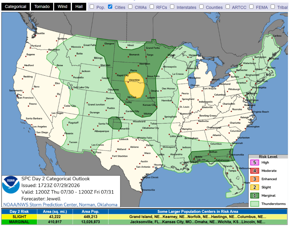
9:44PM The threat for thunderstorms in the dog days of summer are more generalized and far reaching. Severe storms, organized convection and outbreaks are just not common. This is reflected by a pretty green SPC outlook for tomorrow.
from Victoria-Weather

9:44PM The threat for thunderstorms in the dog days of summer are more generalized and far reaching. Severe storms, organized convection and outbreaks are just not common. This is reflected by a pretty green SPC outlook for tomorrow.
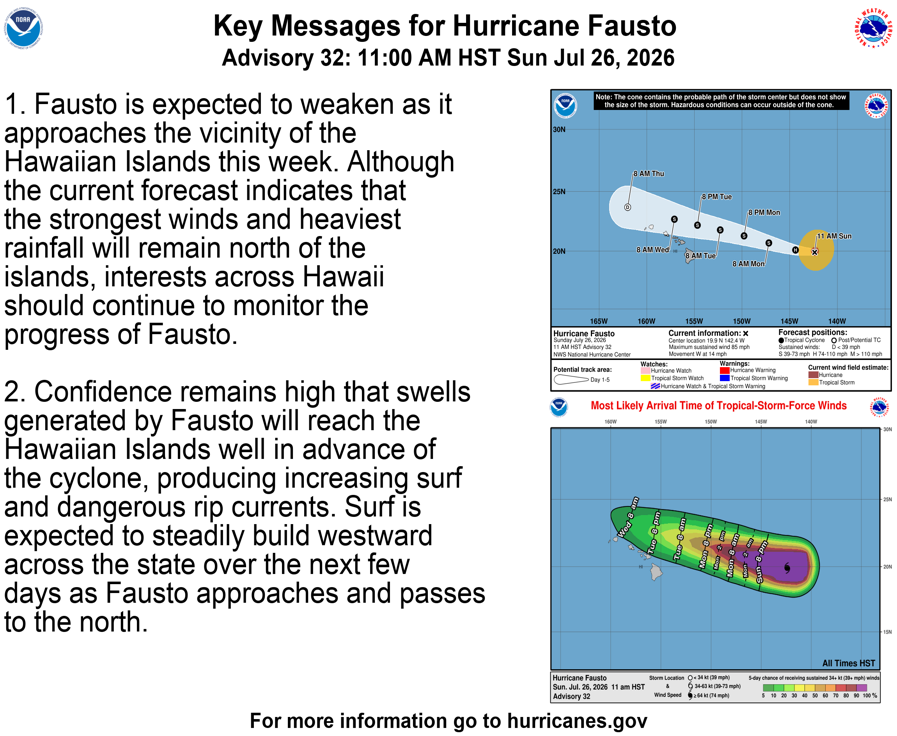
4:55PM: If you hadn’t guessed, I was in Hawaii for the last week and half. Looks like Fausto wants to invade where I just left.
1054PM: Still waiting patiently for things to get going in the western Great Lakes

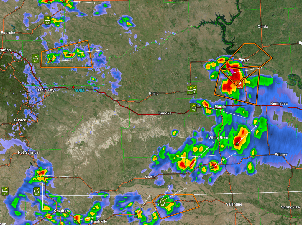
4:06PM: An interesting dynamic here, with three different clusters of sever storms in South Dakota and Nebraska. A couple of low precip, gusty storms, and one big monster hail producer in the middle of the state. This system will organize and turn into a good old fashioned squall, with an enhanced risk downstream in South Dakota.
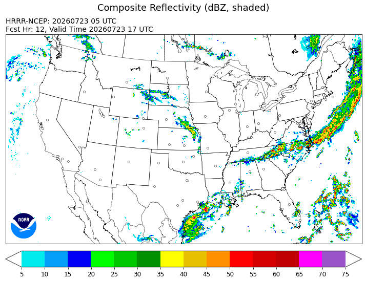
2:57AM: Yes, I am in a different time zone, and yes, I’ve been on vacation. So let’s check in with the HRRR.
It appears there has been some sort of a cold front?
10:01PM Happy Saturday! I think a lot of people label August as the dog days of summer, but it is pretty similar right now. Hot, humid, not much of a break for a lot of the country. This was a good time of year, when I was still in operational meteorology, to do some training or read. There is some down time.
9:46PM: It’s the longest day of the year, which for our purposes means more heat of the day to touch off air mass thunderstorms. A lee trough is bringing weather to the Front Wave, but even with the extra sun, it’s pretty quiet in the middle of the country. Storms, for sure, but the only warning east of Colorado at the moment is in southeast Virginia.
10:57PM: The current round of severe weather, while intense, is certainly in a safer place than it has been lately. As storms continue to the east, they will slide further south than storms that we saw last week, and with a lot less vigor. Happy Fathers Day!
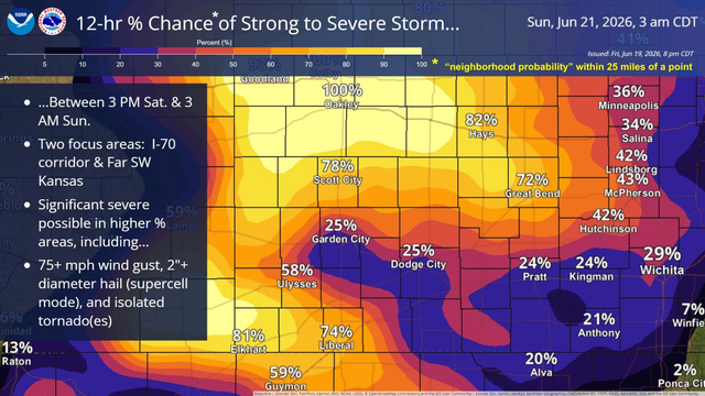
9:23PM: Today was a bit calmer across the country, but business will pick up again in the central Plains tomorrow. Here is a graphic I’ve not seen before, but it promises a busy day in Kansas and Nebraska
10:53PM: This is a mild version of what I expect eastern Texas to look like tomorrow. Stronger activity, maybe a little convection, but not organized, not scary.
10:04PM There has been a litany of thunderstorms across a big swath of the country this week, and even as the threat for tornadoes, wind and hail abate, the lingering effects of torrential rains remain, and will be enhanced by ongoing showers. Thus, we are looking at ongoing flood advisories in the mid-South.
12:17AM: Hello, Gen Z’ers and welcome to June 7th. Somewhat unusually, the main feature for the next several days will be a trough over western Canada. This is leading to severe weather in Montana and North Dakota tonight, and will keep the focus on that part of the world tomorrow as well, and then again by mid week.