I noted in my forecast that I admired the outlets that were leaving rain out of the forecast in Huntsville for Monday. I thought what was showing up in the model guidance was just an overzealous interpretation of the increasing clouds in the area ahead of a cold front and vorticity maximum along the Gulf Coast. I also (this time correctly) suspected that this vort max would reduce overall rainfall in Huntsville, drawing it all into the center of circulation. I should have trusted myself on both accounts, because it didn’t rain a drop on Monday. Not that getting it correct would have helped. Clime ended up winning this one. Actuals: Monday – High 74, Low 54 Tuesday .07 inches of rain, High 64, Low 58
Happy Sunday, thank you for joining us for our second Alabama forecast in a week. I think this might be less interesting than Birmingham a few days ago.
At 953PM, CT, Huntsville was reporting a temperature of 60 degrees with mostly cloudy skies. Dew points mirrored the temperature, and a bit of overcast and fog was settling in over the southern part of the state, likely to encroach on Huntsville overnight as well. Parallel troughs are leading to deeply occluded surface low pressure, the first headed towards Hudson Bay, and a developing low along the lingering boundary over the central Plains. This feature is leading to the return flow and ambient moisture throughout Alabama. Monday will be a fairly humid da for early March. There will be a threat for a rogue sprinkle, but the real threat for rain is coming early on Tuesday. A vorticity maximum analyzed by most models is seen emerging around New Orleans and headed east through southern Alabama on Tuesday. This should limit the capacity for thunderstorms or particularly heavy rain in Huntsville, though the day is still liable to be fairly dreary. Tomorrow – Fog early, then mostly cloudy with some isolated showers, High 75, Low 58 Tuesday – Scattered showers and overcast, High 66, Low 58
TWC: Tomorrow – Areas of patchy fog early. Mostly cloudy skies. High 75, Low 59 Tuesday – Showers and thundershowers in the morning, then cloudy with rain likely in the afternoon. High 66, Low 60
AW: Tomorrow – Mostly cloudy and very warm with a shower in places High 75, Low 57 Tuesday – Cloudy and not as warm with a couple of showers and a thunderstorm High 67, Low 58
NWS: Tomorrow – A 30 percent chance of showers and thunderstorms after 1pm. Partly sunny, High 74, Low 59 Tuesday – A chance of showers, then showers and possibly a thunderstorm after 7am High 69, Low 59
WB: Tomorrow – Mostly cloudy in the morning, then partly cloudy with a chance of showers and a slight chance of thunderstorms in the afternoon, High 73, Low 59 Tuesday – Showers likely and a slight chance of thunderstorms in the morning then showers and a chance of thunderstorms in the afternoon, High 67, Low 58
WN: Tomorrow – Partly cloudy with scattered showers and isolated storms, High 74, Low 59 Tuesday – Mostly cloudy with showers and chance of storms, High 68, Low 59
CLI: Tomorrow – Partly cloudy, High 73, Low 54 Tuesday – Drizzle, High 66, Low 55
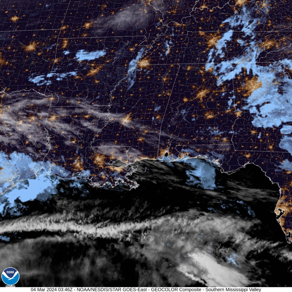
I’m impressed by the outlets leaving rain out tomorrow. They could certainly be right, but I was too chicken to leave it fully out. I worry for Clime’s low temperature forecast. Check out the satellite, with fog really starting to slip into the bayous along the coast.
Sometimes, I cause my own problems. I post something so late that the “tomorrow” of the forecast is actually the “today” of the post time. Sometimes, the issue is that the closest NWS verification facility doesn’t have a 24 hour schedule for observations. Both of these things happened in Huntsville, which made finding the information I needed to properly assess the forecast a bit more challenging. I used Huntsville International for my observations, rather than the Redstone Arsenal, which is closer to downtown, and figured out my own temporal confusions. In end the weather wasn’t particularly dynamic, and everyone assessed an early week cooldown correctly when we put together the forecast Sunday night — er, early morning on Monday. Victoria-Weather, despite our other issues, had the top forecast. Actuals: Monday, the 18th, High 52, Low 32 Tuesday, the 19th, High 46, Low 25
It’s time to put together a forecast in this very warm December. We’re far enough south already that it’s not a concern usually, but I’m not worried about putting snow in the forecast. Will there be storms?
At 1053PM, CT, Huntsville was reporting overcast skies with a breezy northwest wind and a temperature of 44. The clouds are working to arrest a brief cool down as a narrow trough swings through the Great Lakes behind the strong system crashing through the mid-Atlantic. Satellite shows that Huntsville is under the last swatch of overcast, and cooler temperatures should come through by daybreak tomorrow. Cooler temperatures are going to be short lived. High pressure and flow from the southwest will work to bring the warmth back to town. The ridge will take more than the next two days to sneak back out of town, so unseasonable warmth can be expected. Clearer skies overnight will provide a cooler start on Tuesday. Tomorrow – Mostly sunny, High 52, Low 35 Tuesday – Clear and a tad cooler, High 48, Low 26
TWC: Tomorrow – Sunny skies. High 51, Low 35 Tuesday – Sunny skies. High 45, Low 22
AW: Tomorrow – Mostly cloudy; breezy this afternoon High 53, Low 36 Tuesday – Plenty of sunshine, but chilly High 45, Low 24
NWS: Tomorrow – Sunny, High 52, Low 34 Tuesday – Sunny, High 44, Low 22
WB: Tomorrow – Breezy. Partly cloudy in the morning, then clearing. High 53, Low 38 Tuesday – Sunny, High 46, Low 26
WN: Tomorrow – Mostly sunny, High 52, Low 37 Tuesday – Mostly sunny, High 45, Low 24
CLI: Tomorrow – Clear, High 50, Low 27 Tuesday – Sunny, High 41, Low 21
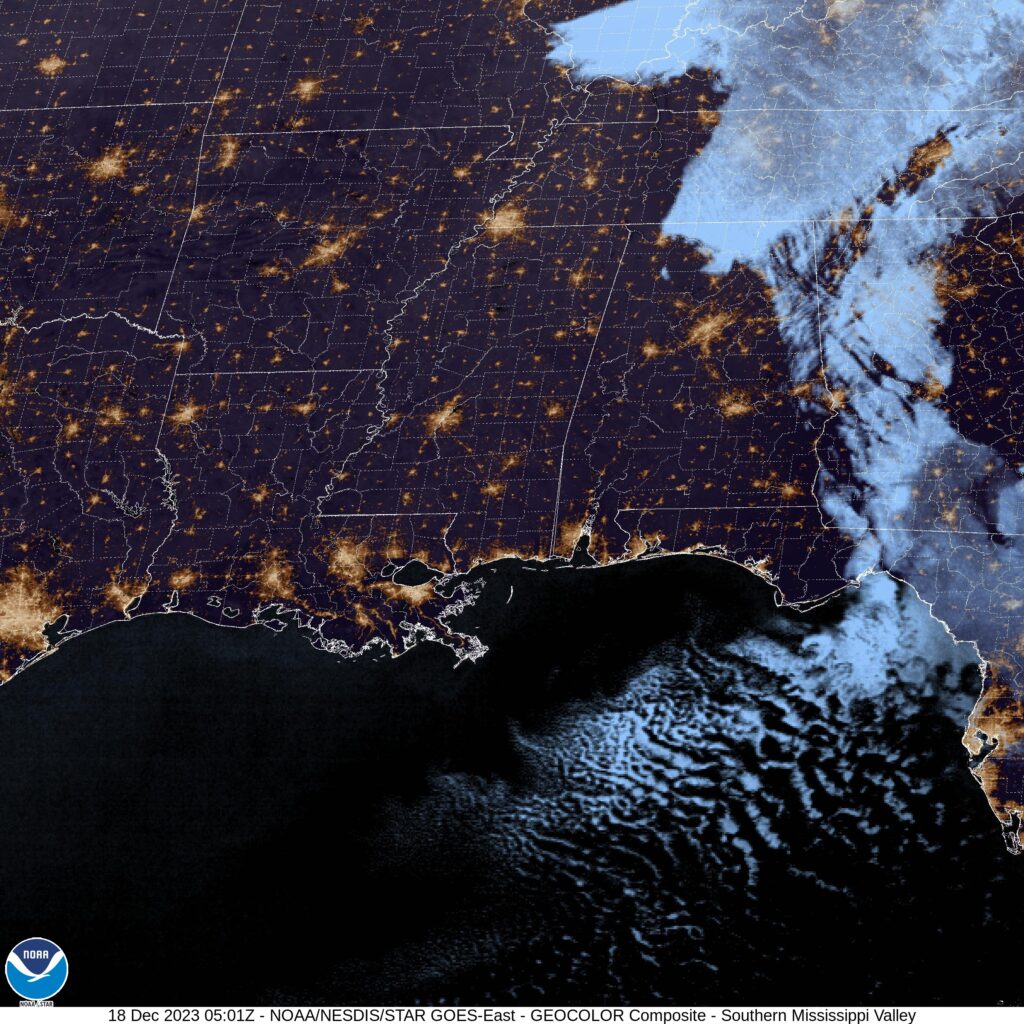
Looks terrific for Huntsville, but a pretty reasonable cool down on Tuesday. The satellite shows that last wisp of clouds in north Alabama.
It seems to this Midwestern forecaster that lately, and especially in the summer, temperatures always sneak past the forecast highs. Apparently, that’s not how it works in northern Alabama! Temperatures failed to surpass 90 in HuntsvHuntsville, Alabamaille as August turned to September, and on the 1st, the low temperature dipped below 60. You can almost sleep in those temperatures! Unbound by our preconceived biases, Forecast.io did not fall into the too warm trap and had the top forecast. Actuals: August 31st, High 89, Low 64 September 1st, High 89, Low 59
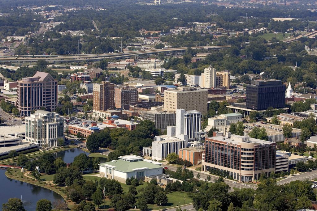
It’s the very end of August, and instead of enduring the heat, many residents of Huntsville – Rocket City, for it’s close ties to the Space Program – are probably indoors following the launch of the Artemis rocket, which was scrubbed yesterday, but will hopefully be launched when weather improves. Speaking of weather, what IS going to happen in Huntsville?
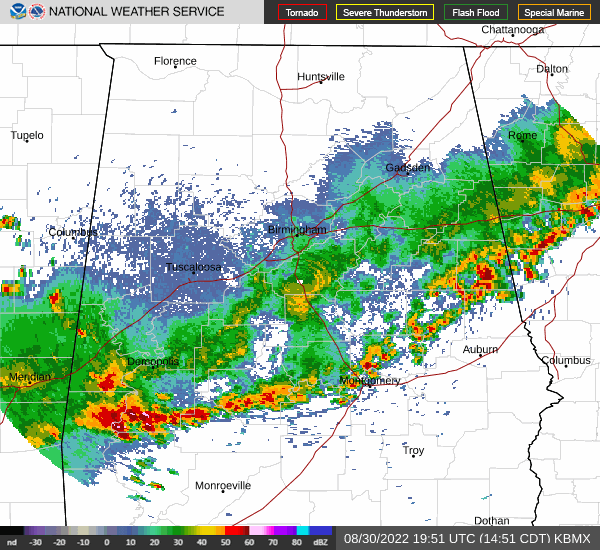
At 1253PM, CT, Huntsville was reporting a temperature of 82 degrees with mostly cloudy skies. Huntsville was one of the rare spots seeing clouds, but high pressure was building throughout the rest of northern Alabama, a rarity this time of year. A line of thunderstorms through central Alabama precedes the south-building ridge, and is allowing Huntsville to enjoy relatively low humidity. The ridge is going to remain stout in the southeast, and keep Huntsville dry through the middle of the week. The cold front bringing thunderstorms south of Huntsville presently is going to weaken as it hits the Gulf Coast and become more permeable. Expect humidity to start building back into the region throughout the forecast period. Tomorrow – Mostly sunny, High 92, Low 66 Thursday – Partly cloudy, High 92, Low 63
TWC: Tomorrow – Sunny high 91, Low 68 Thursday – Sunny, along with a few afternoon clouds. High 92, Low 62
AW: Tomorrow – Mostly sunny and less humid High 92, Low 67 Thursday – Plenty of sun High 94, Low 62
A lot was made of the heat indices in the 110’s across a broad swath of the Plains east through the Great Lakes to the Mid-Atlantic, but Huntsville is at higher elevation, and was battling an area of low pressure that was bringing clouds to the region and some spots of rain near (but not in) Huntsville on Friday and Saturday. Temperatures, as a result, barely scraped 90. Still hot, but not as hot as it could have been. The problem was overnight, when lows were in the muggy low 70s. That’s tough, as the body can’t cool down and recharge, and is an underrated danger of heat waves. As for the verification of Thursday’s forecast, there was a quartet of forecasters on level pegging: Victoria-Weather, The Weather Channel, Accuweather and Forecast.io. Actuals: Friday – High 90, Low 73 Saturday – High 88, Low 72
This drive will straddle the Appalachians, and despite the nexus generally in the Eastern US, we will duck a lot of the traffic trouble. We’re going to take 2 days with a total distance of 1,066 miles. We’ll average 66mph, and will travel 528 miles, a little less than half, on our first day of travel.
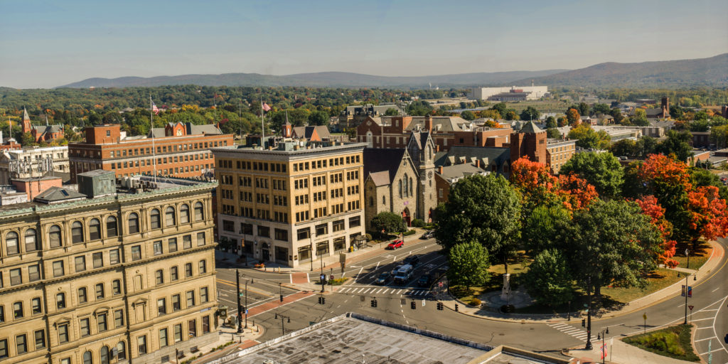
Pittsfield, Massachusetts
DAY ONE (Friday) It’s been a bit active in the eastern United States, but we are looking at a break in the action, at least in the Northeast and Mid-Atlantic tomorrow. A perturbation rolling through the Great Lakes tomorrow will bring some rain to interior New England initially, and reaching the coast by late afternoon. By that time, though, we’ll be well into the Potomac Valley, on our way to Mint Spring, Virginia, which is near Staunton.
DAY TWO (Saturday) The sunshine will continue while we are to the east of the Appalachians, but as we crest them, we will also begin to intersect the moisture flow from the Gulf. Our drive through Tennessee will be dotted with rain and thunderstorms triggered by flow sneaking up the hillsides, and we will have to navigate this threat for the remainder of our drive. There will be more widespread gaps in precipitation the nearer we are to to Hunstville, thanks to the slightly flatter terrain, but the storms will be based nearer to the surface, which suggests a bit more intensity when we are in them. And gosh dang, will it be hot.