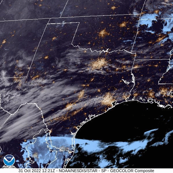
We were forecasting down in east Texas to start the month of November, which was buried under a combination of cold air and onshore flow. College Station was even cooler than expected on the 1st, partially because of a little bit of light rain that fell on town to start the the month, and partially because of the lingering effects of a powerful early season cold front. The trough was narrow though, and temperatures bounced back vigorously on the 2nd, going from a high of 68 on the first to 79 on the 2nd. The National Weather Service collected the victory for this forecast posted on Halloween. Actuals: Nov 1st – .05 inches of rain, High 68, Low 58 Nov 2nd – High 79, Low 54
Texas A&M is located in College Station, and is home to a very good meteorology school. One suspects that at least one of the forecasters in this competition will have a close connection with College Station.
AT 1253PM, CT, College Station was reporting a temperature of 73 with clear skies. A jet streak aloft over east Texas was evident in some streaming cirrus over the region. Further to the south, a thatch of clouds over southern Texas represented return flow on the back end of surface high pressure. As the jet streak carries to the northeast, the Gulf will open further, with moisture allowed to trek north through the state. A weak trough at the entrance of the jet streak is going to exacerbate the shower activity in south Texas, with rain bubbling up through much of the southern half of the Lone Star State. As this upper wave transitions away, and an upper ridge establishes over the center of the country, high pressure will recommit to the southeastern US. Flow into an area of low pressure developing in the High Plains will route north of College Station, and a warm, dry start to November is anticipated. Tomorrow – Chance of evening showers, otherwise warm, High 73, Low 58 Wednesday – Partly cloudy, High 76, Low 60
TWC: Tomorrow – Cloudy early with partial sunshine expected late. High 75, Low 58 Wednesday – Partly cloudy skies. High 80, Low 56
AW: Tomorrow – Intervals of clouds and sunshine with a couple of showers High 73, Low 60 Wednesday – Pleasant with sun and areas of low clouds High 79, Low 60
NWS: Tomorrow – A 20 percent chance of showers before 1pm. Partly sunny, High 72, Low 59 Wednesday – Mostly sunny, High 79, Low 56
WB: Tomorrow – Mostly cloudy in the morning then becoming mostly sunny. High 71, Low 60 Wednesday – Mostly sunny, High 79, Low 58
WN: Tomorrow – Partly cloudy, High 72, Low 54 Wednesday – Partly cloudy, High 79, Low 56
FIO: Tomorrow – Mostly cloudy throughout the day. High 70, Low 57 Wednesday – Mostly cloudy throughout the day. High 77, Low 59
Tomorrow, in a worst case scenario, might necessitate kids staying indoors and eating a whole lot of candy. Happy Halloween!
Never underestimate the ability of a high dew point to hold temperatures back. That was the case in College Station on Wednesday, with dew points in the 70s throughout the entire 24 (actually 48 hour period of the forecast), but another cause was a particularly vigorous onshore breeze that even let in a few drops of mist late in the day on Wednesday. Temperatures were a degree or two cooler than most outlets anticipated as a result. Generally, it was a decent forecast, though, with The Weather Channel and Accuweather claiming a tie. Actuals: Tuesday – High 92. Low 81 Wednesday – High 94, Low 79
East Texas is always a haven of interesting weather. How interesting will it be this week?
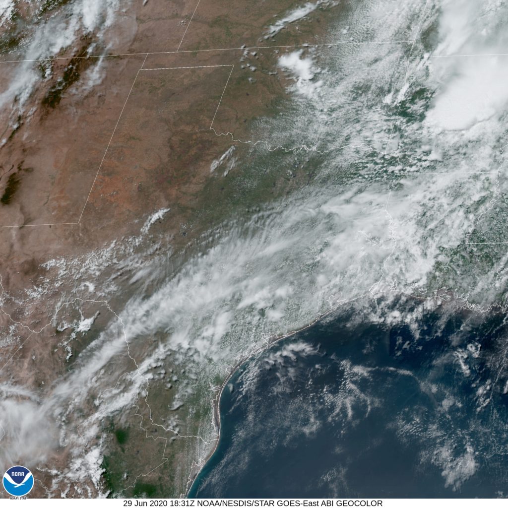
At 1253PM, CT, College Station was reporting a temperature of 90 degrees with mostly cloudy skies. A brisk southerly wind imported moisture from the Gulf, leading to a dew point in the mid 70s, and the general cloudiness of the region. Low pressure in the lee of the Rockies will trend towards dissipation over the next 48 hours, which will snuff out the brisk south winds, leading to a much clearer, and likely much warmer mid-week, even as moisture lingers in the atmosphere. Tomorrow – Partly cloudy, High 93, Low 78 Wednesday – Hotter and sunny, High 97, Low 78
TWC: Tomorrow – Mainly cloudy, High 93, Low 79 Wednesday – Sunshine along with some cloudy intervals, High 95, Low 79
AW: Tomorrow – Breezy and humid with intervals of clouds and sunshine High 93, Low 80 Wednesday – Breezy in the morning; otherwise, humid with intervals of clouds and sunshine High 93, Low 80
NWS: Tomorrow – Partly sunny, High 94, Low 79 Wednesday – Mostly sunny, High 95, Low 78
WB: Tomorrow – Partly cloudy, High 91, Low 80 Wednesday – Partly cloudy, High 92, Low 80
WN: Tomorrow – Partly cloudy, High 94, Low 79 Wednesday – Partly cloudy, High 95, Low 78
FIO: Tomorrow – Humid and mostly cloudy throughout the day. High 94, Low 78 Wednesday – Humid and mostly cloudy throughout the day. High 96, Low 77
Oppressive. Here is a look at the satellite imagery, with clouds across Gulf Coast Texas.
The weekend forecast for College Station, TX was pretty straightforward: Hot and dry. That’s pretty much how it panned out as well. The only hitch in the forecast’s giddy-up was that the overnight lows were just a smidge higher than some had expected. Oh well, I doubt too many people were complaining about it being 74 instead of 72. Weatherbug narrowly edged out NWS/WN for the victory.
Saturday: High 97, Low 74. Sunday: High 94, Low 74. Forecast Grade: A
As we head into the first weekend of October, we head into southeast TX to take a look at College Station, home of Texas A&M! Can we expect some football weather or is the south still holding on to a bit of summer?
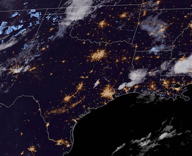
At 953pm CDT, the temperature at College Station, TX was 83 degrees under fair skies. Normally the people of the city would be gearing up for a big Football Saturday and root their Aggies on, but not this weekend as it’s a bye week for them. Luckily, the fans don’t have to be outside watching them play as it’s shaping up to be a very hot weekend in southeast TX. Weak high pressure continues to linger over the region while the main dome of it is parked well out east. An area of low pressure is shifting through the Central Plains into the Upper Midwest and while it will bring rain and thunderstorms from MN/WI down into KS/OK, it’s going to be pretty quiet on Saturday as just some isolated thunderstorms may pop off towards the LA/TX border. The cold front dropping through the Plains will gain more steam throughout the day on Sunday, bringing showers and storms to AR/OK and northern TX, but by the time the front makes it to the area, it should be during the early Monday morning hours. In the meantime, temperatures look to hit the mid-90s all weekend. A sweltering start to October!
Saturday: Partly cloudy and hot. High 94, Low 72.
Sunday: Partly cloudy, continued hot. High 95, Low 72.
TWC: Saturday: Mostly sunny. High 95, Low 72.
Sunday: Mostly sunny. High 95, Low 73.
AW: Saturday: Mostly sunny. High 95, Low 71.
Sunday: Mostly sunny and hot. High 94, Low 72.
NWS: Saturday: Sunny. High 95, Low 73.
Sunday: Sunny. High 94, Low 72.
WB: Saturday: Mostly sunny. High 94, Low 74.
Sunday: Partly cloudy. High 93, Low 74.
WN: Saturday: Mostly sunny. High 95, Low 72.
Sunday: Mostly sunny. High 94, Low 73.
FIO: Saturday: Humid and partly cloudy throughout the day. High 94, Low 72.
Sunday: Partly cloudy throughout the day. High 94, Low 71.
It’s a quiet night for the most part around southeast TX tonight, some storms are lingering east of Houston. A fairly quiet couple of days are in store so enjoy this hot weekend!