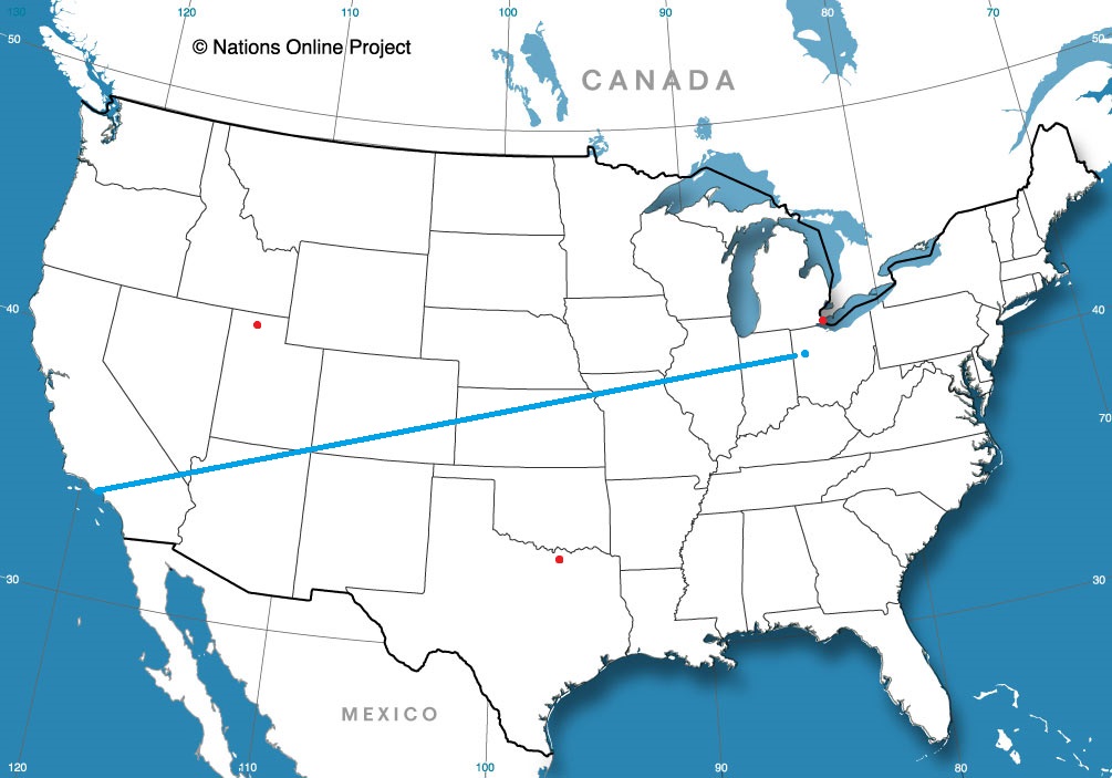
We’re off on a fairly short trip, that somehow still covers 4 states. It will take 6 1/2 days to cover 439 miles, which equates to a pace of about 67.4mph, which is impressive, given the mountainous terrain we will cover through much of our journey. Thanks, freeways.
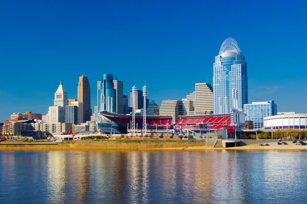
Cincinnati, Ohio
There is a mess of instability in the north Atlantic, and it is extending a few memories into the eastern US. By tomorrow morning, we will see a trough in the Great Lakes and a band on the Atlantic side of the Appalachians, from Virginia to South Carolina. The trough in the Great Lakes is going to leave us alone, though it will be breezy for most of our drive, until about Knoxville. A tropical wave near the Bahamas is going to leak to the north and inflame that rain in the coastal plains. It often seems like it is raining between Knoxville and Asheville. Lean more towards the Asheville side this time, and anticipate a shower or two in Hickory when we role in.
Temperatures were expected to be on cool side in the afternoon in Olympia, thanks to a couple of waves pumping through the Pacific Northwest. The biggest surprise of the whole deal was that temperatures last Sunday started to plummet on the evening. Temperatures were significantly cooler than expected on Sunday, which really made scores look worse than they may actually have been. WeatherNation was able to sneak in for a victory, but scores were all pretty close. Actuals: Sunday, .01 inches of rain, High 59, Low 44 Monday – High 55, Low 45
There are a lot of quirks about Cincinnati. First, the airport is actually across the Ohio River in Kentucky. Next, the radar terminal for the area is actually to the north, in Wilmington, because the WFO there services Columbus, Dayton and Springfield, as well. It begs the question: what exactly IS Cincinnati?
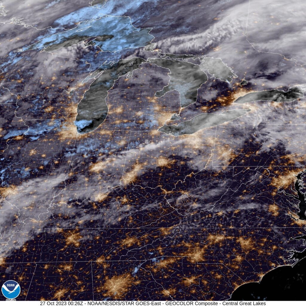
At 352PM, ET, Cincinnati was reporting a temperature of 74 degrees with mostly cloudy skies. The clouds were patchy or much of the tri-state region, with clearer skies at other nearby sites. Low pressure over the northern Plains is entangled with some tropical energy from the south and drenching the western Great Lakes. The two bits of energy are also attached to parallel jet streaks, which are boosting the energy but hampering the mobility of the feature. The leading band of rain is diminishing over Indiana and northwest Ohio tonight, and will wear itself out through the morning hours tomorrow. The trailing cold front will be dragged into the region later in the day Friday, arriving in the predawn on Saturday. By this point, low pressure will be developing over the central Rockies, with a warm front rising towards the Ohio Valley by the late evening, bringing a chance for steadier rain to the region after a cooler day beforehand. Tomorrow – Cloudy with scattered showers, High 74, Low 63 Saturday – Overcast with light rain early, cooler, and more rain late, High 67, Low 57 (Non standard)
TWC: Tomorrow – Showers in the morning, then cloudy in the afternoon. High 76, Low 64 Saturday – Cloudy. Periods of rain early. High 66, Low 60
AW: Tomorrow – Breezy and warm with periods of clouds and sunshine High 76, Low 64 Saturday – Variably cloudy with a thunderstorm High 68, Low 59
NWS: Tomorrow – A chance of rain before 2pm, then a chance of rain and thunderstorms between 2pm and 5pm, then a chance of rain after 5pm. Partly sunny High 77, Low 65 Saturday – A chance of rain. Cloudy High 67, Low 60
WB: Mostly cloudy with a chance of rain, High 72, Low 66 Saturday – Cloudy with a chance of rain, High 65, Low 59
WN: Tomorrow – Partly cloudy with scattered showers and isolated thunderstorms, High 77, Low 65 Saturday – Mostly cloudy with isolated storms, High 67, Low 60
CLI: Tomorrow – Rain showers, High 76, Low 61 Saturday – Thunderstorm, High 66, Low 58
It will be particularly interesting to keep an eye on the temperature trendline for Saturday. Post cold front to overcast to warm front, it could go a lot of different directions.
Halloween is coming soon, followed by the rest of the Holiday season. It’s getting busy of all of us, so these forecasts get a little bit more important to daily life.
We verified a forecast for Racine yesterday, and I will just say that the verification in Victoria could not have been more different. For one thing, it was sunny throughout the forecast period. An expected advance from a tropical storm never really happened and it was honestly pretty great through the middle of last week, just a bit more humid on Wednesday. Clime kept their momentum (ah, there is the title source) by tying Accuweather for the forecast victory. Actuals: Tuesday – High 77, Low 44 Wednesday – High 83, Low 50
A site that review every time I am thinking about the weather is the Aviation Weather Services Decision Support page. The “ADDs” page had observations and flight conditions for every site in the country, initially, and after some updates, any site with an observation in the world. It was a great, easily digestible first stop when looking at the weather.
As is usually the case with life and the internet, the ADD’s page changed. Actually, it pretty much went away, replaced by something new, the Aviation Weather home page. It’s even better. The AWC released an introductory video that walks you through the site.
The new site does some great things. First, it combines all the most useful elements to paint a picture of current conditions, from those terminal observations to radar and satellite imagery. Also on the site, you can find winter weather and all sorts of other governmental forecast sites. There are a couple of different selectable choices, namely the Winter Weather Dashboard and Traffic flow Management Portals, selectable through the Tools option at the top of the page, that serve as clearing houses for important weather links, including the Storm Prediction Center. or the HRRR model.
Poke around it, certainly, to see if there is anything in it for you. I know I’ll be back there learning all of her tricks nearly every day of the week.
We forecast for Racine, Wisconsin a couple of weeks ago, just as a soaker of a storm was going to roll in. On the 13th and 14th of the month, Racine saw a combined total of 1.9 inches of rain. Weather observers needed only look at the rainfall for those two days as well, as for the 48 hours, the high temperature was 57 and the low was 50, both occurring on the 14th. It stayed between 53 and 57 on the 13th. That’s a good sign that the clouds are smothering you, when the temperatures refuse to budge like that. Clime was the steady hand in southeast Wisconsin, earning the top forecast. Actuals: October 13th, .76″ of rain, High 57, Low 53 October 14th, 1.14″ of rain, High 57, Low 50
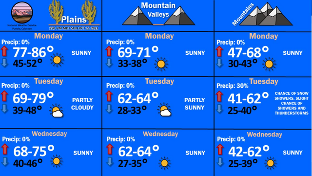
NWS Pueblo just posted this graphic. I think we all know that the Plains are warmer than the mountains, but I think the real intrigue is how close valley temperatures are to the mountains.
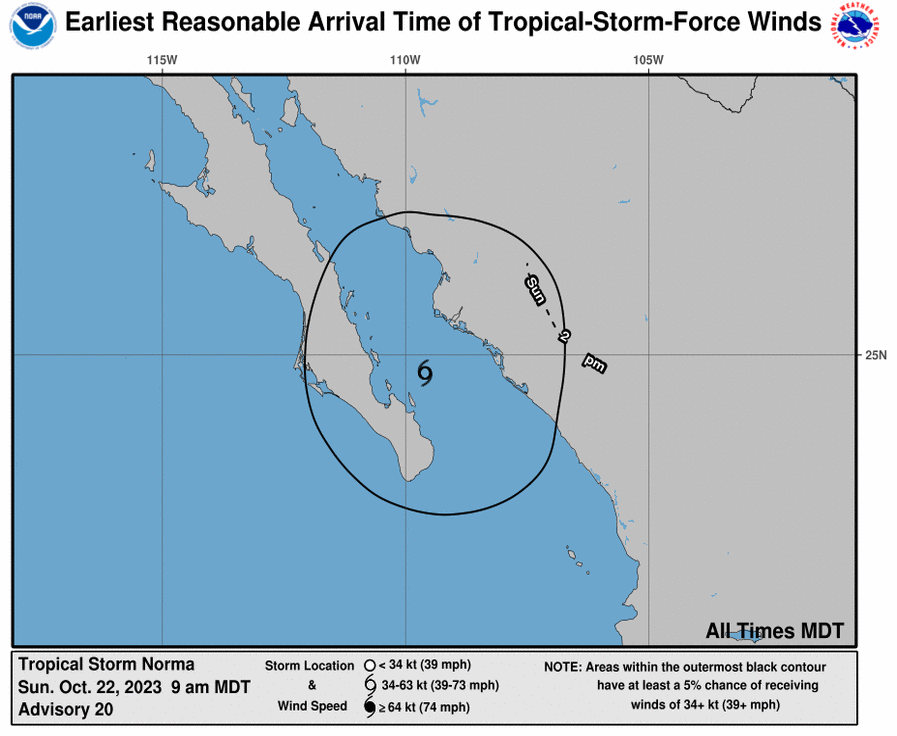
Back when I forecast for Victoria, the forecast took into account Hurricane Norma, which was scheduled to attempt to traverse northern Mexico. Well, it’s Sunday, and Norma is still just hanging out. We’ll see what happens with that verification, what with our no show.
The latest guidance has Norma taking a more northerly tract. It looks rainier than it did when we looked at the beginning of the weekend, but will never really reach east Texas. Instead, look for Norma to bring some heavy rain to west Texas after arriving from the southwest. You know, like tropical features do so often.
We’re off to Washington for this weekend issued forecast. Olympia is the capital of Washington, and the southern most city on the Puget Sound. Let’s check out Western Washington.
At 154PM, PT, Olympia was reporting a temperature of 54 degrees with a low overcast that was blanketing most of the Sound. There was a little bit of rain mixed with these clouds moving north through Centralia, with a some light rain likely to come to the capitol in the next couple of hours. A weak circulation off the coast is driving flow on shore, which is helping to encourage the thick layer of coastal clouds that Washington is enduring this morning. The low is not expected to deteriorate until a parent upper level trough moves onshore late tomorrow. There will be a break in the clouds on Monday morning, but the upper level flow will be reinforced, and a trough will redevelop over Vancouver. The threat on Monday night will be from rain, rather than simply from overcast, though most of the activity will come to the north Sound. Tomorrow – Overcast through the afternoon, chance of a little bit of drizzle. High 61, Low 52 Monday – Breaks in the clouds early, then clouds return with some late showers, High 56, Low 47
TWC: Tomorrow – Areas of fog early, then partly cloudy in the afternoon. Slight chance of a rain shower. High 64, Low 51 Monday – Partly cloudy High 59, Low 47
AW: Tomorrow – Mostly cloudy with a shower in the area High 65, Low 49 Monday – Cloudy High 57, Low 46
NWS: Tomorrow – A 40 percent chance of rain. Cloudy, then gradually becoming mostly sunny, High 61, Low 51 Monday – Mostly cloudy (late rain), High 58, Low 46
WB: Tomorrow – Mostly cloudy, High 60, Low 53 Monday – Mostly cloudy, High 56, Low 48
WN: Tomorrow – Mostly cloudy with scattered rain showers, High 60, Low 52 Monday – Mostly cloudy, High 57, Low 47
CLI: Tomorrow – Partly cloudy, High 63, Low 48 Monday – Mostly cloudy, High 58, Low 43
I think I am more aggressive with my rain forecast because of the rain falling with the weak system in the area today that isn’t being handled by the models.