Michigan City, Indiana to Bellingham, Washington

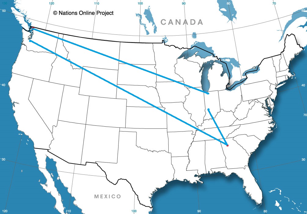
It’s autumn, and it ure feels that way east of the Rockies, even if that’s not the case along the west coast. We’ll take a 4 day run to Puget Sound, which will cover 2182 miles. There is a lot of interstate contained on this route, even if we are covering some high terrain, so the pace will be about 68.2 mph, good for 545 miles a day.

DAY ONE (Thursday)

Michigan City, Indiana

One of the factors in the Upper Midwest being cooler than normal is the presence of deep low pressure over Labrador, which is swinging more cold air and troughing into the area. It will clear up today in Michigan City, but more drizzle and clouds will emerge by tomorrow morning, and will be the situation through most of our Thursday drive. Some drips and drops will spatter our windshield through Chicago, Milwaukee and Madison, and probably won’t truly clear up until after we pass through LaCrosse. We’ll make it to Lakefield, Minnesota before we pull off for the night.

DAY TWO (Friday)
High pressure is entrenched west of that deep area of low pressure. There might be a few high streaking clouds over the western Dakotas, but I would hard pressed to believe they will touch the ground. We’ll traverse South Dakota and clip northeastern Wyoming before we stop in Boyes, Montana, a ghost town in the southeastern corner of the state. It’s going to start warming up by the end of the day.

DAY THREE (Saturday)
The entirety of our day will be spent in the windswept prairies of eastern Montana, and the peaks of western Montana that will be significantly less windswept, and definitely not as cool as you might hope. We’ll make it to Wye, on the northwest side of Missoula, and call it a night.

DAY FOUR (Sunday)
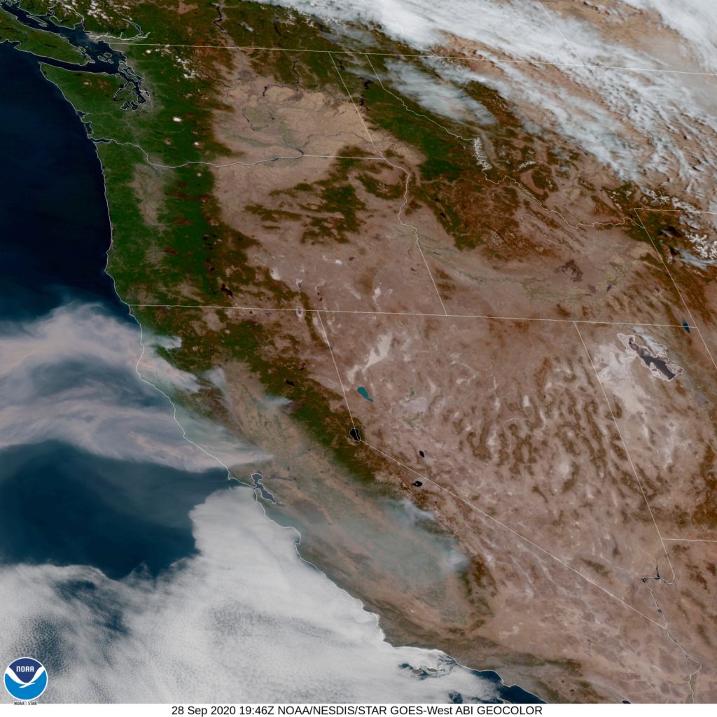
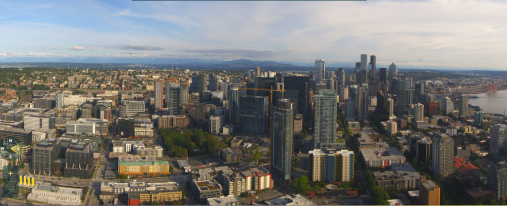
The best news for our Sunday drive is that the threat for wildfires in the Pacific Northwest has significantly lessened. It will be dry and unseasonably warm in the interior west, before it gets a bit more comfortably as we head north from Seattle into Bellingham.

By Nick Kelly / Faithlife Corporation – Faithlife Corporation, CC BY-SA 4.0, https://commons.wikimedia.org/w/index.php?curid=37611512

Bellingham, Washington

It’s interesting how things can change, isn’t it? Usually, when we consider a forecast for a place like western Washington, we would wonder about the threat for rain, but now we are left speculating about the continued impact of so little rain.

At 1253PM, PT, Bellingham was reporting a temperature of 69 degrees with clear skies. There isn’t much going on in the Pacific Northwest, and the only activity on the west coast satellite imagery was smoke emanating from fires in northern California.
Strong low pressure in the Gulf of Alaska is barricaded by high pressure in the west coast. A strong ridge aided by some southerly flow will ensure that Washington remains clear and dry for at least the next two days.
Tomorrow – High 75, Low 52
Wednesday – High 76, Low 52

TWC: Tomorrow – Mainly sunny High 72, Low 53
Wednesday – Sunny.  High 75, Low 54

AW: Tomorrow – Pleasant with plenty of sun High 71, Low 52
Wednesday – Warm and smoky with hazy sunshine High 72, Low 52

NWS: Tomorrow – Sunny, High 73, Low 53
Wednesday – Sunny, High 74, Low 55

WB: Tomorrow – Sunny, High 71, Low 52
Wednesday – Sunny, High 73, Low 56

WN: Tomorrow – Mostly sunny High 74, Low 53
Wednesday – Mostly sunny, High 75, Low 55

FIO: Tomorrow – Clear throughout the day. High 72, Low 51
Wednesday – Clear throughout the day. High 74, Low 55

Pretty quiet in western Washington, but no news isn’t always good news. Here is a look at the satellite with fires blazing across western Washington.

A video of the extensive, long lasting Iowa Derecho

Youtube user Tyler Spiedel had a Go Pro camera set up as the now infamous Iowa derecho blew through Cedar Rapids. For those that weren’t in it, it is a good demonstration of the sustained intensity of this particular storm, and the destruction it caused. Derechos look in many ways like hurricanes more than they do tornadoes.

Fortunately for Midwesterners, human and otherwise (see: The deer at about 40 seconds) storms of this intensity are extremely rare. When they do arise, though, the devastation is widespread.

The Atlantic grinds to a halt

The main topic of conversation in the weather community over the last couple of weeks has been twofold. Either we were talking about the wildfires in the west, or the hyperactive Atlantic, which at one point had 5 active named storms in the Atlantic.

The fires are temporarily tamed, but check out the NHC’s forecast page right now.

Not only are there no active tropical features, but there isn’t even anything on the horizon. The United States and the rest of North America should have a quiet tropical week or two. Thank goodness.

Of course, this should be paired with the standard notice that we are still in late September, and while we are on the other side of the tropical season peak, we are still in a point in the year that is typically fraught with cyclonic peril. Just because it is quiet now doesn’t mean we are out of the woods for the rest of the year. Check back in by the end of the week, and I’m sure there will be something out there to monitor.

Clearing the air

Some of the most vibrant and horrible images of the last few weeks have been from the west coast, where smoke from fires had polluted the skies, turning cities from Seattle to the Bay Area an eerie, haunted shade of red.

After the conflagrations had exploded across he region, under a high pressure regime that trapped the ash and haze near the surface, reducing air quality, visibility and sense of reality. Setting aside the summer long conditions, and climatological deterioration that helped set the ground work for the fires, the high pressure was a short term weather pattern that made things worse over a broader area.

The attendant jet also spilled into the middle of the country, and brought all that smoke with it, rendering most of the country hazy. Fortunately, one feature was going to come through and help with both situations. A trough of low pressure.

Well hallelujah. Early this weekend, a weak, but still strong enough area of low pressure came through the area and scoured the atmosphere of smoke and ash and made life and the air a bit more livable. This is a recent capture from the Space Needle’s skycam.

Not only does this removed the smoke from Seattle, but also removes it from the jet stream, clearing skies through the Midwest as well.

Hopefully, the worst is over, even as fires rage in the Cascades. At least, the impact is no longer felt as severely for as far away as it was earlier this month.

There’s not enough satellite space

Above is this evening’s satellite picture of the Atlantic. Usually, when we discuss the tropics, we can focus on one storm, or if it’s particularly busy, we can look at the western Atlantic and appreciate the activity bubbling up in September.

We need an entire corner of the Earth to fully capture what’s going on, and even then, we can count our blessings that Tropical Storm Alpha has already expired over the Iberian Peninsula, otherwise we wouldn’t be looking far enough to the east to fully encompass all the activity.

Right now, the biggest and most intense storm, right in the middle of the Atlantic, is Teddy. Teddy will only be what we call a “nautical concern” for the next few days as he drifts through the Sargasso Sea. Still, he is a strong enough storm that a hurricane landfall will be possible in Nova Scotia, of all places.

Wilfried is still far enough to the east that she is not a terrible threat, and will continue to be a fish storm, like Teddy but significantly weaker. That leaves Beta.

Tropical Storm Beta stands to become the third Greek Letter hurricane in history, after Beta and Epsilon in 2005. It’s curly path may result in an extended stay off shore. A trip further inland by the middle of next week would surely accelerate deterioration of the storm. Wind and surge don’t look like the primary threats with Beta, but rather rain, like Sally in the Southeast.

There is a lot made out of the prolificity of the 2020 season, but one bit of good news is how infrequently these storms have developed into hurricanes. While there have been a bunch of named storms, and we we will surely surpass 2005 in the number of such storms, we aren’t nearly to the pace of hurricanes as that horrible year. We are on the downslope of the hurricane season now, and hopefully the back side of this peak decelerates much more quickly than it ramped up.

Not so far off

An anomalous batch of cold air settled into the High Plains late last week, bring snow to Denver shortly after they saw triple digits. The cold air spread across the Front Range, and that included places as far south as the Mexican Border. The cold air hung on for a couple of days even in Las Cruces thanks to a cut off low in the region. The cooler forecasts prevailed on this forecast, which is not something you can say that often. Forecast.io nabbed the top forecast honors as the only outlet not to forecast precipitation on Thursday morning.
Actuals: Thursday – High 64, Low 49
Friday – High 73, Low 56

Grade: B – D

Forecaster (s) of the month(s)

OK, I get it. We’re in the middle of September, and I simply haven’t had a chance to circle back and name our forecaster of the month for either July or August. I’m not sure why, especially since Victoria-Weather was the forecaster of the month for July!

It was a tighter contest in August, which isn’t a bad thing, because there were more forecasts. I like to believe the convergence of forecasting values suggests a higher quality of forecasts across the board. That means WeatherNation, the forecaster of the month for August should really embrace their title.

OutletMonth winsyear wins
The Weather Channel9.5
Victoria-Weather7.91
Weatherbug6.49
WeatherNation5.08
National Weather Service4.91
Accuweather3.75
Forecast.io 3.33
This image has an empty alt attribute; its file name is trophy.jpg

Las Cruces, New Mexico

I’ve seen a lot of the country through the years, and the blind spots to me are endlessly fascinating. Southern New Mexico is definitely one of those places for me.

At 1055PM, MT, Las Cruces was reporting overcast skies and a temperature of 51 degrees. A band of showers lay north of Las Cruces. A few showers were nearly certain o clip the city overnight, though it looked as though the bulk of the shower activity would remain north of town. A cut off trough centered in the northern portion of the Land of Enchantment is responsible for the shower activity, but is expected to be drawn towards the mean jet flow over the next couple of days.
The threat for rain and cloud cover will peter through the day on Thursday as the jet trough shifts away from New Mexico. Even though rain will not remain in the forecast, Las Cruces’s position in the entrance region of the jet will allow for a freshness in the air, and a few layered clouds.
Tomorrow – Clearing after some light rain early, High 66, Low 49
Friday – Partly cloudy, High 75, Low 51

TWC: Tomorrow – Mostly cloudy skies early, then partly cloudy in the afternoon. Slight chance of a rain shower High 71, Low 51
Friday – Intervals of clouds and sunshine. High 82, Low 54

AW: Tomorrow – Pleasant with periods of clouds and sunshine (early showers) High 70, Low 51
Friday – Pleasant and warmer with sun and some clouds High 80, Low 55

NWS: Tomorrow – Isolated showers. Partly sunny, High 72, Low 52
Friday – Mostly sunny, High 81, Low 56

WB: Tomorrow – Mostly cloudy in the morning then becoming partly cloudy. Isolated rain showers, High 65, Low 53
Friday – Partly cloudy, High 78, Low 57

WN: Tomorrow – Partly cloudy iwth isolated showers, High 72, Low 52
Friday – Partly cloudy, High 81, Low 52

FIO: Tomorrow – Mostly cloudy throughout the day. High 67, Low 49
Friday – Mostly cloudy throughout the day. High 76, Low 53

Well thank you, Forecast.io, for making my cooler forecast not seem so outlandish. I think some forecasts haven’t been updated recently, since some lows for Thursday aren’t as cold as the current temperatures. Here is the radar with showers streaming past Las Cruces.