We are launching into September, and with that, visiting some very familiar locations, if you’ve been following along this week.
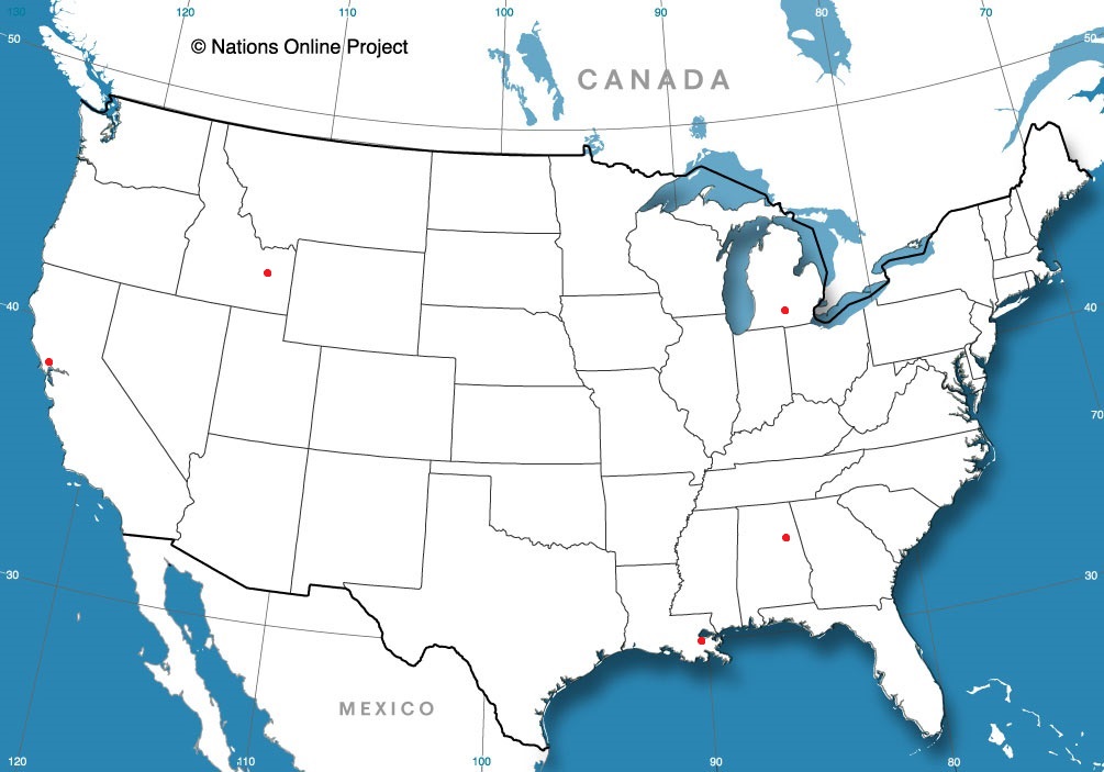
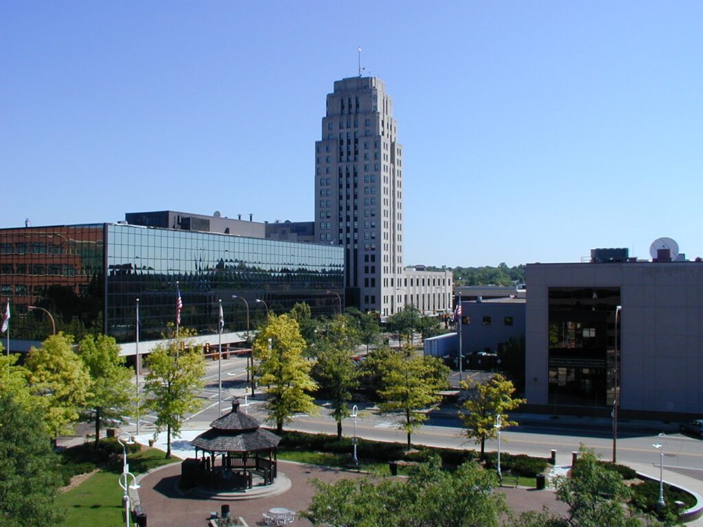
Battle Creek, Michigan
Gadsden, Alabama
Idaho Falls, Idaho
New Orleans, Louisiana
Santa Rosa, California
from Victoria-Weather

We are launching into September, and with that, visiting some very familiar locations, if you’ve been following along this week.
Battle Creek, Michigan
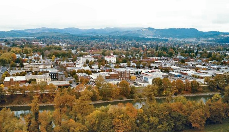
Gadsden, Alabama
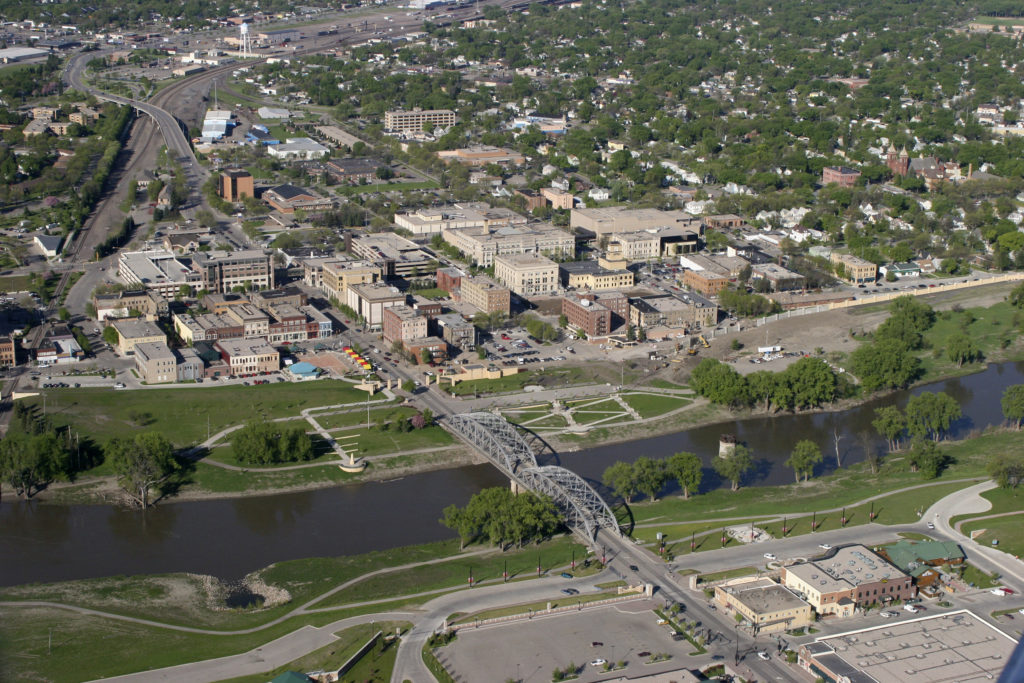
Idaho Falls, Idaho
New Orleans, Louisiana
Santa Rosa, California
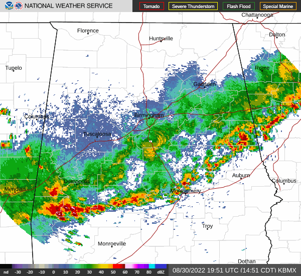
It’s the very end of August, and instead of enduring the heat, many residents of Huntsville – Rocket City, for it’s close ties to the Space Program – are probably indoors following the launch of the Artemis rocket, which was scrubbed yesterday, but will hopefully be launched when weather improves. Speaking of weather, what IS going to happen in Huntsville?
At 1253PM, CT, Huntsville was reporting a temperature of 82 degrees with mostly cloudy skies. Huntsville was one of the rare spots seeing clouds, but high pressure was building throughout the rest of northern Alabama, a rarity this time of year. A line of thunderstorms through central Alabama precedes the south-building ridge, and is allowing Huntsville to enjoy relatively low humidity.
The ridge is going to remain stout in the southeast, and keep Huntsville dry through the middle of the week. The cold front bringing thunderstorms south of Huntsville presently is going to weaken as it hits the Gulf Coast and become more permeable. Expect humidity to start building back into the region throughout the forecast period.
Tomorrow – Mostly sunny, High 92, Low 66
Thursday – Partly cloudy, High 92, Low 63
TWC: Tomorrow – Sunny high 91, Low 68
Thursday – Sunny, along with a few afternoon clouds. High 92, Low 62
AW: Tomorrow – Mostly sunny and less humid High 92, Low 67
Thursday – Plenty of sun High 94, Low 62
NWS: Tomorrow – Sunny, High 89, Low 68
Thursday – Sunny, High 91, Low 64
WB: Tomorrow – Mostly sunny, High 89, Low 69
Thursday – Mostly sunny, High 90, Low 63
WN: Tomorrow – Mostly sunny, High 89, Low 67
Thursday – Mostly sunny, High 91, Low 61
FIO: Tomorrow – Clear throughout the day. High 88, Low 67
Thursday – Clear throughout the day. High 89, Low 60
This is a downright delightful forecast for Huntsville. Dew points in the 60s! Here is a pretty steady line of storms off to the south right now.
Last night, thunderstorms developed along the Minnesota – Iowa border and lifted north through the Twin Cities. One cell in particular tracked from the south metro to the northeast metro. The cell videoed above was part of the tornadic cell, but was not within the tornado warning.
The cells was ultimately responsible for a smattering of weak tornadoes on the southeast side of the Twin Cities metro, with tree damage in some targeted locations on the storm’s path. Eventually, the storm reached the Minnesota State Fair, going on in Falcon Heights, near St. Paul.
Not only did these storms produce quite a bit of strong wind (as seen above), they dumped a quick burst of rain, that left the Fair submerged.
Another line of storms is poised to roll through the Twin Cities in the next hour or so, and though there are some stronger cells, they are mostly non-severe. Just another quick shot of rain — this time focused on the north metro — and a cooler work week ahead.
We are approaching the end of August, and the peak of hurricane season is a little more than two weeks away, and we haven’t had a named feature since Tropical Storm Colin graced the Georgia coast at the beginning of July. The way it looks, we will make it until at least September until we have our “D” storm, given the current NHC outlook.
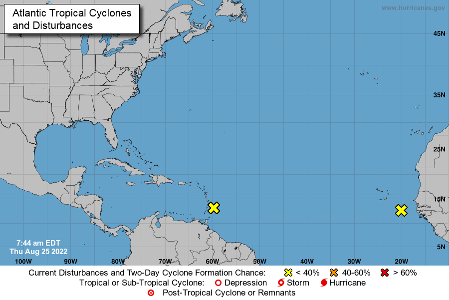
Each of those two yellow x’s represent a wave that ultimately could become a named tropical feature, but the NHC outlook suspects that formation chance is merely 20% through the next 5 days, which takes us to the end of the month with a day to spare. If these storms fail to materialize, and nothing else crops up in the intervening days, it would be the first time since 1997 that we went through August without a named storm in the Atlantic basin, and only the 2nd time since 1961. The fact that one of those x’s lies off the coast of Africa suggests that there is little time for another feature to arrive behind it, and a surprise is even less likely than usual.
The long range GFS model is pretty consistent with a tropical feature showing up at the beginning of September, and that wouldn’t really be a surprise. There is no causation of a quiet September simply because there is a quiet August. Colorado State hasn’t revised their predictions for the season yet. A quiet season in 1992 didn’t have a named storm until August — Hurricane Andrew. That 1961 season didn’t have any August storms, but did have two Category 5 hurricanes later in the season.
I haven’t found a season that hadn’t had a hurricane by September, though, and that would certainly be unusual, if not historic. We’ve also had the first season in 8 years without a named storm before the hurricane season officially starts on June 1st. It’s been a slow start, and it continues to remain slow for the coming days. We should appreciate that while it lasts.
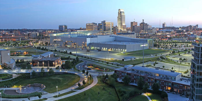
This road trip will be a little bit longer than our intra-Michigan trek yesterday, but it will still take only a day. We’ll cover 619 miles in just over 9 hours, as we skirt Chicago and pass through Des Moines into an underrated town. I think sometimes cities compensate for being in “boring” areas by being extremely interesting. Omaha is certainly interesting, and I would recommend a visit some day.
While today in Michigan is pretty nice (even though I got the road trip backwards! It was supposed to be Jackson to Battle Creek! I digress) there is a weak perturbation moving through the Upper Midwest that will change all that. Excepect some scattered showers and isolated thunderstorms to roll in to the area tomorrow evening, which means we will intercept on the way to Omaha. There will be a chance of these pop up showers – very few and far between – on the south side of Chicago, with the tail of the boundary stationary through southern Iowa. leading to scattered showers mostly south of I-80. Again, even if we see any rainshowers among the corn and Chicago traffic, they will be short lived. Potentially heavy, but short lived. Omaha is great, though, and shouild be drier than points eas.t.
It is not a long drive that we intend to take tomorrow through Lower Michigan. It’s less than an hour and 53 miles from Battle Creek to Jackson. The Google Maps pace is 60mph, but I’ve driven I-94 in Michigan. We’ll be going faster than 60mph.
There really isn’t a lot to say here, honestly. Michigan is a nice enough state, and there are a surprising number of wineries. Not a lot of weather coming through, though. There is high pressure over the Great Lakes, with some mid layered overcast in the northern part of the lakes, but we are on the south side of Michigan, so just enjoy Jackson, I guess!
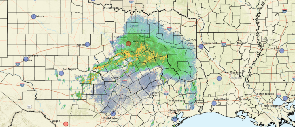
The remnants of a weak tropical feature came ashore in Texas over the weekend, noted only in reference to how quiet the Tropics have been this season. This weak, nameless blob was about all that had troubled North America this summer so far. It gathered a lot more attention overnight into this morning by dumping torrents of rain on the Dallas metro, leading to flash flooding throughout the Big D and Fort Worth.
At least 2 inches of rain have fallen in broad swaths of North Texas and up to 8 were estimated in some spots, making city streets waterlogged and impassable in some places. Radar shows that more rain is coming, though fortunately, Fort Worth should be drying out.
Flash flooding is different than river flooding, in that the onset is much more rapid and isn’t necessarily confined to existing waterways. River flooding can be planned a bit better for evacuations and bracing for the impacts of rising rivers, but flash flooding, like the rain in Dallas, can happen with a lot of rain coming in just a few hours, and is not as easy to anticipate.
There are two particular amplifiers of flash flooding. One of them is the increasingly paved surfaces we find in urban areas. Water pools, unable to drain from roadways, and can cause vehicles to hydroplane or even float. If the water is moving, for example if a nearby waterway has spilled out of its banks, or if the inundated roadway slopes, just a few inches of water are enough to move a vehicle. If water is deep enough, it can cause engines to stall.
The worst case scenario for flash flooding is usually found in hilly or mountainous terrain, such as what happened in eastern Kentucky this summer. Rainwater is channeled into valleys, causing existing rivers and creeks to rise quickly, and sweep away mud, trees and edifices in the water’s path downward. Unlike normal river flooding, which arises from water coming downstream after snow melts or a long, wet season, flash flooding happens in an instant as water flows downhill. Some of the deadliest flash flooding instances in the US occurred in Oregon and Colorado.
Heavier rains are a response to slow moving storms with higher dew points, and are possible even when severe weather hasn’t occurred. It’s always important to stay aware of your surroundings, and not pass through standing water, because you never know what lies beneath.
I talk a lot about the vast expanse of the country we will see in the coming days. This time? Michigan. We are going to be in Michigan a few times.

Road Trip from Jackson, Michigan to Battle Creek, Michigan
Road Trip from Battle Creek to Omaha, Nebraska
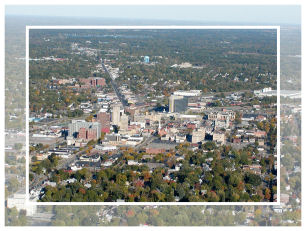
Huntsville, Alabama
Road Trip from Huntsville to Wilmington, North Carolina
My forecast for Benton Harbor was colored by my camping experience upstream the days before the forecast. I was in southeastern Minnesota, mired in cool, cloudy conditions for the weekend, and seeing the same satellite set up over Benton Harbor, I hedged towards the cooler end of things. My mistake. Breezes of over 15 miles an hour were enough of a steering flow, apparently, to clear things out, and allow the warning other outlets foresaw. The Weather Service grabbed a solo victory in this instance.
Actuals: Monday – High 78, Low 61
Tuesday – High 81, Low 57
Grade: A-C
This is an interesting trip to me, one that will cover 3 days and 1,639 miles. We’re hitting a lot of open territory. Big Sky Country, as some have called it. We’ll carry a pace of 65.6mph and break the trip into 524.5 mile segments, with a little extra for day three. Drive fast, the speed limit allows it!
DAY ONE (Saturday)
A surface wave centered over Minnesota is kicking up light rain all throughout Minnesota, encroaching on the Red River. High pressure is going to strengthen and squash the disturbed weather to the southeast. It’s going to be a little chilly, relatively speaking, to start the day, but it should warm quickly in western North Dakota. Eastern Montana will be sunny and warm, and in honor of the drive on Saturday, and the rest of the journey to come, we will stop in Miles City, Montana.
DAY TWO (Sunday)
Eastern Montana is wide open pastures and prairies, and becomes mountainous around Butte and Helena. We’ll run into showers and thunderstorms right here, where the prairies run into the Rocky Mountains. The storms will be widely scattered and may even be dry, and when we start getting to western exposures around Missoula and westward, the threat will significantly lessen. We’ll make it to the Clark Fork River Crossing near Tarkio for the end of the night.
DAY THREE (Monday)
Another shorth wave is moving ashore Sunday night, and some more of those spotty, potentially dry storms in the chimney of Idaho. It’s going to be dry after that in the Pacific Northwest. Fortunately, the Gulf of Alaska gyre is reforming, but for the time being, sit’s still hot in the Pacific Northwest