Earlier, we posted a verification for Dubuque, in which thunderstorms showed up and surprised some of us. Well, this time around, a handful of outlets called for rain in Roanoke, and it never happened. The lingering moisture prevented low temperatures from cooling off too much, but otherwise, the lack of clouds or rain meant high temperatures were near 90. The warmer forecasts held the day, and Victoria-Weather and The Weather Channel had the exact same forecast, which was the winner today. Actuals: Friday, High 88, Low 69 Saturday – High 89, Low 67
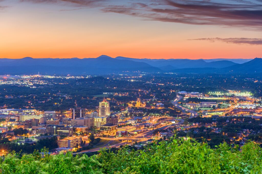
There is a well populated corridor on the Atlantic slope of the Appalachians, stretching from Virginia to the Carolinas. In Virginia, the largest of those towns is Roanoke, where we will forecast today.
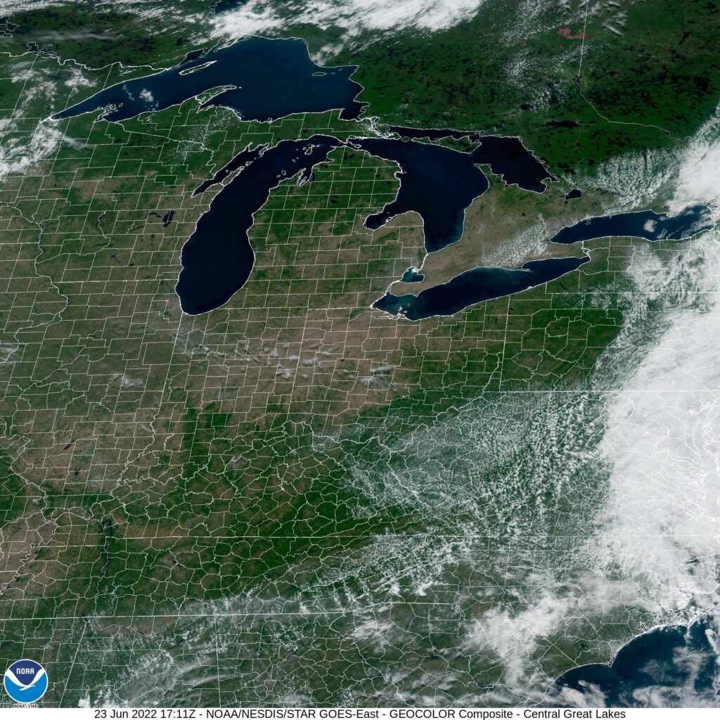
At 1254PM, ET, Roanoke was reporting a temperature of 85 degrees with mostly cloudy skies. A trough was weakening, but still lingered over the east coast. An area of surface low pressure which had been responsible for copious rain in the region through the middle of the week was now off shore, being drawn northward towards the mean flow. Extensive clouds with some isolated showers were being seen in southeastern Virginia, but in the west, scattered cumulus were seen, with a ribbed pattern on radar reflecting gravity waves and brisk flow through the clouds. The clearer air to the west isn’t embodied by a particularly strong air mass, and Roanoke’s position in the lee of the Appalachians opens the possibility of low level moisture leading to morning haze, and the languid retreat of low pressure off shore may indicate some mid level clouds. It won’t be a vividly bright couple of days, but there is definitely enough here to believe that two dry days are ahead. Tomorrow – Morning haze, then partly cloudy, High 88, Low 67 Saturday – Partly cloudy, High 88, Low 67
TWC: Tomorrow – Partly cloudy, High 88, Low 67 Saturday – Partly cloudy, High 88, Low 67
AW: Tomorrow – Mostly sunny High 86, Low 68 Saturday – Partly sunny and humid with a thunderstorm High 87, Low 68
NWS: Tomorrow – Patchy fog before 9am. Otherwise, mostly cloudy, then gradually becoming sunny, High 87, Low 65 Saturday – A slight chance of showers and thunderstorms after 3pm. Mostly sunny, High 89, Low 67
WB: Tomorrow – Patchy fog in the morning. Mostly sunny, High 85, Low 69 Saturday – Mostly sunny. A slight chance of showers and thunderstorms in the afternoon, High 86, Low 69
WN: Tomorrow – Partly cloudy, High 87, low 65 Saturday – Mostly sunny, High 89, low 66
FIO: Tomorrow – Partly cloudy throughout the day. High 88, Low 65 Saturday – Partly cloudy throughout the day. High 88, Low 65
The threat for thunderstorms is so low, I was surprised to see it start showing up in some forecasts. A lot of texture to the clouds ongoing in the area.
One thing I definitely remember about college was going to the early afternoon football games. It was cool, with highs only in the 60s, and the sun would be shining. Purdue would win more than they lost in those years, and I would get home happy…. until I realized I was completely sunburnt. That was the vibe I was getting from the forecast for Roanoke, which warmed to the mid-60s on Sunday, with help from the dry atmosphere in the mid-Atlantic. Especially after a cloudier day with a high of 53 on Saturday, I am sure the 66 degrees left a lot of people outside, getting more sunburnt than they would have guessed. My skin care discipline is not the best, but Victoria-Weather was able to collect the top forecast for the day. Actuals: Saturday – High 53, Low 29 Sunday – High 66, Low 32
Tonight, we take a trip through what should be some nice weather. It’s a two day trek from Sherman to Roanoke, and will cover 1080 miles. That means a pace of 67.8 mph, and that will ultimately mean about 543 miles on the first day, which is a nice even split of the trip into two days.
DAY ONE (Sunday)
Sherman, Texas
High pressure is in charge east of the Mississippi, and an emerging low in the Plains is helping direct some southerly flow to the region. Our drive will be in the sun, in warmer air than the region has seen for a couple of days. We’re going to make it through Arkansas and into Tennessee. Parkers Crossing, Tennessee will be the destination. The town is just northeast of Jackson.
DAY TWO (Monday) That high pressure is just going to hang on in the eastern US. Even the drive through the Smokey Mountains and astride of the Appalachians will be devoid of the fog and haze that can be persistent in that area. Roanoke will be nice for the autumn.
Good evening! Let’s get this weekend forecast off the ground, shall we?
At 1254AM, ET, Roanoke was reporting clear skies and a temperature of 36 degrees. With clear skies and dew points sub freezing, frost is a foregone conclusion tomorrow morning. A sharp trough moving into the area is bringing cold air to he region, but more significantly outside of Roanoke, will aid in the development of a low in the Bight of Georgia, which will prove impactful later this weekend. As the system develops this weekend, it will reinforce the chilly air invading the Roanoke area. There may be a few scattered clouds thanks to the flow over the Appalachians, but there is no threat of the feature moving onshore far enough to bring rain or snow to Roanoke. Expect cool temperatures but generally sunny skies through the weekend, but rain, potentially flooding rain and high surf in Georgia and South Carolina, not that far away. The trough will flatten a bit on Sunday, allowing some warmer temperatures to conclude the weekend. Tomorrow – Partly cloudy, High 53, Low 30 Sunday – Partly cloudy, cool and crisp, High 61, Low 34
TWC: Tomorrow – A mix of clouds and sun early, then becoming cloudy later in the day. High 55, Low 30 Sunday – Mostly cloudy skies early, then partly cloudy in the afternoon. High 62, Low 36
AW: Tomorrow – Times of sun and clouds High 54, Low 34 Sunday – Partly sunny High 62, Low 38
NWS: Tomorrow – Mostly sunny High 54, Low 29 Sunday – Mostly cloudy, then gradually becoming sunny, High 62, Low 38
WB: Tomorrow – Mostly sunny, High 54, Low 33 Sunday – Mostly sunny, High 62, Low 35
WN: Tomorrow – Partly cloudy, High 54, Low 29 Sunday – Partly cloudy, High 62, Low 38
FIO: Tomorrow – Mostly cloudy throughout the day. High 55, Low 30 Sunday – Mostly cloudy throughout the day. High 62, Low 34
The pattern is unkind specifically to Charleston lately. Persistent troughing and development of low pressure over the Bight of Georgia will continue through the early part of the week. Sheesh.
The forecast was pretty clear. The majority of our outlets thought that Sunday would be an entirely dry day in Roanoke, because moisture associated with an area of low pressure in the Tennessee Valley seemed like it would get pinned on the west side of the mountains, at least for another day. A couple of outlets, including The Weather Service and Weatherbug, thought a little bit of rain would spill over those hills. In the end, it was a pretty good shot of rain, about 2 tenths of an inch, that fell on Roanoke. Not great! Except, I suppose, for the Weather Service, who coasted to victory. Actuals – Saturday – High 82, Low 54 Sunday – .19 inches of rain, High 81, Low 62
We’ve made it to October. The leaves are changing, and the weather is cooling down. Pumpkin spice everything.
At 1154PM, ET, Roanoke was reporting clear skies and a temperature of 61 degrees. High pressure is parked over the mid-Atlantic, which is good news, because it is directing Hurricane Sam well away from land, and is going to lead to a very nice start to the weekend. There are two strong jet streaks over the continent, including one in the Canadian Maritimes and another from western Canada to the Canadian Prairies. Between, the flow aloft is contorted into a trough over the Upper Midwest, but is not partnered with vigorous flow. It is reflected by a fairly weak system moving from the Upper Midwest towards the Mid-Atlantic by Sunday. Scattered showers over the Mississippi Valley will struggle to by pass the Appalachians. The weakening low will drift into the eastern Great Lakes, but the mountains and the ridge will keep Roanoke dry through the weekend. Tomorrow – Sunny, High 82, Low 52 Sunday – Mostly cloudy, High 80, Low 59
TWC: Tomorrow – Sunny, along with a few afternoon clouds. HIgh 84, Low 54 Sunday – Partly cloudy skies during the morning hours will become overcast in the afternoon. High 83, Low 61
AW: Tomorrow – Mostly sunny; a beautiful start to the weekend High 83, Low 54 Sunday – Some sun, then turning cloudy High 83, Low 62
NWS: Sunny, High 83, Low 55 Sunday – A slight chance of showers after 2pm. Mostly sunny High 82, Low 60
WB: Tomorrow – Sunny, High 82, Low 57 Sunday – Mostly sunny, a slight chance of showers in the afternoon, High 80, Low 64
WN: Tomorrow – Mostly sunny, High 83, Low 56 Sunday – Partly cloudy, High 82, Low 60
FIO: Tomorrow -Partly cloudy throughout the day. High 83, Low 53 Sunday – Mostly cloudy throughout the day. High 79, Low 59
It’s really interesting to see the disparity in this forecast from outlet to outlet. Rain just doesn’t seem likely to me. I mean, look at this scene and try to tell me it should rain here.