Today we head down south to see what’s in store for the weekend in Annison, AL! This weekend marks the 8th anniversary of the 2011 Super Outbreak, will they have a quiet weekend to reflect, or will they have to keep their eyes on the sky once again?
At 1053pm CDT, the temperature at Anniston, AL was 54 degrees under fair skies. High pressure is sitting over the Deep South, and should keep an area of low pressure off to the north (which will bring snow to MN/WI/IL) so beautiful weather is in store for Saturday! The tail end of the cold front associated with the aforementioned low pressure system sags into the Deep South for Sunday. While mostly cloudy skies are expected for much of the day, only a couple of isolated showers will push far enough south to threaten the Anniston area. If anything does impact the area, it should be short lived. Overall, a very nice weekend is in store, scores better than that fateful day in 2011.
Saturday: Sunny and beautiful. High 79, Low 46.
Sunday: An isolated afternoon shower possible. High 78, Low 53.
TWC: Saturday: Mostly sunny. High 78, Low 45.
Sunday: Isolated thunderstorms. High 78, Low 56.
AW: Saturday: Plenty of sun; beautiful. High 77, Low 43.
Sunday: A passing morning shower. high 78, Low 55.
NWS: Saturday: Sunny. High 78, Low 48.
Sunday: Slight chance of afternoon thunderstorms. High 80, Low 56.
WB: Saturday: Sunny. High 77, Low 45.
Sunday: Partly cloudy. High 77, Low 56.
WN: Saturday: Sunny. High 78, Low 48.
Sunday: Partly cloudy with isolated storms. High 80, Low 56.
FIO: Saturday: Partly cloudy starting in the evening. High 78, Low 47.
Sunday: Partly cloudy until night. High 77, Low 57.
It’s a fairly clear night across the region, and looks to be that way for much of the weekend!
Everyone everywhere says “if you don’t like the weather here, wait for 15 minutes” or something like that. Denver, though, is perhaps the most variable city in the country and we get to forecast for it! Joy.
At 1005AM, MT, Denver was reporting clear skies and a temperature of 59 degrees. These conditions belied an increasingly active p, Low attern in the northern Rockies, as a deepening trough is going to bring some precipitation to the higher terrains this afternoon and evening. It is a shallow amplitude feature and will sweep through the region quickly. There may be a splash of precipitation on Saturday morning. The jet stream at this moment is shaped like a w, and the second lobe will strafe the northern Rockies on Sunday. As the trough emerges in the northern Plains, surface low pressure will develop, with a cold front tailed into the Denver region. This is he most likely time for the area to see wet weather this weekend, with a few afternoon thunderstorms, particularly east of town, a strong possibility. Tomorrow – A bit of morning drizzle, then clearing, High 69, Low 47 Sunday – Late rain and thunderstorms, High 71, Low 42 (late)
TWC: Tomorrow – Sunshine and some clouds. A stray shower or thunderstorm is possible. High 72, Low 48 Sunday – A mix of clouds and sun early, then becoming cloudy later in the day. A stray shower or thunderstorm is possible. High 74, Low 51
AW: Tomorrow – sunshine and some clouds; comfortable High 70, Low 47 Sunday – Times of clouds and sun, a thunderstorm around in the afternoon High 72, Low 44
NWS: Tomorrow – Mostly sunny High 72, Low 49 Sunday – A 20 percent chance of showers and thunderstorms after noon. Partly sunny, High 73, Low 49
WB: Tomorrow – Partly Cloudy (late rain), High 69, Low 49 Sunday – Mostly cloudy with a 20 percent chance of thunderstorms, High 70 Low 47
WN: Tomorrow – Mostly sunny, High 72, Low 49 Sunday – Partly cloudy with isolated storms, High 73, Low 49
FIO: Tomorrow – Partly cloudy until morning. High 72, Low 49 Sunday – Partly cloudy starting overnight. High 77, Low 51
As is only fitting with Denver these forecasts are all over the map.
With a feature moving through New England, it seemed fairly logical that temperatures would tumble in Springfield. It seemed even more likely that the rainier day, Monday, would be cooler than the drier day. As it happened, neither of these things were true, as the cloudier, rainier day ended up several degrees warmer than the drier Sunday. The National Weather Service correctly navigated the less than intuitive forecast for a victory. Actuals: Sunday – .02 inches of rain, High 64, low 51 Monday – .46 inches of rain, High 68, Low 49
I don’t know how Savannah got it’s name. It’s spelled different than the African savannas. Maybe it’s just because it’s so danged hot, just like a savanna. The extra h is for “humid”.
At 1153AM, ET, Savannah was reporting a temperature of 83 degrees with clear skies and a relatively manageable dew point of 59 degrees. There is a jet streak over the northern Gulf of Mexico which is at present providing the nearest cloud cover, as well as the nearest inclement weather, which is developing over east Texas and promises some headaches before the week is through in Savannah. Low pressure is developing in East Texas with a jet streak that will phase into a broader jet trough that extends into the Canadian Prairies. Expect Thursday to remain fairly tranquil, if hot and humid, but showers and storms will be primed to arrive on Friday morning. The association with the broader trough will mean less organization in the storms over Georgia, and the pivoting nature of most high amplitude waves will reduce the chance of a real influx of cold air Friday evening. It will still rain and potentially storm a bit, but Friday would be much worse if these two features didn’t merge. Tomorrow – Mostly sunny, increasing clouds, High 84, Low 63 Friday – Rain, maybe some thunder, generally clearing out in the afternoon, High 82, Low 64
TWC: Tomorrow – Partly cloudy skies in the morning will give way to cloudy skies during the afternoon. High 87, Low 62 Friday – Showers in the morning, then partly cloudy in the afternoon. Thunder possible. High 81, Low 67
AW: Tomorrow – Partly sunny; warm High 87, Low 61 Friday – More clouds than sun, a couple of showers and a thunderstorm; not as hot High 82, Low 65
NWS: Tomorrow – Mostly sunny,High 86, Low 64 Friday – A chance of showers and thunderstorms, then showers likely and possibly a thunderstorm after 7am. Cloudy, High 80, Low 68
WB: Tomorrow – Mostly sunny, High 83, Low 63 Friday – Showers with a chance of thunderstorms, High 83, Low 67
WN: Tomorrow – Mostly sunny, High 86, Low 64 Friday – Mostly cloudy with showers likely, High 80,Low 68
FIO: Tomorrow – Mostly cloudy starting in the afternoon. High 83, Low 61 Friday – Mostly cloudy until afternoon. High 81, Low 66
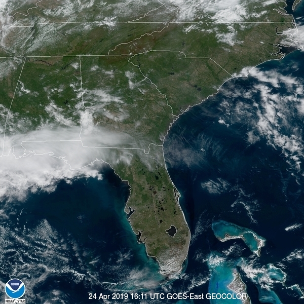
Forecast.iois so bold as to think this system is going to dissipate before it even arrives on the Georgia Coast. Here is the satellite imagery with clouds over the northern Gulf.
Low pressure was sliding it’s way northeast and away from northern Minnesota during the middle of last week. There was even the suggestion that a snowflake could fall near Duluth early on Thursday morning, with some chilly raindrops a sure bet. Indeed, there was a drop or two of rain but it never cooled enough for snow at Duluth. Temperatures did plummet on Friday morning, diping to the mid 20s, but then, they recovered all the way to the low 60s on Friday afternoon. The Weather Channel and Victoria-Weather ended up locked horns for the tie in Duluth. Actuals: Thursday – .09 inche of rain, High 52, Low 37 Friday – High 63, Low 26
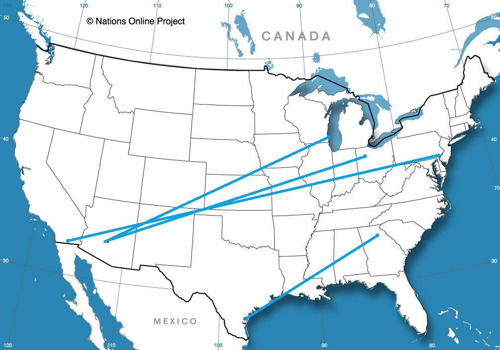
Today we embark on a 5-day, cross-country road trip that’ll cover 2,337 miles. That’s a lot of snacks we need to stock up on! Let’s get a move-on, not a moment to waste!
DAY ONE
An area of low pressure is shifting through far southern Quebec/New England, with a cold front trailing through NY/PA back to the OH Valley. There might be an isolated rain shower lingering in the Syracuse area at dawn, but most of this activity should be off to the northeast of the city as we depart on our westward journey. The day should be dry but cloudy to start, then clouds clear out as we pass Buffalo and follow the shores of Lake Erie to Cleveland. From there we turn southward and end our rather uneventful start to the trip in Columbus.
DAY TWO
An area of low pressure looks to shift into the OH Valley to start the day, bringing some rain shower activity to the Columbus area as we head westward. Conditions improve a bit as we make it to Indianapolis, but a second round of showers is possible as we move through IL towards St. Louis as the tail end of a cold front works in from the north. Heavier stuff should remain off to the south as another area of low pressure lifts northeastward from the Lower MS River Valley, but keep an eye out on some shower activity as we pass St. Louis and finish the day in Rolla, MO.
DAY THREE
A fairly quiet day is expected today as our leg is between systems. Some clouds may increase during the afternoon hours as we head out of southwestern MO past Joplin. Southwerly winds are expected to increase as low pressure begins to intensify in the foothills of CO/WY, but conditions will remain dry as we finish our relatively short day in Oklahoma City.
DAY FOUR
Low pressure speeds off to the north of our route today as it moves through NE to IL, while the tail end of a cold front sags into OK. Cloudy skies and perhaps a shower or two will greet our morning as we start heading towards Oklahoma City, but nothing particularly heavy is expected. Cloudy skies continue as we pass Amarillo but late afternoon/evening storms look to stay north of I-40 as we press onwards into New Mexico. Our day ends in Vaughn, NM.
DAY FIVE
A dry day is in store as we finish our lengthy trip. While low pressure gets situated over the Four Corners region, precip should stay well off to the north over central UT/CO. Gusty winds, particularly in mountain passes, could make for some interesting sections as we head west out of Las Cruces along I-10, but shouldn’t be too bad as we finally make it to Tucson!
One persistent problem that hasn’t gone away, even with improvements to forecasting and technology is the reception of a weather forecast, in particular during alert or warning periods. NPR recently released an article that highlights the number one issue with weather forecast reception among the public.
I reached out to some meteorologists and social scientists in the process of writing my book, (which comes out next month!) and more than any discussion on a particular type of weather phenomenon, the dissemination of alerts and warnings stood out as the most problematic issue with regards to operational meteorology. While meteorologists can continue to refine our communication of the severity and immediacy of a weather situation, it’s hard to tell someone to be vigilant of the weather in their area, if they don’t even know where their area is.
The NPR Facebook post for this article had many commenters claiming that James Spann’s methods for testing this out were flawed. How can anyone figure out where they are if you are given a map with only county and state lines? If you are given a state, I would posit, you should be able to know, roughly, what part of the state you are in. This should take only a couple of glances at the map to get yourself a rough idea. Failing that, warnings are given on a county basis. Learn county names, and you are a step ahead of the game.
Admittedly, I grew up as a kid who loved looking at maps and knowing where I was. I’m visiting relatives as I write this, and I know exactly where I am on a map of South Dakota, just as much for my own interest as for the benefit of receiving weather information (we did get thunderstorms overnight, though they were not severe). Also, I’ve been looking at maps for my entire professional career, so that is surely a benefit to me. That said, I don’t think it’s unreasonable to address one’s physical location in schools across the country at an early age. If it’s too late for some older people, perhaps we can inform young students and THEY can help their parents along the way.
For it’s small size, the state of Massachusetts is a compelling weather state. From the exposed Cape Cod to the mountains of the western Berkshires, there are a lot of different scenarios at work. It’s a difficult place to get a handle on for meteorologists, and not just because Massachusetts is hard to spell.
At 3:53PM, ET, Springfield was reporting a temperature of 67 degrees with overcast skies and a brisk south wind. Low pressure over western Pennsylvania was becoming quite occluded, with warm air surging up the east coast and pushing the occluded/cold front offshore. An inverted trough was brining general rain showers to the eastern Great Lakes, and would be drifting through New England through today. The upper level trough will be overridden by a more laminar flow through eastern Canada. The surface low pressure is going to continue to weaken and lose momentum as it slides into New England. Still, a little bit of shower activity will sneak in tomorrow, and the system will revitalize over the ocean and increase the chance for rain and thunder through the day on Monday. Tomorrow – Scattered showers, High 70, Low 54 Monday – Mor overcast with a better chance for rain, High 67, Low 48
TWC: Tomorrow – Cloudy. Slight chance of a rain shower. High – 67, Low 54 Monday – A mix of clouds and sun in the morning followed by cloudy skies during the afternoon. Slight chance of a rain shower. High 68, Low 48
AW: Tomorrow – Times of clouds and sun High 67, Low 52 Monday – Periods of rain High 66, Low 47
NWS: Tomorrow – A chance of showers, mainly before 9am. Mostly cloudy, High 66, Low 52 Monday – Showers likely, mainly after 2pm. Mostly cloudy, High 66, Low 48
WB: Tomorrow – Mostly cloudy. A chance of showers in the morning, High 65, Low 54 Monday – Showers likely, High 65, Low 46
WN: Tomorrow – Cloudy with heavy showers, High 66, Low 55 Monday – Nostly cloudy with light showers likely High 66, Low 48
FIO: Tomorrow – Mostly cloudy throughout the day. High 68, Low 54 Monday – Mostly cloudy throughout the day. High 68, Low 48
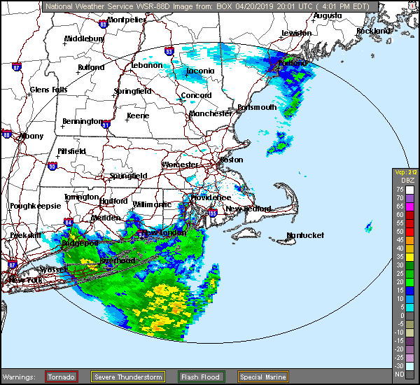
Showers earlier today encircled the region, but looked ominous south of Long Island.
Not unlike today, there were strong thunderstorms over the lower Mississippi Valley. When we looked at the weather in Texarkana, many outlets sounded the alarm, prospecting for severe weather in the region. In fact, when storms really got going, Texarkana was entrenched in heavy rain and wasn’t destabilized enough for severe storms. Temperatures couldn’t even climb out of the 60s, but in better news, it remained cool because the system was almost out of the area already, and Sunday was a much quieter day. Forecast.io had nearly perfect numbers Actuals: Saturday – 1.26″ of rain, High 59, Low 55 Sunday – High 65, Low 45