The weather has been so bad that even in this of all weeks, it has broken through as a major headline in many markets. A week and a half ago, we looked at Florence, Alabama, which was preparing for a cold front that would ultimately be a pittance to what was received this weekend. There was a quick shot of rain on the 14th, after which temperatures started dropping, though not nearly as quickly as some believed. It only got down to 35 before the 15th rolled around The sun was out for Florence, but it wasn’t working, and the high never cleared 40. It was a good forecast over all, with The Weather Channel earning the top spot. Actuals: January 14th, .08″ of rain, High 50, Low 35 January 15th, High 39, Low 23
We are going to northern Alabama on this fine Tuesday evening. It’s pretty quiet out there at this moment, but this time of year, if anywhere is going to see interesting weather, Florence would be a good bet.
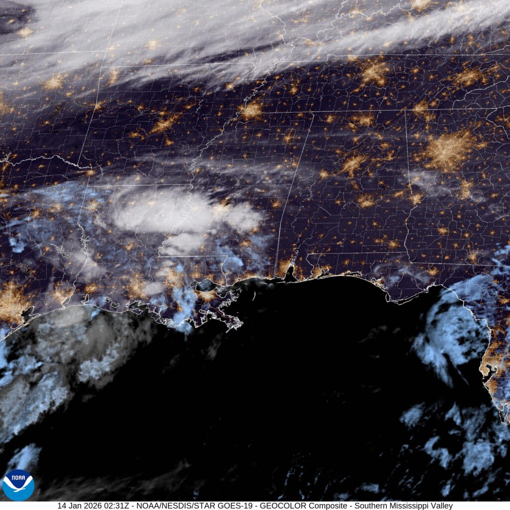
At 753PM, CT, Florence was reporting a temperature of 49 degrees with clear skies. Despite the clear skies, the region was active. A cold front was digging into central Missouri, and ahead of the boundary, there was a bit of convection showing on satellite in the Lower Mississippi Valley. The boundary was associated with a deep digging trough, and is going to move quickly. Moisture from the Gulf and the boundary itself will arrive in Florence by lunch time tomorrow. Tomorrow afternoon will be rainy, with a bit of thunder at the outset. Cold air will follow close behind, but not near enough to allow for any flurries in Florence. The cold air will settle in through Thursday, however, leading to some uncharacteristically brisk conditions. Tomorrow – A little bit of thunder in the late morning, then showers through the afternoon, Getting colder, High 48, Low 28 Thursday – Partly cloudy, chilly, High 39, Low 23
TWC: Tomorrow – Rain early…then remaining cloudy with showers in the afternoon. High 49, Low 34 Thursday – A mainly sunny sky. Colder. High 39, Low 23
AW: Tomorrow – Cloudy and cooler with a touch of rain High 48, Low 32 Thursday – Mostly sunny and cold High 39, Low 22
NWS: Tomorrow – Showers, mainly between 9am and 1pm. High near 49. West southwest wind 5 to 10 mph becoming north northwest in the afternoon. High 49, Low 31 Thursday – Sunny, High 38, Low 22
WB: Tomorrow – Showers, High 49, Low 30 Thursday – Cooler sunny. High 36, Low 22
WN: Tomorrow – Mostly cloudy with light showers, High 49, Low 30 Thursday – Sunny, High 38, Low 22
CLI: Tomorrow – Rain Showers, High 50, Low 30 Thursday – Sunny, High 38, Low 23
This is a day that isn’t particularly chilly for the part of the country I’m in, but in Alabama, this is a winter parka scenario. Take a look at the satellite, with the cold front to the north, and moisture arising from the south.
We transitioned to December in the midst of our forecast period in Florence, Alabama, and for Alabama, anyways, it felt like the season was changing. Overnight lows were below freezing both on the 30th and 1st, and that’s a chill you just can’t shake if you aren’t used to it, even if the high temperature ranges up to the mid-50s, and the sun is shining in the afternoon. The brisk weather in Alabama was brisk business for Victoria-Weather, who had a top notch forecast and won the day. Actuals: November 30th – High 52, Low 34 December 1st – High 55, Low 30
Michigan (and congrats to the Wolverines today) and Alabama are merely a day’s drive apart, so long as you are willing to spend about 9 hours in the car. It’s a 639 mile drive, which puts the drive at about 68mph. I-65 is a fast driving road. Michigan already played today, but Auburn and Alabama have just started. Read all about this trip as you enjoy the game!
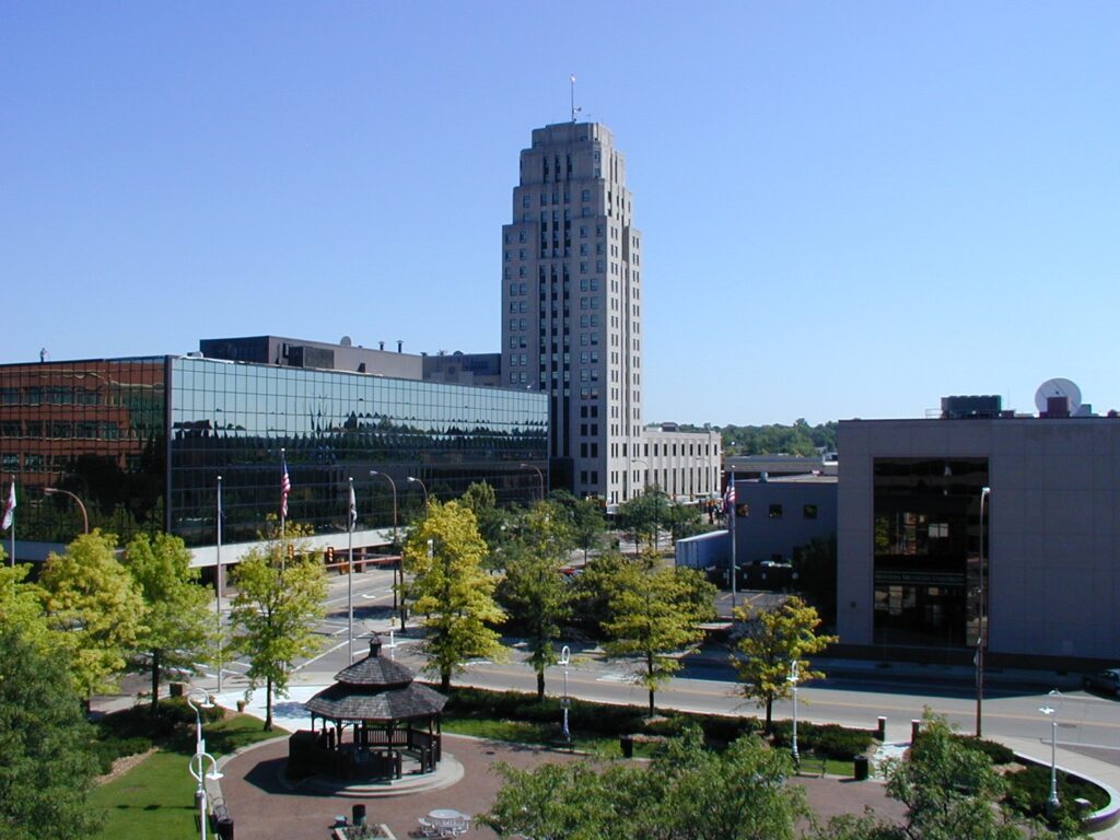
Battle Creek, Michigan
It’s been a pretty snowy stretch for the Great Lakes, but that hasn’t translated to the Lower Peninsula. Cold air is making itself comfortable along the I-65 corridor, and in a lot of cases, that has meant clear skies. There is a weak perturbation along the Ohio River that could spit out some flurries as we drove through Kentucky, but it should be winding down as we reach the Commonwealth. Clear skies will return again as we dip into Tennessee and on to Florence.
We as Americans are blessed with two fairly large Florences. The one in Alabama, the one we are forecasting for today, features a bit of history, as the site of famous recording studios during the early ages of rock and popular music. Let’s see if this forecast rocks, eh?
At 953PM, CT, Florence was reporting clear skies and a temperature of 35 degrees. Dew points were near 20, and surely, Florence would drop below freezing overnight. Since Florence has already had their first freeze for the year, freeze warnings were confined to the Gulf Coast, north of a cold front and on the northern end of the strong jet trough that fed the system in the northeast yesterday. The jet trough is long waved, and not expected to move much for the next two days. This means the cold pool parked over Alabama isn’t going to shift out of town either. There will be chilly days and even colder nights in Florence, given the clear skies that are expected. Tomorrow – Sunny, High 53, Low 25 Sunday – Sunny, High 52, Low 30
TWC: Tomorrow – Generally sunny despite a few afternoon clouds High 52, Low 25 Sunday – Some clouds in the morning will give way to mainly sunny skies for the afternoon. High 51, Low 31
AW: Tomorrow – Mostly sunny High 50, Low 24 Sunday – Partly sunny High 52, Low 32
NWS: Tomorrow – Sunny, High 50, Low 24 Sunday – Mostly sunny, High 51, Low 30
WB: Tomorrow – Mostly sunny, High 48, Low 27 Sunday – Partly cloudy in the morning, then clearing, High 48, Low 36
WN: Tomorrow – Mostly sunny, High 50, Low 24 Sunday – Partly cloudy, High 50, Low 30
CLI: Tomorrow – Sunny, High 51, Low 28 Sunday – Sunny, High 51, Low 33
A look at the satellite provides a good look at warmth radiating out of the southeast overnight (AKA, clear skies). Well, at least north of that band of clouds in central Florida.
During last week’s version of the interminable series of storm systems this month, we visited Florence after a line of thunderstorms had brought severe weather to the city earlier in the day. There was a little bit of light rain that trailed the line that arrived a little bit after midnight that altered the verification a bit, but aside from that, post frontal forecasting is pretty easy. Victoria-Weather earned our first forecast W of the year, up against strong competition. Actuals: Wednesday January 10th, .03 inches of rain High 52, Low 37 Thursday, January 11th, High 57, Low 33
We’re going to sneak down to the Carolinas on the heels of a very active weather day for the southeastern US.
At 906PM, ET, Florence was reporting a temperature of 54 degrees with scattered clouds. A line of thunderstorms swept through earlier, with 63kt gusts reported at Florence. Winds have died down, but with a few post frontal sprinkles over South Carolina, Florence stands to get a little bit more rain before all is said and done. The jet structure is still very active, which will only encourage the area of low pressure to drift to the northeast, bringing the threat for rain to an end overnight tonight. The next round of low pressure is going to get organized in the south central US by Friday evening, which will also indicate the point at which warmer air will start returning to Florence. Dry conditions are expected in Florence from sunrise tomorrow through the day on Thursday. Tomorrow – Some clouds early, then sunny, High 53, Low 38 Thursday – Mostly sunny, High 58, Low 34
TWC: Tomorrow – Sunny, along with a few afternoon clouds. High 53, Low 38 Thursday – Partly cloudy. High 59, Low 35
AW: Tomorrow – Partly sunny, windy and cooler High 53, Low 39 Thursday – Milder with plenty of sun High 61, Low 35
NWS: Tomorrow – Sunny, High 52, Low 40 Thursday – Mostly sunny, High 58, Low 34
WB: Tomorrow – Sunny, High 51, Low 41 Thursday – Mostly sunny, High 59, Low 35
WN: Tomorrow – Mostly sunny, High 52, Low 48 Thursday – Partly cloudy, High 57, Low 34
CLI: Tomorrow – Mostly cloudy, High 54, Low 39 Thursday – Mostly cloudy, High 61, Low 36
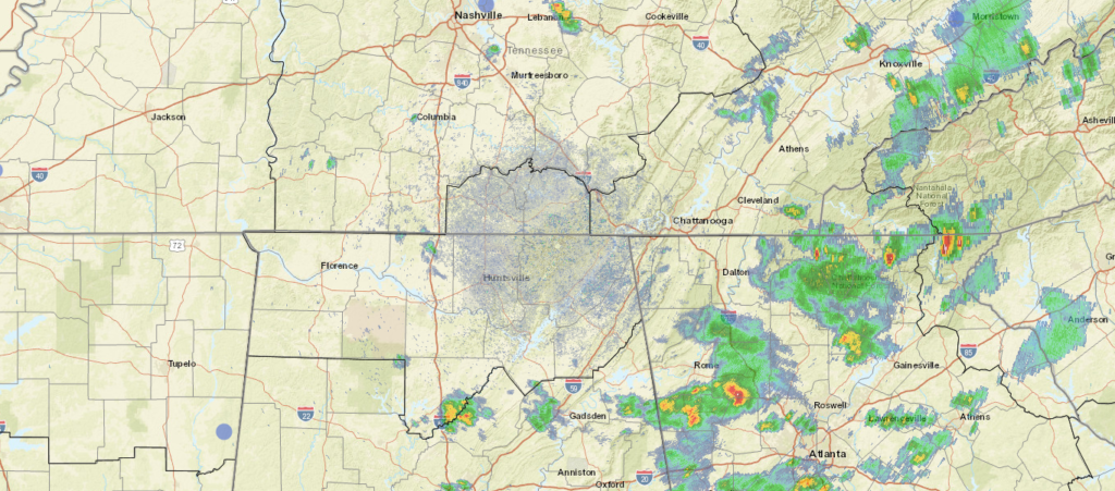
There was quite a bit of severe weather in the southern and southeastern US over the last 48 hours. The strongest and most intense storms were overnight in the Florida Panhandle, but now we are near a break.
It was a slow start to the summer in the southern US, with temperatures that were actually fairly comfortable. It couldn’t last, of course. It never does, and in Florence and the rest of northern Alabama, it was a taste of what residents usually come to expect in August. Temperatures were in the 90s by Monday afternoon, with dew points well into the 70s. It was a steam room just being outside on Sunday and Monday in Florence. Granted, it’s a couple degrees warmer than normal, but it’s also not as far out of the ordinary as the cooler start was. Weatherbug had the top forecast for the period. Actuals: Sunday – High 89, Low 70 Monday – High 94, Low 74
We’re getting our forecasting chops to start August, so it’s a bit too bad that the pattern is so docile. Maybe I should watch what I say before I start tossing out bad forecasts.
At 153PM, CT, Florence was reporting a temperature of 89 degrees with partly cloudy skies, with an isolated thunderstorm close to Huntsville, with even heavier activity to the southeast. A weak over the Smokey Mountains was helping to enflame shower and thunderstorms across the southeastern US, and will leave the threat of storms in the forecast for Florence this afternoon. There is some upper level structure responsible for this trough, which means there will be some progression. A vast ridge will build in the eastern US, leading to clearing for Florence and a lot of the surrounding area while the trough shifts well off to sea. Expect warming conditions with the bonus sunshine on Sunday. Part of the progressive pattern means low pressure will be able to drop the tail of cold front by Monday afternoon. Expect some locally heavy rains as the storms feast on the hot humid air. Tomorrow – Mostly sunny, High 91, Low 69 Monday – Hot, humid with an afternoon thunderstorm, High 92, Low 70
TWC: Tomorrow – Sunshine and clouds mixed. High 93, Low 70 Monday – Mixed clouds and sun with scattered thunderstorms. High 93, Low 75
AW: Tomorrow – Partly sunny and humid High 93, Low 72 Monday – Partly sunny and humid; a thunderstorm in the afternoon High 93, Low 76
NWS: Tomorrow – Patchy fog before 7am. Otherwise, mostly sunny High 91, Low 69 Monday – A 50 percent chance of showers and thunderstorms. Mostly sunny High 91, Low 73
WB: Tomorrow – Patchy Fog in the morning. Partly cloudy, High 90, Low 71 Monday – Partly cloudy with a chance of showers and thunderstorms, High 91, Low 74
WN: Tomorrow – Partly cloudy, High 91, Low 69 Monday – Partly cloudy with chance of storms, High 91, Low 73
FIO: Tomorrow – Humid and mostly cloudy throughout the day. High 91, Low 67 Monday – Humid and partly cloudy throughout the day. High 91, Low 72
It’s clearing out pretty well for the afternoon in Florence. It looks like the weekend will be good for outdoor activities.
Sometimes, but not very often, a road trip comes along, and the route that Google comes up with a route that I was not expecting. This is one of those times! Instead of a route down the coast, we’re going to be headed through the mountains of Appalachia for a day and a half. The drive will cover 767 miles at a pace of a mere 61.5mph. Thanks, mountains! We’ll leave ourselves with a half day after driving 492 miles on the first day.
DAY ONE (Thursday)
Buffalo, New York
High pressure will be the name of the game on Thursday, keeping any inclement weather at bay. The drive is one in which we will appreciate the dry weather, as moving through the mountains is difficult enough as it is. There isn’t a single straight road in central Pennsylvania or the entire state of West Virginia, which is fun because of the scenery, but less enjoyable when the weather gets a little sideways. It might start to get a bit breezy by the end of the day, and we’ll pull off for the night in Bluefield, West Virginia, which is on the border with Virginia, right before a long tunnel that goes under the state line.
DAY TWO (Friday) The big difference between Thursday and Friday for our little drive will be the terrain. Friday will be a much flatter day. Weatherwise, the big change will be a reduction in the wind. It will be still and pleasant for the duration of our drive, should you be so inclined to pull off at a random road side Waffle House. Or just wait, and get lunch in Florence, it’s only a 4 1/2 hour drive on Friday.