Something as a swan song to the persistent trough that had been bringing showers and thunderstorms to the middle of the country, Fayetteville reported showers and thunderstorms on both Sunday and Monday. The wet weather was not nearly as significant as it had been, and it didn’t even show up on Tuesday. The benefit was that temperatures were comfortable in the 80s, and that the forecast was skillful. The Weather Channel, Weather Service and Weathernation all tied at the top spot. Actuals: Sunday – .15 inches of rain, High 84, Low 70 Monday – .01 inches of rain, High 85, Low 69
So many of our trips are west to east, but not enough follow the longitude more closely. Our drive will last for two days and cover 1025 well interstated miles. The pace will be a swift 67.4mph thanks to the busy roads we travel. Day one will be the longer of the two days, requiring us to cover 539.5 miles. Not much longer, but it still counts as longer.
DAY ONE (Wednesday)
Valdosta, Georgia
Summer is all different things to all different people, and this year, with the wide variety of weather hitting different neighborhoods, there is a little something for everyone. The southeast generally sees popcorn showers and thunderstorms every afternoon during the dog days. There will indeed be a few isolated showers and storms over Georgia, populating earlier than normal. There will be a hazy pause in eastern Tennessee, but a stalled surface trough, running perpendicular to our route, will be the source of showers and storms as we trek into Kentucky. The threat for rain will be highest for the last hour or so, as we pull into Pittsburg, near London, Kentucky.
DAY TWO (Thursday) That surface trough is orphaned in the Ohio Valley, and will continue to be a source of precipitation on Thursday. As time progresses though, a perturbation will develop in this trough, and rain fall will organize and become heavier by the time we leave. The best threat for heavy rain with isolated thunderstorms for the entire trip will be from the beginning of our day on Thursday through about Sidney, Ohio. Dry air is likely in northwest Ohio, with a stray shower repopulating around Saginaw Bay, just at the very tail end of this soggy drive.
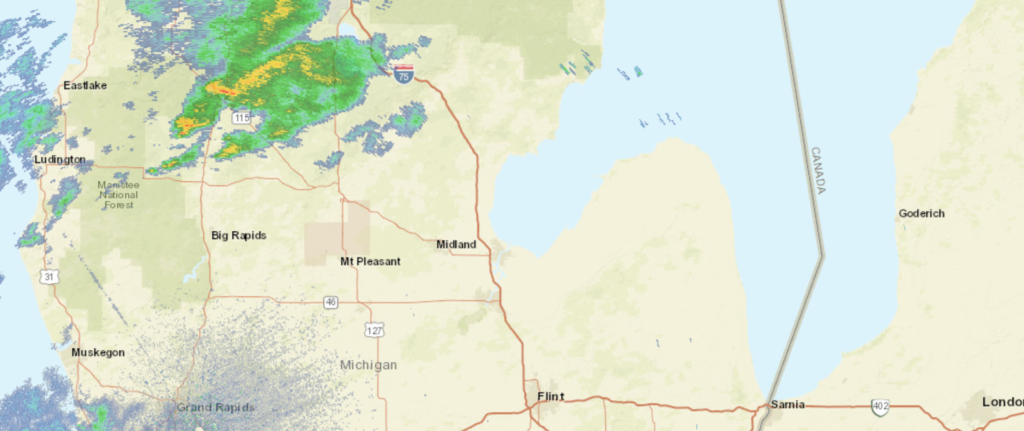
The greater Saginaw area is one of the more surprisingly well populated regions out there, in my opinion. Let’s get all those Michiganders a forecast.
At 953AM, ET, Saginaw was reporting fair skies with a temperature of 79 degrees, Clouds were looming just to the northeast, with nearby Midland reporting overcast conditions at the leading edge of a slow moving boundary, which has produced training, flash flooding rains from the central Plains to the Great Lakes. The nearest batch of rain to Saginaw was lingering to the northwest around Houghton Lake. The upper level trough that has led to the persistent rain in the region is finally showing some mobility, as it is strengthening in flow but receding in it’s amplitude. As a result, showers and thunderstorms across Michigan today look to be a little more robust, and a stray severe storm can’t be ruled out. For all the mechanisms of the upper level trough, it still doesn’t look to be terribly progressive, and will instead pulse from Ontario into the US. Today looks to be the stormiest day of showers and storms, but they will likely recur on Wednesday and Thursday, however without the same vigor. Thursday in particularly looks like precipitation may be absent the thunder, and that much of the day will be sunny. Tomorrow – Mostly cloudy with scattered showers and storms, High 82, Low 68 Thursday – Isolated showers, otherwise cooler with sun, High 76, Low 62
TWC: Tomorrow – Mostly cloudy skies early, then partly cloudy in the afternoon. High 83, Low 68 Thursday – Partly cloudy early followed by mostly cloudy skies and a few showers later in the day. High 74, Low 63
AW: Tomorrow – Mostly cloudy and humid; a thunderstorm around in the afternoon High 82, Low 68 Thursday – Times of clouds and sun with a shower in the area; cooler High 72, Low 63
NWS: Tomorrow – Showers likely, with thunderstorms also possible after 8am. Mostly cloudy, High 82, Low 69 Thursday – A chance of showers and thunderstorms. Mostly sunny, High 75, Low 63
WB: Tomorrow – Partly cloudy with a 50 percent chance of showers and thunderstorms, High 81, Low 69 Thursday – Partly cloudy with a 50 percent chance of showers and thunderstorms, High 74, Low 65
WN: Tomorrow – Mostly cloudy with showers likely, High 82, Low 69 Thursday – Partly cloudy with chance of storms, High 75, Low 63
FIO: Tomorrow – Possible light rain overnight. High 82, Low 69 Thursday – Partly cloudy throughout the day. High 74, Low 61
It’s striking to see how cool Saginaw will be, particularly in the wake of our post yesterday about the Pacific Northwest. Below is the radar, with rain over northern Michigan.
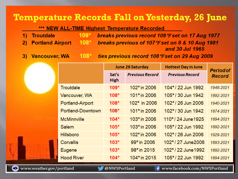
The pattern across the country has once again stalled, and it is going to have dangerous effects in the Pacific Northwest. A severely tilted trough is holding up traffic across the country. A weakening system in the middle of the country is being propped up by a severely tilted trough, which in turn is blocking a ridge wrapping in from the west.
The strength of the ridge, and the continued entrenchment of the ridge are pushing temperatures to record totals. Not just for the day, or the month, but all time. Check out some of the totals from the Portland weather service office so far.
The trough is continuing to weaken in the middle of the country, which should allow the ridge out west to break down and start propagating to the east. Temperatures in Portland, which are, at the moment, sitting at 111, will start dropping after Monday, which will again hit well into the triple digits.
The summer, in particular the next few weeks, look like they will be above normal, however fortunately, the record breaking heat looks to be near it’s end. Without this particular wave to focus on, the attention will be turned to the persistent drought still smothering the west coast, and is being worsened in parts of the Pacific Northwest, no thanks to the inferno.
There are certainly a few different Columbia to Fayetteville options out there, and this was the longest trip possible of any of those combinations. This particular iteration will result in a day and a half drive, covering 921 miles. The pace between these SEC college campuses will be a somewhat tame 61.9mph covering 495 mile on our first day of travel. Let’s just get going, then.
DAY ONE (Sunday)
Columbia, South Carolina
It’s certainly a nuisance for residence from the central Plains to the Great Lakes to have to endure several days of rain and thunderstorms, but as we drive from Columbia through northern Georgia, we will reap the benefits. The moisture being directed further to the north and west will allow the southeast to dry out a bit. A stream of moisture keeps showing up on the various model runs in the late evening over eastern Alabama, so don’t be surprised to see a little rain from the Georgia line to Birmingham. Mostly cloudy, warm and muggy conditions will continue west to Tupelo, Mississippi where we will round out the day.
DAY TWO (Monday) The five plus hours through northern Mississippi, and across the state of Arkansas will be increasingly cloudy, and the higher terrain in northern Arkansas is likely to see spots of misty fog. Rain should stay clear of our route, but for the very end, when an isolated thunderstorm will certainly be possible along the hilly I-49 stretch, reaching into Fayetteville.
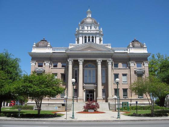
The Ozarks are definitely the nicest part of Arkansas, and I think most residents of the other parts of Arkansas would agree with that. Will the weather be just as beautiful?
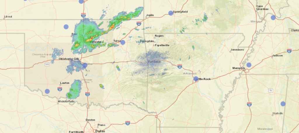
At 753PM, CT, Fayetteville was reporting a temperature of 81 degrees with overcast skies. A cold front sliced through the Plains, and moisture has been streaming through the region for the last several days. The added rain of the most recent system has led to flash flood watches in northwest Arkansas. Presently, the only band of heavy rain was northwest of Tulsa, with the axis running from Nowata to Guthrie. The narrow band of showers and storms will move very slowly, and perhaps won’t even cross into Arkansas tonight. There is a trough across the northern US that is particularly strong for late June, and it’s angle is so severe that it is having a difficult time propagating. Further preventing much motion is the pattern is the strong ridge fostering the record heat in the Pacific Northwest. With little structural change, the peak June sun will help weaken the jet flow, but not the curvature of the trough. Showers and storms will be a possibility through the next couple of days, though with less organization. Intensity may not wane, however, as day time heating could lead to more torrential downpours. The boundary will weaken, but the fuel reservoir will deepen. Tomorrow – Scattered showers and storms, High 84, Low 70 Monday – Isolated thunderstorms, High 86, Low 71
TWC: Tomorrow – Thunderstorms likely. Storms may contain strong gusty winds. High 83, Low 69 Monday – Variable clouds with scattered thunderstorms. High 85, Low 69
AW: Tomorrow – Periods of rain and a thunderstorm High 84, Low 72 Monday – Mostly cloudy and humid; a thunderstorm in the afternoon High 84, Low 69
NWS: Tomorrow – Showers and possibly a thunderstorm, High 84, Low 70 Monday – Showers likely and possibly a thunderstorm. Partly sunny, High 84, Low 70
WB: Tomorrow – Showers likely and scattered thunderstorms, High 81, Low 73 Monday – Showers likely and scattered thunderstorms, High 83, Low 71
WN: Tomorrow – Partly cloudy with showers likely, High 84, Low 70 Monday – Partly cloudy with showers likely, High 84, Low 70
FIO: Tomorrow – Rain in the morning. High 82, Low 70 Monday – Possible light rain in the afternoon and evening. High 84, Low 69
Rain isn’t close to Fayetteville at the moment, but more rain is coming, even if they miss this round.
There has been a persistent drought across the west. It’s been tough this year, but it’s been ongoing for years now. The northern end of the San Joaquin Valley is no exception. Our forecast for Sacramento came before the blistering heat that is coming to the Northwest, and temperatures were relatively comfortable, only reaching the upper 80s for the weekend of our forecast, but as has been typical: no rain. Weatherbug claimed the top forecast, continuing a trend of success for that outlet. Actuals: June 12th, High 88, Low 59 June 13th, High 87, Low 61
The heat is on in the southwestern United States, but there will be a seasonable reprieve in the southeast. We’ll cover most of it on our 2 day trek, covering 1,325 miles. The second day will be pretty long, so travel with a second driver. The pace will be 68.8mph, which we will use to take a 550 mile chunk out of on the first day, hopefully getting us out of Texas. Let’s find out and get going.
DAY ONE (Wednesday)
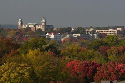
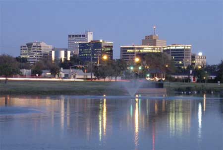
Midland, Texas By Hellorawr at English Wikipedia – Own work by the original uploader, Public Domain, https://commons.wikimedia.org/w/index.php?curid=29124005
Often in the summer, cold fronts expire along the coast, and just leave a convergence zone , amplified by the daily sea breezes. That’s what to expect in the coming days, but only as far west as about Lafayette, and not too terribly far inland. This will keep the hottest and most humid air penned to the south, relatively cool, definitely drier air will populate our route to Texas. We will make it just east of Shreveport and the town of Dubberly for our initial day of driving.
DAY TWO (Thursday) Another feature of summer in the southeast when moisture feeds systems in the Midwest and Great Lakes by streaming across the region. Guidance is pretty consistent with a potential band of light rain over western Mississippi as we drive through. From there through Georgia, expect more isolated showers and storms becoming more active as the area warms up in the afternoon. the Carolinas look a little bit drier, thanks to a weak little spot of development in the Gulf Stream, which will cycle in some subsiding air. Warm — but not too hot — weather awaits in Columbia.
We are taking a forecast trip to the capital of California.
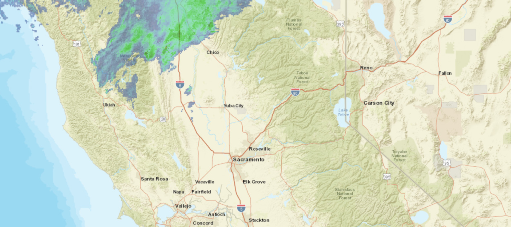
At 753PM, PT, Sacramento was reporting a temperature of 78 degrees with partly cloudy skies. Showers were seen in the mountains north of Chico, as a north Pacific gyre continues to spin some moisture to the Pacific Northwest. It hasn’t brought any rain to the Sacramento area, but temperatures are moderated by the cool Pacific air. Expect the temperature tends to change with a subtle update to the wind direction. Instead of cool Pacific air funneling towards Sacramento, downsloping will be enhanced and the heat will return to Sacramento tomorrow and continue through the weekend. Tomorrow – Partly cloudy, High 90, Low 58 Sunday – Partly cloudy, High 89, Low 64
TWC: Tomorrow – Sunny skies. High 91, Low 59 Sunday – Sunny skies. High 89, Low 62
AW: Tomorrow – Very warm with plenty of sunshine High 89, Low 58 Sunday – Mostly sunny High 89, Low 61
NWS: Tomorrow – Sunny High 90, Low 59 Sunday – Sunny, High 90, Low 62
WB: Tomorrow – Sunny warmer, High 90, Low 59 Sunday – Sunny, High 87, Low 62
WN: Tomorrow – Sunny, High 90, Low 59 Sunday – Sunny, High 90, Low 62
FIO: Tomorrow – Clear throughout the day. High 91, Low 57 Sunday – Clear throughout the day. High 90, Low 60
Hot and dry, just what Californians aren’t looking to hear.