
The pattern across the country has once again stalled, and it is going to have dangerous effects in the Pacific Northwest. A severely tilted trough is holding up traffic across the country. A weakening system in the middle of the country is being propped up by a severely tilted trough, which in turn is blocking a ridge wrapping in from the west.
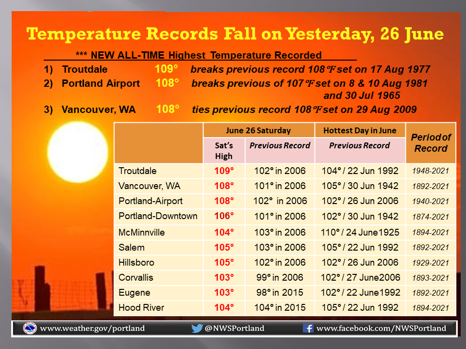
The strength of the ridge, and the continued entrenchment of the ridge are pushing temperatures to record totals. Not just for the day, or the month, but all time. Check out some of the totals from the Portland weather service office so far.
The trough is continuing to weaken in the middle of the country, which should allow the ridge out west to break down and start propagating to the east. Temperatures in Portland, which are, at the moment, sitting at 111, will start dropping after Monday, which will again hit well into the triple digits.
The summer, in particular the next few weeks, look like they will be above normal, however fortunately, the record breaking heat looks to be near it’s end. Without this particular wave to focus on, the attention will be turned to the persistent drought still smothering the west coast, and is being worsened in parts of the Pacific Northwest, no thanks to the inferno.