When a drought is on, there is nothing better than a long, steady rain, and at the beginning of last week, that is exactly what Columbia, Missouri got. Over two inches of rain fell between Monday and Tuesday of last week, giving the region a drink, and starting to rejuvenate the Missouri and Mississippi Rivers. Everyone had rain in the forecast, and correctly prognosticated a non-standard day, though I don’t think anyone was this optimistic on total rainfall. Weatherbug had the top forecast for the day, which ultimately came down to solid temperature trending. Actuals: Monday, Oct 24th, .59 inches of rain, High 74, Low 58 Tuesday, October 25th, 1.45 inches of rain, High 56, Low 42
If you know any thing about me, know that I love it that we take road trips that are a bit different The trip, just shy of 8 hours, makes it’s biggest turn at Cedar Rapids. Has that ever happened? I don’t think so! It’s a 491 mile trek, covering 3 states at a pace of about 62mph. And we get to see Cedar Rapids!
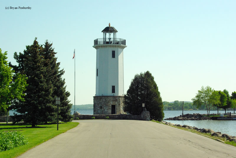
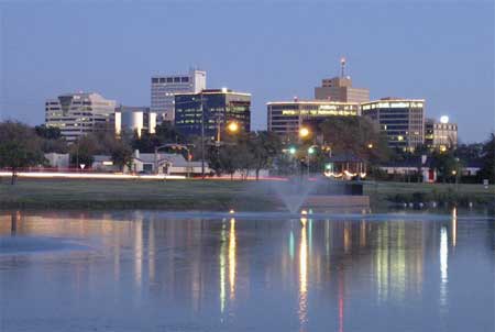
Columbia, Missouri
Low pressure spinning over the mountains is going to sink deeper to the southern Plains. The light rain showers that are threatening the Upper Midwest are going to be drawn south to the more organized region of instability in Texas by the time we would depart tomorrow. The weather will get less cloudy and potentially a few degrees warmer as we head to eastern Wisconsin.
Columbia is the home of the University of Missouri, and like most of the population of Missouri, isn’t terribly far from St. Louis.
At 154PM, CT, Columbia was reporting a temperature of 83 degrees with fair skies. Low pressure moving through the northern Plains was inducing brisk southerly winds that were bringing temperatures up to unusually high levels, and introducing a little bit of moisture to the atmosphere. Columbia was on the cusp of drought, but is not presently under a red flag warning, even with the gusty winds. The strong feature in the Plains is going to gain a tighter circulation and start moving north toward the Dakotas and Minnesota. The cold front, owing to the primarily northerly vector of the system, will be slow moving. The boundary will flare in Kansas and Oklahoma tomorrow morning, and slowly traipse across Missouri before arriving in Columbia in the evening on Monday. The base of the trough will be fertile ground for more cyclonic development, and a wave will develop in the Red River Valley and move north, ensuring that after the rain and thunder start on Monday, it will persist, though likely with less thunder, through the early part of Tuesday, with colder temperatures following. Tomorrow – Rain and thunder arriving late after another warm October day. High 74, Low 54 Tuesday – Rain through the afternoon, then clearing, High 54, Low 46
TWC: Tomorrow – Cloudy with occasional rain in the afternoon. Thunder possible High 72, Low 50 Tuesday – Periods of rain High 52, Low 49
AW: Tomorrow – Mostly cloudy, breezy and not as warm; a couple of afternoon showers and a heavy thunderstorm High 72, Low 55 Tuesday – Cloudy, breezy and cooler with heavy rain tapering off High 55, Low 46
NWS: Tomorrow – Showers, mainly after 2pm High 73, Low 59 Tuesday – Showers likely, mainly before 2pm. Mostly cloudy High 59, Low 46
WB: Tomorrow – Cloudy, showers in the afternoon, High 74, Low 56 Tuesday – Showers likely mainly in the morning, High 57, Low 46
WN: Tomorrow – Mostly cloudy with showers, High 74, Low 63 Tuesday – Mostly cloudy with scattered showers, High 56, Low 48
FIO: Tomorrow – Rain throughout the day. High 79, Low 63 Tuesday – Rain throughout the day. High 67, Low 46
It is non-standard temperature season! What a rainy forecast for eastern Missouri. I wouldn’t be surprised to see several inches of rain in some parts of the state. The low is easily apparent up in Montana even this afternoon.
After expecting Mindy to drift a bit further north than she actually did, a lot of outlets ended up looking foolish on our forecast for Columbia, 6 of the 7 thought that the storm would pass close enough to central South Carolina that the state capital would get a bit, perhaps a substantial bit, of rain. Judging by storm reports, was only ever really a problem down by Tybee Island in Georgia, and Columbia didn’t actually get any rain. None. So Forecast.io who had no precipitation in the forecast got a share of the victory, but so too did Victoria-Weather, who despite the whiff on Mindy, accurately forecast the high and low on Friday. Even though forecasters were disappointed by their inaccuracy, I’m sure Columbia residents were just fine. Actuals: Thursday – High 85, Low 67 Friday – High 84, Low 64
It’s the weekend, baby! And our drive is going to cover a lot of country at what is really the right time of year to be taking such a journey. Temperatures are usually perfect for keeping the windows down, while you can stop and take in football games on the weekend, or baseball games in the week. This drive will take 5 days, so plenty of chances to stop, and will cover 2782 miles. It’s a hike, but we will break it up into 543 mile chunks at a pace of 67.8mph. Day 5 will be the longest, but it is also the stretch with the fewest roadside attractions.
DAY ONE (Saturday)
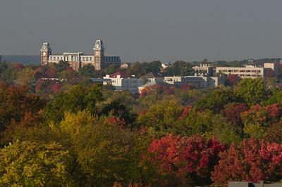
Columbia, South Carolina
The eastern US needs to dry itself out, and it will get the chance on Saturday. High pressure is going to build across the southeastern US, at least at the surface. It’s strength will help guide Larry and Mindy northward, while temporarily preventing the development of more tropical activity in the Gulf. It’s not permanent, but it is going to last long enough. Expect now weather related impairment as we head from Columbia to Kuttawa in western Kentucky. It’s kind of a resort-y area, so hotels will be plentiful.
DAY TWO (Sunday) Low pressure is sliding through the Great Lakes toward eastern Canada, and a nearly stationary front will be left in it’s wake. It will try to bubble up some isolated showers and storms along the Minnesota-Iowa border on Sunday afternoon, but the ridge to the south is just going to be too much. Expect instead warmer than normal temperatures along our route, which will end in Dunbar, Nebraska, which is in the southeastern corrner of the state.
DAY THREE (Monday) Driving across Nebraska, at least to me, is fun. It’s really easy to figure out where you are, as the farmland leads to regularly intervals between towns, and you can move pretty quick, especially on a quiet day like Monday. There will be a spot of shower and thunderstorm activity late in the day though, as we approach the Wyoming border. Isolated thunderstorms will pop up in the front range, or until we are over Sherman Summit approximately. We’ll be on the other side of the high range and through Laramie to the Bath exit about 20 miles west of Laramie.
DAY FOUR (Tuesday) Storm activity will pick up in the Plains on Tuesday, so nice work getting out of there when we did. Some late showers and storms will pop up in southern Wyoming, but they should hold until we are into Utah. It looks pretty stormy in the Colorado Rockies too, but that is neither here nor there. In this case, “there” is outside of Wells, Nevada, where we will suspend our journey for the night.
DAY FIVE (Wednesday) Hopefully, the rain that moved through the northwest today helped to quench some of the fires in Northern California and Oregon, but I don’t have high hopes. Temperatures will be dry, and the sky will almost certainly be tinged an unsettling color as we pass through Sierras into northern California and settle into the northernmost Central Valley, to park our butts in Redding.
It’s a two forecast day here on September 8th. Let’s see if we can forecast better here than in Florida.
At 1056PM, ET, Columbia was reporting mostly cloudy skies and a temperature of 72. A slow moving cold front lay across the South Carolina Upstate, and was inching southeastward. Showers and storms have mostly wound down for the night, but the boundary’s presence will not allow anyone to take more rain out of the forecast. Tropical Storm Mindy sits over the northeastern Gulf, and will track toward the Carolinas by tomorrow afternoon, forecast to take a path south of Charleston, if it holds together as well as some guidance projects. Regardless of the storm’s strength tomorrow, there will be an increased threat of rain and storms with isolated tornadoes as circulation passes south of Columbia. On the positive side, the organization will help clear the region out more swiftly, and Friday looks like a dry day. Tomorrow – Scattered showers and embedded thunderstorms. Tornadoes possible in the area, High 84, Low 70 Friday – Becoming sunny, High 84, Low 64
TWC: Tomorrow – Showers early then scattered thunderstorms developing later in the day. High 81, Low 70 Friday – Partly cloudy skies. High 83, Low 61
AW: Tomorrow – Times of clouds and sun with a couple of showers; humid High 83, Low 72 Friday – Beautiful with times of clouds and sun High 84, Low 62
NWS: Tomorrow – A chance of showers and thunderstorms, mainly after 9am. Mostly cloudy, High 84, Low 72 Friday – Sunny, High 86, Low 63
WB: Tomorrow – Mostly cloudy in the morning then becoming partly sunny. A chance for showers and thunderstorms. High 82, Low 72 Friday – Sunny, High 82, Low 63
WN: Tomorrow – Partly cloudy with a chance of storms, High 84, Low 72 Friday -Mostly sunny, High 85, Low 63
FIO: Tomorrow – Humid and mostly cloudy throughout the day. High 83, Low 70 Friday – Clear throughout the day. High 84, Low 63
I feel pretty confident that there will be showers and storms in Columbia tomorrow, to some degree. It appears our computer overlords at Forecast.io disagree. Showers are winding down for the evening.
There are certainly a few different Columbia to Fayetteville options out there, and this was the longest trip possible of any of those combinations. This particular iteration will result in a day and a half drive, covering 921 miles. The pace between these SEC college campuses will be a somewhat tame 61.9mph covering 495 mile on our first day of travel. Let’s just get going, then.
DAY ONE (Sunday)
Columbia, South Carolina
It’s certainly a nuisance for residence from the central Plains to the Great Lakes to have to endure several days of rain and thunderstorms, but as we drive from Columbia through northern Georgia, we will reap the benefits. The moisture being directed further to the north and west will allow the southeast to dry out a bit. A stream of moisture keeps showing up on the various model runs in the late evening over eastern Alabama, so don’t be surprised to see a little rain from the Georgia line to Birmingham. Mostly cloudy, warm and muggy conditions will continue west to Tupelo, Mississippi where we will round out the day.
DAY TWO (Monday) The five plus hours through northern Mississippi, and across the state of Arkansas will be increasingly cloudy, and the higher terrain in northern Arkansas is likely to see spots of misty fog. Rain should stay clear of our route, but for the very end, when an isolated thunderstorm will certainly be possible along the hilly I-49 stretch, reaching into Fayetteville.
The heat is on in the southwestern United States, but there will be a seasonable reprieve in the southeast. We’ll cover most of it on our 2 day trek, covering 1,325 miles. The second day will be pretty long, so travel with a second driver. The pace will be 68.8mph, which we will use to take a 550 mile chunk out of on the first day, hopefully getting us out of Texas. Let’s find out and get going.
DAY ONE (Wednesday)
Midland, Texas By Hellorawr at English Wikipedia – Own work by the original uploader, Public Domain, https://commons.wikimedia.org/w/index.php?curid=29124005
Often in the summer, cold fronts expire along the coast, and just leave a convergence zone , amplified by the daily sea breezes. That’s what to expect in the coming days, but only as far west as about Lafayette, and not too terribly far inland. This will keep the hottest and most humid air penned to the south, relatively cool, definitely drier air will populate our route to Texas. We will make it just east of Shreveport and the town of Dubberly for our initial day of driving.
DAY TWO (Thursday) Another feature of summer in the southeast when moisture feeds systems in the Midwest and Great Lakes by streaming across the region. Guidance is pretty consistent with a potential band of light rain over western Mississippi as we drive through. From there through Georgia, expect more isolated showers and storms becoming more active as the area warms up in the afternoon. the Carolinas look a little bit drier, thanks to a weak little spot of development in the Gulf Stream, which will cycle in some subsiding air. Warm — but not too hot — weather awaits in Columbia.
Monday turned out to be miserable in central South Carolina. A round of heavy rain moved north and into the Columbia area early on in the day, and didn’t allow Columbia to come up for air at any point. Monday only saw a 3 degree spread from high to low as they collected35 inches of rain through the day. The Weather Channel has continued their solid month with a victory in the South Carolina state capital. Actuals: Sunday, High 62, Low 30 Monday – .35 inches of rain, High 51, Low 38
The drive from eastern Wisconsin to central South Carolina, if taken today, would be slowed mightily by rain gripping a wide swath of the eastern United States. We will start this two day trek tomorrow, though, so nothing to fear! The drive will cover 1,013 miles, which we will in turn cover at a pace of 65.3mph. The second day will be a little bit shorter, by a half hour or so, and our target distance on Tuesday will be 523 miles. all very manageable, yes?
DAY ONE (Tuesday)
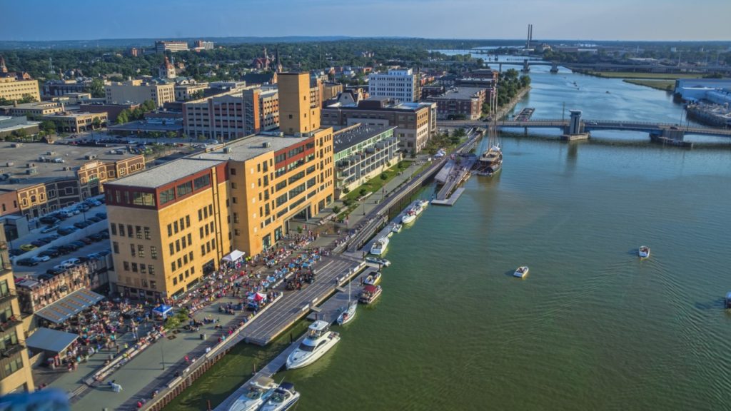
Green Bay, Wisconsin (By Chris Rand)
Low pressure moving through the eastern portion of the country is gradually unraveling today, and will continue to tomorrow. That means that precipitation which was translating quickly earlier in the week is slowing way down. None of it is reaching into Wisconsin, so the drive south towards the Illinois line should be drama free, but when we hit the Windy City, there is a pretty good chance it will be snowing. The snow will continue in this inverted trough south through Indiana, with a gradual change to rain south of Indianapolis. Precipitation won’t be heavy, but it won’t need to be to slow travel down. We’ll reach the eastern suburbs of Louisville, particularly the town of Middletown, by the end of the day.
DAY TWO (Wednesday) The back end of that system will swing to the south overnight. The dry slot will disappear from west of the Appalachians, and the light snow will return to our route, and last through our drive in Kentucky. We will turn south at Lexington and there might be a window of dry air by the time we reach Knoxville, which should last us through the rain shadow afforded by the Smokey Mountains from Asheville to Spartanburg, but the cold front associated with this low will start to redevelop on Wednesday afternoon. More rain will move into Columbia from the south, and will be there to greet us upon our arrival.