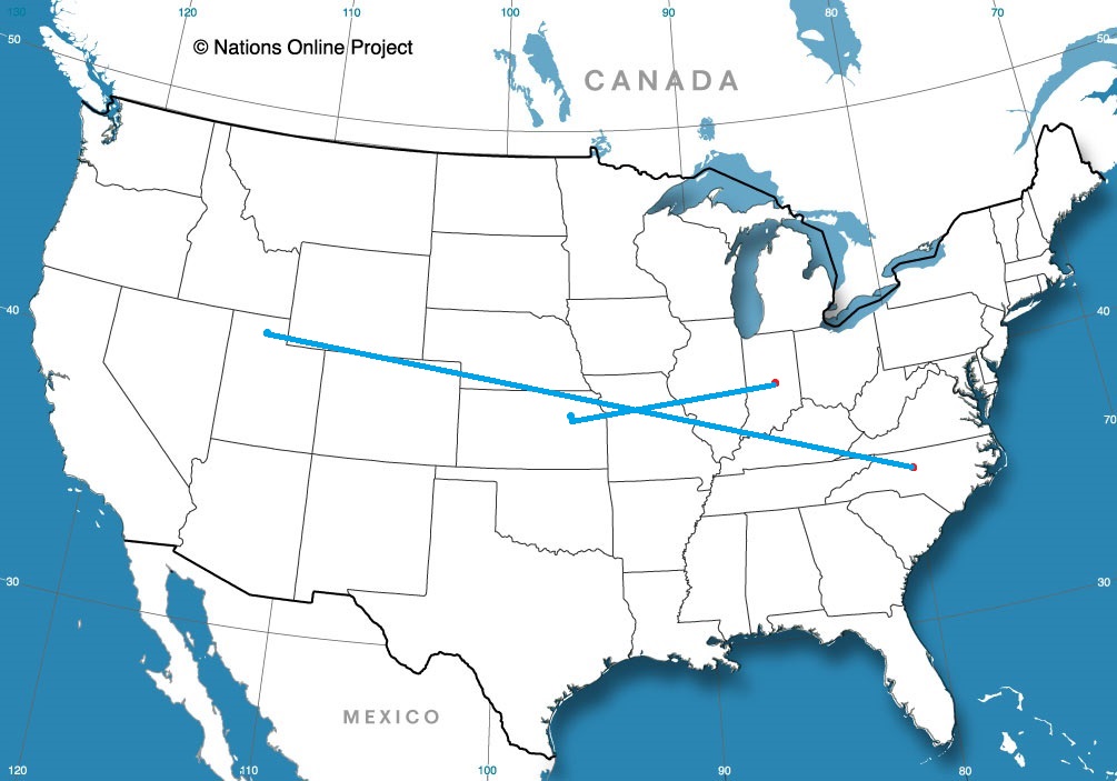
The middle and southern part of the country has been battered of late, but at least we are moving to a calmer stretch. Holy smokes is it going to be cold, though. We’ll take 1 day to march across this icy terrain, from Lawrence to Indianapolis, covering 521 miles at a pace of 67mph. Even St. Louis can’t slow us down.
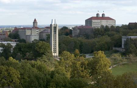
Lawrence, Kansas Campus skyline #1-7: from JRP rooftop #8-34: sunrise, from Coop Elevator on Haskell Ave. 10-25-05 Credit: Doug Koch/KU University Relations # 06200_1 through _34
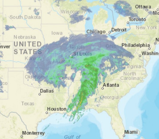
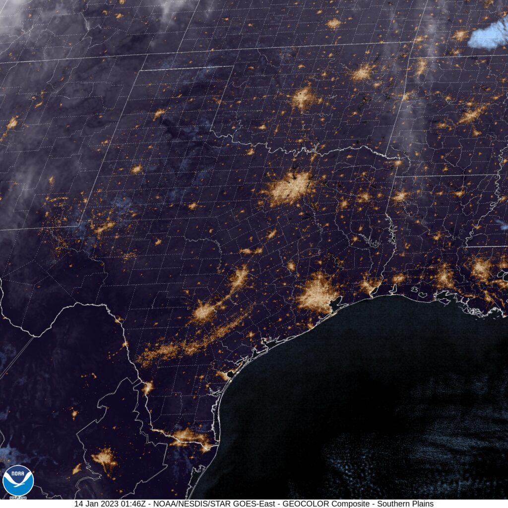
Cold air has built in behind a stormy, snowy system that moved through this week. There is some high pressure to the south, which is doing a good job of stifling moisture which is trying to reach a Clipper moving through the Canadian Prairies, and will head for the western Great Lakes as we get moving. I don’t trust Clippers moving through the cold to stay bound by where the models say it will snow. There isn’t much precipitable water with these, and the flakes fly even if there is no real moisture available. To that end, I suspect the last stretch, from the Illinois side of the Mississippi all the way to Indianapolis will feature some flakes. The steadier activity will be in Indy on our arrival.
We’re back to forecasting today, in one of the two states most dear to me. Let’s see if we can get a better showing from Clime.
At 1154PM, ET, Indianapolis was reporting cloudy skies and a temperature of 37. It looked like a wet day was on its way for the Circle City, as a classically comma shaped storm system was moving from the lower Mississippi Valley, where it is currently centered over western Tennessee and shifting to the northeast. A wide shield of non convective precipitation runs from southern Ohio to eastern Oklahoma and was starting to shift north. There is light rain being reported in Shelbyville and moderate rain in Bloomington. The steady rain is expected to arrive soon, and will continue through the morning, at least, with snow expected to mix in by the early afternoon. The feature is backed by a strong upper level trough, and will be chased by some very cold air and some northwesterly flow. The low after shifting out of the region will lag in the Canadian Maritimes, so the combination of latent moisture, flow off of Lake Michigan and cold air will lead to some persistent light snow in central Indiana through Thursday. Tomorrow – Rain changing to snow, High 38, Low 34 Thursday – Overcast with scattered clouds, High 34, Low 23
TWC: Tomorrow – Snow during the morning will give way to lingering snow showers during the afternoon. High 37, Low 34 Thursday – Occasional snow showers. High 34, Low 26
AW: Tomorrow – Colder with wet snow, 4-8 in; breezy this morning; hazardous travel expected due to slick roads and heavy snowfall rates High 37, Low 33 Thursday – Cloudy with a couple of flurries, High 33, Low 26
NWS: Tomorrow – Snow before 1pm, then rain and snow likely. The snow could be heavy at times. High 38, Low 32 Thursday – Snow likely, mainly before 1pm. High 33, Low 27
WB: Tomorrow – Rain Likely. Snow mainly in the morning. Snow may be heavy at times in the morning. High 37, Low 33 Thursday – Cloudy. Snow likely in the morning. High 34, Low 25
WN: Tomorrow – Cloudy with heavy wintry mix High 34, Low 31 Thursday – Cloudy with light snow likely High 33, Low 30
CL: Tomorrow – Light Freezing rain, High 38, Low 31 Thursday – Heavy snow showers, High 33, Low 26
Guys, I’m concerned about Clime. Their temperatures are fine, but how they distill a daily forecast is strange. Anyways, I think the change to snow is going to be a little slower than the other outlets have indicated, but some parts of Indy are going to see half a foot of snow with this one. I captured the broader storm system, just because it is so perfect.
Austin stayed on the cooler end of the spectrum after our forecast last week, even as low pressure in the Southern Plains emerged and started drawing warm air to the north. It did get quite a bit warmer, but not to the level some of our outlets expected. Nearly all errors were because the forecast was too warm, and the warmest forecast belonged to newcomer Clime, and as a result were the lowest total, while Victoria-Weather, the coolest ‘cast, earned a solid victory. Actuals: January 14th, High 65, Low 34 January 15th, High 72, Low 47
It is the beginning of the year, and already we have had our first notable severe weather outbreak. With the strong storms pounding the west, it was only a matter of time before the cold air wrought havoc when making contact with the more sultry air east of the Rockies.
Tornadoes left a path of damage in Alabama and Georgia over the weekend, including a tornado that led to the deaths of at least 6 west of Montgomery. The strong areas of low pressure have drawn unstable air as north as Iowa, where the first January tornado was reported there since 1986. Now, a strong storm is expected to leave a foot of snow in the northern High Plains.
It will be the tornado that struck Selma, Alabama that will be remembered the most out of this town, striking a town so closely associated with the Civil Rights Movement on the weekend that celebrates one its greatest champions, Dr. Martin Luther King, Jr. The tornado went through the heart of the city, just north of the down town area and the Edmund Pettus Bridge, damaging homes, churches and businesses throughout the city. StormChasingVideo provides a look at the city and nearby Autauga in the aftermath of the tornado.
As long as cold air resides in the west, feeding into much warmer air east of the Rockies, there will be a threat that storm systems could amplify quickly and dangerously. The snow storm in the Dakotas and Nebraska today will ultimately lead to an additional threat for severe weather in the Mississippi Valley later the is week. The long term outlook, for a cold wet west indicates an active winter in the south as well.
2023 is here! We are two weeks in, only 50 to go. I can’t tell you what is all going to happen this year, but I can tell you what you can expect from Victoria-Weather in the next couple of weeks.
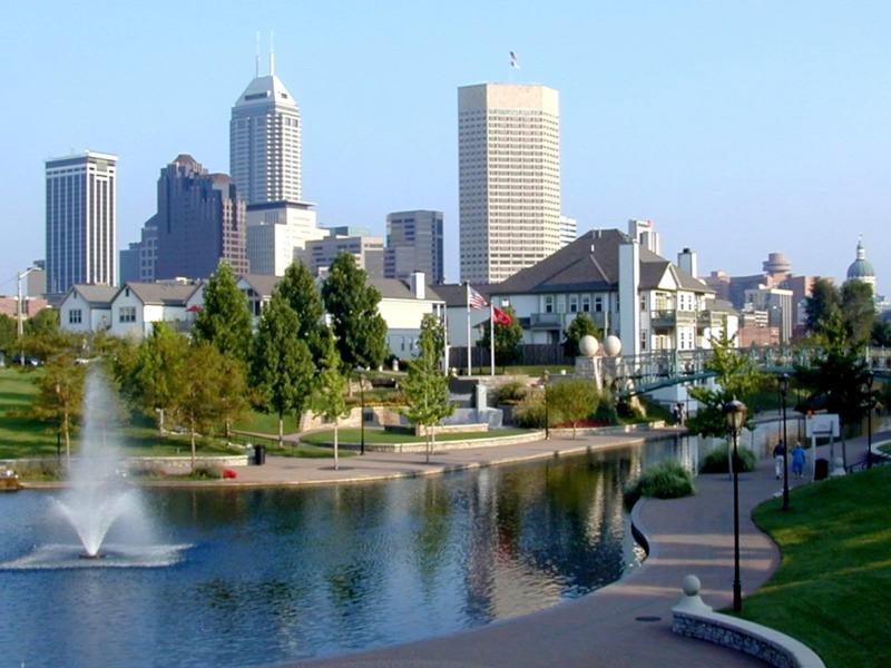
Indianapolis, Indiana Road Trip from Lawrence, Kansas to Indianapolis
Greensboro, North Carolina Road Trip from Logan, Utah to Greensboro
We made it to the first forecast of the year, and the first performance for Clime. Hopefully, the forecast won’t keep Austin weird.
At 753PM, CT, Austin was reporting a temperature of 41 degrees with fair skies. High pressure has settled in over the middle of the country in the wake of a strong area of low pressure that left a trail of destruction through the South yesterday, and has brought a chill to the air across Texas. A broad ridge is encompassing the western US, with an undercutting ridge setting up for the next day or so. For the forecast purpose, this ridge will remain intact through Saturday and usher in a return of some warmer air. The next round of low pressure will arrive east of the Rockies on Sunday, and will begin to deepen swiftly. While it is likely to become the next significant round of wintry weather, it will merely lead to a warm up in Austin on Sunday. Tomorrow – Sunny, High 65, Low 36 Sunday – Partly cloudy, High 75, Low 47
TWC: Tomorrow – Mostly sunny skies. High 67, Low 38 Sunday – Partly cloudy skies. High 77, Low 50
AW: Tomorrow – Plenty of sun; a nice start to the weekend High 64, Low 36 Sunday – Warm with intervals of clouds and sunshine; breezy in the afternoon High 73, Low 50
NWS: Tomorrow – Sunny High 65, Low 37 Sunday – Mostly sunny, High 75, Low 48
WB: Tomorrow – Mostly sunny, High 64, Low 38 Sunday – Partly cloudy, High 74, Low 51
WN: Tomorrow – Mostly sunny, High 65, Low 37 Sunday – Partly cloudy, High 75, Low 48
CL: Tomorrow – Sunny, High 67, Low 38 Sunday – Sunny, High 77, Low 52
Oh man, I was worried that Clime was going to start with a carbon copy of The Weather Channel, but then that Sunday low came through. Similarity is explainable though, given how stark the satellite looks.
Strictly speaking, this is our first forecast of 2023! Finally! We’re going to cover a road trip through the Southeast, which will cover merely one day, but it will be a full 8+hour day that entails 522 miles. We will pace ourselves at about 63mph, slowed by some back roads and certainly by Atlanta.
Tallahassee, Florida
It’s pretty quiet in the southeastern US right now, and that might lead intended travelers to think they have a good shot at getting quickly out of town and on the road. Not so fast. Surface low pressure in the Panhandle region will shift into the Lower Mississippi Valley overnight and really absorb a lot of the moisture. What is a non story tonight will quickly become active, bringing rain to Morristown by lunch time. The threat for wet weather will start on the drive, likely northwest of Atlanta, and between Marietta and Calhoun, the brunt of the cold front will arrive, with thunderstorms and wind likely. North of the boundary, it will be cooler, but still windy and a little rainy. This can get dicey in the undulations of eastern Tennessee, so be careful northeast from Chattanooga on slick roads. After a long, stormy day… Morristown!
Many lamented the loss of Forecast.io across the internet, and perhaps in honor of their impending retirement, Forecast.io did better than normal. That is to say, they finished in a tie for 4th. Lewiston withstood a Pacific storm that brought precipitation to the Cascades and Northern Rockies, and eventually to the middle of the country. Lewiston only had about an eighth of an inch of rain between the two days of our forecast period at the end of the year, and temperatures lingered just below 50 degrees. All told, it wasn’t nearly the story seen outside of the region between the Ranges. The Weather Channel rang in the new year with a victory. Actuals: December 30th, .04 inches of rain High 50, Low 37 December 31st, .09 inches of rain, High 46, Low 36
There are phrases that have been around the meteorological lexicon for years, and then get adopted into the media, and become part of what many find to be a sensationalized parlance. The polar vortex stands out to me, as does the bomb cyclone. These are real, definable things that suddenly take on a more ominous tone because they are uttered on the news regularly.
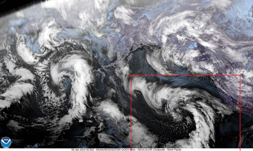
Right now, we are hearing about the “Atmospheric River”. Allow me to show you what that result of the atmospheric river is on satellite. It’s unusual, I think, to look at satellite over the north Pacific, because it isn’t somewhere we usually look at, and the perspective is a tad wonky, but here it is.
And that, boxed in red, is an area of low pressure, showing off the typical comma shaped cold front with a little warm front evidenced as angling towards San Francisco Bay. It’s not particularly unusual, but the discussion surrounding this feature is probably amplified by the persistent drought, which has rendered rainmakers rare over the last several years, and ongoing concerns over climate change flaring anxiety over every weather phenomenon.
The jet, in response to oceanic circulations, tends to rise and form a ridge at the California Coast, leading to the semi permanent Gulf of Alaska low (which feeds moisture into British Columbia and the Pacific Northwest with regularity) and a semi permanent area of surface high pressure west of the Baja Peninsula. In the winter, the jet is more apt to dig a little bit further south, because the cold California coastal waters don’t cause the atmosphere to differ as extensively as happens in the summer, and that coastal ridge can break down.
So the jet sinks south, and a regular old area of low pressure moves into California. It is coming off the ocean, so it will be laden with moisture, and it is interacting with the terrain, so it will dump a lot of precipitation, especially in the Sierras. This will do a lot of work in refilling dried reservoirs as the snow melts in the spring, and is how California usually maintains a sustainable quality of life. The southern source of the jet has led, in the past, to some “atmospheric rivers” to be dubbed “the Pineapple Express”.
All they are, really, is a more southerly jet that brings consequential weather to the West Coast. he phenomenon isn’t strange, but the location is, made a little bit more unusual by the recent climatology.
We’ve made it through 2022, and are looking forward to 2023. The end of the year saw The Weather Channel claim the final prize, though the newly retired Forecast.io was close behind. The Forecast.io site is already shuttered, and there are widespread lamentations over the DarkSky app. After the few years we’ve used that site as one our verification comparables, I can confirm that it was one of the easiest to use, and most readable, accessible outputs. On the other hand, it was consistently the least accurate, proving the continued value of meteorologists inserting their input in the process. In fact, despite Forecast.io’s strong end, it was the worst outlet of the year, and it wasn’t close. Alternately, the National Weather Service was abominable in December, but were the top forecast of the year. They had a steady hand throughout the season, racking up only the third most individual forecast wins of the year, but still won the year’s title. It was made closer by their sloppy end, but the first 11 months were so good, it didn’t matter. Congrats to the Weather Service on their year, and a Happy 2023 to everyone!