It’s that time of year for the Great Lakes. The Lakes haven’t yet iced over, but it’s still fairly chilly. There is a weak wave moving through the region, which means that it will be streaming cold air over the warm water, and it’s just going to keep snowing. It’s not really the western New York, multiple feet of snow kind of Lake Effect, just a persistent flurry that won’t go away. No thank you!
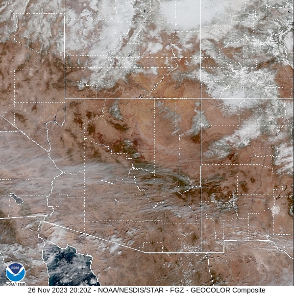
Flagstaff, Arizona
Northern Arizona has weather that is more akin to the Rockies, which makes it a more palatable destination for people visiting the Grand Canyon. Flagstaff is a lot more palatable than some people think when they hear “Arizona”. It would be a real shock to hit 110 in Flagstaff.
At 157PM, PT, Flagstaff was reporting a temperature of 39 degrees with clear skies. An upper level trough was tailed east to west from the central Plains towards the Great Basin. Unlike tilted troughs normally behave, this will shove off to the east overnight, with high pressure building into the western US.
The high pressure in the region will allow temperatures to warm up a bit. The subtropical jet will still run through northern Mexico, so summer like temperatures are not going to return to Arizona, with only a few fair clouds for Flagstaff.
Tomorrow – Partly cloudy, High 42, Low 19
Tuesday – Fair skies, High 48, Low 18
TWC: Tomorrow – Cloudy. High 42, Low 19
Tuesday – Sunshine and clouds mixed. High 47, Low 19
AW: Tomorrow – Partly sunny and chilly High 41, Low 21
Tuesday – Partly sunny High 47, Low 17
NWS: Tomorrow – Mostly cloudy, High 43, Low 16
Tuesday – Sunny, High 47, Low 16
WB: Tomorrow – Mostly cloudy, High 40, Low 23
Tuesday – Mostly sunny, High 46, Low 21
WN: Tomorrow – Mostly cloudy, High 43, Low 17
Tuesday – Mostly sunny, High 47, Low 18
CLI: Tomorrow – Overcast, High 40, Low 20
Tuesday – Sunny, High 45, Low 20
Some diversity to the temperature forecasts, which is nice, and makes sense. Like I said, northern Arizona is very much like the Rockies, which are mercurial at their best. Satellite shows some streaming clouds in southern Arizona, and more congested clouds north of the border.
Turkey Day snow in the mountains
Snow totals in the mountains were less than one might expect for typical weather advisories. Sure, in the tallest peaks it piled up, but even at some of the resorts, there were only 3-5″ of snow, less on the heavily travelled corridors. Hopefully that means everyone did their holiday traveling safely.
Happy Thanksgiving!
Per the National Weather Service:
A significant winter storm will continue today across the Northern/Central Rockies and portions of the Central Plains. Gusty winds, heavy snow and ice are all possible especially across central Wyoming. Minor to moderate travel impacts are expected across Utah, Central/Southern Wyoming, Colorado and the Nebraska Panhandle.
NWS – State College
So I hope that you aren’t spending this holiday traversing the most desolate stretches of American highways, and instead are spending it with loved ones. Happy Thanksgiving!
A sigh of relief
There was an enhanced risk for severe weather in the Lower Mississippi Valley Monday, which often means a long night of terrible reports. The severe storms were over by nightfall, and there just weren’t as many reports as the high end events can often bring.
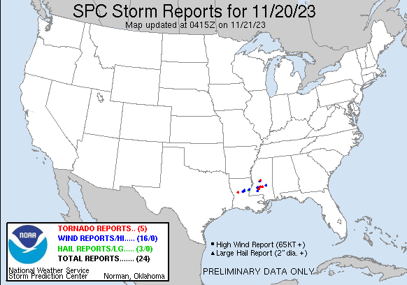
Furthermore, this storm system has brought a soaking rain to a part of the country that desperately needs it. Louisiana and Mississippi are dry, and will welcome the rain, especially if it comes without severe weather.
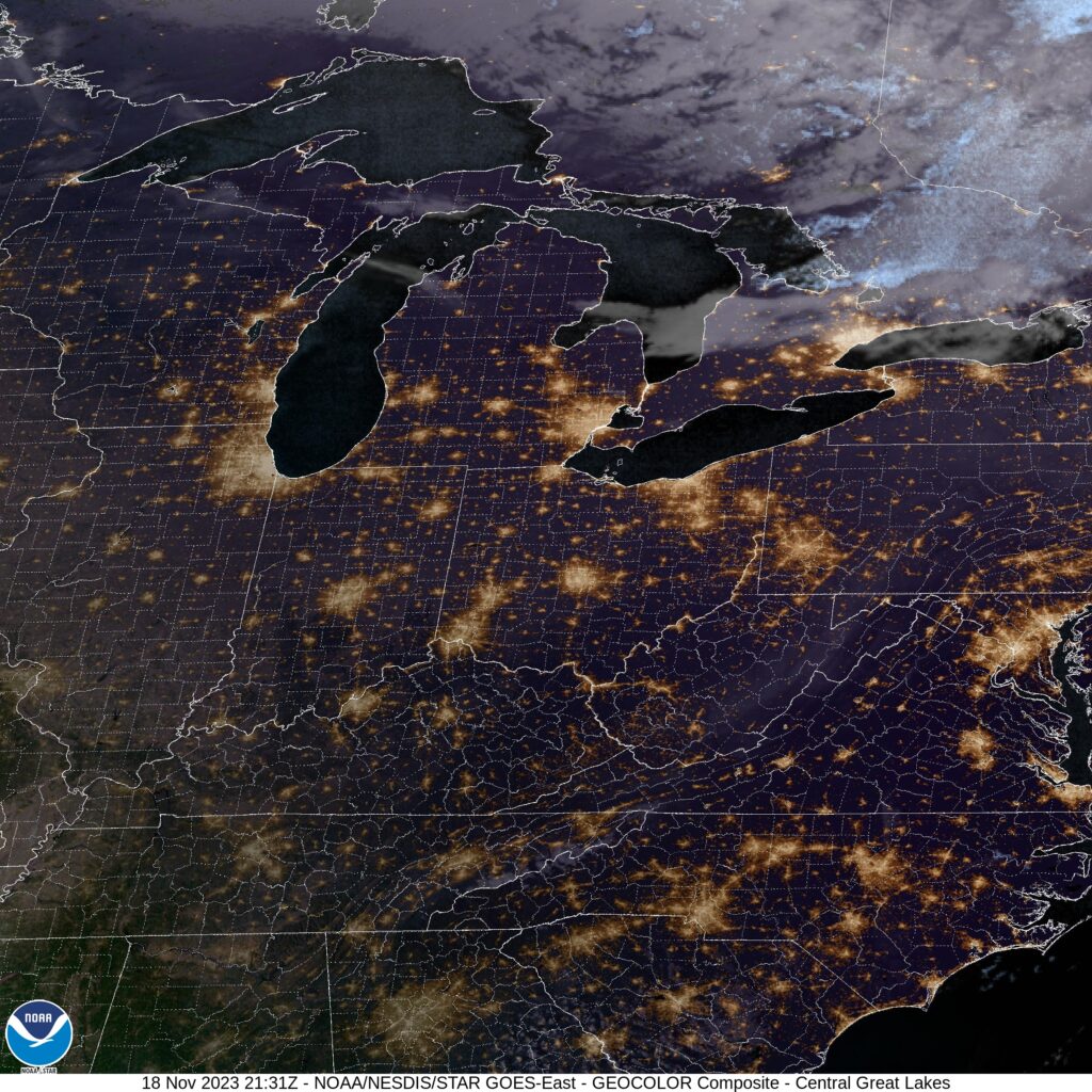
Monroe, Michigan
Happy Saturday, everyone. Let’s see if the weather will keep everyone happy to begin the weekend.
At 415PM, ET, Monroe was reporting a temperature of 49 degrees with clear skies. Low pressure in eastern Canada has recently dragged a cool front through town, which will bring cooler but still pleasant weather through the weekend.
A deep trough of the mid-latitude jet is going to traverse the desert Southwest and begin the development of a surface trough that will organize over the Red River Valley. By Monday evening, the system will move to the northeast, approaching the Lower Ohio Valley. The leading edge of rain will arrive after sunset on Monday night, to begin a pretty wet middle of the week.
Tomorrow – Mostly sunny, High 49, Low 29
Monday – Increasing clouds with rain late, High 45, Low 29
TWC: Tomorrow – Sunny skies. High 51, Low 30
Monday – Cloudy. Late Rain, High 45, Low 32
AW: Tomorrow – Mostly sunny High 50, Low 33
Monday – Sun and areas of high clouds in the morning, then mostly cloudy in the afternoon (late rain) High 46, Low 35
NWS: Sunny, High 49, Low 29
Monday – Mostly cloudy, High 46. Low 30
WB: Tomorrow – Mostly sunny, High 50, Low 31
Monday – Cloudy (Late rain) High 45, Low 29
WN: Tomorrow – Mostly sunny, High 50, Low 29
Monday – Mostly cloudy, High 46, Low 30
CLI: Tomorrow – sunny, High 48, Low 32
Monday – Mostly cloudy, High 46, Low 34
Some difference of opinion on whether there will actually be rain on Monday evening. Looks pretty likely to me. Not now, though. Pretty quiet now.
Snow season is here
I know a big chunk of the Northern Plains saw snow late in October, but it has been nice enough to begin November that I am guessing there is a cross section that doesn’t really remember the wintry weather. As we get deeper into November, every successive storm feature is more and more likely to bring winter weather advisories, or even more severe. For example, take a look at the current advisories from the NWS:
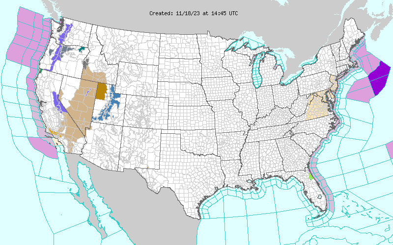
There are advisories for the Cascades, Sierras and Wasatch Mountains. It’s still early enough in the season that the first few waves necessitate a warning, but late enough that the snow is definitely here.
Coming Soon…
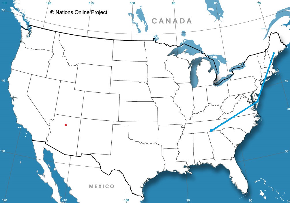
We’re getting deeper into fall, heading into the Holiday Season. Here’s hoping that weather cooperates for all of us in our travel plans. We have a couple of east coast road trips that might give a lot more people some weather information than just those in the destinations at either end of the trip, what with the heavily traveled roadways in question.
Flagstaff, Arizona
Road Trip from Lewiston, Maine to Salisbury, Maryland
Road Trip from Salisbury to Chattanooga, Tenessee
Fresh info, top forecast
When we forecast for Logan over the weekend, I noted that some of the outlets were trending away from each other, and I suspected that it was because the model guidance updated, and some outlets jumped on the changes and others hadn’t updated their forecast yet. I presumed I had the freshest data, and if that was the case, then that was what led to Victoria-Weather’s forecast victory for Logan. The new data was cooler overnight, which was the fate that befell Logan.
Actuals: Saturday, High 51, Low 23
Sunday, High 55, Low 24
Grade: A – F
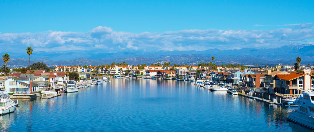
Lima, Ohio to Oxnard, California
Let’s hit the road for a 4 day trip to the West Coast. We are enjoying a stretch of quiet weather throughout most of the country, so let’s see if that holds for our 2,298 mile journey. We’ll have a pace of 67.6mph, which means the first three days will have a goal of 541 miles, with a longer day coming for Saturday.
DAY ONE (Wednesday)

Low pressure is churning in the northern Gulf of Mexico, bringing much needed rain to the Coast, and importantly, preventing much moisture from building into the middle of the country. Our first day of driving will be pretty easy, frankly, and we will see 4 states by the end of it. The stop for the night will be near Devil’s Elbow, Missouri, the site of the last part of the original Route 66 that was in use before being replaced by Interstate.
DAY TWO (Thursday)
Low pressure isn’t entirely the property of the Gulf. The Polar Jet is running along the Canadian border, and is going to kick up a Clipper that will charge through the Canadian Prairies. By Thursday, a cold front will slice through the Plains, and we will cross paths with it as we reach the end of our day in Amarillo. That said, don’t be surprised to see winds really pick up around Oklahoma City and continue through the day.
DAY THREE (Friday)
The wind will subside, and temperatures will be a bit chillier than when we awoke the morning before, even though we are a bit further south. The drive will be pretty easy, albeit barren of many chances to stop for gas. We’ll traverse New Mexico and eventually land in the Chevalon Creek Wildlife Area, not far from Winslow, and quite the beautiful spot.
DAY FOUR (Saturday)
I would say that 3/4ths of the drive on Saturday will be free of issues, but we are approaching the rainy season in California, and it is trying to start on time. An area of low pressure is moving near the coast by the weekend, and after we cross the Cajon Pass to Pasadena, we will be under the threat for some light showers. Our route will hug the San Gabriel and Topatopa Mountains, which will only make rain likelier, which isn’t great news, because Californians aren’t the best at driving in inclement conditions. We’ll make it, though, and prepare for things to green up with this taste of rain.