There was a little bit of a debate for the forecast for Ocean City. Would the system moving through be quick and usher in colder air? Would it be slow and let some light rain linger into the weekend? Most outlets kind of hedged. The clouds would linger, and the cold air wouldn’t arrive. Instead, there was light precipitation early Saturday morning AND the cold air came in. Victoria-Weather went the cold route along with Weatherbug, while Accuweather was the only outlet that had rain on Saturday’s forecast, and everything worked out to a three way tie, with all others several points off. I should note, this is the one rare site where I do not use an NWS observation point, because the nearest is Atlantic City, another site we might forecast for, so I used the nearest site available from Weatherforyou.com. Actuals: Friday – .22 inches of rain, High 48, Low 41 Saturday – .07 inches of rain, High 46, Low 30
We keep bouncing from coast to coast, so that means for this forecast, we’re hitting the East Coast.
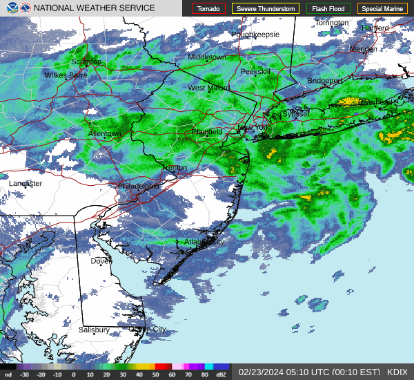
At 1154PM, ET, Ocean City was seeing temperatures of 46 degrees and overcast skies. Rain was pressing north, and the back end of the line lay from Trenton to Farmingdale, with Long Island and southern New England seeing sustained shower activity. The upper level pattern is complicated. The deepest area of low pressure is in Canada, but a more generalized trough extends from New England to the Carolinas. Overnight, a southern, secondary low will develop in the Smokey Mountains and shift off shore through tomorrow evening, bringing more rain to Ocean City through Friday. On Saturday, the low will move offshore and start headed to the Maritimes and pull cold air into the mid-Atlantic. There will be some snow in the northern Appalachians, but only patchy clouds and a return of cooler temperatures are expected to start the weekend in Ocean City. Tomorrow – Scattered showers, especially in the early afternoon, High 48, Low 42 Saturday – Clearing, High 44, Low 32
TWC: Tomorrow – Rain showers in the morning becoming a steady light rain in the afternoon High 51, Low 42 Saturday – Sunshine and clouds mixed. High 44, Low 35
AW: Tomorrow – Occasional rain; breezy this morning; a brief cold shot to start the weekend High 49, Low 42 Saturday – A shower in spots in the morning; otherwise, breezy with times of clouds and sun High 44, Low 36
NWS: Tomorrow – Rain likely. Patchy fog after 8am. Otherwise, cloudy High 50, Low 41 Saturday – Mostly sunny, High 42, Low 36
WB: Tomorrow – Rain likely. Patchy fog. High 48, Low 43 Saturday – Partly sunny, High 44, Low 29
WN: Tomorrow – Mostly cloudy with light rain, High 48, Low 44 Saturday – Partly cloudy, High 44, Low 32
Temperatures are going to hover and steadily drop. It’s possible all highs and lows are around midnight, so that stinks for my ability to hammer this out quickly. Here is the radar, with rain pulling away, for now, from Ocean City.
The end of February saw another, somewhat repetitive pattern, with perturbations emerging from the southern Plains and heading for the eastern Great Lakes. It happened more than once, including early last week when we were forecasting in Ocean City, New Jersey. It was about to rain on Sunday night when we looked at the forecast, and to the surprise of a few, that rain mixed with snow on Monday morning. It was more rain than snow, however, and nothing accumulated as the day wore on. Ultimately, it was a tied forecast win for Forecast.io and Victoria-Weather. I had a typo in my forecast, so I am ok letting FIO have the plaudits on this go-around. Actuals: Monday – .46″ of rain, High 45, Low 31 Tuesday – High 51, Low 35
It’s been a long time since we put together a road trip. It’s for the best, as the world hasn’t been quite so navigable of late. Our drive this week will cover three days, with the third day lasting quite a bit longer than the first two. It’s 1794 miles from the New Jersey coast to west Texas, and we will cover that at an aspirational speed of about 66mph. Hopefully, we can get 532 miles out of the first two days of the trip.
DAY ONE (Thursday)
Ocean City, New Jersey
A quick little feature is shifting out of te Great Lakes today, and will pass the mid-Atlantic coast overnight tonight. By the time we start rolling on Thursday, high pressure will be strengthening over the Ohio Valley and upper Appalachians. Sunny skies, though entirely too cool for much windows down driving, will be on the order throughout our drive from the coast to our day one waypoint, Columbus, Ohio.
DAY TWO (Friday) The next area of low pressure is going to move from the southern Plains and pass nearly entirely south of our route on Friday, rendering the better part of the drive dry. Towards the very tail of the day, though, an inverted trough will phase with an upper level wave from the Upper Midwest. This will produce clouds and a bit of light precipitation across a large tract of the mid and upper Mississippi Valley. This will include Missouri, and we might see a few flakes west of Rolla. We’ll stop for the night on County Road J south of Powellville, Missouri on Friday night. Don’t expect a wild nightlife.
DAY THREE (Saturday) Any precipitation we see overnight will be insignificant to grassy areas, but it may make for some slick spots early on. Temperatures and sunshine will lead to wet and eventually dry roads pretty quickly. Expect good conditions through Oklahoma City, before it might get a little bit dicier. A bit of development is expected along a boundary in east Texas and Oklahoma, and some light rain showers are possible from there to about Wichita Falls. It will get dry again, I suspect, as we turn westward again, and on to Lubock.
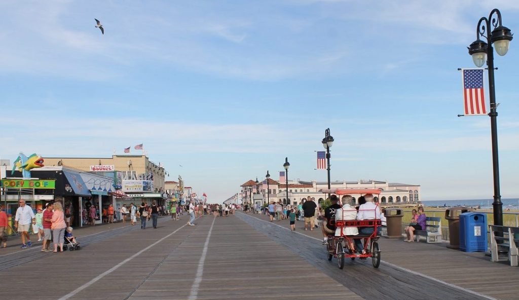
Ocean City is in the southern part of the state of New Jersey, not far from Atlantic City. Sheesh, Ocean City, Atlantic City…. we get it, New Jersey, you are on an ocean.
At 854PM, ET, Ocean City was seeing a temperature of 29 degrees with clear skies. High pressure lay over the east coast, but the broad, nearly immobile trough over the country at the beginning of the month is no longer, replaced with a fast moving perturbation sliding presently across the Great Lakes. was expected to arrive on the east coast as early as tomorrow morning. The line between rain and snow will be razor thin, but the southern Jersey Shore should be safe from snowfall, but heavy rain, perhaps embellished with a thunderstorm will move quickly through the Garden State. Clear skies will return on Monday evening, followed by a pleasant day on Tuesday. Tomorrow – Rain, some thunder early, then clearing. High 45, Low 22 Tuesday – Mostly sunny, High 48, Low 32
TWC: Tomorrow – Rain likely, High 45, Low 30 Tuesday – Partly cloudy. High 46, Low 33
AW: Tomorrow – Breezy with periods of rain from late morning on High 44, Low 33 Tuesday – Intervals of clouds and sunshine; breezy in the afternoon High 45, Low 35
NWS: Tomorrow – A slight chance of rain and snow before 9am, then rain High 43, Low 29 Tuesday – Partly sunny High 45, Low 33
WB: Tomorrow – Rain, High 44, Low 28 Tuesday – Mostly sunny High 48, Low 35
WN: Tomorrow – Mostly cloudy with a light wintry mix High 43, Low 28 Tuesday – Partly cloudy, High 45, Low 33
FIO: Tomorrow – Rain starting in the morning. High 45 Low 31 Tuesday – Partly cloudy throughout the day. High 47, Low 32
Pretty unanimous across the board for this forecast, though several outlets are calling for some of the precipitation to mix. We’ll see!
Thanks to our RSS feed, which apparently doesn’t get purged just because the content of the entire website is obliterated, we still know the contents of our post for Ocean City New Jersey, before the big calamity. The good news for us is that the forecast went very well for us, as Victoria-Weather claimed forecast supremacy, even as we fumbled with our own very existence. A quick wave moved through town and lead to a bit of snow, thanks in large part to temperatures that were cooler than expected…. by everyone but Victoria-Weather. Actuals: Thursday, March 7th, High 38, Low 12 Friday – .07 inches of precipitation, reported as snow, High 41, Low 19