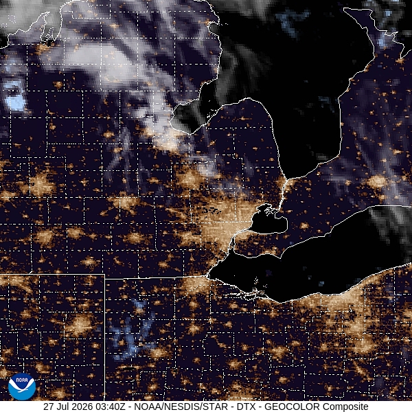
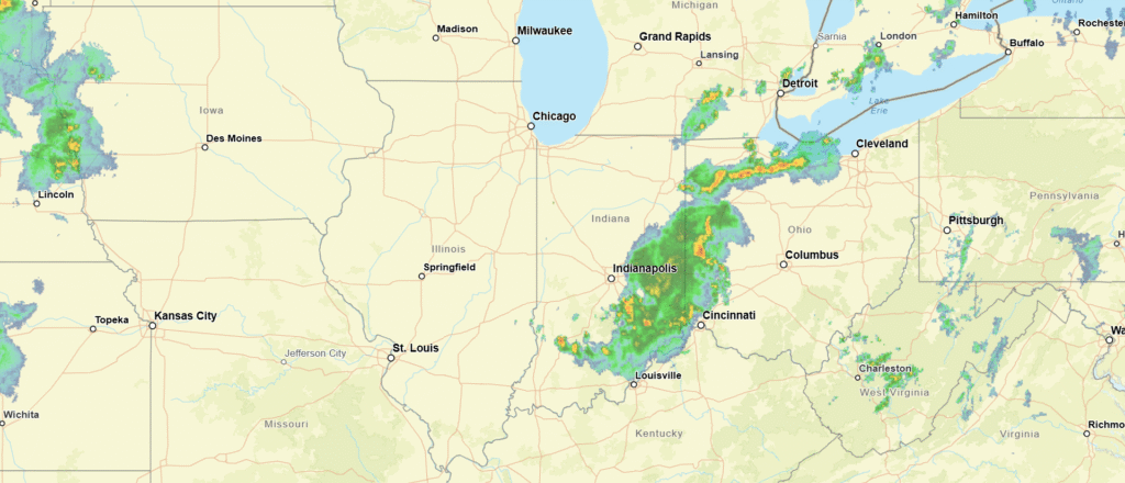
Prescott, Arizona

Arizona has a reputation as being a hot, nearly desolate place in the summer, outside of Phoenix, which is simply hot. Many population centers in Arizona though, have sought refuge in the cooler mountains in the rest of the state. Prescott is one of those towns!

At 1253PM, PT, Prescott was reporting clear skies and a temperature of 75 degrees. As if to illustrate the point of a chillier time in the mountains, the Sun Valley and Phoenix remained in the upper 90s. Temperatures were decided by elevation, and moisture was relatively low. The dry line straddling the Texas-New Mexico border was active, and keeping Prescott and the southwest out of the monsoon, which was already ongoing in the central Rockies.
Aiding the dry line was a weak area of low pressure that had found its way to an anchorage in the southwestern corner of the US. A blocking pattern in the center of the US was going to keep this regime in place for the next several days at least, with moisture kicked up and around the Grand Canyon State. The low pressure will help ensure temperatures in Prescott don’t match those found at lower elevations and to the south for the duration of the forecast period.
Tomorrow – Mostly sunny, High 72, Low 49
Saturday – Mostly sunny, high 76, Low 49

TWC: Tomorrow – Mainly sunny, High 73, Low 48
Saturday – Sunny, High 75, low 46

AW: Tomorrow – Plenty of sun; breezy in the afternoon High 77, Low 48
Saturday – Pleasant with plenty of sunshine High 77, Low 44

NWS: Tomorrow – Sunny, High 77, Low 47
Tomorrow – Sunny, High 79, Low 47

WB: Tomorrow – Breezy, Sunny, high 72, Low 42
Saturday – Sunny, high 74, Low 41

WN: Tomorrow – Sunny, High 72, Low 44
Saturday – Mostly sunny, High 78, Low 47

CLI: Tomorrow – Sunny, High 73, Low 48
Saturday – Sunny, high 75, Low 46

The low temperature guidance is completely divergent, and it appears as though many of our competitors are heeding the longer range, larger scope models. I’m wary, because it is the higher resolution models that are going warmer. I tend to trust them a little bit more when terrain is in play. And thus, I am on the higher end of those low forecasts. Here is the satellite centered over New Mexico, highlighting the flow up and around Arizona.

Iowa City, Iowa

Its forecast time, friends! It’s been stormy to begin May in Iowa, and the nearby town of Coralville was winged by a tornado not a month ago. I suspect we will enjoy a bit more tranquil weather this week.

At 1152AM, CT, Iowa City was reporting mostly cloudy skies and a temperature of 62 degrees. It was a bit cooler than might typically be expected in May in eastern Iowa, thanks to low pressure parked over eastern Kansas. In fact, Iowa City was a bit warmer than points westward, where a northerly flow was pressing into the region. Upper level flow is weak, so a look towards lower levels will help dictate the weather through the middle of the week.
As the low center moves nearly due eastward through the Ohio Valley, mostly cloudy to overcast conditions will remain in place through tomorrow morning. Finally, there will be a breakthrough in the afternoon, with sunnier skies and warmer temperatures. The tail of a cold front will slump southward through the Upper Midwest, drawing some southerly flow to the region, followed by a dip in temperatures as flow switches to northerly once again on Wednesday
Tomorrow – Mostly cloudy, High 76, Low 55
Wednesday – Mostly cloudy, High 72, Low 53

TWC: Tomorrow – Partly cloudy. High 80, Low 54
Wednesday – Partly cloudy. High 76, Low 51

AW: Tomorrow – Pleasant and warmer with times of clouds and sun High 81, Low 54
Wednesday – Mostly sunny and beautiful High 76, Low 52

NWS: Tomorrow – Mostly cloudy, then gradually becoming sunny, High 79, Low 53
Wednesday – Sunny, High 73, Low 52

WB: Tomorrow – Partly sunny in the morning then clearing. High 78, Low 53
Wednesday – Sunny, High 75, Low 53

WN: Tomorrow – Partly cloudy, High 79, Low 53
Wednesday – Mostly sunny, High 74, Low 52

CLI: Tomorrow – Partly cloudy, High 77, Low 52
Wednesday – Sunny, High 73, Low 52

Quite a bit of overcast for the state of Iowa this afternoon, but a warm up is on the way.

Youngstown, Ohio

We are headed to northeastern Ohio for our month ending forecast. It should be getting warmer right? Right?

At 451PM, ET, Youngstown was reporting a temperature of 55 degrees with cloudy skies and a brisk west-northwest wind. Low pressure is parked over southern Ontario, and is bringing continuing bands of rain to the upper Ohio Valley. At present, the heaviest rain is falling over central Pennsylvania, while another band of lighter showers is evident on radar along I-77 between Canton and Cambridge.
The center of circulation isn’t going to be urged out of Ontario until after the entrance to a strong jet trough comes into being. That won’t be until Wednesday or Thursday of next week, which means reinforcing chilly flow will continue in Youngstown until then. The surface feature is going to continue occluding through the next couple of days, so clouds and rain will become lighter over time. Unfortunately, that makes it more likely for even chillier temperatures as time goes on. It will be quite breezy throughout the beginning of the week, making already cool temperatures feel even chillier.
Tomorrow – Scattered showers throughout the day, High 48, Low 38
Tuesday – Lighter showers with an isolated peek of sunshine, High 44, Low 34

TWC: Tomorrow – Showers early, becoming a steady rain later in the day.  High 47, Low 39
Tuesday – Rain and snow showers in the morning transitioning to light rain in the afternoon. High 41, Low 36

AW: Tomorrow – Cloudy, breezy and colder with a touch of rain High 45, Low 39
Tuesday- Breezy in the morning; cloudy and cold with a passing shower or two; there can be some wet snowflakes mixed in High 42, Low 35

NWS: Tomorrow – Showers, with thunderstorms also possible after 3pm High 48, Low 38
Tuesday – Rain and snow showers, becoming all rain after 9am.  High 44, Low 36

WB: Tomorrow – Showers. A slight chance of a thunderstorm in the afternoon, High 46, Low 40
Tuesday – Snow showers in the morning. Showers, High 41, Low 36

WN: Tomorrow – Cloudy with light showers and isolated thunderstorms, High 48, Low 38
Tuesday – Mostly cloudy with a light wintry mix, High 44, Low 36

CLI: Tomorrow – Rain showers, High 45, Low 37
Tuesday- Rain showers, High 42, Low 35

Frankly, I think any snow shower activity on Tuesday morning will be inconsequential. Like, a flake or two just to make people feel bad because it will be May 2nd. I don’t have the heart to include it in my forecast. Radar is fairly active, reflective of the larger storm centered to the north.

Pine Bluff, Arkansas

It’s time for a forecast in Arkansas. Arkansas finds itself between the Dixie Alley and the more traditional Tornado Alley in the high Plains, and sees it’s fair share of twisters. This is the time of year for them, but will that be the case this week?

At 953PM, CT, Pine Bluff was reporting a temperature of 61 degrees with overcast skies. Surface low pressure over the Great Lakes is dragging a cold front through northern Louisiana. A chilly north wind is blowing throughout Arkansas, and while much of the state is expected to cool significantly overnight, it will likely be slow to do so in Pine Bluff. A jet running parallel to the base of the trough is suspending the cold front, leaving clouds across southern Arkansas, and preventing radiational cooling. Amid the clouds are a few light rain showers streaming across Arkansas, but dropping dew points in the area are preventing all the rain seen on radar from reaching the ground.
In the entrance area of the southern jet, there is going to be some disorganized shower and thunderstorm development. Onshore flow in the region will bring about enough moisture and potential energy for some rain and embedded thunderstorms across east Texas, with some activity spilling eastward. The best threat for rain will be on Sunday, wrapping up late in the evening. Monday should mostly be dry, but unseasonably cool. More clouds are expected to move in late on Monday.
Tomorrow – Scattered showers ending in the late evening, High 55, Low 45
Monday – Mostly sunny, with clouds returning late, High 65, Low 40

TWC: Tomorrow – Cloudy skies (early rain). High 59, Low 46
Monday – Except for a few afternoon clouds, mainly sunny. High 69, Low 41

AW: Tomorrow – Cloudy and cooler High 59, Low 48
Monday – Mostly cloudy High 69, Low 43

NWS: Tomorrow – A 20 percent chance of rain before 9am. Mostly cloudy, High 58, Low 45
Monday – Mostly sunny, High 66, Low 42

WB: Tomorrow – Mostly cloudy. A chance of rain in the morning. High 68, Low 47
Monday – Mostly sunny, High 68, Low 43

WN: Tomorrow – Mostly cloudy with isolated showers, High 58, Low 45
Monday – Partly cloudy, High 66, Low 42

CLI: Tomorrow – Light rain showers, High 61, Low 45
Monday – Partly cloudy, High 66, Low 43

Model guidance is falling short of the blend and consensus temperature forecasts. We’ll see who is better, man or machine. Rain has moved into Pine Bluff since I started writing this forecast.

Canton, Ohio

Canton is the home of the football hall of fame. It isn’t football season, but I don’t know a lot else about Canton.

At 1051PM, ET, Canton was reporting a temperature of 60 degrees with fair skies. High pressure is smothering the eastern two thirds of the country, and a nice dry, warm launch to spring has seized Ohio and the Great Lakes at large.
Satellite shows the greatest concentration of cloud cover spreading into the Appalachians of Pennsylvania and New York, thanks to the exit region of a jet sliding into New England. There are some streaming clouds over Ohio that may help prevent temperatures from plummeting overnight. Non tropical low pressure rising out of the Gulf will bring another smattering of clouds later in the week.
Tomorrow – Mostly sunny, High 76, Low 50
Thursday – Sunny, High 77, Low 52

TWC: Tomorrow – Abundant sunshine. High 77, Low 53
Thursday – Mainly sunny. Mainly sunny, High 79, Low 51

AW: Tomorrow – Partly sunny and very warm; breezy in the afternoon; dry and breezy conditions can lead to an elevated fire risk High 78, Low 53
Thursday – Mostly sunny and very warm High 78, Low 52

NWS: Tomorrow – Sunny High 78, Low 52
Thursday – Sunny High 78, Low 51

WB: Tomorrow – Partly cloudy, High 74, Low 53
Thursday – Sunny, High 76, Low 52

WN: Tomorrow – Mostly sunny, High 75, Low 52
Thursday – Sunny, High 80, Low 51

CLI: Tomorrow – Sunny, High 75, Low 54
Thursday – Sunny, High 79, Low 52

It’s going to be a battle of temperatures in what should be a pretty good forecast. Satellite is fairly quiet.

Dothan, Alabama

It feels like Dothan is home to many forecasts in our history. If that’s the case, then this should be a slam dunk, right?

At 1153AM, ET, Dothan was reporting a temperature of 61 degrees. A thick, anomalous splotch of overcast was situated over southeastern Alabama and the surrounding bits of Florida and Georgia, keeping temperatures in Dothan, Enterprise and the surrounding environs several degrees off the pace of other nearby locations. Flow was generally southerly, though dew points were still quite comfortable, with a lingering cold front from the southern Great Lakes to the High Plains, with more development to follow.
The cold front will stall over the Ohio Valley through the day on Thursday, leading to some warmer temperatures in Dothan. With a broad slow moving trough in the western US, the central Mississippi Valley will be ripe for development. An area of low pressure will develop over St Louis and encourage the southerly flow, making for an even warmer day on Friday.
Tomorrow – Mostly sunny, High 81, Low 55
Friday – Sunny, High 84, Low 58

TWC: Tomorrow – Areas of patchy fog early. Some clouds in the morning will give way to mainly sunny skies High 83, Low 53
Friday – Areas of patchy fog early. Sun and a few passing clouds High 84, Low 60

AW: Tomorrow – Intervals of clouds and sunshine; start of a period of much warmer weather High 84, Low 53
Friday – Partly sunny and breezy High 83, Low 59

NWS: Tomorrow – Widespread dense fog, mainly before 8am. Otherwise, mostly cloudy through mid morning, then gradual clearing, High 82, Low 54
Friday – Patchy fog before 9am. Otherwise, mostly cloudy, then gradually becoming sunny, High 83, Low 58

WB: Tomorrow – Mostly cloudy in the morning, then clearing. Areas of fog in the morning, High 80, Low 53
Friday – Partly sunny in the morning, then clearing. Patchy fog in the morning. High 82, Low 58

WN: Tomorrow – Partly cloudy, High 82, Low 54
Friday – Mostly sunny, High 83, Low 58

CLI: Tomorrow – Sunny, High 82, Low 52
Friday – Partly cloudy, High 83, Low 57

Here you can see that splotch over Dothan, remnant from some morning fog. It’s probably going to settle back in tonight.

Utica, New York

On this, the first day of the round of 64 in the NCAA tournament, we go to Utica, a town that sure sounds like a college town. Alas, they are not home to any Division 1 universities, but they are situated in the scenic Adirondacks.

At 153PM, ET, Utica/Rome was reporting a temperature of 43 degrees with overcast skies. The temperatures have bounced back nicely in the wake of the first real nor’easter of the season, however the climb in temperatures is aided by another system developing in the Mississippi Valley. Southerly winds will continue through the mid Atlantic today, bringing even more warm air to Utica, continuing what has been a very toasty winter season, though at this point in the year, and this system in particular are quite spring like.
The storm is responsible for severe weather in the Red River Valley that will become more widespread this afternoon. Of more pertinence to the Utica region is the sloppy mix in the Northern Plains. As most systems do, this feature is starting its poleward motion, and at this time even the northern flank of this feature is mixing with rain. This suggests that warmer air will pull further north, and as the system moves through, Utica can expect an all rain event tomorrow. The rain will be fairly light with a dry slot nosing into the Adirondacks, and temperatures will fall off on Saturday as the cold air arrives. By that point, most of the moisture will have pressed into Canada, and a chilly breeze will be more noticeable than the few flakes in the evening.
Tomorrow – Scattered showers, High 44, Low 32
Saturday – Chilly and breezy with a little bit of flurry activity late, High 35, Low 24

TWC: Tomorrow – Rain, High 45, Low 30
Saturday- Mostly cloudy. Snow showers around in the afternoon. High 37, Low 30

AW: Tomorrow – Periods of rain, High 47, Low 32
Saturday – Mostly cloudy with a couple of snow showers; any heavy snow shower could cover the ground quickly and reduce visibility High 40, Low 26

NWS: Tomorrow – Showers, mainly after 9am High 45, Low 31
Saturday – A chance of snow showers after 3pm High 37, Low 25

WB: Tomorrow – Rain showers with freezing rain likely in the morning with rain showers in the afternoon, High 42, Low 32
Saturday – Partly sunny in the morning then becoming mostly cloudy. A 40% chance of snow showers, High 36, Low 24

WN: Tomorrow – Mostly cloudy with showers, High 45, Low 31
Saturday – Windy with snow showers possible, High 35, Low 29

CLI: Tomorrow – Drizzle, High 45, Low 32
Saturday – Light snow, High 39, Low 23

More wet weather is on the way for Utica. It seems pretty ok for now, but the next feature looms.

Fond du Lac, Wisconsin

We’re headed to eastern Wisconsin for our forecast this afternoon. Eastern Wisconsin is a well populated region, but Fond du Lac is interesting in that it is offset from Lake Michigan, along with Appleton, on Lake Winnebago. The weather is bound to be different than Green Bay or Milwaukee.

At 253PM, CT, Fond du Lac was reporting a temperature of 36 degrees with overcast skies. A lingering winter weather advisory was still out for Fond Du Lac, but the thrust of the precipitation was already falling over Lake Michigan. Circulation associated with this system was centered just to the west of Wausau, and though the bulk of the snow is out of the region, light flurries are expected to persist in America’s Dairyland overnight and into the wee hours tomorrow morning.
After that, the short wave leading to the snow in the area today will continue towards the easter Great Lakes, and a narrow but stout ridge of high pressure will set up in the Upper Midwest and move east into Wisconsin. As a result, Monday afternoon and the day on Tuesday will be seasonably pleasant.
Tomorrow – Snow early, then clearing and cooling, High 29, Low 20
Tuesday – Sunny, High 31, Low 11

TWC: Tomorrow – Cloudy (early snow), High 29, Low 22
Tuesday – Mostly sunny, High 29, Low 10

AW: Tomorrow – Mostly cloudy with flurries; breezy in the morning, then becoming chilly High 31, Low 22
Tuesday – Plenty of sunshine, but chilly High 32, Low 11

NWS: Tomorrow – Snow likely, mainly before 7am, then a chance of flurries after 2pm. Mostly cloudy, High 29, Low 21
Tuesday – Sunny High 29, Low 10

WB: Tomorrow – Mostly cloudy. Chance of light snow in the morning, then chance of flurries in the afternoon, High 29, Low 24
Tuesday- Sunny, High 29, Low 14

WN: Tomorrow – Mostly cloudy with light snow showers, High 29, Low 20
Tuesday – Mostly sunny, High 29, Low 10

CLI: Tomorrow – Light snow showers, High 28, Low 19
Tuesday – Sunny, High 28, Low 12

The threat for snow is going to be more of the nuisance variety, but it will be persistent. The threat of this forecast is the pending cold to start the week.

Michigan City, Indiana

I think we can all agree that Michigan City, Indiana is a strange name for a town that is part of the greater Chicagoland region, yes?

At 255PM, ET, Michigan City was reporting a temperature of 39 degrees with clear skies. A brisk flow is coming off of Lake Michigan, a true lake breeze flowing from the colder dense air to relatively warm air of northern Indiana, absent of prevailing synoptic flow. Temperatures were about 5 or 6 degrees warmer away from the Lake.
A broad ridge aloft is helping the southern Great Lakes to dry out, and it should be a fairly pleasant middle of the week in Michigan City. A broad area of low pressure in the Rockies and High Plains bears watching, however. It will be slow in transpiring, but low pressure will develop at the surface through the day on Saturday. Precipitation will arrive in Michigan City late on Thursday. It is likely to be a chilly rain, but given the uncertainty wrought by the lateness in development of this feature, snow cannot be left out of the forecast.
Tomorrow – Mostly sunny, High 44, Low 30
Thursday – Increasing clouds with a late rain-snow mix, High 41, Low 32

TWC: Tomorrow – Mostly cloudy skies High 43, Low 30
Thursday – Overcast.  High 42, Low 30

AW: Tomorrow – Sun and clouds, High 41, Low 29
Thursday – Cloudy, late rain and snow, High 42, Low 33

NWS: Tomorrow – Partly sunny High 42, Low 30
Thursday – Mostly cloudy, Late rain/snow, High 44, Low 30

WB: Tomorrow – Cloudy, high 42, Low 32
Thursday – Cloudy, high 42, Low 32

WN: Tomorrow – Partly cloudy, High 42, Low 30
Thursday – Partly cloudy, High 44, Low 30

CLI: Tomorrow – Overcast, High 42, Low 29
Thursday – Overcast, High 41, Low 29

I think you can see some of the uncertainty with the model guidance showing up in the forecast. The models aren’t spread over a wide range, but without any thing fully developed yet, there is a lack of precipitation commitment. Look how clear it is right now! And you’re telling me it might snow?

Greensboro, North Carolina

The winter track has not been kind to the low country of the Carolinas this year. It’s been quite dry and warm in the eastern Carolinas and a drought, not quite as severe as other parts of the country, has been building. Might we finally get a soaking of rain in North Carolina? Greensboro, in particular?

At 954PM, ET, Greensboro was reporting cloudy skies and a temperature of 48 degrees. Most of the Tar Heel State was reporting clear or fair skies, but Greensboro was under a high overcast. Greensboro’s observation reflects the satellite a bit more accurately, as a feather of clouds is seen extending from the Atlantic through Viginia and on to the Ohio Valley. This is extended from low pressure now headed for Greenland, and following a strong jet streak, running west to east through the region.
Temperatures are expected to remain on the warm side in Greensboro to start the work week. A pulse moving through the northern Great Lakes will connect a warm front through a secondary trough moving behind the offshore front, and will touch off some mountain showers in Virginia and western North Carolina. More high overcast is anticipated in Greensboro on Monday afternoon. The real show will be massing in the High Plains. Warm air is going to start rushing north on Tuesday ahead of this feature, with temperatures beginning to rise, even among the layered clouds across the region.
Tomorrow – mostly cloudy, High 65, Low 42
Tuesday – Mostly cloudy, High 71, Low 49

TWC: Tomorrow – Cloudy. Slight chance of a rain shower. High 64, Low 44
Tuesday -Partly cloudy, High 72, Low 51

AW: Tomorrow – Times of clouds and sun with a shower in places in the afternoon High 62, Low 45
Tuesday – Mostly cloudy; a shower cannot be ruled out High 70, Low 49

NWS: Tomorrow – A slight chance of rain after 1pm. Cloudy High 62, Low 44
Tuesday – A slight chance of rain. Partly sunny, High 71, Low 51

WB: Tomorrow – Cloudy, a slight chance of rain in the afternoon, High 60, Low 44
Tuesday – Partly sunny with a 20 percent chance of rain. High 71, Low 52

WN: Tomorrow – Mostly cloudy with isolated showers, High 62, Low 44
Tuesday – Partly cloudy, High 71, Low 51

CLI: Tomorrow – Light rain showers, High 61, Low 43
Tuesday – Partly cloudy, High 69, Low 48

I think with the lack of moisture in the area, the ongoing dry, and the warm temperatures, rain just doesn’t ring true to me as a worthwhile forecast. I’ll probably be wrong! Hope I am. Here is satellite, with that feather of clouds in the mid-Atlantic.