Brownsville, Texas

Throughout most of the summer, the deep south of Texas is so hot and far removed from the jet stream, there is nothing interesting about the weather. How will it be as we visit in late January and February?

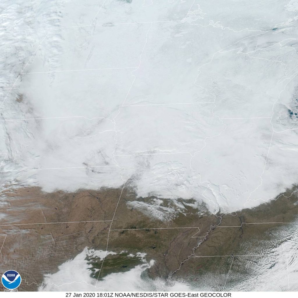
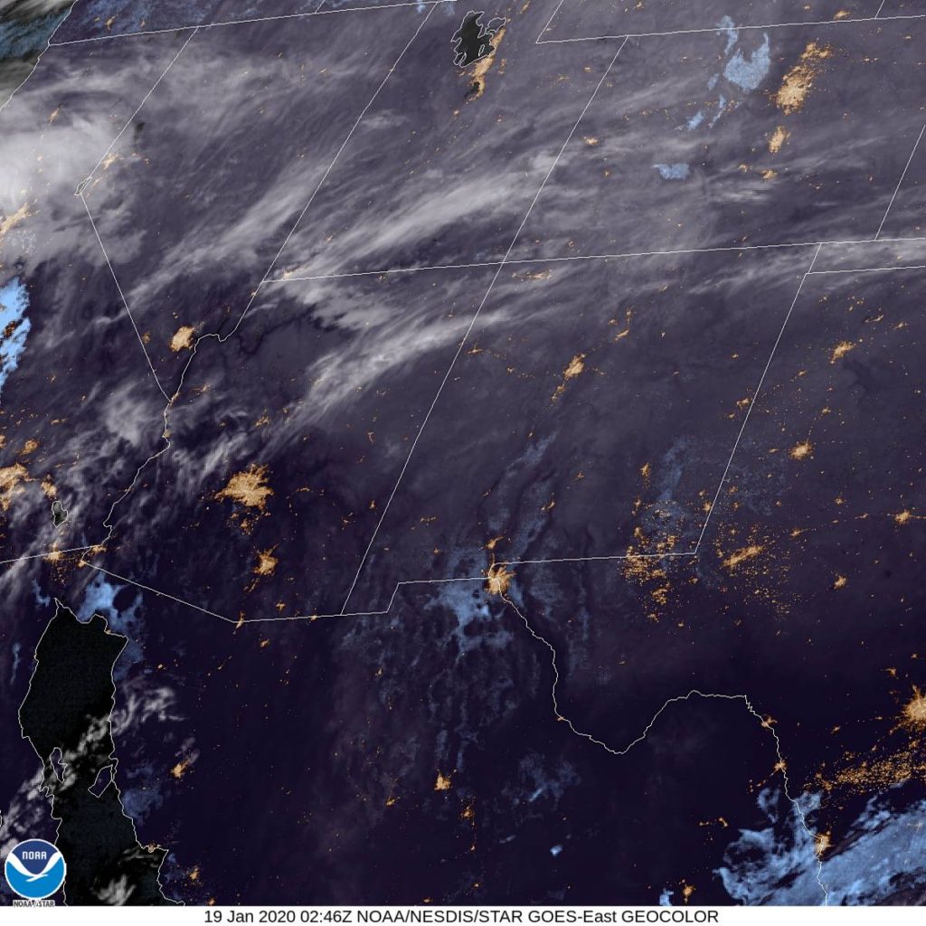
At 153PM, CT, Brownsville was reporting a temperature of 67 degrees with overcast skies. The overcast conditions spread through the center of the country, from border to border, as a deep upper level trough settled into the country.
The base of the trough will continue to shift eastward overnight, with cold air chasing the clouds out of town, but not before bringing the threat of some light rain to the city in the early morning hours. Some cyclonic development will occur over the northern Gulf, which will encourage more dry air from the north into the afternoon. Saturday morning in particular will be quite cold, thanks to the clearer and northerly winds.
Tomorrow – Light rain early, High 64, Low 52
Saturday – Clearing and cooler, especially in the morning, High 70, Low 47

TWC: Tomorrow – Cloudy skies early will become partly cloudy later in the day (early showers) High 67, low 56
Saturday – Intervals of clouds and sunshine. High 72, low 50

AW: Tomorrow – Clouds giving way to some sun with a shower in spots early in the morning, then becoming breezy High 67, Low 58
Saturday – Sunshine and patchy clouds High 70, Low 49

NWS: Tomorrow – Patchy drizzle with a slight chance of rain before 9am. Cloudy, then gradually becoming mostly sunny, High 65, Low 51
Saturday – Mostly sunny High 69, Low 48

WB: Tomorrow – Mostly cloudy with with a 20% chance of rain showers in the morning, then partly cloudy in the afternoon. High 65, low 55
Saturday – Sunny, High 70, Low 51

WN: Tomorrow – Partly cloudy with isolated showers, High 67, Low 55
Saturday – Mostly sunny, High 71, Low 50

FIO: Tomorrow – Light rain tonight and tomorrow morning. high 66, Low 56
Saturday – Partly cloudy throughout the day. High 70, Low 52

Here is a look from the forecast from KRGV. They are an Accuweather outlet, so if their forecast looks a little familiar, that’s why.

Weirton, West Virginia to St. Joseph, Missouri

Weirton lies along the banks of the Ohio River, while St. Joseph is on the Missouri. Maybe they aren’t the most famous towns on their respective rivers, but they do offer a chance to get up close to them. It will require a day and a half drive over the course of 832 miles. Our first day will conclude 518.7 miles in, slowed by travelling off-interstate to a pace of 64.8mph.

DAY ONE (Tuesday)

Weirton, West Virginia

High pressure has nosed into the western Great Lakes, and will suppress much rising air, which usually just means that there won’t be any showers or storms in the area. This is true, but for our purposes, it means an inversion across much of the region as well. This suggests there will be A) low clouds and B) morning fog, thanks to the high moisture content in the region, thanks to snow melt and a lack of motivation to clear out. As the day goes on, expect improved visibility and maybe even a bit of sun in the afternoon over Illinois and Indiana. We’ll stop in Buffalo, Illinois, between Springfield and Decatur, for our sole break of the trip.

DAY TWO (Wednesday)
A weak feature sliding along the Texas Gulf Coast will extend an inverted trough to the Show Me State, which means a few wet flakes across the region. Given the temperatures, it seems likely that this will lead to some especially icy roads in northern Missouri, even if there isn’t a lot of accumulation. I’m concerned about the threat for some freezing mist in the morning. Drive safely!

St. Joseph, Missouri

St. Joseph, Missouri

We’re going to check in a little north of Kansas City for our first forecast of the week. What can we expect from the weather in the middle of the country to start the week?

At 1153AM, CT, St. Joseph was reporting light fog and a temperature of 36 degrees. They weren’t indicating cloud cover, but a quick look at satellite imagery would confirm that they are socked in with overcast. Warm temperatures were melting snow and leading to saturated air masses from Kansas City to the Canadian border, and with warm temperatures expected to continue, no end is in sight.
A weak upper level trough is parenting an even weaker surface feature sliding out of the Rockies and into the Texas/Oklahoma region through the night tonight and into tomorrow. An inverted trough associated with this system will sneak into the St. Joseph area in the evening and linger through the morning. Some light precipitation, likely just mist mixed with some flakes, will persist overnight. Temperatures hovering close to freezing will make for treacherous roads in the region on Wednesday morning.
Tomorrow – Light precip, including snow and freezing drizzle, starting in the evening, High 32, low 27
Wednesday – Mixed precipitation including snow and light icing through mid morning, then clearing, High 34, Low 26

TWC: Tomorrow – Cloudy (late snow) High 29, Low 26
Wednesday – Cloudy skies. A few flurries or snow showers possible. high 30, Low 24

AW: Tomorrow – Cloudy High 32, Low 27
Wednesday – A passing morning flurry; otherwise, partly sunny High 32, Low 24

NWS: Tomorrow – Mostly cloudy (Late snow) High 33, Low 26
Wednesday – Mostly cloudy (Early snow) High 33, Low 24

WB: Tomorrow – Cloudy, high 31, low 29
Wednesday – Partly sunny, High 31, Low 27

WN: Tomorrow – Mostly cloudy with a slight chance of light snow, High 33, low 28
Wednesday – Mostly cloudy, High 33, Low 24

FIO: Tomorrow – Foggy tomorrow morning. High 32, low 27
Wednesday – Overcast throughout the day. High 34, Low 25

Ah, the dangerous mixed bag. Model guidance is pretty low key on precipitation out of this event, and you could go a lot of different ways. I feel like, with temperatures as warm as they are, we are going to expect a lot more low visibility misty fog, and not as many flakes. I don’t know where TWC is coming from with their temperatures. Too cloudy for it to be so cold, in my opinion. In any event, here is the satellite, with a dome of cloud cover over the area.

Dry air

Here’s something you might not know about Arizona: It’s a very dry place. Dew points in Prescott hit the low 20s early last week, which is fine in the summer, but it means temperatures can really cool off in the evenings. A little bit of moisture moved in on Monday, and while it was warmer over night, there were also clouds and slightly cooler temperatures in the afternoon. Weatherbug had the top forecast in Prescott, but it was a fairly level playing field.
Actuals: Sunday (19th) High 60, Low 25
Monday (20th) High 55, Low 34

Grade: B-C

Madison, Wisconsin to Weirton, West Virginia

That, my friends, is a lot of W’s. We are going to trek through the Great Lakes right in the middle of winter. Does this mean Lake effect snow? Maybe! There is only one way o find out, I suppose. Our drive till take one long day, covering 606 miles, bogged down by the Windy City, which will let us move at a nearly glacial pace of 62mph. We’ll get there. Sometime.

Madison, Wisconsin

It’s not Lake effect snow that will be the problem on our Saturday drive, but rather just standard, regular back side of an area of low pressure snow that will be an issue. It’s not going to be heavy, save, perhaps for the stretch of northern Indiana downwind of Lake Michigan. the snow will be wet, too, and well trafficked roads might not even ice over with the snow. But any snow, especially in a metropolitan area like Chicago, is going to really slow down travel. Snow will still be possible across Ohio, but it will be a misty, flaky brand of snow that won’t accumulate and will be tough to wipe off your windshield without the help of washer fluid. Weirton awaits, whether or not you can get the grime off your windshield.

Weirton, West Virginia

Prescott, Arizona to Madison, Wisconsin

I think this might be the first road trip of the year, right? It will be a 3 day trip through the heart of the country, covering 1689 miles at a pace of about 65mph. That will mean the first two days will be complete after just short of 520 miles on days 1 and 2, with a 10 hour day coming on Sunday. 2020, here we come!

DAY ONE (Friday)

Prescott, Arizona

We are headed for a trip through the southern Rockies at the right time. Atmospheric instability is confined to the central Plains for the most part, with a dose in the northern Rockies, leaving Arizona and New Mexico fairly unperturbed. We’ll check in on Flagstaff and Albuquerque on our eastward journey, stopping west of Santa Rosa, New Mexico to end our day and our work week.

DAY TWO (Saturday)
As we continue to the east, we’ll slice through a couple of Panhandles before spending the rest of the day in southern Kansas. I don’t recall ever spending much time in this part of the world on a road trip, and I especially don’t remember cutting through Wichita to get anywhere. Usually, it’s just a bypass on I-35. Not this time! Instead, we will enjoy an increasingly warm day, free of any atmospheric interference before we reach El Dorado, where we will end our day. Along the way, appreciate Greensburg, a city that has had to completely rebuild after a devastating tornado in 2007.

DAY THREE (Sunday)
Sure, this day will be the longest, and it will also be the gloomiest, with clouds becoming much more likely thanks to a combination of general troughiness* over the Plains, and the melting snow north of Kansas City leading to clouds and fog along most of the route. On the other hand, at least the car won’t be unbearably hot because of the penetrative sun, and we will get to see Des Moines! And Dubuque! Both are very nice towns. So is Madison, for those unaware.

* Not an actual science word

The force field

There are a lot of reasons that storm systems or wet weather don’t ever reach a location. Rather than coming up with the explanation on a per occasion basis, a lot of people just say that there was a force field around a city. Sure, there was the system moving through the Tennessee Valley towards the coast towards Hinesville last week, but I think we can just say it didn’t rain there because of a force field. earned victory.
Actuals: Tuesday (14th) – High 79, Low 60
Wednesday (15th) – High 77, Low 62

Grade: A-B

Prescott, Arizona

Prescott is the sweet spot of Arizona. Not as hot as Phoenix in the summer, not as snowy as Flagstaff in the winter. Sweet.

At 753PM, MT, Prescott was reporting clear skies with a temperature of 40 degrees. Clear skies have moved across Arizona in the wake of a fairly wet week across the state.
A high amplitude but somewhat shortwave trough is rolling through the western US, allowing for surface high pressure across the Intermountain West. Expect continued zonal flow across Arizona, which should mean a few scattered clouds in Prescott.
Tomorrow – Partly cloudy, High 62, Low 27
Monday – Mostly cloudy, High 59, Low 32

TWC: Tomorrow – Mostly sunny skies. High 60, Low 29
Monday -Cloudy. High 59, Low 33

AW: Tomorrow – Mostly sunny High 60, Low 27
Monday – Mostly cloudy High 60, Low 30

NWS: Tomorrow Sunny, High 57, Low 29
Monday – Mostly cloudy High 57, Low 35

WB: Tomorrow – Mostly sunny in the morning, then becoming partly cloudy, High 59, Low 30
Monday – Mostly cloudy, High 57, Low 34

WN: Tomorrow – Mostly sunny, High 57, Low 29
Monday – Mostly cloudy, High 57, Low 34

FIO: Tomorrow – Clear throughout the day, High 59, Low 30
Monday – Overcast throughout the day. High 59, Low 34

Well, that’s about it. Pretty easy breezy, if I’m being honest. Take a look at this fairly tranquil satellite imagery. I can see Phoenix!

Coming soon…

In the next several days, I’m really going to have put on my forecast pants. with a trio of road trips, and a quartet of forecasts to challenge myself with.

Road Trip from Prescott, Arizona to Madison, Wisconsin

Road Trip from Madison to Weirton, West Virginia

St. Joseph, Missouri
Road Trip from Weirton to St. Joseph

Brownsville, Texas

Ocala, Florida

Salisbury, Maryland.

2019 Forecaster of the Year

This year, there was a grand cluster of similarly competent forecasters. 5 Outlets were matched pretty well, but then there was one outlet that was very bad (sorry, Forecast.io) and one that was really good, but it took until December to realize how dominant they had been. Victoria-Weather won the month of December, while the ultimate winner for the year tied for second…. and that was all it took to finish well above the runner up this year. Congratulations to the Forecaster of the Year,

THE WEATHER CHANNEL!

For completeness, here is the chart of individual forecast wins. It shows that The Weather Channel didn’t necessarily have the highest peaks, but they were able to stay steady all year. Here’s to a wonderful 2020!

OutletMonth winsyear wins
Victoria-Weather117.98
Weatherbug16.41
The Weather Channel114.03
Accuweather19.64
Forecast.io9.45
National Weather Service19.31
WeatherNation8.64