
We’re going to check in a little north of Kansas City for our first forecast of the week. What can we expect from the weather in the middle of the country to start the week?
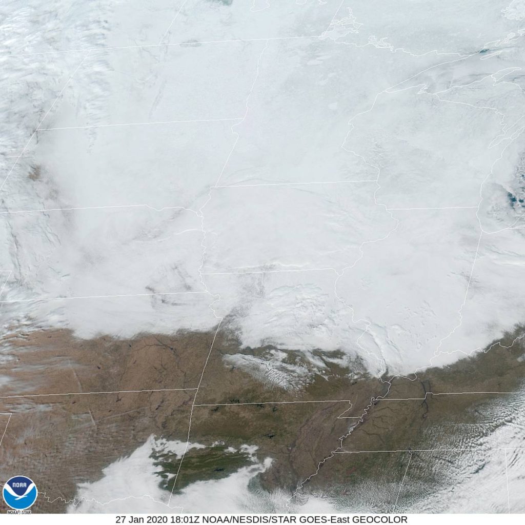
At 1153AM, CT, St. Joseph was reporting light fog and a temperature of 36 degrees. They weren’t indicating cloud cover, but a quick look at satellite imagery would confirm that they are socked in with overcast. Warm temperatures were melting snow and leading to saturated air masses from Kansas City to the Canadian border, and with warm temperatures expected to continue, no end is in sight.
A weak upper level trough is parenting an even weaker surface feature sliding out of the Rockies and into the Texas/Oklahoma region through the night tonight and into tomorrow. An inverted trough associated with this system will sneak into the St. Joseph area in the evening and linger through the morning. Some light precipitation, likely just mist mixed with some flakes, will persist overnight. Temperatures hovering close to freezing will make for treacherous roads in the region on Wednesday morning.
Tomorrow – Light precip, including snow and freezing drizzle, starting in the evening, High 32, low 27
Wednesday – Mixed precipitation including snow and light icing through mid morning, then clearing, High 34, Low 26
TWC: Tomorrow – Cloudy (late snow) High 29, Low 26
Wednesday – Cloudy skies. A few flurries or snow showers possible. high 30, Low 24
AW: Tomorrow – Cloudy High 32, Low 27
Wednesday – A passing morning flurry; otherwise, partly sunny High 32, Low 24
NWS: Tomorrow – Mostly cloudy (Late snow) High 33, Low 26
Wednesday – Mostly cloudy (Early snow) High 33, Low 24
WB: Tomorrow – Cloudy, high 31, low 29
Wednesday – Partly sunny, High 31, Low 27
WN: Tomorrow – Mostly cloudy with a slight chance of light snow, High 33, low 28
Wednesday – Mostly cloudy, High 33, Low 24
FIO: Tomorrow – Foggy tomorrow morning. High 32, low 27
Wednesday – Overcast throughout the day. High 34, Low 25
Ah, the dangerous mixed bag. Model guidance is pretty low key on precipitation out of this event, and you could go a lot of different ways. I feel like, with temperatures as warm as they are, we are going to expect a lot more low visibility misty fog, and not as many flakes. I don’t know where TWC is coming from with their temperatures. Too cloudy for it to be so cold, in my opinion. In any event, here is the satellite, with a dome of cloud cover over the area.
Comment (1)