The mountains and waterways of coastal California can lead to a need for microclimate forecasting. This seemed to be the case in Napa, where, sure, a ridge built in, but the southwest winds off San Pablo Bay, often gusting to 20mph, held sway. High temperatures never crossed into the 80s, despite there not being a single forecast lower than 81 degrees. As is typically the case when things skewed towards the low side, Weatherbug was the top forecaster, and it wasn’t particularly close. Actuals: Tuesday – High 79, Low 51 Wednesday – High 79, Low 56
Cross country road tripping is the name of the game today, as we start on a 5 day journey. It is a 2,607 mile voyage which we will cover at a pace of 68.6mph, which is indicative of all the freeway time we are spending. That means a 549 mile a day pace for days 1-4, with a shorter drive to finish things off thanks to our blistering pace.
DAY ONE (Friday)
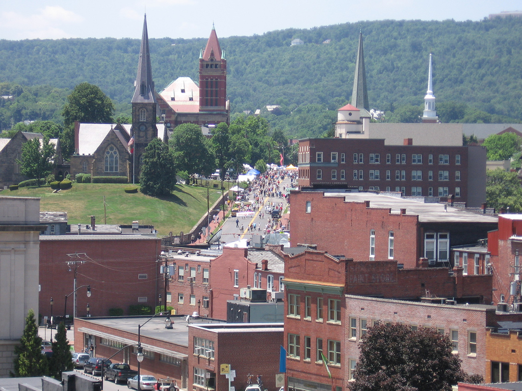
Napa, California
Low pressure over the Gulf of Alaska is pretty much just hanging out in place, and a cold front is becoming mostly stationary in the Pacific Northwest. This is all good news for people chugging along I-80, as we will be on Friday. It will make it hard to leave Napa, though, but driving through Sacramento and Reno will be a bit easier. Our drive will take us to Death Star Valley. Ope, sorry, Star Wars fan. That should be the Deeth/Starr Valley exit in northeastern Nevada.
DAY TWO (Saturday) The drive through the west will take its typical winding path through Salt Lake City then continue on into Wyoming. There isn’t a lot going on… BUT WAIT! There is a hint that the monsoon might be getting organized by this weekend. If that happens, there is an extremely remote chance at an isolated storm popping up over south central Wyoming by the end of the day. We’ll end the day at Cooper Cove, north of Laramie for our Saturday night stop.
DAY THREE (Sunday) Lee troughing is going to be fast in developing over central Nebraska, ready to turn towards the Upper Midwest, but it won’t tap into much moisture until it is closer to the Great Lakes. Surface high pressure will be in rapid pursuit, with some convergence and resultant thunderstorms over the Panhandle late in the day. We will already be in Ashland, about 30 miles before Omaha, when the day is through.
DAY FOUR (Monday) The next big storm is going to be brewing in the northern High Plains by the beginning of next week. A warm front may be expressed with a few spotty showers from Omaha to Cedar Rapids, but it certainly won’t be a cumbersome delay or terribly heavy precipitation. Dry air — well, rain free air — will be the name of the game for the rest of the drive to the Granger/Mishawaka area on the east side of South Bend, Indiana. It’s going to be hot and humid, so finding a place with a pool, or at least functioning air conditioning, will be a priority.
DAY FIVE (Tuesday) Expect to finish strong, especially through Ohio, where it should be mostly cloudless. There will be a line pretty near the border with Pennsylvania where clouds will become more likely. Pittsburgh and Johnstown look to be in a bit of a damming situation, which means temperatures are going to be noticeably cooler than those that we will arrive from.
It’s below normal right now in the Upper Midwest, but also, surprisingly, the weather is cooler than average in the northwest, as far south as the Napa Valley. Finally, North Dakota and the North Bay have something in common.
At 1254PM, PT, Napa was reporting a temperature of 78 degrees with clear skies. Temperatures were warm despite a fresh breeze of the San Pablo Bay. After a stretch of time with a broad trough positioned over the northwestern US, a short waved ridge is pressing inland over the west coast, helping to establish the sunny skies. The next wave is already positioning in the Gulf of Alaska, with a mature area of low pressure marching towards the coast. The associated occluded and cold front will impact British Columbia and the American Pacific Northwest late on Tuesday, with some mid to high overcast streaking across Napa later in the day on Wednesday, but precipitation is unlikely. Tomorrow – Mostly sunny, High 83, Low 50 Wednesday – increasing clouds, High 84, Low 55
TWC: Tomorrow – Partly cloudy skies. High 85, Low 51 Wednesday – Partly cloudy. High 87, Low 56
AW: Tomorrow – Mostly sunny and warm High 84, Low 51 Wednesday – Mostly sunny and warm High 86, Low 56
NWS: Tomorrow – Areas of fog before 8am. Otherwise, sunny High 85, Low 51 Wednesday – Mostly sunny, High 86, low 55
WB: Tomorrow – Sunny, High 81, Low 51 Wednesday – Partly cloudy, High 83, Low 56
WN: Tomorrow – Mostly sunny, High 85, Low 51 Wednesday – Mostly sunny, High 86, Low 55
FIO: Tomorrow – Partly cloudy throughout the day. High 81, Low 52 Wednesday – Mostly cloudy throughout the day. High 84, Low 59
A beautiful day for northern California, and the middle of the week seems delightful as well.
Every knows that now, it is very hot out west. This hasn’t been the case all summer on the west coast, as it seems as though it has been recently during every summer, and even this month, it took at least an extra day in Napa. We though the warm up would start on the 7th, but instead, wind came off the Pacific and temperatures dropped a few degrees, which was certainly not the expectation. Fortunately, these changes in California don’t necessarily sink forecasts, so most of us won’t be totally embarrassed by this verification. A trio, Victoria-Weather, Weatherbug and WeatherNation all get to stake a claim to the victory. Actuals: August 6th – High 80, Low 60 August 7th, High 77, Low 59
Look at this, two days in a row with posts! This time, we get to look forward to another week long road trip, this time headed eastward. It will take 5 days and 2648 miles to get from Napa to Cumberland. The trip this time will be divided evenly into our 8 hour segments, each at a 66.2mph and 529.6 miles a day. Some people just like symmetry.
DAY ONE (Wednesday)
Napa, California
The tropical Pacific doesn’t really impact the western US like the tropical Atlantic does, but there is a tropical feature, hurricane Elida drifting around out there. In truth, that’s the most interesting thing going on out there, as our drive from Napa to Wells, Nevada will be without incident.
DAY TWO (Thursday) I’m wary of guidance that shuts off the monsoon after it’s been going on for a while, which is what the models are showing right now. Whether I believe it or not, I think our route along I-80 during the day time will take us through the rest of Nevada and all of Utah without encountering a storm, before we arrive in Woodedge, Wyoming, which i about a half hour west of Laramie.
DAY THREE (Friday) Low pressure is going to be rising through Canada, drawing north a batch of hot humid air. This will mean a few thunderstorms developing in the high plains ahead of a cold front that will be moving towards the Upper Midwest. I wouldn’t be surprised if there are a few severe storms in and around Lincoln when we pull in for the night. Before that, though, it will be a mostly sunny, hopefully air conditioned day on the road in Nebraska,
DAY FOUR (Saturday) The derecho that blew through he Midwest yesterday followed I-80 from Des Moines to northern Indiana, not unlike our route on Saturday. Don’t be surprised to see some sheered warehouse roofs and freshly sawed stumps wherever we end up along that stretch. An area of low pressure developing in the Carolinas will do a good job of disrupting moisture flow to the Upper Midwest, so the cold front that will be in Minnesota on Friday won’t really be much of a concern. There may be a few clouds with some spots of rain, but nothing too well organized around the Quad Cities. We’ll stop for the night in Lake Station in northwest Illinois.
DAY FIVE (Sunday) That area of low pressure in the mid-Atlantic isn’t forecast to move anywhere this weekend. It seems as though moisture won’t filter west over the entirety of the Appalachians, but low level moisture and some patchy showers seem fairly likely as soon as we cross the Ohio River, but mostly cloudy skies are probably be fore that. This will be the worst drive of any through our trip, but at least we will be arriving in Cumberland!
Road tripping is sort of en vogue right now, given the potential of coronavirus transmission with air travel, so why not see the country in a week long transnational road trip? It will take us 6 days to get from coast to coast, covering 3200 miles. We’ll average 68mph and nearly 545 miles a day. Right through the center of the country!
DAY ONE (Friday)
Lewiston, Maine
Isaias has long departed the Eastern Seaboard, but the remainder of a weak surface trough still lingers in the mid-Atlantic,and is continuing to threaten the area with showers and storms from Long Island to Florida. Inland, those storms are filtering towards the mountains, beginning to rise up with the elevation and raining out at higher terrain. For our purposes, that means a threat of rain as we approach the Catskills. The threat for isolated rain and thunder will linger until about Oneida, with clearing skies returning until we arrive at Batavia, between Buffalo and Rochester, and our destination for the day.
DAY TWO (Saturday) On the other side of the Appalachians, life is good. High pressure has taken care of the Great Lakes and is doing a good job of suppressing Gulf moisture and shunting systems from the Plains to the north. Not a bad day to drive through Ohio. We’ll end in Hammond, Indiana, in the Chicago region.
DAY THREE (Sunday) As we move west, the ridge will shift east, opening the Mississippi Valley up to the Gulf’s moisture. The Sunday drive will be soupy. Scattered spots of drizzle might be possible with the rising warm air in Illinois, but it should clear out through Iowa. Unfortunately, the sunny skies and humidity will only be priming the region for strong thunderstorms, of which a few might arrive in eastern Nebraska just as we are passing through Omaha and Lincoln. Severe weather is a strong possibility as we pull off the highway in Milford, just west of Lincoln.
DAY FOUR (Monday) After a stormy evening in Nebraska, it should improve dramatically as we cross the windswept prairie of Nebraska and enter the windswept hills of Wyoming. Some monsoon thunderstorms may be seen on the horizon over the peaks in Colorado, but our route should be dry. We will end near Walcott, but most of southern Wyoming is all the same, so who knows!
DAY FIVE (Tuesday) There isn’t going to be too much difference on Tuesday. Generally, the drive will be just fine, but in slopes, there could be a stray thunderstorm associated with the seasonal monsoon. It shouldn’t be an enormous concern, with the largest issue being dust from downdrafts in dry storms west of Salt Lake City. Our day will conclude in Elko, which, yes, does have some casinos. No, you probably shouldn’t go, what with the pandemic and all.
DAY SIX (Wednesday) The monsoon doesn’t really reach as far west as the Sierras, and we should get on the road before we have to deal with the afternoon storms around Elko. Smooth sailing into Napa, then. Heck, we even get to approach from Sacramento, which is a heck of a lot easier than coming from San Francisco.
All right, another forecast! I’ve been to the Napa area within the last year, and I do have to say, it is significantly more beautiful than I anticipated, but also much different. That said, I didn’t quite know what to expect.
At 754PM, PT, Napa was reporting a temperature of 64 degrees with clear skies. Fog and low clouds were settling into the South Bay as night encroached, and the clear skies and dewpoints in the mid 50s suggest that fog will be likely in the Napa Valley as well, particularly given that it is only approaching 8pm. A trough moving through the Pacific Northwest is churning things up further to the north along the Pacific Coast, while high pressure hasn’t yet settled into the southwest to provide the offshore winds to battle back the marine layer. Napa looks like it will warm up a bit as the weekend arrives, which may limit the morning and evening haze on Friday. Tomorrow – Cloudy early, then sunny, with haze arriving late, High 80, Low 56 Friday – Sunnier, High 82, Low 57
TWC: Some clouds in the morning will give way to mainly sunny skies for the afternoon High 83, Low 57 Friday – Mainly sunny. High 81, Low 55
AW: Tomorrow – Mostly sunny High 83, Low 57 Friday – Beautiful with areas of low clouds early; otherwise, mostly sunny High 83, Low 55
NWS: Tomorrow – Mostly cloudy through mid morning, then gradual clearing, High 81, Low 56 Friday – Sunny, High 81, Low 55
WB: Tomorrow – Partly cloudy in the morning, then becoming sunny. Patchy fog in the morning, High 85, Low 59 Friday – Partly cloudy in the morning, then becoming sunny, High 80, Low 57
WN: Tomorrow – Mostly sunny, High 80, Low 56 Friday – Mostly sunny, High 80, Low 55
FIO: Tomorrow – Clear throughout the day. High 87, Low 54 Friday – Clear throughout the day. High 85, Low 53
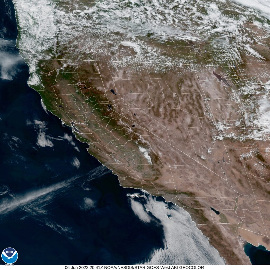
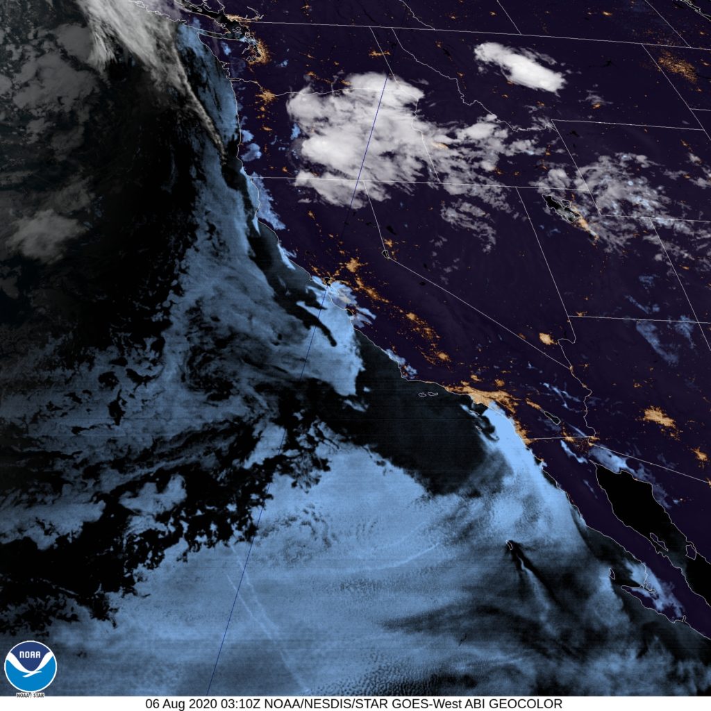
Forecast.io is clearly using their own model guidance. Yikes. Here is the satellite imagery, showing the low clouds along the coast, getting ready to envelop San Francisco.