On the 22nd, we put together a forecast for Trenton, where weather was looking fine. It continued as such for most of Wednesday the 23rd as well, but in the afternoon, things went from clear to cloudy in the span of a couple of hours, and then Trenton sat in the sludge for the rest of the forecast period. there was a little bit of rain that came with the overcast, which put Clime off of the victory, and instead handed it to the unlikely duo of Accuweather and Weatherbug. Actuals: Tuesday August 23rd, High 78, Low 59 Wednesday – August 24th, .15 inches of rain, High 72, Low 66
When I plugged this trip into Google Maps, it defaulted to buses and trains. If you don’t want to partake in a 5 day cross country journey, then I guess I can’t blame you. That’s what Google wants too. We’ll cover 2806 miles at a pace of 68.4mph, with an 8 hour daily goal of 547 miles. It’s a good old fashioned road trip, an we can make good time, but only if we leave now.
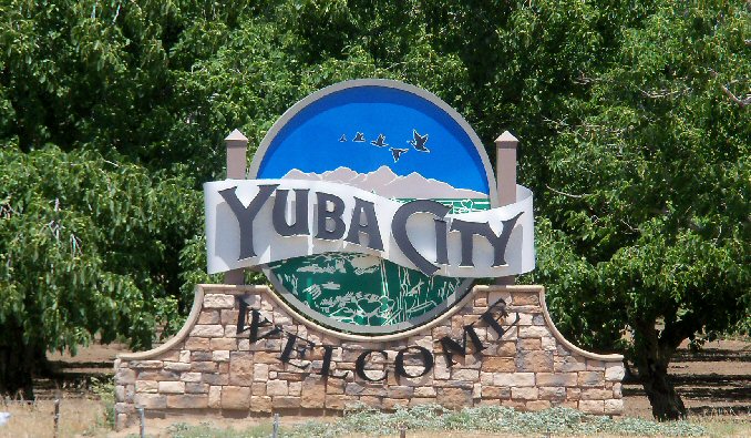
DAY ONE (Thursday)
Yuba City, California
It’s pretty wild to think about it, but our drive on Thursday will take us from Yuba City to Wendover, Utah, through the wasteland of northern Nevada, and the region is presently between two tropical storms. Hilary was swept north of the region last week, and now the remnants of Tropical Storm Howard are moving into the 4 Corners. I wouldn’t be entirely surprised to see some clouds on the eastern and southern horizon when we reach Wendover and the home of the Bonneville Raceway, but the drive will stay dry.
DAY TWO (Friday) Howard is going to get hung up in the Rockies and lose his self among the seasonal monsoon. Wyoming will be rainier than one might expect, and we’ll dodge a few showers, maybe a rumble of thunder, as we trek through Wyoming on I-80. I would expect the heaviest rain will be west of Laramie, but we won’t get much further than the home of the University of Laramie, stopping west of Cheyenne at exit 348 as our day concludes.
DAY THREE (Saturday) High pressure in Canada is going to start sinking south, squashing out any life that Howard had. This will mean any lingering moisture will spread west to east along a cold front that is going to mostly be stationary through Saturday. Rain will be most likely early in the day, but there will be a chance for clouds and some isolated showers throughout the day as we make it to Avoca, Iowa, which is East of Omaha. As is all of Iowa, but this is pretty close to Omaha.
DAY FOUR (Sunday) All good things on Sunday! We’re going to finally start encountering some populated locations, including Chicago, but we’ll do it on the weekend, and one with good weather conditions at that. We’ll see a lot of sun, maybe a little bit of smoke in the atmosphere from the Canadian wildfires, but other than that, hakuna matata. We’ll reach Howe, Indiana for our destination for the day.
DAY FIVE (Monday) By the time Monday rolls around, all weather eyes will likely be out to see, where Franklin will be spinning between Bermuda and the Carolinas. The tail of the cold front we have been talking about will be working to kick Franklin to the sea, but for our own selfish purposes, it will be allowing dry conditions to enter Ohio and Pennsylvania as were traverse those two states to get to New Jersey.
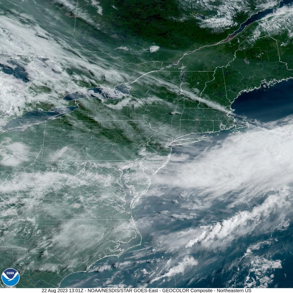
The intrigue right now is out west, where many are still contending with the issues brought out by a landfalling tropical storm over a desert. As is Victoria-Weather custom, we will end up forecasting on the other side of the country.
At 853AM, ET, Trenton was reporting clear skies and a temperature of 77 degrees. Fog was lifting in the valleys of eastern Pennsylvania, with clouds still lingering through the region, remnants of the moisture leading to the fog. High clouds indicated the jet running northwest to southeast through southern New England, with the moisture and heat in the Mid-Atlantic rising northeastward as a ridge builds from the Midwest. Because the jet is so strong, the burgeoning heat and humidity in the Plains will not be able to build northeast towards the Mid-Atlantic. Instead, as the jet begins to break down, expect a little bit more air mass mixing, with cooler temperatures aloft merging with the soupy air in the south, bringing an increase of clouds for Trenton with some cooler temps by Thursday. Tomorrow – Partly cloudy and warm, High 82, Low 60 Thursday – Mostly cloudy, High 78, Low 65
TWC: Tomorrow – Sunshine and clouds mixed. High 80, Low 60 Thursday – Showers in the morning, then cloudy in the afternoon. High 74, Low 64
AW: Tomorrow – Sunny to partly cloudy High 81, Low 59 Thursday – Mostly cloudy and cooler with a couple of showers High 74, Low 65
NWS: Tomorrow – Mostly sunny High 81, Low 58 Thursday – A chance of showers, with thunderstorms also possible after 5pm. Cloudy, High 77, Low 63
WB: Tomorrow – Mostly sunny, High 77, Low 62 Thursday – Cloudy with a 40 percent chance of showers, High 73, Low 67
WN: Tomorrow – Partly cloudy, High 81, Low 58 Thursday – Mostly cloudy with scattered showers, High 77, Low 63
CLI: Tomorrow – Partly cloudy, High 78, Low 60 Thursday – Overcast, High 74, Low 63
The satellite image has a smattering of clouds, but the real question is how much rain is really going to come with the breakdown of our ridge. I think most of it will remain in higher terrain, but clearly, I am in the minority.
The strong start in reference is definitely not a reference to the January posting consistency, but rather how well the National Weather Service handled a challenging forecast in Trenton to start the year. The first round of wet weather of the year slid up the east coast and brought a bit of early morning rain and eventually plummeting temperatures. The NWS threaded this treacherous needle getting only 1 degree of error, and having a proper temperature forecast. A solid start to the new year. Actuals: January 2nd, .07 inches of rain, High 59, Low 35 January 3rd, High 34, Low 21
Trenton is right on the border with Pennsylvania, but you couldn’t ask for a longer drive into the next state over. It will take a whopping 6 1/2 hours to cover the 435 miles across the Keystone state,. The pace will be 65mph, which seems faster than I anticipated. Road trip 2022!
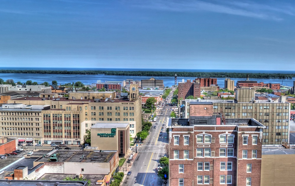
Erie, Pennsylvania
A large juggernaut of low pressure is battering the mid-Atlantic today, getting perilously close to the Trenton area. Pennsylvania itself is under the grips of a chilly high pressure. The nice thing about big areas of organized low pressure is that they move, and do so swiftly more often than not. The low will be headed for Newfoundland by the time we awake tomorrow morning, and Trenton, just like the entirety of Pennsylvania, will be cold but sunny and dry.
Erie is going to go down as a 2021 forecast, so here it is, the first official forecast of 2022.
At 1153PM, ET, Trenton was reporting low clouds and rain, with a temperature of 53 degrees. S cold front over the eastern Great Lakes is being held up by a developing and active area of low pressure. The cold front is backed by a deep cold pool, and that conflict of air mass is helping the low in the Poconos to continue to strengthen. In the short term, this means rain for Trenton. The initial feature will move towards the Canadian Maritimes, but the upper level dynamics in the region will remain unchanged. A deeper, stronger area of low pressure will emerge in the southeast while the cold front starts to sink towards Trenton. The cold air will arrive before the northeastward moving low pressure center, and as a result, snow is anticipated, at the very least to mix in on Monday, particularly around midday. This second feature is going to be stronger, windier as well as being more quickly moving. By the end of the day, it will be quite a bit clearer. Tomorrow – Rain likely through much of the day, High 57, Low 36 Monday – Rain mixing to snow, clearing late, High 36, Low 25
TWC: Tomorrow – Overcast. Slight chance of a rain shower High 59, Low 37 Monday – Scattered snow flurries and snow showers before noon. Becoming partly cloudy later. High 36, Low 23
AW: Tomorrow – Considerable clouds and mild; a little morning rain followed by a passing shower this afternoon High 56, Low 35 Monday – Clouds giving way to some sun and much colder High 34, Low 24
NWS: Tomorrow – A chance of showers before 11am, then a chance of showers after noon. Patchy fog before 11am. Otherwise, cloudy, High 59, Low 35 Monday – Mostly sunny High 34, Low 22
WB: Tomorrow – Patchy fog in the morning. Cloudy with a 40 percent chance of showers, High 59, Low 37 Monday – Mostly sunny, High 37, Low 25
WN: Tomorrow – Mostly cloudy with light rain showers High 59, Low 36 Monday – Partly cloudy, High 36, Low 33
FIO: Tomorrow – Light rain overnight and in the morning. High 61, Low 35 Monday – Overcast throughout the day. High 36, Low 24
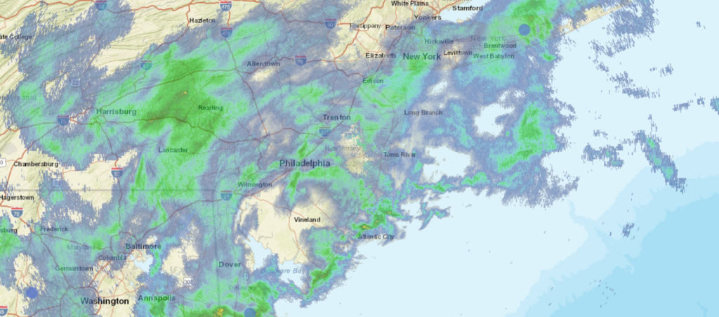
A bold move by other outlets keeping precipitation out of the picture entirely on Friday. Still, and especially with snow flurries, it tends to get everywhere. I don’t think anyone will cut precip out of the forecast on the coast in their forecast for Monday afternoon and evening. Here is all the rain around the region tonight.
Two cities that are slightly inland, but have been pummeled by extremely heavy rain in the last week. They seem similar, but are separated by 2884 miles. We will take 5 days to cover all this ground, including a really long day at the end, moving at a pace of 67mph, and we will cover about 536.5 miles a day for the first 4 days of the week. If there is anything nasty coming this week, we will sure see it on this trip.
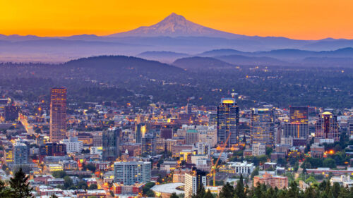
DAY ONE (Thursday)
Portland, Oregon
The next wave of wet weather moving into the Pacific Northwest will really arrive on shore overnight tonight, though rain and some mountain snow has continued to fall from Portland to the Cascades. The wind and precipitation will be heavier through the morning as far east as Biggs Junction than it has been today, but then, it will cut off. The system will be angled towards the north, and should leave the rest of our route on Thursday unmolested. We’ll stop in Wendell, Idaho which is northwest of Twin Falls, for the night.
DAY TWO (Friday) A ridge is setting up over the Rockies for late in the week, and that coincides pretty sweetly with our trek through the region. Idaho, Utah and Wyoming will be dry on Friday, with seasonable warmth and sunshine. We’ll make it to Arlington, Wyoming, northwest of Laramie on Friday.
DAY THREE (Saturday) The low pressure feature that was arriving on shore as we attempted to leave Portland is going to ride over the ridge as we head east. It will feature a mostly inactive cold front diving into the northern High Plains on Saturday as we cross the Nebraska prairies. We will make it to Lincoln, where we will stop for the night, amid increasing breezes and temperatures ready to cool down. Now, my alma mater, the Purdue Boilermakers are playing in Lincoln on Saturday, but I swear this is just a coincidence.
DAY FOUR (Sunday) A cold front is going to be moving at about our pace through Iowa and northern Illinois, but this is probably a good thing. It looks like it will be dry throughout the drive, but will instead just give us a nice little tailwind. Sure, it will feel chilly when we stop for gas, but that gas will come with better mileage! Of course, the stop and go of the Chicago area will slow us down, and we will make it to Hobart, Indiana, just across the border, leaving one final, albeit lengthy day to wrap this bad boy up.
DAY FIVE (Monday) That crisp breeze will be our companion, only helped, surely, but the Great Lakes to our north. The Appalachians in Pennsylvania will bring respite from the wind, and ultimately the cold, as the East Coast looks to mostly avoid the worst of the cold air brought by the area of low pressure quickly marching towards Hudson Bay. Trenton will be experiencing some partly cloudy skies with southerly breezes when we arrive, a far cry from what they saw last weekend