We’re headed southeastward to start the work week. Getting into the middle of November, a trek to the beach might be a good idea. It will take two days to get from Illinois to the Treasure Coast, covering 1162 miles. That will cover nearly 70 miles an hour, and we will over 554 miles on our first day, leaving a longer day for Tuesday. Beach day!
DAY ONE (Monday)
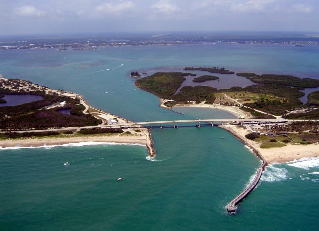
Champaign, Illinois
Low pressure in the Great Lakes has hooked up with the remnants of Rafael at this point, which is slowing the eastward traffic down a bit. By the time we get going on Monday morning, it will have dried out in east Central Illinois, and will be dry, if with some patchy clouds, for our route. The tail of the cold front, fused to the remnants of Rafael, will stall through Georgia, bringing about some mid to lower level overcast through the Smokey Mountains as we pass through Chattanooga. The day will conclude in Calhoun, just north of Atlanta.
DAY TWO (Tuesday) That low in the Gulf will refuse to go away, but will get forced apart by a burgeoning ridge of high pressure in the eastern two thirds of the country. The low moving out of the Great Lakes will be safely off in the Canadian Maritimes, and our drive on Tuesday to Sebastian will be done with very good conditions, save for all those Florida drivers to worry about.
On Christmas Eve, while all the children were snug in their beds with sugar plums dancing in their heads, we were stirring with a forecast for Sebastian, Florida. It made me pine for the years I spend in Florida, as highs were near 80 on Christmas and the day after, with barely a cloud in the sky. With the way this month has gone, it nearly rates as a Christmas miracle, but Victoria-Weather had the top forecast for Sebastian. Actuals: Saturday (Christmas), High 80, Low 53 Sunday – High 78, Low 53
How far are you willing to travel for a holiday? It’s going to take 5 days to make this trip, covering 2914 miles. Sounds like a perfect Christmas gift to me, especially when a pace of 69mph can be sustained. The swift pace will allow 555 miles to be the goal on days 1-4, with a long conclusion to the trek.
DAY ONE (Sunday)
Reno, Nevada
The western US is getting battered by a holiday weather system that is bringing cold weather and snow mostly to the peaks of the Cascades and Sierras, but even to the lower terrain between, at least to a certain level. Seattle and Portland were in line to see some unusual snowfall for Christmas, and white capped peaks are definitely coming to Nevada and Utah. The snow should be done outside of the highest points of northern Nevada, but that won’t necessarily be the case in Utah, where heavy snow could, theoretically, even lead to some road closures. Expect a tougher slog through Utah, especially where the terrain gets a little more hilly east of Salt Lake City We will stop for the day, mercifully, in Wanship, in heart of the Wasatch.
DAY TWO (Monday) The pattern in the western US is just going to be active for the beginning of the week. The low will split in two over the next couple of days, sending the first round of snow and cold air to the Upper Midwest, while leaving quite a bit of moisture in the Pacific Northwest as well. The northern Rockies will be between these two branches of the feature, so while it won’t be stormy, it won’t be great either. Mountain snow with lighter flurries in the valleys will continue through Utah and western Wyoming, but at least the lee side of the Rockies, in Wyoming and western Nebraska will be a bit more favorable, with spots of sun, but mostly cloudy skies. The day will conclude in Big Spring, right at the northeast corner of Colorado, just on the Nebraska side.
DAY THREE (Tuesday) The continued rotation of the low pressure in the west will regenerate again on Tuesday. Expect a generally ok drive through the rest of Nebraska, and the 4 hours that will take, but a cold rain is possible as soon as we hit Nebraska City and the Iowa border. Even more robust precipitation is possible after we make the eastward jaunt at Kansas City, and a cold, steady rain is possible when we stop for the night in Sweet Springs, about an hour east of KC.
DAY FOUR (Wednesday) The rain we see on Tuesday will be the result of a rising warm front, but we won’t really ever be able to get south of the boundary, and our day will begin on a chilly note in Missouri. The lingering boundary will be diffuse and stretched across the mid-Mississippi Valley, an environment rife for redevelopment. Late in the day, a new feature will begin to arise in Mississippi and bring us some cold rain starting around Nashville. Heavier rain will be persistent in the higher terrain of eastern Tennessee throughout the day, so bring an umbrella as we get to our hotel in Manchester, about halfway between Nashville and Chattanooga.
DAY FIVE (Thursday) The front bringing that rain will weaken as it shifts east through the mountains, and at long last, we can expect to be out of any threat for heavy precipitation. Some light showers and overcast will persist from Manchester through the remainder of our time in Tennessee, as well as much of the state of Georgia. We should finally emerge into dry conditions around Tifton, and it will probably even be sunny by the time we alight upon Sebastian.
I spend every other Christmas in Florida, and it definitely feels right to me. So come with me and enjoy the holiday among palm trees and hopefully some sunshine.
At 1035PM, ET, Sebastian was reporting clear skies and a temperature of 58 degrees. A cold front moved through town earlier in the week, and even dropped an isolated tornado in the Fort Myers, but has left the southeastern US embraced in a pleasant bubble of high pressure. Some stability in the southeastern US will be in order through Christmas and Boxing Day, with a very strong, very linear jet streak running through the Great Lakes is going to continue to tamp down any significant weather. Unseasonable warmth will be in order for Sebastian. Tomorrow – Sunny, High 79, Low 55 Sunday – Sunny, High 79, Low 54
TWC: Tomorrow – Sunny skies. High 81, Low 55 Sunday – Sunny skies. High 80, Low 55
AW: Tomorrow – Plenty of sunshine; beautiful weather for Christmas Day High 80, Low 58 Sunday – Sunny High 78, Low 56
NWS: Tomorrow – Sunny, High 78, Low 57 Sunday – Sunny, High 77, Low 55
WB: Tomorrow – Sunny, High 79, Low 57 Sunday – Sunny, High 76, Low 57
WN: Tomorrow – Mostly sunny, High 77, Low 60 Sunday – Mostly sunny, High 75, Low 58
FIO: Tomorrow – Clear throughout the day. High 77, Low 55 Sunday – Clear throughout the day. High 75, Low 56
With skies as clear as this, you can almost make out Santa and his reindeer. Merry Christmas all!
Sebastian and Vero Beach aren’t far from each other, but they were far enough apart that they had some distance in their highs on Monday. Whereas the high in Vero Beach was in the low 80s, it only hit the high 70s in Sebastian. Why? It probably has to do with the location of the local geography. The barrier islands are broader near Vero Beach, and the Sebastian airport sits near a river, all meaning that the influence of water has a better chance of tempering changes to temperature in Sebastian. Just a theory. In any eventr, The NWS and WeatherNation tied for the top forecast. Actuals: Sunday, High 79, Low 63 Monday- High 78, Low 66
Hello, and happy weekend! If you are ready for this southeastern US trek, then I am too. It’s an 837 mile trek, and if we did it in 1 day, it would take 12 hours. Possible, sure, but I think we would all prefer a more relaxed day and a half pace. We’ll cover the ground at a clip of nearly 70mph, which is a great advertisement for I-75.Our full day of travel will conclude after about 558 miles.
DAY ONE (Monday)
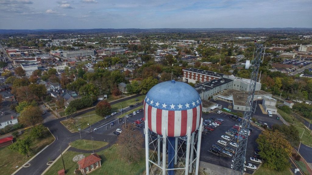
Bowling Green, Kentucky
We are picking a great day to depart from Bowling Green. Another reinforcing bolt of Atctic air is pressing into the center of the country, which will bring more wind and rain to Kentucky and Tennessee by the time Monday is thorugh. Fortunately, it will get to the route between Bowling Green and Chattanooga well after we have reached Georgia. The Peach State will still be it’s regular sultry self, with a bit of added humidity ahead of the strong emerging cold front in the Ohio Valley. We’ll be in the safety of Florida by the time the day ends, spending the night in Jasper, not far across the state line. Good thing bad weahter never comes to Florida.
DAY TWO (Tuesday) That strong cold front will continue to sink to the southeast, it will lose most of it’s on shore mustard. Sure, there will be wind and some mid level clouds, but most of the actual rain showers will lie offshore. We should outpace the cold front, but a head wind will be gusting towards the lower pressure, so be sure to grip the steering wheel securely. Always good advice when driving in Florida, actually.
Hey, did anyone watch The Little Mermaid on ABC earlier this week? Why do I ask? Oh, no reason.
AT 153PM, ET, Sebastian was reporting a temperature of 77 degrees with clear skies. There were showers being seen south of town, from West Palm Beach towards Miami, and a brisk onshore wind carried some light rain near Cape Canaveral, but the air mass moving into the region was the same cool dry one found across the eastern part of the country. The showers south of town are associated with a fairly strong area of low pressure in the Gulf Stream. An upper level trough lies over the Florida Peninsula, and will drift east out of the area, allowing some humidity and clouds to filter back in, however the skies are likely to stay clear. Tomorrow – Sunny, High 79, Low 60 Monday – A few clouds, High 82, Low 64
TWC: Tomorrow – Sunshine and clouds mixed. High 79, Low 65 Monday – Intervals of clouds and sunshine. High 82, Low 68
AW: Tomorrow – Partly sunny High 80, Low 68 Monday – A passing shower in the morning; otherwise, partly sunny High 81, Low 70
NWS: Tomorrow – Mostly sunny High 79, Low 65 Monday – Mostly sunny High 81. Low 65
WB: Tomorrow – Partly sunny, High 78, Low 68 Monday – Partly sunny, High 81. Low 69
WN: Tomorrow – Partly cloudy, High 79, Low 65 Monday – Partly cloudy, High 81, Low 65
FIO: Tomorrow – Partly cloudy throughout the day. High 78, Low 68 Monday – Partly cloudy throughout the day. High 81, Low 71
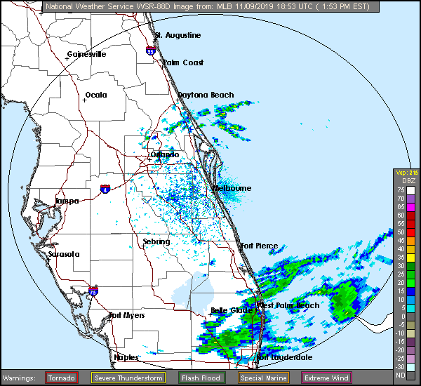
Here is a look at the radar, showing a nice window of dry along the Atlantic Coast of Florida.