Lubbock, Texas to Cumberland, Maryland

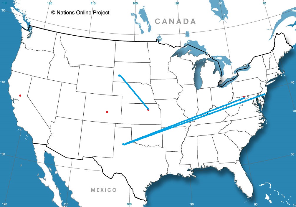
West Texas to Western Maryland. I’m not sure there is a whole lot in common between the two locales, but maybe more than one would initially suspect. It’s a three hour drive, covering 1526 miles. We’ll move at a pace of about 67mph. The first two days will be the longer of the two at 536 miles, with the last day coming at only about a 7 hours drive. Barely anything to worry about.

Day One (Sunday)

Lubbock, Texas

Texas and Oklahoma, along with much of the rest of the middle of the country, are going to see a cold front move through overnight tonight. It’s going to really slow down south and west of St. Louis, and throughout a lot of the day, particularly after we cross the Red River north of Wichita Falls, we will be traveling in the wake of the front. There will be some wind and a little bit of rain on the back end of the feature, and I’m not fully confident we will ever get out of it on Sunday. Fortunately, after we arrive in Big Cabin, in northeastern Oklahoma, things will trend drier, and we won’t have to worry about it on the window all night. Boy, Big Cabin… I hope there is some sort of place to stay in Big Cabin.

DAY TWO (Monday)
High pressure will build over the Great Lakes behind the system moving through overnight tonight, bringing cooler temperatures back to the area. Nothing extraordinary, mind you, but perhas back down to normal through Missouri and Illinois, before we pull in for the night in Monrovia, Indiana, the last exit before the Indianapolis metro.

DAY THREE (Tuesday)
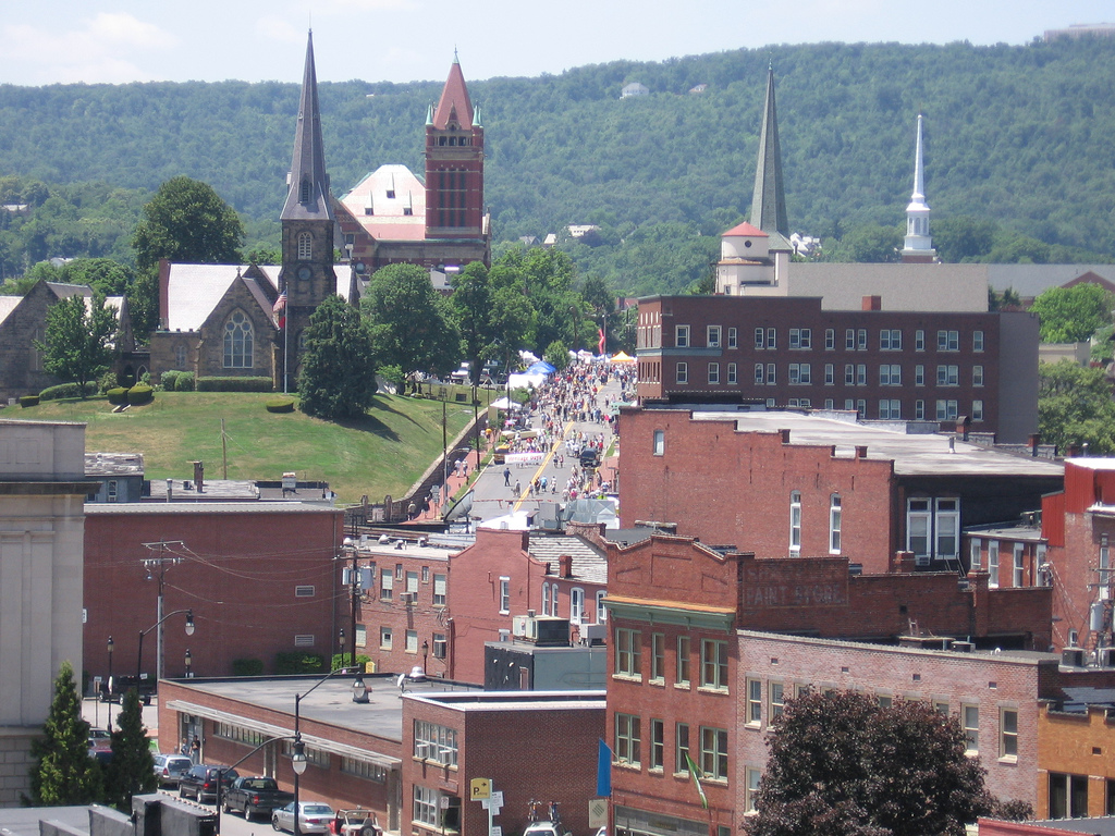
The cooler weather will rotate back up towards the North Pole, where it belongs, but the clear skies will remain. Some westerly wind may lead to a few clouds over the higher terrain in West Virginia, but it will be pretty more than impactful on our drive. Cumberland will be dry when we pull into town.

Cumberland, Maryland

Cumberland, Maryland

Let’s see what’s going on inland in Maryland tonight.

AT 955PM, ET, Cumberland was reporting a temperature of 35 degrees with light rain. That rain wasn’t likely to continue through the night. The back edge of this batch of rain, presently inundating the District of Columbia, was nearby. A more likely change, however, would be that the rain changes to snow before precipitation ceases. A trio of southwest to northeast jet streaks presently lies across the mid Atlantic, fostering an environment of instability, with light rain moving across the region.
Some jet coalescence will occur in the next 12 hours, offering guidance for the activity in the area right now. It will jet off towards New England, while additional cyclogenesis will begin at the base of the trough, over the high Plains. As it drifts into the Upper Midwest, a well developed warm front will track through the area on Sunday morning. Fortunately, the warm air will arrive before the precipitation, and only rain is expected. Unfortunately, the system is going to occlude quickly, and the cold front will also drag itself across western Maryland by Sunday afternoon. Sunday, as a result, will be rainy throughout the day.
Tomorrow – Wintry mix early, then clearing and mostly cloudy. High 56, Low 34
Sunday – Rain all day, High 51, Low 39

TWC: Tomorrow – Light rain early. A mix of sun and clouds in the afternoon. (early snow), High 58, Low 34
Sunday – Rain likely. Potential for heavy rainfall, High 49, Low 42

AW: Tomorrow – A passing morning shower; otherwise, mostly cloudy and not as cool (Early snow) High 58, Low 34
Sunday – Rain High 50, Low 40

NWS: Tomorrow – Rain, mainly before 1pm High 56, Low 38
Sunday – Rain, mainly after 7am. The rain could be heavy at times. High 53, Low 42

WB: Tomorrow – Patchy fog in the morning. Mostly cloudy with a chance of rain and freezing rain likely in the morning, then partly sunny with isolated rain showers in the afternoon. High 54, Low 36
Sunday – Rain, High 48, Low 41

WN: Tomorrow – Mostly cloudy with scattered showers, High 57, Low 34
Sunday – Mostly cloudy with rain, High 53, Low 40

FIO: Tomorrow – Light rain until afternoon. High 57, Low 34
Sunday – Rain throughout the day. High 53, Low 40

It looks pretty rainy in and around Cumberland this weekend. At least we are all used to being indoors by now, right? Here is the rain right now. Not showing much in Cumberland, but that is probably an effect of the mountains in western Maryland.

The Road Back

It was a really tough middle of February, but late last week, the recovery and a look towards spring began. We put together a forecast for Gulfport, which, even along the Gulf Coast, endured unusually cold weather. They started bouncing back on Friday and Saturday, however, with temperatures almost touching 60 on Saturday. It’s not warm, especially in southern Mississippi, but it was getting there. To go along with the positive vibes, there was a three way tie atop the leaderboard. Accuweather, Weatherbug and Forecast.io secured the top spot.
Actuals: Friday, High 56, Low 33
Saturday – 57, Low 28

Grade: B-C

Ocean City, New Jersey to Lubbock, Texas

It’s been a long time since we put together a road trip. It’s for the best, as the world hasn’t been quite so navigable of late. Our drive this week will cover three days, with the third day lasting quite a bit longer than the first two. It’s 1794 miles from the New Jersey coast to west Texas, and we will cover that at an aspirational speed of about 66mph. Hopefully, we can get 532 miles out of the first two days of the trip.

DAY ONE (Thursday)

Ocean City, New Jersey

A quick little feature is shifting out of te Great Lakes today, and will pass the mid-Atlantic coast overnight tonight. By the time we start rolling on Thursday, high pressure will be strengthening over the Ohio Valley and upper Appalachians. Sunny skies, though entirely too cool for much windows down driving, will be on the order throughout our drive from the coast to our day one waypoint, Columbus, Ohio.

DAY TWO (Friday)
The next area of low pressure is going to move from the southern Plains and pass nearly entirely south of our route on Friday, rendering the better part of the drive dry. Towards the very tail of the day, though, an inverted trough will phase with an upper level wave from the Upper Midwest. This will produce clouds and a bit of light precipitation across a large tract of the mid and upper Mississippi Valley. This will include Missouri, and we might see a few flakes west of Rolla. We’ll stop for the night on County Road J south of Powellville, Missouri on Friday night. Don’t expect a wild nightlife.

DAY THREE (Saturday)
Any precipitation we see overnight will be insignificant to grassy areas, but it may make for some slick spots early on. Temperatures and sunshine will lead to wet and eventually dry roads pretty quickly. Expect good conditions through Oklahoma City, before it might get a little bit dicier. A bit of development is expected along a boundary in east Texas and Oklahoma, and some light rain showers are possible from there to about Wichita Falls. It will get dry again, I suspect, as we turn westward again, and on to Lubock.

Lubbock, Texas

Unrelenting flurries

Snow was reported sporadically for the first 36 hours of the forecast period in Utica. The grand total accumulation was about 2 hundredths of an inch of precipitation, which is probably less than half an inch of true accumulation. Downwind of the Great Lakes, that practically qualifies as a no snow day. Temperatures were a challenge, cooling more than expected on Saturday. Ultimately, Victoria-Weather continued our winning streak.
Actuals: Friday, Snow reported, not measured. High 28, Low 21
Saturday – .02 inches of snow, High 28, Low 7

Grade:

Ocean City, New Jersey

Ocean City is in the southern part of the state of New Jersey, not far from Atlantic City. Sheesh, Ocean City, Atlantic City…. we get it, New Jersey, you are on an ocean.

At 854PM, ET, Ocean City was seeing a temperature of 29 degrees with clear skies. High pressure lay over the east coast, but the broad, nearly immobile trough over the country at the beginning of the month is no longer, replaced with a fast moving perturbation sliding presently across the Great Lakes. was expected to arrive on the east coast as early as tomorrow morning.
The line between rain and snow will be razor thin, but the southern Jersey Shore should be safe from snowfall, but heavy rain, perhaps embellished with a thunderstorm will move quickly through the Garden State. Clear skies will return on Monday evening, followed by a pleasant day on Tuesday.
Tomorrow – Rain, some thunder early, then clearing. High 45, Low 22
Tuesday – Mostly sunny, High 48, Low 32

TWC: Tomorrow – Rain likely, High 45, Low 30
Tuesday – Partly cloudy. High 46, Low 33

AW: Tomorrow – Breezy with periods of rain from late morning on High 44, Low 33
Tuesday – Intervals of clouds and sunshine; breezy in the afternoon High 45, Low 35

NWS: Tomorrow – A slight chance of rain and snow before 9am, then rain High 43, Low 29
Tuesday – Partly sunny High 45, Low 33

WB: Tomorrow – Rain, High 44, Low 28
Tuesday – Mostly sunny High 48, Low 35

WN: Tomorrow – Mostly cloudy with a light wintry mix High 43, Low 28
Tuesday – Partly cloudy, High 45, Low 33

FIO: Tomorrow – Rain starting in the morning. High 45 Low 31
Tuesday – Partly cloudy throughout the day. High 47, Low 32

Pretty unanimous across the board for this forecast, though several outlets are calling for some of the precipitation to mix. We’ll see!

The last gasp of a cold spell

When we put together our forecast for Dubuque, they were at the tail end of their extended inhabitance of a February cold spell for the record books. Wednesday dipped down all the way to -13, but the Thursday low was a relatively mild 2 above, a difference of 15 degrees. Not bad! The biggest issue with the forecast was a tendril of light snow that moved through the Mississippi Valley. It came about 12 hours later than expected, which meant that everyone missed on the precipitation forecast, even the select few who actually through it might snow. Victoria-Weather was better than the rest on temperatures, and won the forecast with ease.
Actuals: Wednesday – High 12, Low -13
Thursday- Trace of precipitation, High 18, Low 2

Grade: C-D

Hattiesburg hears thunder

While the catastrophe in Texas has garnered many of the headlines this week, the disaster was more widespread than that. From cold weather throughout the Plains to snow and ice nearly everywhere west of the Appalachians, many people suffered loss, disruption and discomfort. In Hattiesburg, temperatures were significantly colder than normal, but at least late in the week, precipitation was all rain. There were even some rumbles of thunder on Wednesday night as the second feature of the weeklong event passed to the north. Ice was a huge problem to the north of Hattiesburg, and even with over an inch of rains, and temperatures in the 20s, before the precipitation rolled in, you might even say they were lucky. Victoria-Weather had the top forecast.
Actuals: Wednesday – .93 inches of rain, High 42, Low 20
Thursday – .24 inches of rain, High 43, Low 32

Grade: B-C

Coming soon…

We’re moving a little bit more quickly around here, aren’t we? It’s kind of fun. We have a busy week ahead, too, so lets hope I can maintain this pace.

Road trip from Ocean City, New Jersey to Lubbock, Texas

Cumberland, Maryland
Road Trip from Lubbock to Cumberland

Topeka, Kansas
Road Trip from Rapid City, South Dakota to Topeka

Colorado Springs, Colorado

Sacramento, California

Gulfport, Mississippi

You know all those times where I said that forecasts would soon be coming more quickly? Well, we are now at those times. Another forecast, and another for southern Mississippi.

AT 953PM, CT, Gulfport was reporting a temperature of 40 degrees with overcast skies. North winds continued to bring cold air to the region, behind a cold front that lay between Pensacola and Tallahassee. Sub freezing temperatures continued to the north, where ice, snow and cold have drastically impacted basic utilities.
The jet trough is restructuring the surface area of low pressure. Presently, there is an elongated surface trough, which is producing the rain and snow seen up and down the coast, but the base of the jet trough will interact with the low pressure channel along the Gulf Stream through the day tomorrow. As a more organization comes to the surface feature, low level moisture and clouds will pull away from Gulfport. It may not be warm, but Friday afternoon and Saturday will at least have sunshine.
Tomorrow – Mostly cloudy early, then clearing, High 52, Low 35
Saturday – Sunny, feeling warmer, High 58, Low 30

TWC: Tomorrow – Partly cloudy skies. High 51, Low 32
Saturday – A mainly sunny sky High 55, Low 30

AW: Tomorrow – Mostly sunny and cold High 50, Low 32
Saturday – Plenty of sunshine, but cool High 56, Low 28

NWS: Tomorrow – Mostly cloudy through mid morning, then gradual clearing High 49, Low 31
Saturday – Sunny, High 56, Low 27

WB: Tomorrow – Partly cloudy in the morning, then clearing. High 49, Low 33
Saturday – Sunny, High 56, Low 28

WN: Tomorrow – Mostly sunny, High 49, Low 32
Saturday – Sunny, High 55, Low 29

FIO: Tomorrow – Partly cloudy throughout the day High 51, Low 33
Saturday – Clear throughout the day. High 56, Low 30

I am a little more optimistic for a warm up. Full sun in southern Mississippi should at least get a little closer to 60, right? The cool, moisture rich air of the southeast is leading to a lot of clouds tonight.