Birmingham, Alabama

Should we try to get kind of crazy today? Let’s try to get two forecasts in in one day!

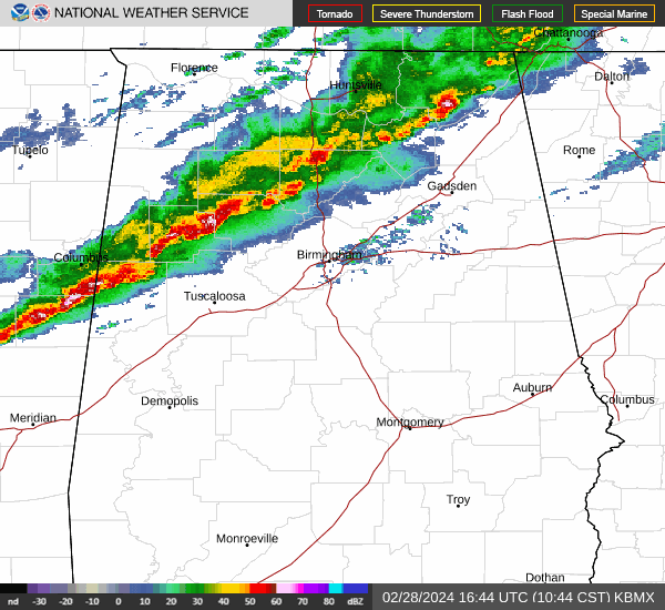
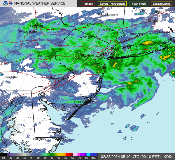
At 1053AM, CT, Birmingham was reporting a temperature of 73 degrees with light rain. The rain was popping up on radar a few miles ahead of more significant weather. Thunderstorms will be moving into Birmingham within the hour, and are presently lined up from north of Warrior to north of Aliceville, and will bring primarily a threat of some gusty winds, rain and thunder.
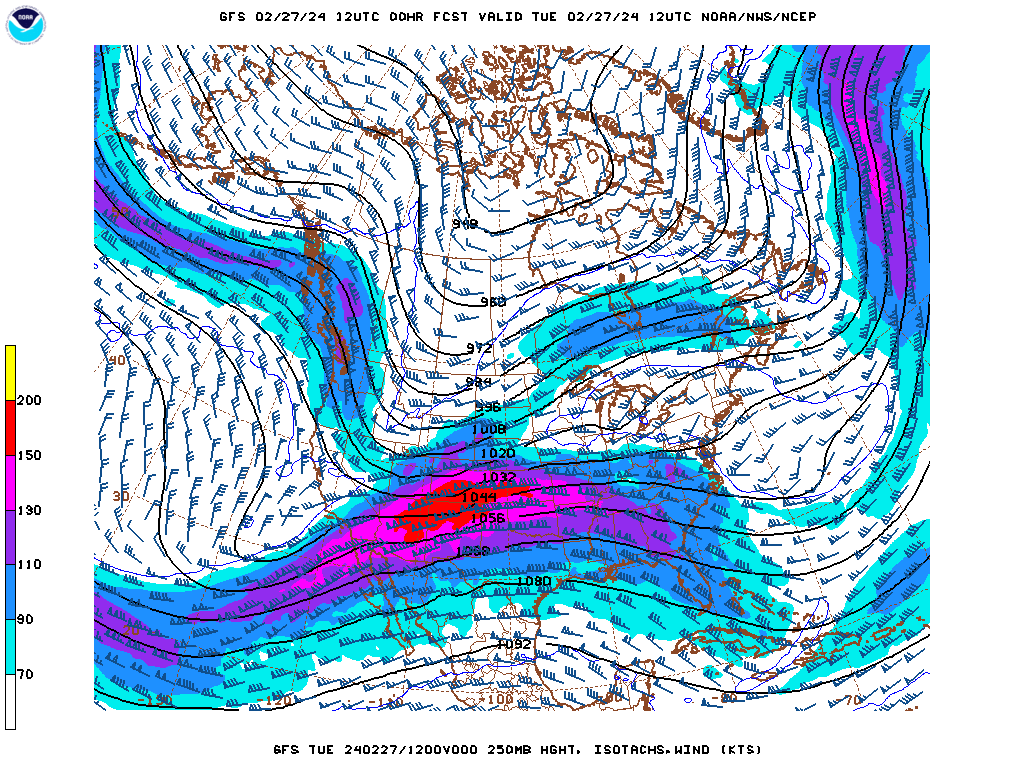
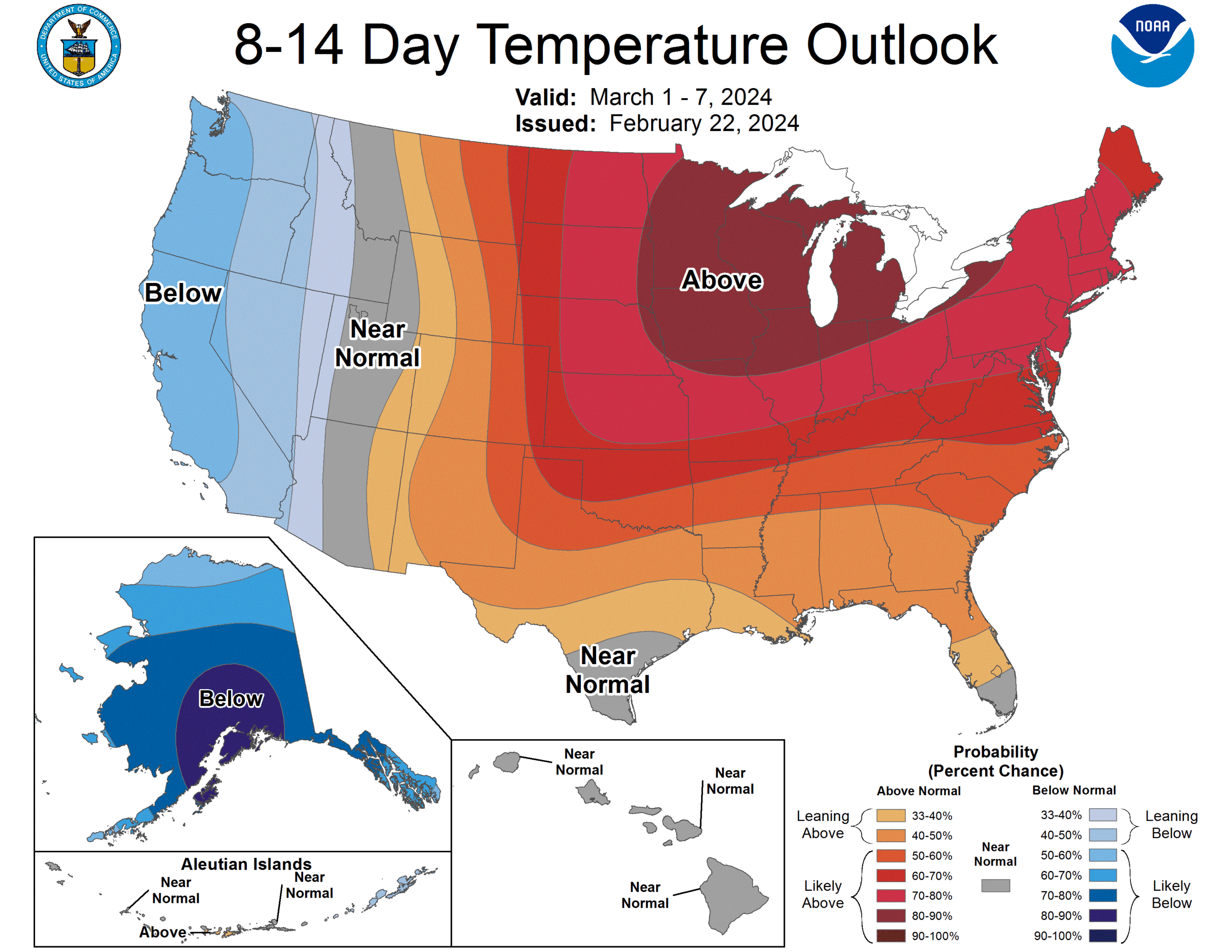
A healthy cold pool will chase the front out of town, leaving a cool afternoon in northern Alabama, followed by a crisp morning tomorrow. The jet structure is bifurcated right now, so despite a strong ridge to the north, Texas will be a ripe environment for cyclogenesis late this week. A much weaker feature than either the storm that is going to sweep through momentarily, or the strong system preparing to slam the west coast will develop in Texas and slide into Alabama on Friday morning, bringing a few showers and storms to Alabama’s largest city.
Tomorrow – Mostly sunny and chilly, increasing clouds late, High 52, Low 37
Friday – Scattered showers, cloudy, High 52, Low 47

TWC: Tomorrow – Cloudy skies, slight chance of a rain shower, High 55, Low 36
Friday – Cloudy with periods of rain, high 54, Low 45

AW: Tomorrow – Mostly cloudy and cooler High 53, low 36
Friday – Periods of rain and a thunderstorm High 54, low 46

NWS: Tomorrow – Partly sunny, High 54, low 34
Friday – Showers and possibly a thunderstorm High 53, Low 45

WB: Tomorrow – Partly sunny, High 55, Low 39
Friday – Showers, a slight chance of a thunderstorm in the morning, then a chance of a thunderstorm in the afternoon, High 53, low 49

WN: Tomorrow – Mostly Cloudy, High 56, Low 35
Friday – Mostly cloudy with showers and chance of storms, High 53, Low 45

CLI: Tomorrow – Light rain showers, High 59, Low 33
Friday – Rain showers, High 56, Low 45

We see a lot of towns in Alabama, but we don’t often touch on Birmingham. While we are here, we are getting some active weather, though! Radar shows this line of thunderstorms on the door steps.

Birmingham,

Merced, California

We’ve had a few western forecasts of late, but if there was ever a year to spend a lot of forecasting energy in California, it’s this year.

At 653AM, PT, Merced was reporting a temperature of 40 degrees with clear skies. It was a chilly start to the day that will ultimately stay fairly clear and cool. Clouds will increase late in the day, however and give rise to a much more interesting day tomorrow. Presently, Merced is between two strands of a strong jet; a broad trough to the south, allowing cooler air to the region, and a wavier northern jet, which is ridged at this time, leading to the clear conditions seen in town today.
Of course, with the waves, this means a trough is on its way shortly. Strong low pressure is tied to this wave, moving out of the Gulf of Alaska, and it is expected to retain some of that strength through the day tomorrow. A cold front will arrive in the afternoon tomorrow, starting at least 36 hours of rain, heavy at times in Merced, and vigorous snow in the mountains, with blizzard warnings already out for the Sierras. It will be quite cool for residents of Merced, and by the time the system gets out of the way on Sunday, a snowflake or two could reach the central Valley and hit Merced on Sunday.
Tomorrow – Increasing clouds, with rain in the afternoon, High 63, Low 43
Friday – Rain, heavy at times, High 59, Low 50

TWC: Tomorrow – Partly cloudy skies during the morning hours will give way to occasional showers in the afternoon. High 66, Low 45
Friday – Showers early becoming a steady light rain later in the day. High 59, Low 50

AW: Tomorrow – Some sun, then clouds with a shower late in the afternoon; significant snow expected in the mountains; travel will be dangerous, if not impossible east High 65, Low 44
Friday – Cloudy with showers High 62, Low 50

NWS: Tomorrow – Rain likely after 4pm. Increasing clouds, High 65, Low 43
Friday – Rain, High 60, Low 50

WB: Tomorrow – Sunny in the morning then partly sunny with a 50 percent chance of rain in the afternoon, High 65, Low 43
Friday – Rain, High 60, Low 50

WN: Tomorrow – Partly cloudy with light rain likely, High 64, Low 45
Friday – Mostly cloudy with rain, High 59, Low 51

CLI: Tomorrow – Light rain showers, High 64, Low 45
Friday – Light rain showers, High 63, Low 48

It’s going to be regular nasty, not just California nasty with this system. Accuweather kind of expanded the radius of where Merced is, but they aren’t wrong. It might be downright impassable late this week in the Sierras. But look how nice thing look right now!

A little of both

There was a little bit of a debate for the forecast for Ocean City. Would the system moving through be quick and usher in colder air? Would it be slow and let some light rain linger into the weekend? Most outlets kind of hedged. The clouds would linger, and the cold air wouldn’t arrive. Instead, there was light precipitation early Saturday morning AND the cold air came in. Victoria-Weather went the cold route along with Weatherbug, while Accuweather was the only outlet that had rain on Saturday’s forecast, and everything worked out to a three way tie, with all others several points off. I should note, this is the one rare site where I do not use an NWS observation point, because the nearest is Atlantic City, another site we might forecast for, so I used the nearest site available from Weatherforyou.com.
Actuals: Friday – .22 inches of rain, High 48, Low 41
Saturday – .07 inches of rain, High 46, Low 30

Grade: B-C

Spring severe weather is around the corner

I know we’ve already had some rough weather, and I also realize we haven’t seen much winter, but we are now only a few days away from March, and by this point, it’s certainly not out of the question to start bracing ourselves for severe weather outbreaks. In fact, we could see one as soon as this afternoon.

Low pressure is going to tap into the historically warm temperatures in the middle of the country, with an assist from the still seasonably strong jet flowing through the middle of the country. This is a classic comma style severe weather profile. The line from the Cincinnati area to Cape Girardeau of Enhanced Risk will likely include hail and gusty winds, while the bubble in Chicago and Milwaukee looks like a prime spot for a few tornadoes. All parts of the severe weather zone, however, will be poised to receive some of those three categories of severe weather, including some super cells in the southeast as storms develop, and some hail producers in Chicagoland.

As noted above ,the jet is still very strong, especially in the middle of the country.

The jet is a proxy for the temperature gradient at the surface, so the trough, a strong one, moving in from the west is containing the impetus for the storms coming today. The jet will sink a little further south, allowing more seasonable air into the middle of the country, at least for a day or two.

After today’s outbreak, don’t be surprised if we wind up with more again soon, after temperatures climb through the eastern third of the country over the weekend. The jet will still be strong and wavy, which will allow for the fluctuation in temperature and the strong spring storms to bridge those gaps. It’s not unusual to see strong storms this time of year, (though today’s are maybe a bit further north than normal), and they are on their way.

A beautiful bounce back

It’s good to be in San Diego. Just a statement for always, but also specifically now, where last week, weather bounced back pretty nicely after significant rain caused problems for most of Southern California early last week. It continued a trend of flooding rain across the region to start 2024. It wasn’t quite the issue to end last week. After a chilly beginning on Thursday, temperatures started climbing and the sun came out, preventing even wispy morning fog. The Weather Channel turned out the top forecast, narrowly edging their oppoinents.
Actuals: Thursday – High 63, Low 51
Friday – High 73, Low 51

Grade: A- C

It looks like the Upper Midwest will miss winter

When encountering anyone here in Minnesota lately, the generic weather conversation always steers towards how snowless the winter has been. There is also always the circumspect admonishment that we are probably really going to get hammered in March and April, but the most recent look ahead from the Climate Prediction Center suggests that time is running out for a real shot at snow.

For the end of February, and then to start March, it’s going to be well above normal in the Great Lakes. This, as we head further away from the coldest part of the year means that the time for snow is likely running out, with barely a foot having fallen over the course of the year.

While temperatures have indeed been quite warm all winter, the cold that settled in persistently did so without any moisture: there was no snow during the cold snaps. Snow on the ground would have helped temperatures remain a bit lower going forward, but that was one of the many compounding factors that worked against a normal winter around here.

We’ve been trending towards this being the warmest recorded winter in many places in the western Great Lakes, and a scorching start to March will pretty much lock that in.

Ocean City, New Jersey

We keep bouncing from coast to coast, so that means for this forecast, we’re hitting the East Coast.

At 1154PM, ET, Ocean City was seeing temperatures of 46 degrees and overcast skies. Rain was pressing north, and the back end of the line lay from Trenton to Farmingdale, with Long Island and southern New England seeing sustained shower activity. The upper level pattern is complicated. The deepest area of low pressure is in Canada, but a more generalized trough extends from New England to the Carolinas. Overnight, a southern, secondary low will develop in the Smokey Mountains and shift off shore through tomorrow evening, bringing more rain to Ocean City through Friday.
On Saturday, the low will move offshore and start headed to the Maritimes and pull cold air into the mid-Atlantic. There will be some snow in the northern Appalachians, but only patchy clouds and a return of cooler temperatures are expected to start the weekend in Ocean City.
Tomorrow – Scattered showers, especially in the early afternoon, High 48, Low 42
Saturday – Clearing, High 44, Low 32

TWC: Tomorrow – Rain showers in the morning becoming a steady light rain in the afternoon High 51, Low 42
Saturday – Sunshine and clouds mixed. High 44, Low 35

AW: Tomorrow – Occasional rain; breezy this morning; a brief cold shot to start the weekend High 49, Low 42
Saturday – A shower in spots in the morning; otherwise, breezy with times of clouds and sun High 44, Low 36

NWS: Tomorrow – Rain likely. Patchy fog after 8am. Otherwise, cloudy High 50, Low 41
Saturday – Mostly sunny, High 42, Low 36

WB: Tomorrow – Rain likely. Patchy fog. High 48, Low 43
Saturday – Partly sunny, High 44, Low 29

WN: Tomorrow – Mostly cloudy with light rain, High 48, Low 44
Saturday – Partly cloudy, High 44, Low 32

CLI: Tomorrow – Rain showers, H8gh 50, Low 36
Saturday – Mostly cloudy, High 44, Low 20

Temperatures are going to hover and steadily drop. It’s possible all highs and lows are around midnight, so that stinks for my ability to hammer this out quickly. Here is the radar, with rain pulling away, for now, from Ocean City.

San Diego, California

We’re forecasting in southern California today. It’s been a rainy start to the week, which has become a regular trend this month.

At 751AM, ET, San Diego was reporting a temperature of 51 degrees with overcast skies. The most recent band of rain showers was still leading to reports of light rain in Oceanside, but was starting to peel away from the coastal areas, and becoming an issue primarily for the Inland Empire and Mohave Desert. In the wake of another rain event, there are flood watches throughout the San Diego area.
A smattering of light showers will continue throughout the day, particularly in the higher terrain of southern California, with an end coming before nightfall. Robust onshore flow at the upper levels will likely lead to some cloudy conditions even after the rain ends. A large area of low pressure off the coast of northern California is expected to linger, sending moisture rich ocean air at the low levels as well, which may mean morning fog the next couple of days in San Diego, but there will be a break from the rain until at least next week.
Tomorrow – Mostly cloudy, High 61, Low 52
Friday – Morning haze and fog, then clearing, High 70, Low 51

TWC: Tomorrow – Partly cloudy. High 64, low 51
Friday – Cloudy skies early, then partly cloudy in the afternoon. High 70, Low 50

AW: Tomorrow – Areas of fog in the morning; otherwise, clouds giving way to some sun; a welcome break from recent heavy rain High 64, Low 49
Friday – Patchy fog in the morning; otherwise, clouds giving way to some sun High 70, Low 49

NWS: Tomorrow – Mostly cloudy, then gradually becoming sunny High 64, Low 49
Friday – Sunny, High 70, Low 50

WB: Tomorrow – Partly cloudy, High 62, Low 50
Friday – Partly cloudy in the morning, becoming mostly sunny, High 68, Low 48

WN: tomorrow – Partly cloudy, High 64, low 51
Friday – Mostly sunny, High 68, Low 51

CLI: Tomorrow – Partly cloudy, High 64, Low 48
Friday – Sunny, High 70, Low 45

What a relief for San Diego to start coming out of this soggy week. It might even warm up a bit over the coming days and help San Diego feel more like San Diego again. Not much left on radar, fortunately.

Columbus, Georgia to Hattiesburg, Mississippi

We’re going to spend most of this 5 hour drive in Alabama, touching Montgomery and Mobile along the way. This pretty short drive will cover 327 miles at a pace of 64.1mph, which is also pretty reasonable for a short trip. All right, places to be, let’s go.

Columbus, Georgia

There is a strong area of low pressure in the Canadian Maritimes, and it is producing a cold front that is very active even in central Florida tonight. The boundary is reinforced by an area of low pressure emerging in the Gulf of Mexico. The increasing circulation will induce northerly winds in the southeastern US. While Florida will be particularly rainy, Alabama and it’s neighbors will be seasonably cool, with bright blue skies. It won’t even be humid in southern Mississippi when we arrive Sunday afternoon.

Hattiesburg, Mississippi