
I know we’ve already had some rough weather, and I also realize we haven’t seen much winter, but we are now only a few days away from March, and by this point, it’s certainly not out of the question to start bracing ourselves for severe weather outbreaks. In fact, we could see one as soon as this afternoon.
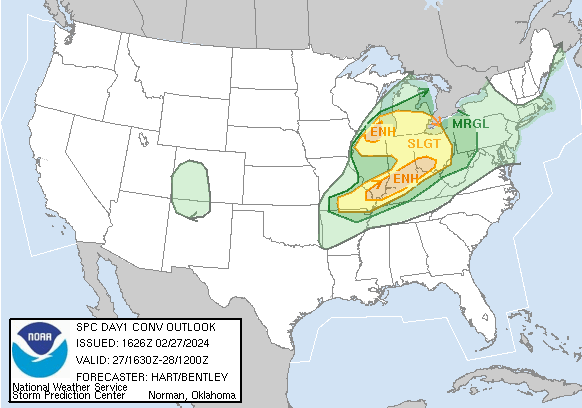
Low pressure is going to tap into the historically warm temperatures in the middle of the country, with an assist from the still seasonably strong jet flowing through the middle of the country. This is a classic comma style severe weather profile. The line from the Cincinnati area to Cape Girardeau of Enhanced Risk will likely include hail and gusty winds, while the bubble in Chicago and Milwaukee looks like a prime spot for a few tornadoes. All parts of the severe weather zone, however, will be poised to receive some of those three categories of severe weather, including some super cells in the southeast as storms develop, and some hail producers in Chicagoland.
As noted above ,the jet is still very strong, especially in the middle of the country.
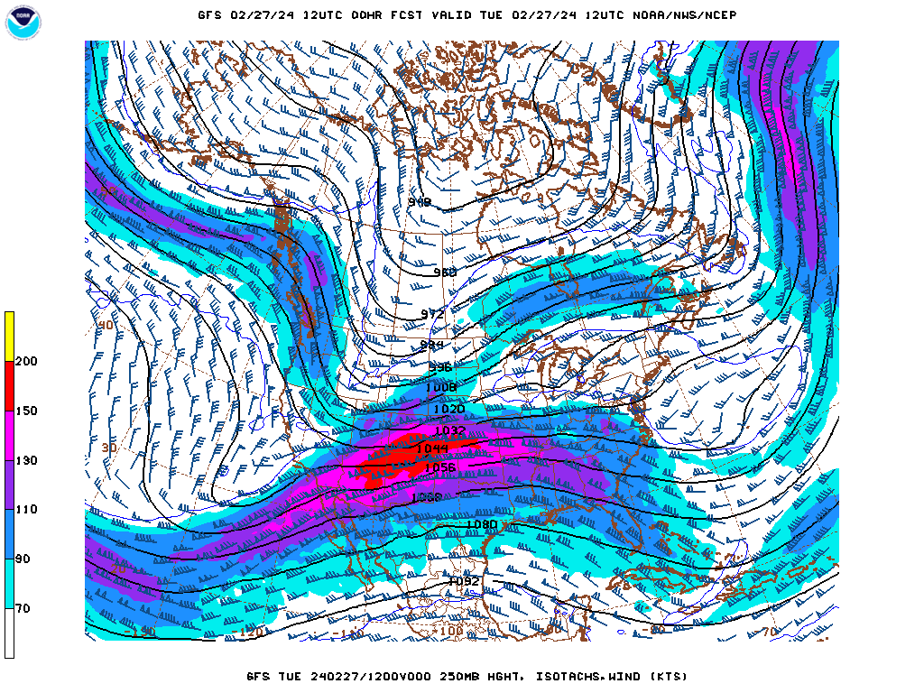
The jet is a proxy for the temperature gradient at the surface, so the trough, a strong one, moving in from the west is containing the impetus for the storms coming today. The jet will sink a little further south, allowing more seasonable air into the middle of the country, at least for a day or two.
After today’s outbreak, don’t be surprised if we wind up with more again soon, after temperatures climb through the eastern third of the country over the weekend. The jet will still be strong and wavy, which will allow for the fluctuation in temperature and the strong spring storms to bridge those gaps. It’s not unusual to see strong storms this time of year, (though today’s are maybe a bit further north than normal), and they are on their way.