Jacksonville, Florida to Syracuse, New York

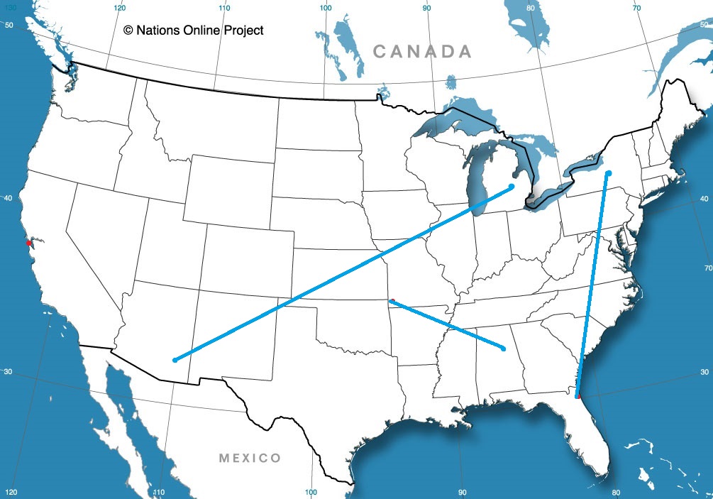
I-95 is a busy stretch of road in the Mid-Atlantic, but we will spend a lot of time on this famous freeway south of Washington, where it successfully avoids a lot of the busiest spots. It will take two days to get from Jacksonville to Syracuse, and will cover 1071 miles. The pace of the drive will be 67.2mph, and we will make it about half way by the time the first day ends. One day mostly on I-95, one day mostly not.

DAY ONE (Friday)

Jacksonville, Florida

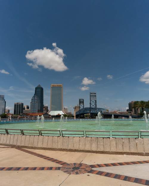
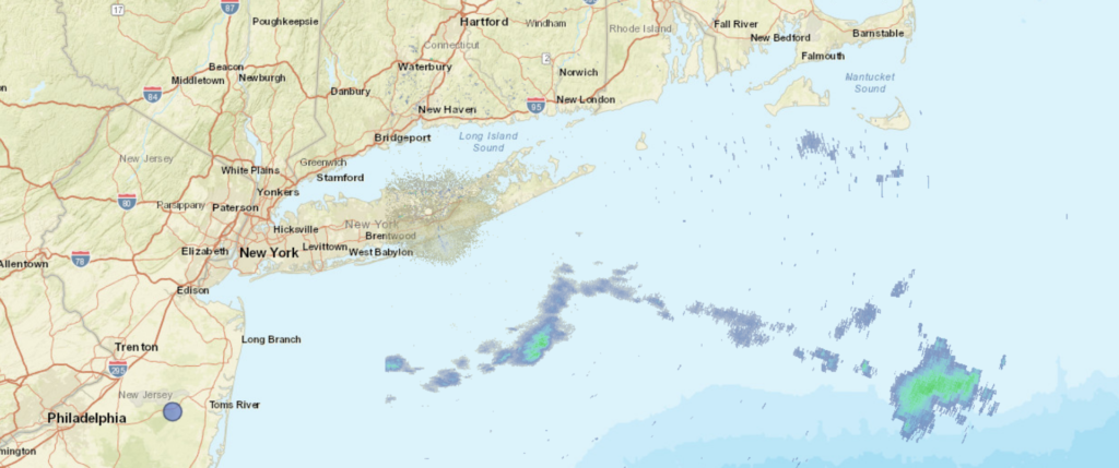
It’s going to be a rough day in Jacksonville, and indeed along the East Coast today as the system that has wrought havoc on the lower Mississippi Valley and surrounding environs continues to march towards the Atlantic. Areas west of Jacksonville are presently under a tornado watch, and a slight risk of severe weather extends all the way north through Virginia. Essentially, our route for day one. But we are leaving tomorrow, and the boundary will already have passed by, leaving a post-storm tranquility to the area. Dry, calm, potentially well trafficked conditions will proceed as we head through Georgia and the Carolinas to Emporia, Virginia, tucked away west of Norfolk.

DAY TWO (Saturday)
It will be chilly in Emporia when we arrive Friday night, but it is far enough south that we will duck any of the late storm flurries that will be persistent in Pennsylvania and New York on Friday. A little bubble of high pressure will emerge over the mid-Atlantic to start the weekend, but clouds associated with this feature have been stubborn. Don’t be entirely surprised if it stays cloudy and cool, especially north of Washington, and then through the remainder of the route to Syracuse.

Syracuse, New York

Jacksonville, Florida

A lot of places in Florida seem like straightforward forecasts, but Jacksonville is far enough north, and not as prone to sea breezes on all sides as the rest o the state. What I am saying is, Jacksonville can be a bit more challenging. Let’s investigate, and see if today is as tough as I promised.

At 956PM, ET, Jacksonville was reporting clear skies and a temperature of 62 degrees. The airport was actually the cool spot in the area, with warmer temperatures south and along the coast. High pressure is firmly entrenched in the eastern third of the United States, and there isn’t a cloud in the sky over the Sunshine State.
The ridge will be dislodged through the middle of the week, as a robust trough starts to press out of the Rockies and into the Plains. The skies above Jacksonville will not betray a strong cold front on it’s way towards the city through the day Tuesday and much of the day Wednesday. Some clouds will finally arrive late in Wednesday, with a bit of high overcast, and an increase of winds. The rain and thunder will hold off until Thursday morning.
Tomorrow – Sunny morning haze, High 77, Low 57
Wednesday – Increasing clouds late, with some breeze, High 85, Low 59

TWC: Tomorrow – A mainly sunny sky. High 78, Low 56
Wednesday – Sunshine and clouds mixed. High 85, Low 63

AW: Tomorrow – Plenty of sunshine High 79, Low 54
Wednesday – Breezy with more clouds than sunshine High 84, Low 60

NWS: Tomorrow – Sunny, High 79, Low 56
Wednesday – Patchy fog between 7am and 8am. Otherwise, partly sunny, High 84, Low 63

WB: Tomorrow – Sunny, High 77, Low 59
Wednesday – Patchy fog, mostly sunny, High 83, Low 65

WN: Tomorrow – Mostly sunny, High 79, Low 56
Wednesday – Partly cloudy, High 84, Low 63

FIO: Tomorrow – Clear throughout the day. High 77, Low 58
Wednesday – Mostly cloudy throughout the day. High 80, Low 64

It turns out, it wasn’t a particularly adventuresome forecast. Time will tell if it is difficult. Despite how calm things looks for the next 48 hours in Jacksonville, the middle of the country looks to be pretty in line for another round of severe weather. Cold fronts catch the attention of Floridians, and this week will grab some attention. Right now, it’s a good night for stargazing.

Windswept in the Colorado Foothills

I spoke too soon after confidently revealing the results of the verification in New Haven. The weather in Colorado Springs as the first third of the month concluded was poised to go downhill, but like the Rockies to the west, the slope was steep. Steeper than expected, frankly, and it resulted in some of the worst forecasts I’ve seen in a while. Snow was able to clear the Palmer Divide relatively early on Wednesday the 9th, and it was accompanied by cold air, without any of the bump that downsloping usually allows. it was one of the worst forecasts I’ve seen in a while, frankly, as temperature got significantly colder faster than anyone really expected. Then, there is Forecast.io who was a disaster, not even having snow in the forecast at all. Yikes all the way around. The Weather Service was merely bad, and not terrible, and secured this victory. They shouldn’t feel good about it, though.
Actuals: March 9th, snow, High 28, Low 3
March 10th, snow reported, not measured, High 12, low 0

Grade: C-F

Albany, Georgia to Milwaukee, Wisconsin

The snowbirds are returning to the north, and while I don’t think Albany is a bit vacation destination, I would imagine there are several people travelling through or near Albany. This particular drive will last two days and cover 992 miles. The drive snakes through some larger towns, and not as much open country as would be conducive to a fast trip, so our pace will be about 65mph, with a day 1 journey of 523 miles, with a little bit shorter day to end it. Go home, Snowbirds!

DAY ONE (Friday)

Albany, Georgia

What do I always say about spring and fall? The systems are bigger and badder, thanks to the clash of air masses, and the system that brought tornadoes to Austin and New Orleans, and continues to bring rain to the east coast, will linger on the Eastern Seaboard as we depart tomorrow, thanks to a deep occlusion and the whole beast just spinning itself over the Great Lakes. Our drive through Georgia and Tennessee will be just fine, but don’t be surprised to see clouds ahead of us when we reach Horse Cave, Kentucky. Lingering light precipitation isn’t moving too quickly thanks to the bogged down system. Horse Cave is near Mammoth Cave, so get away from all the weather worries and just go underground!

DAY TWO (Saturday)
Guidance suggests a lot more movement as the weekend approaches, but I’m not as optimistic. I don’t think it is going to be fully cleared out, say north from Indianapolis, as the models project. It will be chilly and cloudy, with lingering moisture. I would, therefore, anticipate a wet snowflake to fall at any moment as we trudge through Chicago and on north into Milwaukee. Everything slows traffic in Chi-town, but this should be a mild dose of it. Even if it takes a while for this precipitation to shove off, Sunday in Milwaukee should start to look like spring.

Milwaukee, Wisconsin

Back on track

I have returned from vacation, and if our forecast in New Haven is any estimation, I didn’t really need one. The beginning of March was a warm one in New England, and that usually means rain. That was indeed the case in New Haven, where our forecast swooped in at the end of a warm spell which was ultimately marked by some rain. The cool down was deftly anticipated by Victoria-Weather, and that gained a victory for us.
Actuals: March 7th, .02 inches of rain, High 61, Low 48
March 8th, High 49, Low 32

Grade: B-C

Coming Soon…

We’ve reached spring break season, and I too am taking a vacation this month. Let’s hope that I am not thinking even a little bit about the weather while I am there! I guess I am saying I don’t want this

Jacksonville, Florida

Road Trip from Jacksonville to Syracuse, New York

Road trip from Tucson, Arizona to Muskegon, Michigan

San Francisco, California

Joplin, Missouri
Road Trip from Anniston, Alabama to Joplin

Colorado Springs, Colorado to Albany, Georgia

Spring break! Georgia has some great vacation destinations, though I’m not entirely sure that Albany is a site many are thinking of. Our drive for this trek will take three days, with the final day a bit shorter. We’ll cover 543 miles at a day at a pace just shy of 68mph, ultimately traveling 1553 miles on our journey. It’s been active in the southeastern US. Will that continue?

DAY ONE (Sunday)

Colorado Springs, Colorado

As I noted, there have been a parade of strong systems moving through the Eastern US of late, and the most recent has just brought snow to the eastern Great Lakes and interior New England, with severe storms along the coastal Carolinas. Behind those features, high pressure has been returning to the Plains and Mississippi Valley. It’s been a chilly start to March, but warm air will start building north on Sunday in western Kansas. It won’t be warm, but it will be warmer as we end the day in Lawrence, Kansas.

DAY TWO (Monday)
The next ripple will arrive in the Plains by the beginning of the week, but will initialize with a bit less vitriol than our most recent system. It will get there, but it won’t bother us too much on Monday. Guidance hints at some very scattered showers in Missouri, but they won’t be heavy enough to be a problem in the unfortunate event we pass through one. That threat should abate as soon as we cross into Illinois. Expect mostly cloudy skies with temperatures approaching seasonable in western Kentucky. We will finish the day just across the border in Clarksville, Tennessee.

DAY THREE (Tuesday)
A much more focused wave will develop over the lower Mississippi Valley on Tuesday, and will quickly start moving towards our route. Light precipitation will start on the north end of the Atlanta metro. I feel like we should be dry in the high country, so we can save the fun for the chaos of Atlanta traffic. The real show comes around Macon, when thunderstorm activity will become more widespread and intense. Severe weather, including hail and tornadoes, isn’t out of the question. That will probably be the scene in around Albany when we arrive. Get indoors quickly!

Albany, Georgia

Colorado Springs, Colorado

In terms of the weather, and especially in the spring, many systems originate in the lee of the Rockies, right here in eastern Colorado. Let’s check out what is getting started over the next couple of days.

At 1054PM, MT, Colorado Springs was reporting a temperature of 27 degrees with clear skies. A vast trough over much of the western 2/3rds of the country is keeping things unseasonably cool. Within the trough, a weak wave has brought light precipitation to the upper Midwest, with a cold front extending to a knot of precipitation centered over Wyoming. At this time, all snow is being penned north of the Palmer Divide, however the entrance of the broad trough is partially responsible for this low, and will give the feature a bit of emphasis in the coming days.
Despite the snow currently just over the state line in Wyoming, it will take until late tomorrow afternoon for the snow to reach Colorado Springs. Snow will continue intermittently, as the forcing mechanism will struggle to traverse the divide, and will be oriented west to east across the foothill of the Rockies. The boundary will stall across southern Colorado, but precipitation is going to be light. The lingering clouds and flow off the Divide will help prevent a massive cool down, but Thursday will certainly be chillier.
Tomorrow – Increasing clouds with snow late, High 35, Low 16
Thursday – Scattered snow showers, lighter in the afternoon, High 19, Low 5

TWC: Tomorrow – Partly cloudy skies during the morning hours will give way to occasional snow showers in the afternoon. High 30, Low 13
Thursday – Cloudy skies with afternoon snow showers. High 19, Low 6

AW: Tomorrow – Sunny to partly cloudy in the morning, then a coating to an inch of snow in the afternoon High 33, Low 12
Thursday – Colder with periods of snow, accumulating an additional 1-3 inches High 17, Low 8

NWS: Tomorrow – Snow, mainly after 2pm. Patchy blowing snow after 4pm. High 32, Low 8
Thursday – Snow showers likely, mainly after 11am. Mostly cloudy, High 19, Low 3

WB: Tomorrow – Mostly cloudy Periods of snow in the afternoon. Patchy blowing snow in the afternoon, High 32, Low 13
Thursday – Snow showers likely. Light snow accumulations, High 17, Low 9

WN: Tomorrow – Mostly cloudy with light snow, High 31, Low 13
Thursday – Mostly cloudy with light snow showers likely, High 18, Low 3

FIO: Tomorrow – Mostly cloudy throughout the day. High 34, Low 15
Thursday – Overcast throughout the day. High 22, Low 8

Accuweather has a storm total of 4-8 inches of snow in Colorado, while Forecast.io doesn’t have any snow in the forecast. One of them will be wrong. All told, I think 2-4″ of fluff is the most likely scenario in Colorado Springs.

On track

When we put together the forecast for Chicago at the end of February, there was a strong southwest to northeast jet, that really hasn’t changed a whole lot, even now as we enter the middle of March. One change, I suppose, is that the jet has lifted a bit to the north, so Chicago is now warmer, but back in February, the Windy City would get snow on the north side of a feature, followed by cold air. That’s the pattern we followed leading into the last weekend of the month. The cool down rate was a bit challenging, and gave way to some spotty forecast consistency, but ultimately, the Weather Service (who allowed a Midway Airport specific forecast, unlike nearly all other comers) grabbed a victory.
Actuals: Friday 2/25 – .04 inches of liquid in light snow, High 31, Low 20
Saturday 2/26 – High 33, Low 16

Grade: B-C

New Haven, Connecticut

I love the spring. Winter is such a long slog, and then you start getting this taste of warmth that brings along the first thunderstorm activity of the year. Even when it’s colder, you can bet it’s going to be interesting. Let’s knock out this likely entertaining forecast.

At 453PM, ET, New Haven was reporting sunny skies and haze. An occluded feature over Newfoundland is extending a cold front just to the south of Long Island. This boundary runs further to the east southeast and intersects a more vigorous feature centered over the Ozarks. The resulting languid pace of the boundary south of town will lead to high humidity, and clouds and overnight fog for New Haven in the immediate future.
The stronger low to the western low will progress northeastward, buoyed by a rapidly propagating, strong jet perturbation, will moves swiftly to the northeast. The front will back up and move north through New Haven, but without much moisture within the feature. A little bit of rain is possible overnight, but a warm early afternoon will follow. The cold front will arrive in the late evening, perhaps shortly after sunset, and will bring showers and thunderstorms. Precipitation will wrap up quickly, but Tuesday will be breezy and much colder,
Tomorrow – Early showers, late showers and thunderstorms with some breezy conditions. High 57, Low 45
Tuesday – Clouds clearing early, with breezy and chilly conditions. High 49, Low 32

TWC: Tomorrow – Cloudy skies with periods of rain later in the day. High 56, Low 48
Tuesday – Mostly sunny skies. High 51, Low 37

AW: Tomorrow – Cloudy and mild; a little rain late in the afternoon High 59, Low 49
Tuesday – Cooler with clouds yielding to sun (early rain) High 52, Low 34

TWC: Tomorrow – Showers likely, mainly after 4pm. Increasing clouds, High 57, Low 46
Tuesday – Sunny High 51, Low 34

WB: Tomorrow – Mostly cloudy in the morning then partly sunny with a slight chance of showers in the afternoon, High 55, Low 48
Tuesday – Sunny, High 50, Low 31

WN: Tomorrow – Mostly cloudy with light showers likely, High 57, Low 46
Tuesday- Mostly sunny, High 46, Low 36

FIO: Tomorrow – Rain overnight and in the evening. high 59, Low 46
Tuesday – Possible light rain overnight. High 53, Low 35

The description of the precipitation is pretty different across the board, from the amount and intensity to the timing. No two forecasts are alike. Not much on the local radar display right now.