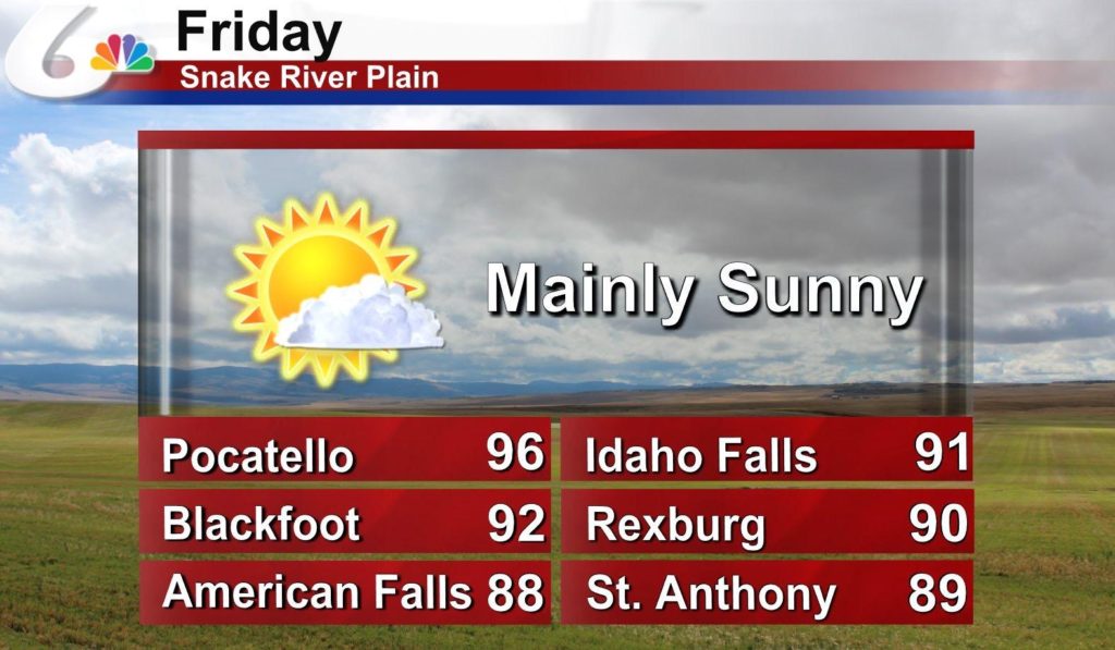
Pocatello behaved mostly as expected, if you managed to sleep in every day. If you woke up early though on the 18th and 19th, you would find that temperatures were significantly colder than what most outlets forecast. It wasn’t a bad forecast overall for the winners (Who happened to be us, Victoria-Weather) because the high temperatures were handled well, and the precipitation threat was for later in the week. Low temperatures ended up as low as 26 on the 19th, which was a bit cooler than the 40s WeatherNation threw out there. Actuals: October 18th, High 76, Low 30 October 19th, High 73, Low 26
I saw that we are on the cusp of some changes to the pattern in the interior northwest. It is October, so perhaps you can guess what kind of changes those might be.
At 1153AM, MT, Pocatello was reporting clear skies and a temperature of 62. The clear skies were leading to chilly nights with the low dew points, but the sunshine meant temperatures were unbound in the afternoon, and record highs have been dotting the region of late. The low trough off the west coast in conjunction with the ridge has established what is known as a Rex Block, stifling flow in Idaho. The western US is going to remain under this Rex Block until the weekend, and flow through the region will remain fairly stagnated. Expect some morning haze or smog, especially in the valleys, thanks to the lack of flow at the surface, but continued warm temperatures and sunny skies in the afternoon. Things will be quite a bit different this weekend, however. Tomorrow – Sunny with haze, High 76, Low 35 Wednesday – Sunny, hazy in the morning, High 73, Low 34
TWC: Tomorrow – Sunny skies High 76, Low 36 Wednesday – Intervals of clouds and sunshine. High 74, Low 35
AW: Tomorrow – Warm with plenty of sunshine High 76, Low 34 Wednesday – Brilliant sunshine and warm with the temperature approaching the record of 78 set in 1950 High 75, Low 35
NWS: Tomorrow – Sunny, High 74, Low 42 Wednesday – Sunny, High 73, Low 43
WB: Tomorrow – Sunny, areas of frost in the morning, High 72, Low 35 Wednesday – Sunny, High 71, Low 36
WN: Tomorrow – Sunny, High 74, Low 42 Wednesday – Mostly sunny, High 73, Low 43
FIO: Tomorrow – Clear throughout the day. High 74, Low 40 Wednesday – Partly cloudy throughout the day. High 72, Low 37
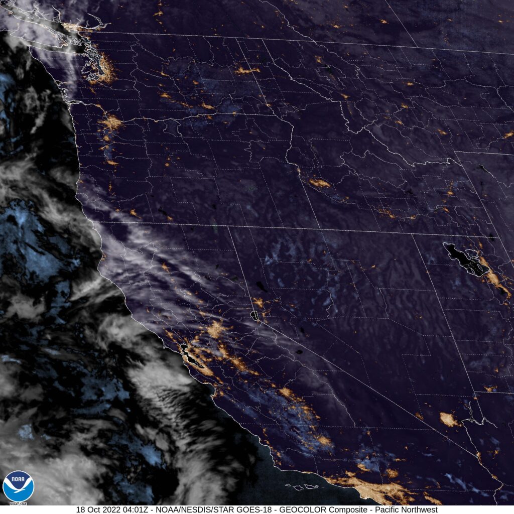
Pretty different forecast lows, but consistent elsewhere. Makes sense when the satellite imagery looks like this. By the way, the change I hinted at in the intro is coming over the weekend. It’s going to get cold and snowy for a lot of the Northwest.
Joining us today for the forecast is Doug Iverson, the Chief Meteorologist at KPVI in Pocatello, Idaho. Mr. Iverson likes to go by the moniker Doug I. the Weather Guy, and can be found at Twitter @dougiweatherguy. Mr. Iverson is a native to Idaho, and surely has a little extra insight into the weather of Pocatello. Take it away, Doug!
Yay…the weekend is almost here. The Snake River Plain will see less of that wildfire smoke and more of that hot sun.
Popocatepetl is a volcano in Mexico. Pocatello was a white hot city in Idaho last week. Popocatello is a portmanteau by a meteorologist who thinks he is funny. Victoria-Weather thought it would be even warmer in Pocatello as July faded to it’s conclusion than it actually was, but we still managed to collect a much needed victory. Actuals: Tuesday – High 93, Low 55 Wednesday – High 93, Low 54
Something about Pocatello always seemed interesting to me. If I’m being honest, I think I just like the way the name sounds.
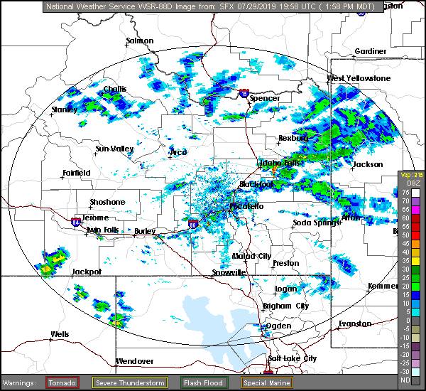
At 127PM, MT, Pocatello was reporting a temperature of 83 degrees with a brisk wind from the northeast, right down the Snake River Valley. There is a general area of showers in the higher terrain east of Idaho Falls contributing to the brisk winds, and any lightning that results from these showers will be particularly dangerous, as the region is tinder dry. A weak ridge over the Rockies is no match for the monsoon, which will continue to bring showers and storms to the Tetons, particularly in the afternoon for the next two days. Showers and storms aren’t likely to settle down into Pocatello, but similar to today, wind is likely to rush in and the fire threat probably won’t abate. Tomorrow – Partly cloudy and hot, High 95, Low 53 Wednesday – Mostly cloudy, High 96, Low 57
TWC: Tomorrow – Sunshine along with some cloudy intervals. High 94, low 57 Wednesday – A mix of clouds and sun early, then becoming cloudy later in the day. High 91, Low 61
AW: Tomorrow – Partly sunny; hot High 95, Low 58 Wednesday – Rather cloudy High 92, Low 59
NWS: Tomorrow – Sunny, High 93, low 61 Wednesday – Partly sunny, High 91, Low 61
WB: Tomorrow – Sunny, High 89, Low 57 Wednesday – Mostly sunny, High 88, Low 57
WN: Tomorrow – Mostly sunny, High 93, Low 60 Wednesday – Partly cloudy, High 91, Low 63
FIO: Tomorrow – Partly cloudy throughout the day. High 94, low 59 Wednesday – Mostly cloudy throughout the day. High 93, Low 62
Look at that range in high temperature forecasts! For a forecast with no rain involved, we can brand this as E for exciting. Here is a look at the radar, with those storms over the Tetons.
It is a hot and active time in the northern US right now. Where there are no storms, there is blistering heat, but where there are storms, the heat abates. What will we contend with? The heat? The storms? Certainly the humidity? The only way to know is to look into the future, as we forecast for this 4 1/2 day trip, which will cover 2,463 miles. We will collect 532 miles a day. at a modest 66.5mph
DAY ONE (Tuesday)
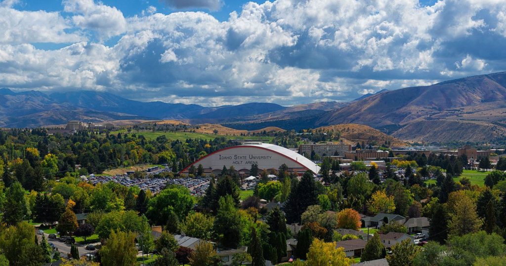
Pocatello, Idaho
DAY ONE (Thursday) While things have been a bit tumultuous this week, the biggest, baddest area of low pressure in the Plains is lifting towards Hudson Bay, as though it were a regular winter feature. This will provide a modicum of relieve for waterlogged farmers in the northern Plains, and a great deal of relief for anyone navigating the wilds of Idaho and Wyoming, as we will. There won’t be much to get in our way as we trek eastward, stopping in Egbert, Wyoming by night’s end.
DAY TWO (Friday) Flow over the mountains will continue to be westerly, and as it ever does, it will fill in the gap behind the previous system with another lee trough. It will be tapped of moisture, though, and will function only to accelerate the warm air from the Gulf to the Plains. Hot and stick in Nebraska, and western Iowa, where we will alight upon Wiota, west of Des Moines, for the night.
DAY THREE (Saturday) That advancing area of low pressure will start causing problems on our Saturday drive. The GFS, generally agreed to be more reliable in the longer term is indicating widespread precipitation from Iowa to Illinois and Indiana, though I suspect that is a resolution issue. Instead, it’s going to be hot and humid all day, with only a stray thunderstorm here or there. Granted, those storms will likely dump a lot of rain where ever they do show up, which will severely cramp our style. The drive will end in Howe, Indiana, off of the Indiana Toll Road. when we get there depends on how bound up a stray thunderstorm makes Chicago.
DAY FOUR (Sunday) That area of low pressure from earlier in the trip, the one that we noted would be headed towards Hudson Bay? Well, he’s still going to be there, just hanging out. This will lead to much of the eastern third of the country being active, though not in a terribly organized way. Scattered thunderstorms cropping up in the heat of the day, without any semblance of a plan. This will require us to be vigilant with the wipers from Howe to Syracuse, though there is a chance those showers start tapering off as we role into Syracuse for the night.
DAY FIVE (Monday) The mishmash of showery humid air will organize a bit to start next week. In New England and New York, this can be a bit more dangerous because of all the tree coverage. A bit of wind can block roadways for hours with the debris. don’t be surprised to see extra traffic through Albany and on to Massachusetts and southern New Hampshire.