Santa Barbara, California

Hello! We’re back with another forecast, and this time, we’re off to Santa Barbara on the California coast, upstream from Los Angeles. It’s a nice town, by all accounts. Will the weather be just as nice?

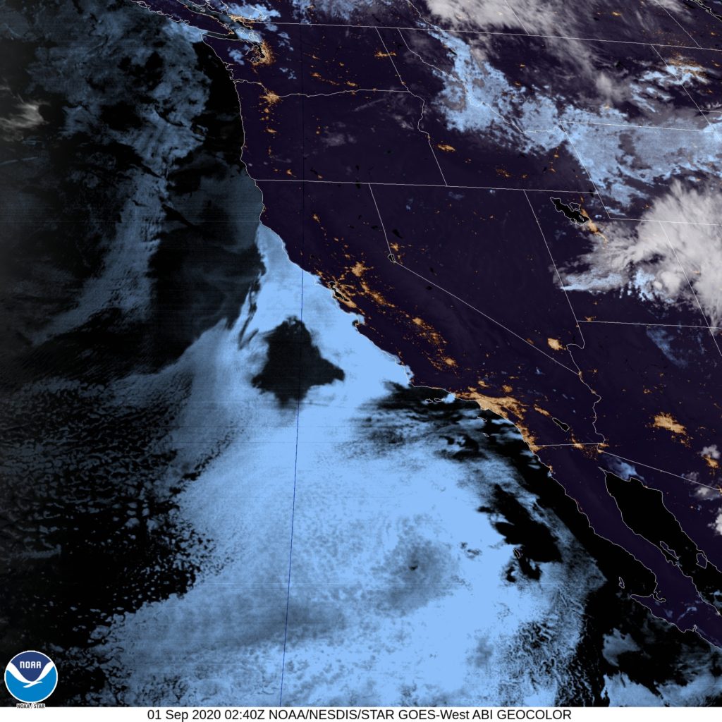
At 753PM, PT, Santa Barbara was reporting clear skies with an onshore breeze and a temperature of 62 degrees. It seems like a a prime night for fog and low clouds rolling in, leaving to a dreary morning. Indeed, satellite shows the marine layer settling in already from Lompoc to the Bay Area.
An area of low pressure inland is helping to drive the onshore flow, though that is expected to pivot eastward through the period which will leave the flow to more local forces. Not much change in pattern is expected along the coast in Santa Barbara.
Tomorrow – Morning clouds and fog, clearing by mid morning, then sunny, High 71, Low 57
Wednesday – Clouds and fog continue, but less than Tuesday, High 75, Low 56

TWC: Tomorrow – Some clouds in the morning will give way to mainly sunny skies for the afternoon. High 70, Low 58
Wednesday – Mainly sunny. High 73, Low 58

AW: Tomorrow – Mostly sunny and pleasant High 72, Low 57
Wednesday – Areas of low clouds early; otherwise, mostly sunny and nice High 72, Low 57

NWS: Tomorrow – Patchy fog before 11am. Otherwise, cloudy through mid morning, then gradual clearing, High 78, Low 62
Wednesday – Patchy fog before 11am. Otherwise, cloudy through mid morning, then gradual clearing, High 79, Low 62

WB: Tomorrow – Low clouds and fog in the morning, High 70, Low 59
Wednesday – Low clouds and fog in the morning, High 70, Low 59

WN: Tomorrow – Partly cloudy, High 74, Low 60
Wednesday – Partly cloudy, High 74, Low 60

FIO: Tomorrow – Clear throughout the day. High 71, Low 56
Wednesday – Clear throughout the day. High 75, Low 59

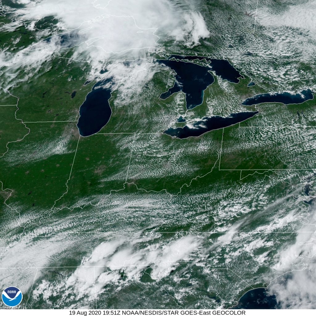
Look at the temperatures. Do you think the Weather Service knows something? Here is a look at the satellite showing the clouds creeping up the coast.
Rally!

The Weather Channel didn’t have a great August, but they had a very good showing in Wheeling. Temperatures were in the mid 80s, with a sprinkle of thunderstorm activity late last week in the West Virginia northern Panhandle. The Weather Channel captured the forecast almost perfectly, bucking their recent trends.
Actuals: August 20th, High 84, Low 53
August 21st, .04 inches of rain, High 85, Low 61

Grade: A-C

Louisville, Kentucky

Louisville, Kentucky, is one of the first places I ever went on a road trip to just for the sake of having done it. It holds a place in my heart, I guess is what I’m saying.

At 328PM, ET, Louisville was reporting a temperature of 88 degrees with fair skies. The dew points were in the low 70s, but as near as Bloomington, Indiana, the dew point was 10 degrees cooler. A strong early autumnal system which has absorbed the remnants of Laura is presently forcing a cold front through Kentucky. A line of thunderstorms lay through southern Kentucky, while the back edge of clouds is in the south Louisville metro, and the change in airmass is just north of the Ohio. Continued improvement is expected for Louisville today.
The jet structure still remains in Canada, and so the refreshment behind this cold front isn’t likely to last long. A surface perturbation is forecast to move from the western Gulf Coast to the east north east Sunday night, bringing rain to the area through early Monday afternoon. Some thunder is possible on Sunday night, with a dreary morning on Monday, though it should clear up later in the day.
Tomorrow – Late showers and thunderstorms, High 83, Low 63
Monday – Cloudy with some early sprinkles, High 80, Low 66

TWC: Tomorrow – Considerable cloudiness. (Evening rain) High 80, Low 64
Monday – Rain showers early with some sunshine later in the day. High 82, Low 66

AW: Tomorrow – Partly sunny, evening storms, High 79, Low 64
Monday – Mostly cloudy and humid with widely separated thunderstorms High 81, Low 65

NWS: Tomorrow – A 30 percent chance of showers and thunderstorms after 3pm. Partly sunny, High 80, Low 63
Monday – Showers and thunderstorms likely, mainly before 9am. Mostly cloudy, High 82, Low 66

WB: Tomorrow – Partly cloudy with a 30% chance of showers and thunderstorms, High 78, Low 69
Monday – Mostly cloudy with a 40% chance of showers and thunderstorms, High 79, Low 70

WN: Tomorrow – Partly cloudy with scattered storms, High 80, Low 65
Monday – Partly cloudy with thunderstorms likely, High 82, Low 66

FIO: Tomorrow – Mostly cloudy throughout the day. High 81, Low 63
Monday – Rain overnight and in the morning. High 83, Low 65

We’re all hovering in the low 80s for the next couple of days, but I’m going in a different direction, I guess. Make sure to take a look at what WAVE-NBC’s meteorologists have to say, and then check out the radar on their site for a pretty discernible line of storms in the southern part of the state.

Laudable forecasts

Another summer, and another scary hurricane has made landfall somewhere in North America. Laura, while a strong storm and having made landfall in the US may not be as well remembered as storms like Michael, Maria, Dorian or Harvey for a variety of factors. Those factors are, of course, Covid-19, Civil unrest and the virtuous fight for social justice and racial equality, and the ongoing Republican National Convention. Laura was, depending on your home market, not even in the top three news stories of the day.

It’s too bad for a variety of reasons, not the least of which is that it turns attention away from those residents who were greatly impacted by this storm, particularly in Cameron and Lake Charles, Louisiana, but also because the forecasts were so good, and apparently so well heeded, the death toll is not as large as one might suspect from a strong storm striking the US Mainland.

in a time when science is so heavily scrutinized, it is important to remind the populace that we usually get it right, and the recommendations for safety and well being are rooted in good intentions and factual assessment. That, and the pain that Laura has brought (even through it came with a lower casualty total) will likely fly under the radar, so to speak

Another excellent forecast that came up in the last couple of weeks was the one for Durham, which was posted here about two weeks ago. Victoria-Weather and the National Weather Service collected the top forecasts thanks to solid temperature outlooks, despite heavy rain that was going to fall in the area.

Actuals: August 14th, .63 inches of rain, High 88, Low 73
August 15th, 1.37 inches of rain, High 84, Low 72

Grade: A-B

Bay City, Michigan

We’re going to take a trip up to the Great Lakes at just the time of year that the Great Lakes are the most pleasant.

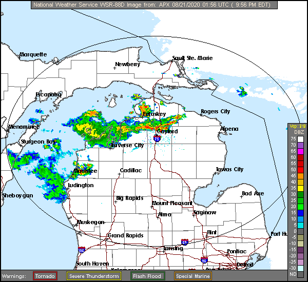
At 953PM, ET, Bay City was reporting clear skies and a temperature of 72 degrees. A weak cold front moving across the Mackinac Strait, with a line of thunderstorms north of and heading for Gaylord. A weak upper level trough has sagged into northern Michigan with the cold front, but as the surface low associated with it continues off towards northern Quebec, the boundary will stall.
The proximity of the boundary will mean a threat for an afternoon thunderstorm in Bay City, however it is more likely that the wet weather will stay north of of Saginaw Bay. A lower level feature in the Upper Midwest will redirect flow and press rain and storms back northward out of Lower Michigan. Saturday will be clearer, albeit warmer and muggier.
Tomorrow – Partly cloudy, High 85, Low 64
Saturday – Sunny, High 88, Low 62

TWC: Tomorrow – Partly cloudy skies. High 87, Low 62
Saturday – Partly cloudy skies. High 88, Low 60

AW: Tomorrow – Mostly sunny and warm High 87, Low 62
Saturday – Mostly sunny and very warm High 88,Low 60

NWS: Tomorrow – Mostly sunny High 85, Low 64
Saturday – Sunny High 88, Low 62

WB: Tomorrow – Partly cloudy then clearing, High 87, Low 62
Saturday – Mostly sunny, High 87, Low 63

WN: Tomorrow – Partly cloudy, High 86, Low 64
Saturday – Mostly sunny, High 88, Low 61

FIO: Tomorrow – Clear throughout the day. High 87, Low 61
Saturday – Partly cloudy throughout the day. High 86, Low 61

The radar looks perhaps a bit more ominous than it actually is. That is especially the case for the southern end of this image, which is where Bay City lies.

Wheeling, West Virginia

It took quite a bit of cartographic gymnastics to come up with the borders of West Virginia. Wheeling is in the northern Panhandle of the state, along the mighty Ohio River.

At 353PM, ET, Wheeling was reporting a temperature of 78 degrees with clear skies and a light north wind. There was some scattered stratocumulus bracketing northern West Virginia, while lazy low pressure existed on the coastal side of the Appalachians. Some taller clouds were popping up in the mountains, but high pressure will remain in place over the eastern Great Lakes through tomorrow.
An upper level trough will start to foment surface troughing, originating around the Mississippi Delta and building northeast to the Blue Ridge Mountains. Circulation and organization will be weak, but given the ripe environment, there will be showers and storms on the southern horizon. Wheeling should be far enough north to evade wet weather, but expect an increase of clouds in the afternoon.
Tomorrow – Sunny, High 86, Low 55
Friday – Increasing clouds, High 87, Low 59

TWC: Tomorrow – Sunshine and some clouds. High 84, Low 52
Friday – More clouds than sun. A stray shower or thunderstorm is possible. High 86, Low 61

AW: Tomorrow – Beautiful with sun and areas of high clouds High 84, Low 55
Friday – Variable cloudiness with a thunderstorm High 81, Low 64

NWS: Tomorrow – Sunny, High 87, Low 55
Friday – A slight chance of showers after 2pm. Partly sunny, High 89, Low 63

WB: Tomorrow – Sunny, High 85, Low 55
Friday – Partly sunny. A slight chance of showers in the afternoon. High 86, Low 63

WN: Mostly sunny High 87, Low 55
Friday – Partly cloudy with isolated showers, High 89, Low 63

FIO: Tomorrow – Clear throughout the day. High 86, Low 54
Friday – Mostly cloudy throughout the day. High 88, Low 62

Accuweather is taking a different path, aren’t they? I’m not sold on thunderstorms, and on a nice clear day like today, how could you even THINK about bad weather?

A delayed heat wave

Every knows that now, it is very hot out west. This hasn’t been the case all summer on the west coast, as it seems as though it has been recently during every summer, and even this month, it took at least an extra day in Napa. We though the warm up would start on the 7th, but instead, wind came off the Pacific and temperatures dropped a few degrees, which was certainly not the expectation. Fortunately, these changes in California don’t necessarily sink forecasts, so most of us won’t be totally embarrassed by this verification. A trio, Victoria-Weather, Weatherbug and WeatherNation all get to stake a claim to the victory.
Actuals: August 6th – High 80, Low 60
August 7th, High 77, Low 59

Grade: C-D

Cumberland, Maryland to Durham, North Carolina

After so many lengthy road trips lately, here is a refreshing change. This trip will take the better part of day, about 6 hours, and cover 385 miles. We will pass through the DC Metro and start our day in the mountains, so our pace of 66.5mph is actually pretty good.

Cumberland, Maryland

The mid-Atlantic is at the mercy of a pair of systems that are about a thousand miles apart. The first is a developing area of low pressure off the coast of Chesapeake Bay, and the second is wafting through Hudson Bay. The Hudson Bay feature is dragging a pretty effective cold front, given its length, through the Great Lakes and will press towards the Appalachians by tomorrow afternoon. It won’t be particularly active though, given the offshore feature’s presence, but it will be come increasingly cloudy as it departs. The initial part of the route through DC will be mostly cloudy, with some light rain to South Hill, Virginia, which will become more likely from there to Durham.

Durham, North Carolina

Durham, North Carolina

Time to get this forecast wagon hitched and on the road!

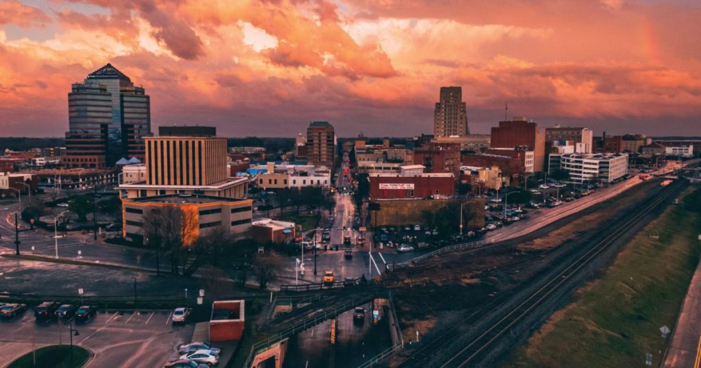
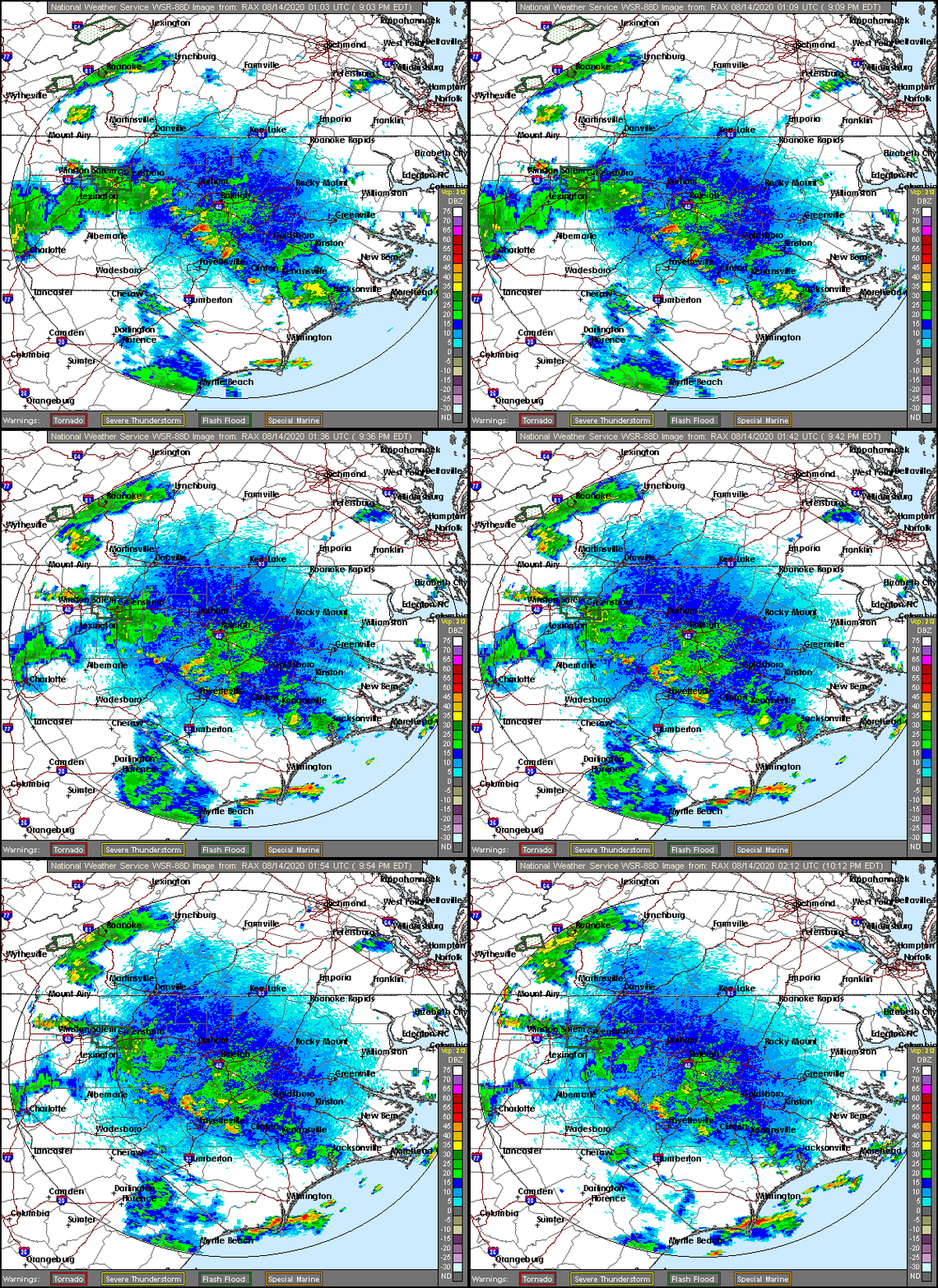
At 953PM, ET, Durham was reporting a temperature of 73 degrees with clear skies. There was a line of very weak thunderstorms extending from north of Fayetteville to south of Mount Airy, but it was continuing to diminish for the night. A lower level trough over the mid-Atlantic is churning up a few showers and thunderstorms throughout the area, and the persistence is leading to the threat of flash flooding where the storms sit in place, but it is clear and humid where they are not.
The low level wave will shift off shore and low pressure will deepen rapidly in the Gulfstream, The deepening low pressure will extend west to the coast, with moisture building into the Carolinas again on Saturday. Before that, a little bit of dry air will dig in thanks to the circulation of the deepening low, but the beginning of the weekend might be a bit drearier.
Tomorrow – Partly cloudy with late showers and storms, High 88, Low 73
Saturday – Scattered showers and storms, High 85, Low 73

TWC: Tomorrow – Mostly cloudy in the morning with scattered thunderstorms developing later in the day. High 86, Low 71
Saturday – Thunderstorms. Potential for heavy rainfall. High 82, Low 72

AW: Tomorrow – Mostly cloudy with a couple of showers and a heavy t-storm, mainly later; watch for flash flooding High 86, Low 71
Saturday – Mostly cloudy and humid with a couple of showers and a thunderstorm around, some can be heavy late High 84, Low 72

NWS: Tomorrow – Showers and thunderstorms likely, mainly after 3pm. Mostly cloudy, High 88, Low 72
Saturday – Showers and thunderstorms, mainly after 8am High 85, Low 72

WB: Tomorrow – Cloudy with a slight chance of showers and thunderstorms in the morning then partly sunny with showers and thunderstorms likely in the afternoon, High 84, Low 72
Saturday – Showers and thunderstorms, High 81, Low 72

WN: Tomorrow – Mostly cloudy with thunderstorms likely, High 88, Low 72
Saturday – Mostly cloudy with thunderstorms, High 86, Low 72

FIO: Tomorrow – Possible light rain and humid throughout the day. High 86, Low 71
Saturday – Rain and humid throughout the day. High 83, Low 72

Interestingly enough, we just started watching the Last Dance tonight, and here we are, forecasting for Durham. Maybe not that interesting. Anyways, here is a look at the radar, showing those isolated storms. There is a lot of ground clutter that is making it look worse than is true on the ground.