
We’re going to take a trip up to the Great Lakes at just the time of year that the Great Lakes are the most pleasant.
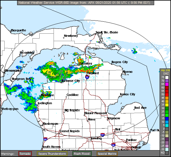
At 953PM, ET, Bay City was reporting clear skies and a temperature of 72 degrees. A weak cold front moving across the Mackinac Strait, with a line of thunderstorms north of and heading for Gaylord. A weak upper level trough has sagged into northern Michigan with the cold front, but as the surface low associated with it continues off towards northern Quebec, the boundary will stall.
The proximity of the boundary will mean a threat for an afternoon thunderstorm in Bay City, however it is more likely that the wet weather will stay north of of Saginaw Bay. A lower level feature in the Upper Midwest will redirect flow and press rain and storms back northward out of Lower Michigan. Saturday will be clearer, albeit warmer and muggier.
Tomorrow – Partly cloudy, High 85, Low 64
Saturday – Sunny, High 88, Low 62
TWC: Tomorrow – Partly cloudy skies. High 87, Low 62
Saturday – Partly cloudy skies. High 88, Low 60
AW: Tomorrow – Mostly sunny and warm High 87, Low 62
Saturday – Mostly sunny and very warm High 88,Low 60
NWS: Tomorrow – Mostly sunny High 85, Low 64
Saturday – Sunny High 88, Low 62
WB: Tomorrow – Partly cloudy then clearing, High 87, Low 62
Saturday – Mostly sunny, High 87, Low 63
WN: Tomorrow – Partly cloudy, High 86, Low 64
Saturday – Mostly sunny, High 88, Low 61
FIO: Tomorrow – Clear throughout the day. High 87, Low 61
Saturday – Partly cloudy throughout the day. High 86, Low 61
The radar looks perhaps a bit more ominous than it actually is. That is especially the case for the southern end of this image, which is where Bay City lies.
Comment (1)