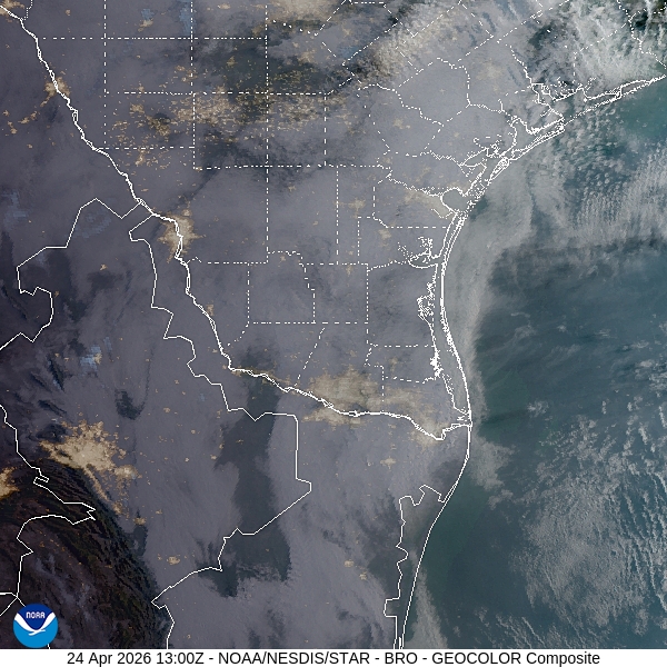
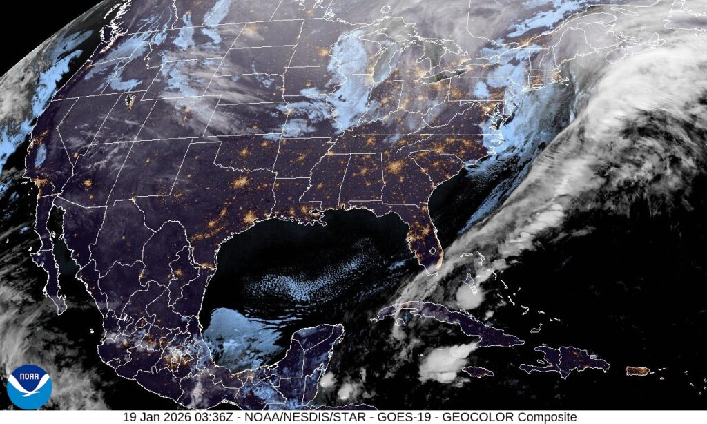
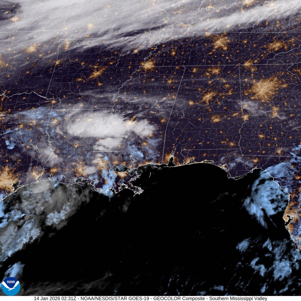
Springfield, Illinois
Off to the farmland outpost and capital of Illinois for today's forecast. I just passed through Springfield for the first time ever a couple weeks ago. It was very nice.
At 1251PM, CT, Springfield was reporting a temperature of 30 degrees with a fairly steady east wind. There was a hole within a broad swath of overcast over the Midwest, and Springfield was enjoying some sunshine and warmer temperatures compared to sites even just to the west near the Mississippi River.
Sharp upper level troughing through the Rockies is leading to an intense amplification of a lee side trough along the Front Range. This is indicative of the system preparing to emerge from the highlands into the Mid Mississippi valley. The first impact for Springfield will be a warm up, thanks to southerly flow, and a few clouds. The heaviest rain and thunderstorm activity will develop over and just east of Springfield on Monday morning, followed by a cool, northwesterly wind. Don't be surprised if there are a few spots of drizzle Sunday evening before the real show starts on Monday.
Tomorrow - Increasing clouds, warm with some light rain late. High 44, Low 24
Monday - Some rain early, then clearing and colder, High 40, Low 31
TWC: Tomorrow - Cloudy skies with a few showers later in the day High 43, Low 24
Monday - Considerably cloudy (rain/snow before sunrise) High 38, Low 34
AW: Tomorrow - Breezy and milder with some sun, then increasing clouds, evening shower, High 45, Low 28
Monday - Breezy with partial sunshine High 40, Low 27
NWS: Tomorrow - A 20 percent chance of rain after noon. Mostly cloudy High 47, Low 25
Monday - Partly sunny, (showers before sunrise) High 41, Low 32
WB: Tomorrow - Mostly cloudy. A 20 percent chance of rain in the afternoon. High 47, Low 25
Monday - Partly sunny (predawn rain/snow) High 41, Low 34
We are in a very active pattern right now, and as Springfield's forecast indicates, the weather will be changing quickly from day to day. Satellite shows the Illinois capital in a clear window.

Brownsville, Texas
Off to very far south Texas. Funny, because that is exactly where the weather is not.
At 420PM, CT, Brownsville was reporting a temperature of 75 degrees. There were clouds streaming across the Rio Grande Valley from the Gulf of Mexico darkening the sky, but there wasn't a threat for major synoptic development for the region.
Developing low pressure will generate a return flow, drawing moisture northeast away from Brownsville. Rain may actually develop with convergence, but it would happen over the Gulf, with much dryer air finding it's way into Brownsville.
Tomorrow - Mostly cloudy, High 79, Low 65
Saturday - Partly cloudy, High 79, Low 66
TWC: Tomorrow - Cloudy skies early, followed by partial clearing. High 81, Low 65
Saturday - Mostly cloudy skies High 83, Low 67
AW: Tomorrow - Patchy fog in the morning; otherwise, breezy and warm with clouds breaking for some sun High 79, Low 64
Saturday - Clouds giving way to some sun High 80, Low 64
NWS: Tomorrow - Areas of fog before 9am. Otherwise, partly sunny High 82, Low 64
Saturday - Mostly sunny, High 78, Low 66
WB: Tomorrow - Mostly cloudy. Areas of fog in the morning High 82, Low 64
Saturday - Mostly cloudy in the morning then clearing High 81, Low 66
Not bad, eh? Especially for people expecting to get a foot of snow in northern Iowa tomorrow. Satellite shows some clouds over the Rio Grande Valley.

Clear skies win the day
Those mountains can be pesky, that's for sure, but one thing rings true no matter where you are. If you have clear, dry air, the temperatures will fluctuate. So it was in Prescott, where temperatures hit peaks warmer than anyone though, and dipped cooler than all but one low temperature forecast. The extreme forecasters ended up with the top spots, as you might imagine. The National Weather Service was the most XTREME and thereby the most successful.
Actuals: Tuesday - High 52, Low 25
Wednesday - High 57, Low 23
Grade: B
In Chico, we’re the man
When you think of California, unless you are thinking of maybe Tahoe, you don't often think of sub-freezing temperatures, but this was the case in Chico the past two days. Yesterday, the morning dipped all the way down to 19. The more incredulous forecasters, those who kept forecast lows a bit to warm, ended up way off, whereas Anthony's forecast was spot on.
Actuals: Monday - High 48, Low 26
Tuesday - High 48, Low 19
Grade: B
Prescott, Arizona
I always seem to get forecasts for west of the Continental Divide. Good thing I lived out that way, right?
At 753pm MST, the temperature in Prescott, Arizona was 40 degrees under partly cloudy skies. Earlier on Monday, a system moved through the Four Corners region, bringing higher elevation snows to portions of Utah and Colorado, and rain showers to lower areas in Arizona and New Mexico. Luckily, the system has moved on into the Central US and high pressure is building over the Desert Southwest. On Wednesday, another powerful system will bully its way into the Pacific Northwest bringing some possibly historic snowfall to the Seattle area. However, the high pressure will keep all of this activity well to the north of Arizona, so it will be another bright and sunny day for the fine residents of Prescott. Enjoy!
Tuesday: Sunny. High 49, Low 28.
Wednesday: Continued sunny. High 55, Low 25.
TWC: Tuesday: Sunny. High 48, Low 28.
Wednesday: Mostly sunny. High 53, Low 26.
AW: Tuesday: Plenty of sun, but chilly. High 50, Low 26.
Wednesday: Plenty of sun. High 55, Low 26.
NWS: Tuesday: Patchy fog, then sunny. High 50, Low 24.
Wednesday: Sunny. High 56, Low 25.
WB: Tuesday: Mostly sunny. High 50, Low 26.
Wednesday: Mostly sunny. High 54, Low 25.
Parts of northeast AZ just have some high clouds, while the bulk of the system from earlier is seen way in the upper right corner of the image as it shifts into the Plains. Not much else going on in the area otherwise!

Chico, California
Off we go to California's Central Valley! Surely this Golden State getaway will bring warm temps and sunny skies right?... right?!
At 7:15pm PST, the temperature at Chico, CA was 43 degrees under fair skies. A cold front has dropped through Northern California earlier today, and with a broad trough moving over the Western US, temperatures are expected to be on the chilly side for the next couple of mornings. In fact, a Hard Freeze Watch is in effect for Monday night into Tuesday morning as temperatures are expected to drop into the low to mid 20's. Precipitation was pretty much absent as the system moved through and only a few high clouds remained, predominately over the Sierra Nevada. Temperatures will rebound nicely into the upper 40s each of the next couple of days, well, nicely for people living in colder portions of the country. I'm sure the residents of Chico aren't big fans of having to scrape off their windshields before they go to work.
Monday: Sunny. High 48, Low 28.
Tuesday: Sunny. High 47, Low 22.
TWC: Monday: Sunny. High 50, Low 26.
Tuesday: Mostly sunny. High 50, Low 22.
AW: Monday: Intervals of clouds and sun. High 49, Low 30.
Tuesday: Partly cloudy. High 49, Low 27.
NWS: Monday: Mostly sunny, morning frost. High 47, Low 28.
Tuesday: Mostly sunny, another frosty morning. High 47, Low 23.
WB: Monday: Mostly sunny. High 50, Low 29.
Tuesday: Partly cloudy. High 50, Low 26.
Here we see some high clouds off to the east of Chico, but much of the rest of the region is fairly cloudy free, esp the Central Valley. Wear an extra layer next couple of mornings!

Frigid Friday
As the trough descended upon Pittsburgh, temperatures dropped overnight and kept on going throughout the day on Friday. Not much of a fun surprise for people kicking off their Friday the 13th weekend plans, but alas, that's Winter for ya! A couple of inches coated the city by the time Saturday rolled around, but precip changed over from rain to snow at 11:27pm Thursday night, which ultimately let VW to a win!
Thursday: 0.63" of precip mainly as rain, also a trace of snow. High 46, Low 33.
Friday: 1.7" of snow (0.18" liquid equivalent). High 33, Low 16.
Forecast Grade: B
60s in January
About a week and a half ago, I put together a forecast for Athens, Georgia, while I myself was actually IN Georgia. I can tell you from experience, it was unnecessarily cold on the morning of the 4th. The fountain in front of my hotel was frozen. In Athens, the low on the 4th was 19. That said, the very next day, warm air came a-chargin' and they hit 61 degrees. Not bad. The Weather Channel had the top forecast.
Actuals: January 4th, High 51, Low 19
January 5th, High 61, Low 32
Grade: B
Your typical January warm up
It's been a while since our last verification, and thus, we get to take a look at a forecast for Rogers, Arkansas that I put together, valid for the 3rd and 4th. If you recall, the country was undergoing an unseasonable warm up, something that even included the low temperatures despite a lot sun angle with clear skies at night. Just what you expect in the dead of winter. I didn't transcribe the forecast low on the 4th for The Weather Channel, for some reason, so this isn't going to count towards anything, but Accuweather had the top forecast of those that I correctly transcribed, by a wide margin.
Actuals: January 3rd: High 48, Low 21
January 4th: High 55, Low 35
Grade: A
Pittsburgh, Pennsylvania
Haha! Back! We are resuming where we left off, just a week later. Off to western PA!
At 1051PM, ET, Pittsburgh was reporting a temperature of 41, with cloudy skies. Rain is widespread across the region, as it is across most of the east, as a deep trough is pulling a rainy low northeast along the Appalachians. As the system moves north, it is pulling warm air with it, as another, superficially weaker system is actually fostering a true Arctic front, and the stronger low over Pittsburgh is in it's warm sector.
The upper troughs will merge overnight tonight and the surface systems will become indistinguishable. Cold air will move into the area tomorrow late in the evening. Through that time, scattered showers and heavier rain will persist. The change to snow will come late tomorrow, and should be seamless, as in there will be no freezing rain. Snow will continue through the day on Friday as well as the trough dominates the country, and cold air invades the region. Temperatures will be warm enough that snow will be very wet, limiting accumulations, but definitely not preventing them.
Tomorrow - Rain changes to snow before midnight, High 45, Low 31
Friday - Snow, High 32, Low 21
TWC: Tomorrow - A few showers early with overcast skies later in the day (mix late). High 48, Low 33
Friday - Windy with occasional snow showers. High 33, Low 25
AW: Tomorrow - Mostly cloudy with a couple of showers (rain and snow) High 50, Low 18
Friday - Very windy; cloudy and much colder with snow showers, accumulating up to an additional inch High 25, Low 18
NWS: Tomorrow - Showers likely, mainly before 7am. Cloudy (snow after 10) High 48, Low 36
Friday - Snow showers likely, mainly before 2pm. Cloudy, High 36, Low 19
WB: Tomorrow - Cloudy. Showers likely...mainly in the morning (snow after 10). High 47, Low 30
Friday - Snow showers likely. Additional snow accumulation possible. Brisk and much cooler.High 30, Low 22
Accuweather is strange tonight. Really calling for some temperature swings with this forecast that probably won't bear out, given the clouds. Here is the active radar, with the heaviest rain east of Pittsburgh.
