This is a cool trip, with a route through the mountains. lasting three days and covering 1,671 miles. That breaks down to about 66.8mph, and two days of 534.7 miles, with a longer day at the end. It’s going to be pretty scenic, I think!
DAY ONE (Monday)

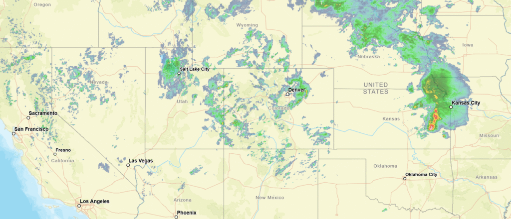
As you may have heard, there is severe weather in the Plains tonight. It will be more widespread and significant tomorrow as the low shifts to the Mississippi Valley. A cold front is expected to dangle off the southwestern flank of the feature, with strong thunderstorms possible. There is significant disagreement in the models as to whether storms will fire along this front as far west as our route, but if they do intercept, it will be around Eden, Texas. We won’t escape the state by the end of the day, rounding out the day in Forsan, near Big Springs.
DAY TWO (Tuesday)
The drive on Tuesday will be through the back roads of west Texas and New Mexico, including a pretty good cross section of Albuquerque. The big area of low pressure will be transitioning well away from the middle of the country by midweek, so the drive will ultimately be partly cloudy, with a bunch of scenery to enjoy. We’ll reach Counselor, New Mexico, halfway to Farmington.
DAY THREE (Wednesday)
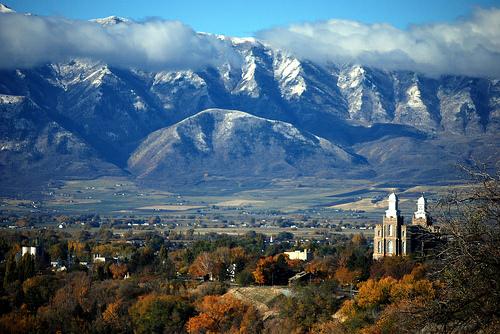
Soak this day in. We’re going to trek through some of the most beautiful country the nation has to offer. We’ll run past several national parks, Moab and other tracts that aren’t federally protected, but still attractive. The weather will cooperate, with overcast coming back into the picture between Salt Lake and Logan. It will be one of the more exemplary drives we’ve taken, and the weather will generally be pretty great, too.