Our first forecast of May was for Alabama. Anniston was awaiting a boundary with showers and thunderstorms. Unfortunately for some temperature forecasts (i.e. the warm ones), clouds preceded the thunderstorms and kept temperatures on the 6th from reaching their maximum potential. Fortunately, this did suppress the severe threat in northern Alabama, which mean Anniston got a good soaking, but avoided the nastiest of it. Accuweather had the forecast of the day, nailing the temperatures on the 7th. Actuals: May 6th, 1.18″ of rain and thunderstorms, High 77, Low 61 May 7th, .18″ of rain, High 71, Low 56
Our forecast this evening will take us to the South. It’s been cool this May. Does that apply to Alabama?
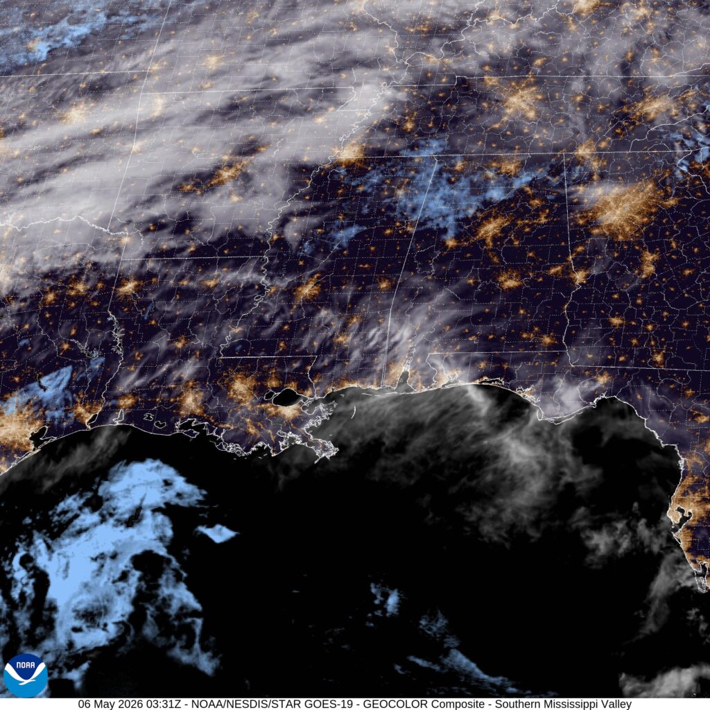
At 953PM, CT, Anniston was reporting fair skies with a temperature of 67 degrees. The area lay southeast of a cold front sliding listlessly through the Mississippi Valley, which accounted for a southerly flow in the region. The boundary will be reenergized by the daylight tomorrow. The boundary will arrive in Alabama tomorrow, with showers and thunderstorms likely. There is some disagreement on the timing for Anniston, but no doubt that the storm chances are high. The batch of energy will slow down, with clouds and rain hanging on through mid-morning, followed by a much cooler day on Thursday. Tomorrow – Afternoon rain and thunder High 81, Low 64 Thursday – Rain early, then clearing and colder High 73, Low 55
TWC: Tomorrow – Cloudy in the morning then strong thunderstorms developing later in the day. Damaging winds, large hail and possibly a tornado with some storms. High 77, Low 64 Thursday – Cloudy early with partial sunshine expected late. Cooler. High 72, Low 57
AW: Tomorrow – Mostly cloudy and humid; an afternoon thunderstorm High 75, Low 63 Thursday – A brief morning shower or two; otherwise, cloudy High 71, Low 56
NWS: Tomorrow – A slight chance of showers before 10am, then a slight chance of showers and thunderstorms between 10am and 1pm, then showers likely and possibly a thunderstorm after 1pm. Mostly cloudy, High 82, Low 63 Thursday – Showers likely and possibly a thunderstorm before 1pm, then a chance of showers. Mostly cloudy, High 75, Low 59
WB: Tomorrow – Mostly cloudy. A slight chance of showers and thunderstorms in the morning then showers likely with a chance of thunderstorms in the afternoon. High 80, Low 69 Thursday – Showers likely with a chance of thunderstorms in the morning then partly sunny with a chance of showers in the afternoon. High 71, Low 56
WN: Tomorrow – Mostly cloudy with showers and a chance of storms High 82, Low 63 Thursday – Mostly cloudy with showers and a chance of storms High 75, Low 60
CLI: Tomorrow – Thunderstorm High 80, Low 63 Thursday – Light rain showers High 74, Low 55
There is an enhanced risk for severe storms in central Alabama tomorrow with this boundary. The front is pretty sloppy tonight, and things are clear in Anniston.
It’s time for another road trip. We’re just going to take one day to head from Alabama to Missouri, crossing the Mississippi River and trying to dodge rain drops. It’s a 659 mile journey that we will cover at a pace of about 64.3mph, which is slowed by Memphis and not spending as much time as we would like on arterial interstates.
Anniston, Alabama
High pressure will be in retreat over the southern US, but it will still be comfortably in place in northern Alabama and Mississippi tomorrow. Dry skies with mostly sunny conditions will guide us through Birmingham and Tupelo, but an organizing system in Louisiana will start to kick some clouds north by the time we reach Memphis. Don’t be surprised if there are a few spits of rain starting around Hardy, Arkansas, which may linger the rest of the way through the Missouri Ozarks. North of the highest terrain, from Springfield to Joplin, it should be a bit drier, but the chances for rain are certainly not going to be zero.
The verification for Anniston was interesting. There was no rain to be seen anywhere, but an area of clouds last Wednesday parked itself over town just before noon. Not only did it stop diurnal heating, but a batch of cold air rushed in underneath it and made sure highs never reached the 50s. There was a cold front that showed up to the north of Anniston, but the rain never filtered down to Alabama, thanks to the effects of a cold front over the central Gulf preventing much moisture from reaching the Southeast. So it was a strong cold front, stronger than we anticipated, but with nothing to show for it. The combined forces of Accuweather and Weatherbug tied for the top forecast. Actuals: April 20th, High 76, Low 46 April 21st, High 55, Low 40
All right, everyone, we’ve got a road trip coming. The drive from Anniston to San Antonio will cover a day and a half and 923 miles. We’ll net around 542 miles on our full day at a pace of about 67.8mph, and having a big day of Texas driving to finish things off.
DAY ONE (Wednesday)
Anniston, Alabama
Things are looking pretty good for the southeast, thanks to a boundary implanted in the southern Gulf. Precipitation won’t be able to filter south as far as Anniston, or really any part of our route. It will be uncharacteristically cool in Alabama or Mississippi, and you will probably find people in Egan, Louisiana, the destination for Wednesday night, in layers when we arrive.
DAY TWO (Thursday) Surface high pressure is going to drift further to the east on Thursday, and for the first time this season, as far as I remember, a moisture rich return flow will follow the west end of the ridge. Some showers and low clouds will drift into central Texas fairly early in the day. Most noticeably when we step out in San Antonio, the humidity will have arrived.
Alabama has certainly seen it’s share of terrible weather this spring. I suspect our forecast through the middle of this week will be a bit less intimidating.
At 1153AM, CT, Anniston was reporting clear skies and a temperature of 67 degrees. While temperatures were warm, dew points sat merely in the low to mid 40s, so it wasn’t exactly summerlike northeast of Birmingham. A strong jet lay south of the Gulf Coast, keeping any frontal activity well offshore, and providing for a pleasant, subsident air mass, which is also working to stave off other inclement weather from the north. A trough in the northern High Plains will drive southeastward, carrying with it a less active cold front than would be expected, given it’s strength. The front will pass without incident on Wednesday in the early evening, save for a switch in the wind direction. Tomorrow – Sunny, High 77, Low 46 Wednesday – Increasing clouds, High 64, Low 43
TWC: Tomorrow – Sun and a few passing clouds. High 75, Low 48 Wednesday – Partly cloudy skies. High 60, Low 47
AW: Tomorrow – Partly sunny High 76, Low 47 Wednesday – Sunny to partly cloudy and cooler High 60, Low 45
NWS: Tomorrow – Mostly cloudy, then gradually becoming sunny, High 76, Low 49 Wednesday – Sunny High 63, Low 44
WB: Tomorrow – Partly cloudy, High 75, Low 46 Wednesday – Cooler, Partly cloudy in the morning then clearing. High 60, Low 45
WN: Tomorrow – Partly cloudy, High 79, Low 47 Wednesday – Mostly sunny, High 63, Low 46
FIO: Tomorrow – Mostly cloudy throughout the day. High 76, Low 50 Wednesday – Partly cloudy throughout the day. High 61, Low 44
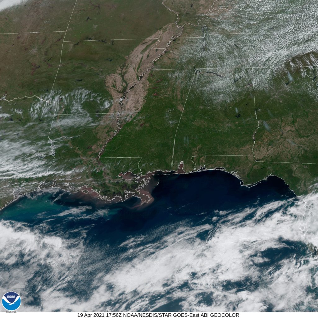
That change in wind will, I guess, bring cooler temperatures. Don’t be surprised if Wednesday highs are higher than forecast here. It won’t be colder, though. Check out this beautifully clear satellite image of Alabama.
Today we head down south to see what’s in store for the weekend in Annison, AL! This weekend marks the 8th anniversary of the 2011 Super Outbreak, will they have a quiet weekend to reflect, or will they have to keep their eyes on the sky once again?
At 1053pm CDT, the temperature at Anniston, AL was 54 degrees under fair skies. High pressure is sitting over the Deep South, and should keep an area of low pressure off to the north (which will bring snow to MN/WI/IL) so beautiful weather is in store for Saturday! The tail end of the cold front associated with the aforementioned low pressure system sags into the Deep South for Sunday. While mostly cloudy skies are expected for much of the day, only a couple of isolated showers will push far enough south to threaten the Anniston area. If anything does impact the area, it should be short lived. Overall, a very nice weekend is in store, scores better than that fateful day in 2011.
Saturday: Sunny and beautiful. High 79, Low 46.
Sunday: An isolated afternoon shower possible. High 78, Low 53.
TWC: Saturday: Mostly sunny. High 78, Low 45.
Sunday: Isolated thunderstorms. High 78, Low 56.
AW: Saturday: Plenty of sun; beautiful. High 77, Low 43.
Sunday: A passing morning shower. high 78, Low 55.
NWS: Saturday: Sunny. High 78, Low 48.
Sunday: Slight chance of afternoon thunderstorms. High 80, Low 56.
WB: Saturday: Sunny. High 77, Low 45.
Sunday: Partly cloudy. High 77, Low 56.
WN: Saturday: Sunny. High 78, Low 48.
Sunday: Partly cloudy with isolated storms. High 80, Low 56.
FIO: Saturday: Partly cloudy starting in the evening. High 78, Low 47.
Sunday: Partly cloudy until night. High 77, Low 57.
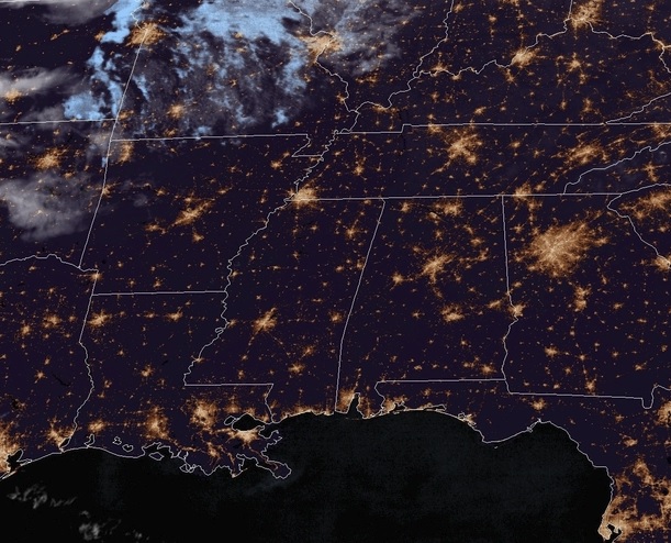
It’s a fairly clear night across the region, and looks to be that way for much of the weekend!