Our forecast for Brownsville was for hot, humid days over the weekend, which was expected to lead to some morning fog, especially on the coast. Brownsville is further inland, but even there, the atmospheric moisture was so thick that the condensate was registered as .01″ of precipitation on Saturday. It was still plenty hot and plenty humid in the afternoon when the fog was burned off. There was a three way tie among our most unexpected trio: WeatherNation, WeatherBug and Clime. Actuals: Saturday: .01″ of precipitation, High 88, Low 75 Sunday – High 90, Low 78
This is a cool trip, with a route through the mountains. lasting three days and covering 1,671 miles. That breaks down to about 66.8mph, and two days of 534.7 miles, with a longer day at the end. It’s going to be pretty scenic, I think!
DAY ONE (Monday)
Brownsville, Texas
As you may have heard, there is severe weather in the Plains tonight. It will be more widespread and significant tomorrow as the low shifts to the Mississippi Valley. A cold front is expected to dangle off the southwestern flank of the feature, with strong thunderstorms possible. There is significant disagreement in the models as to whether storms will fire along this front as far west as our route, but if they do intercept, it will be around Eden, Texas. We won’t escape the state by the end of the day, rounding out the day in Forsan, near Big Springs.
DAY TWO (Tuesday) The drive on Tuesday will be through the back roads of west Texas and New Mexico, including a pretty good cross section of Albuquerque. The big area of low pressure will be transitioning well away from the middle of the country by midweek, so the drive will ultimately be partly cloudy, with a bunch of scenery to enjoy. We’ll reach Counselor, New Mexico, halfway to Farmington.
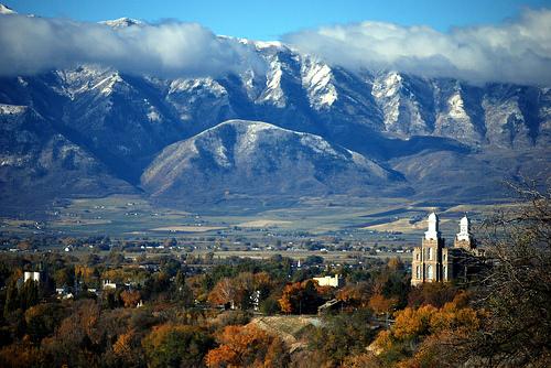
DAY THREE (Wednesday) Soak this day in. We’re going to trek through some of the most beautiful country the nation has to offer. We’ll run past several national parks, Moab and other tracts that aren’t federally protected, but still attractive. The weather will cooperate, with overcast coming back into the picture between Salt Lake and Logan. It will be one of the more exemplary drives we’ve taken, and the weather will generally be pretty great, too.
We are headed to the Rio Grande for our forecast tonight. It’s been a while since we have issued a forecast for Texas, and today, we are going as far south into Texas as we can get.
At 953PM, CT, Brownsville was reporting a temperature of 81 degrees with cloudy skies. The air was soupy, with dew points in the mid-70s. It is getting deep enough into the spring that the course of the jet has lifted to the north. Flow is through the the Gulf and into low pressure in the Canadian Prairie, giving rise to the local humidity. A deeper trough is going to develop over the Desert Southwest before rotating north into the Central Plains. A cold front will drape through the Plains, and present a severe threat for the Ozarks, in particular, however for interests around Brownsville, it will mean continued warmth and humidity, with clouds early, and some coastal fog. Tomorrow – Mostly cloudy, High 91, Low 75 Sunday – Mostly Cloudy, High 94, Low 75
TWC: Tomorrow – Cloudy early with partial sunshine expected late. Areas of patchy fog. High 89, Low 76 Sunday – Mostly cloudy skies early, then partly cloudy in the afternoon. Areas of patchy fog. High 90, Low 76
AW: Tomorrow – Mostly cloudy and humid High 90, Low 76 Sunday – Humid with clouds and sun; breezy in the afternoon High 91, Low 77
NWS: Tomorrow – Partly sunny High 90, Low 77 Sunday – Mostly cloudy, then gradually becoming sunny High 91, Low 75
WB: Tomorrow – Mostly cloudy in the morning then becoming mostly sunny High 89, Low 75 Sunday – Mostly sunny High 90. Low 76
WN: Tomorrow – Partly Cloudy, High 88, Low 76 Sunday – Partly cloudy, High 90, Low 76
CLI: Tomorrow – Partly cloudy High 89, Low 75 Sunday – Partly cloudy High 90, Low 76
Oof. Does anyone have a lemonade? Cloudy skies in the South Texas morning.
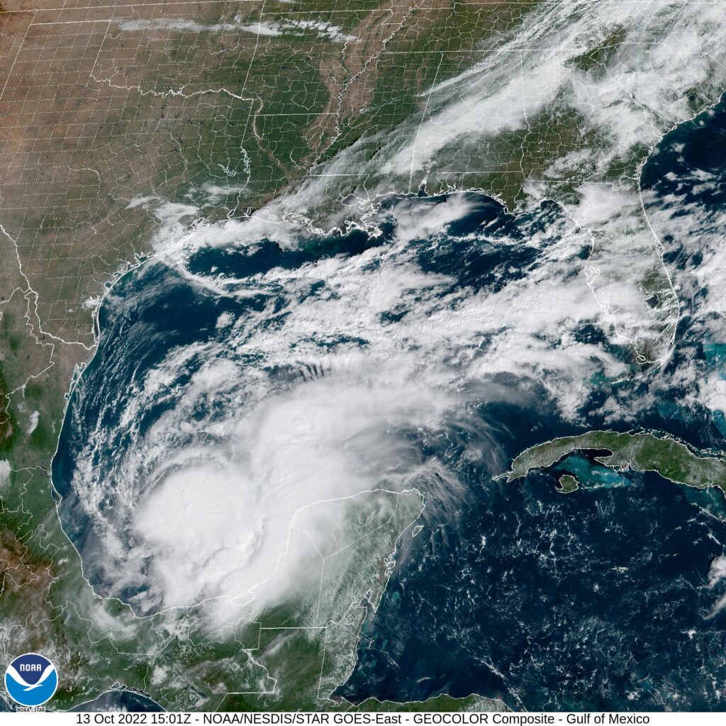
There was a threat of some showers cycling through south Texas on the back of tropical storm Karl, which was spinning down in the Bay of Campeche. Tropical storms, until the reach land, tend to draw moisture towards themselves, and this was the case in Brownsville in the middle of October. It was hot and dry in Brownsville for our forecast period, which led to a forecast victory for WeatherNation, which had the combined success of a their piggybacking off of the Weather Service’s temperature forecast, and their own foresight to leave rain out of the forecast. Actuals: October 14th, High 92, Low 74 October 15th, High 91, Low 74
Brownsville is part of a surprisingly well populated stretch in the far southern part of Texas, including Harlingen and McAllen. Brownsville is the furthest south, and closest to the Gulf of Mexico. It also happens to be significantly further from any town, excepting Harlingen and McAllen, than anyone really expects.
At 953AM, CT, Brownsville was reporting a temperature of 83 degrees with clear skies. A dry line was spread through central Texas, and while the Dallas area had dew points in the the 40s, it was already in the mid 70s along the Rio Grande. There was a threat for strong thunderstorms closer to Corpus Christi this afternoon, and some of those shower and thunderstorms flaring south towards Brownsville can’t be ruled out later today. Additionally, Tropical Storm Karl was churning away in the Bay of Campeche. Tropical Storm Warnings extended to Matamoros on the other side of the Rio Grande, but his presence only raised the threat for coastal thunderstorms this afternoon. Karl is moving southward, expected to landfall near Coatzcoalcos on the Campeche coast, so the attention will be turned to the dry line to the north of Brownsville. Without the counterclockwise rotation from Karl, the dry line will lose it’s potency as well. The dry line dichotomy will linger through the period, but the threat for showers and storms will abate over deep south Texas. As Karl continues to waste away in Central America, Brownsville will be more stable than normal for a hot humid stretch, with mostly sunny skies and temperatures preparing to climb. Tomorrow – Partly cloudy, High 90, Low 73 Saturday – Mostly sunny, High 92, Low 73
TWC: Tomorrow – Partly cloudy with afternoon showers or thunderstorms. High 89, Low 73 Saturday – Intervals of clouds and sunshine. High 92, Low 73
AW: Tomorrow – Partly sunny with a thundershower in spots in the afternoon High 90, Low 73 Saturday – Partly sunny and humid; breezy in the afternoon High 91, Low 72
NWS: Tomorrow – A 20 percent chance of showers and thunderstorms. Mostly sunny High 90, Low 74 Saturday – Mostly sunny, High 92, Low 74
WB: Tomorrow – Mostly sunny, High 89, Low 74 Saturday – Mostly sunny, high 90, Low 73
WN: Tomorrow – Partly cloudy, High 90, Low 74 Saturday – Mostly sunny, High 72, Low 74
FIO: Tomorrow – Humid and partly cloudy throughout the day. High 87, Low 73 Saturday – Humid and partly cloudy throughout the day. High 88, Low 73
Its strange that the driest forecast is the coolest forecast. Strange. Karl is showing up dramatically on the Gulf satellite imagery.
Usually, when we talk about border battles in sports we are talking about two states that share a border playing each other. In this case, we are just talking about the very tight forecast fight in Brownsville as January turned to February. January ended with a splash of rain and unusually cool temperatures. February started a little brighter, especially for WeatherNation who had the best forecast on February 1st, missing only by one degree on the morning low, and pegging the 71 degree high. They earned the very rare solo victory after diverging from the NWS forecast. Actuals: Friday, Jan. 31st. .1 inches of rain, High 66, Low 53 Saturday, Feb 1st, High 71, Low 49
Throughout most of the summer, the deep south of Texas is so hot and far removed from the jet stream, there is nothing interesting about the weather. How will it be as we visit in late January and February?
At 153PM, CT, Brownsville was reporting a temperature of 67 degrees with overcast skies. The overcast conditions spread through the center of the country, from border to border, as a deep upper level trough settled into the country. The base of the trough will continue to shift eastward overnight, with cold air chasing the clouds out of town, but not before bringing the threat of some light rain to the city in the early morning hours. Some cyclonic development will occur over the northern Gulf, which will encourage more dry air from the north into the afternoon. Saturday morning in particular will be quite cold, thanks to the clearer and northerly winds. Tomorrow – Light rain early, High 64, Low 52 Saturday – Clearing and cooler, especially in the morning, High 70, Low 47
TWC: Tomorrow – Cloudy skies early will become partly cloudy later in the day (early showers) High 67, low 56 Saturday – Intervals of clouds and sunshine. High 72, low 50
AW: Tomorrow – Clouds giving way to some sun with a shower in spots early in the morning, then becoming breezy High 67, Low 58 Saturday – Sunshine and patchy clouds High 70, Low 49
NWS: Tomorrow – Patchy drizzle with a slight chance of rain before 9am. Cloudy, then gradually becoming mostly sunny, High 65, Low 51 Saturday – Mostly sunny High 69, Low 48
WB: Tomorrow – Mostly cloudy with with a 20% chance of rain showers in the morning, then partly cloudy in the afternoon. High 65, low 55 Saturday – Sunny, High 70, Low 51
WN: Tomorrow – Partly cloudy with isolated showers, High 67, Low 55 Saturday – Mostly sunny, High 71, Low 50
FIO: Tomorrow – Light rain tonight and tomorrow morning. high 66, Low 56 Saturday – Partly cloudy throughout the day. High 70, Low 52
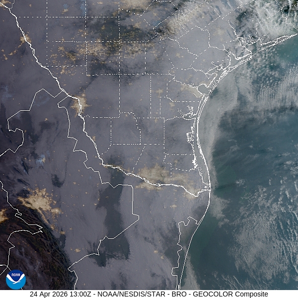
Here is a look from the forecast from KRGV. They are an Accuweather outlet, so if their forecast looks a little familiar, that’s why.