Reno, like many location in the western US, had a rough go of things over Christmas. On Christmas Eve, in addition to some light snow mixing in, Reno saw 1.28″ of rain, and another .28″ of rain on Christmas Day, which accounts for about 20% of the expected ANNUAL rainfall in Reno. Temperature rebounded on Christmas to ensure all precipitation came as rain, but it was definitely a good day to spend indoors. Clime, which has absolutely no holiday spirit, successfully envisioned this forecast, and got the daily win. Actuals: Wednesday – 1.28″ of rain and snow, High 53, Low 32 Thursday – .28″ of rain, High 50, Low 37
We’re heading west over the Christmas break. On the plus side, we have work off for the next several days, so we don’t have to worry about that. On the negative end, the drive is over the holidays, which means everyone has time off. Good luck finding help at the convenience store if you need it. The drive will last a little more than 3 1/2 days, covering 1,948 miles at a pace of 67mph. That means the three long days of driving will cover 537 miles. I’m excited to see where we end up on Christmas!
DAY ONE (Wednesday )
Monroe, Louisiana
The Gulf is definitely open, at least on the western side. Fortunately, there isn’t a lot to trigger this instability for Christmas Eve. There may be some lingering clouds throughout the day, and we aren’t going to find a firm dry line, so it’s hard to say when the clouds will end, but they should eventually. We will stop for the day in Newlin, in west Texas. Santa, come to Newlin!
DAY TWO (Thursday/Christmas) It will be a bright and beautiful morning on Christmas as we arise in Newlin. Will we receive gifts? That depends on your Naughty or Nice list status, but we should treasure the good weather we will see for the remainder of the Texas Panhandle and throughout New Mexico. Clouds my begin to pop up as we hit some terrain west of Albuqueque, but precipitation will remain closer to the Four Corners. Our drive will pass into Arizona on Christmas day, but only just. We’ll spend the night in Lupton, preparing for a much rougher day on Friday.
DAY THREE (Friday) I know it sounds crazy to say, but in the higher terrain near Flagstaff, don’t be surprised to see some snow. It should stay away from the interstate, and I suspect the drive in Arizona, at least, will remain dry. We will take US-95 from Kingman, which means we will cross by the Hoover Dam before we reach Las Vegas. Unfortunately, the Vegas portion of the matter may also feature some isolated showers. It will be an improvement for Sin City, which may see some thunderstorms and heavy rain on Christmas Day, so be careful if the city is recovering from the unusual weather. We will continue northwest to Beatty, which will also be unusually damp.
DAY FOUR (Saturday) The center of low pressure, the main one at the base of the trough will move ashore on Boxing Day and have a tough time maintaining itself when it arrives inland. It’s going to completely dissipate at the surface by Saturday. This means that whatever rain fell over the Holiday week on 95 will be dried and gone for the conclusion of our trip through Nevada. The only problem will be finding a place to stop to use the restroom!
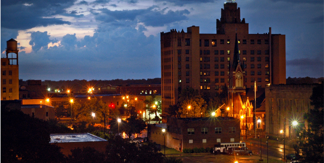
Happy Holidays, everyone! This forecast for Reno will take us across Christmases Eve and Day. Christmas in Reno, sounds like it should be airing on Hallmark Channel.
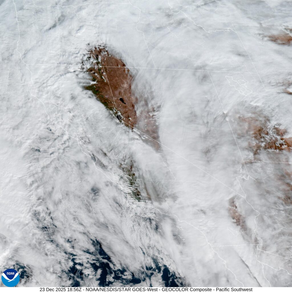
At 1055AM, PT, Reno was reporting a temperature of 57 degrees with clear skies and a brisk south wind. This is in response to a strong trough along the West Coast. A center of circulation lies off the California shore, with southerly flow rushing through the Golden State. The Sierras are beset by heavy snow, and are also keeping Reno clear for now. Most of the region is covered by clouds, however there is a donut hole over western Nevada. The low itself will be moving northeast before arriving on the coast on the Oregon coast. The robustness of this feature and the paired advance of the jet structure will allow for a fully realized cold front to be dragged along with it. Expect some substantial rainfall, particularly for Reno, on Christmas Eve. The surface feature and leading edge of the jet will continue east of the region by Christmas. The base of the trough will still foster cyclonicity in the Pacific, which will mean more southerly flow in the west. While Reno will see less precipitation for Christmas, the Sierras will not, and travel into California from Reno will remain treacherous. Tomorrow – Rain likely, High 43, Low 37 Christmas – Partly cloudy, with some passing showers, High 37, Low 31
TWC: Tomorrow – Cloudy. Periods of rain early High 46, low 39 Christmas – Rain showers, with winds diminishing later in the day. High 44, Low 38
AW: Tomorrow – Mostly cloudy and cooler with a bit of rain; breezy in the afternoon Hgh 46, Low 39 Christmas – Mostly cloudy, becoming windier and chilly with a couple of showers High 44, Low 36
NWS: Tomorrow – Rain. Snow level 6700 feet lowering to 6100 feet High 50, Low 40 Christmas – Rain. Snow level 5700 feet High 46, Low 35
WB: Tomorrow – Rain and snow. Snow level lowering to 6500 feet. Snow accumulation of 1 to 3 inches. High 46, Low 39 Christmas – Snow and rain. Snow level 5500 to 6000 feet. High 43, Low 39
WN: Tomorrow – Cloudy with rain, High 49, Low 39 Christmas – Cloudy with rain, High 46, Low 35
CLI: Tomorrow – Rain showers High 51, Low 41 Christmas – Rain showers High 47, Low 39
Nevadans aren’t often beset with soggy days, so getting it on Christmas is particularly bad luck. they have a pretty nice window of sunshine right now, however!
How far are you willing to travel for a holiday? It’s going to take 5 days to make this trip, covering 2914 miles. Sounds like a perfect Christmas gift to me, especially when a pace of 69mph can be sustained. The swift pace will allow 555 miles to be the goal on days 1-4, with a long conclusion to the trek.
DAY ONE (Sunday)
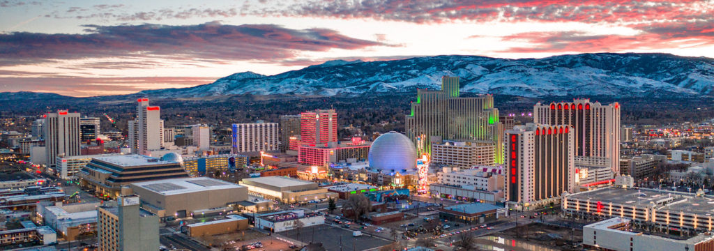
Reno, Nevada
The western US is getting battered by a holiday weather system that is bringing cold weather and snow mostly to the peaks of the Cascades and Sierras, but even to the lower terrain between, at least to a certain level. Seattle and Portland were in line to see some unusual snowfall for Christmas, and white capped peaks are definitely coming to Nevada and Utah. The snow should be done outside of the highest points of northern Nevada, but that won’t necessarily be the case in Utah, where heavy snow could, theoretically, even lead to some road closures. Expect a tougher slog through Utah, especially where the terrain gets a little more hilly east of Salt Lake City We will stop for the day, mercifully, in Wanship, in heart of the Wasatch.
DAY TWO (Monday) The pattern in the western US is just going to be active for the beginning of the week. The low will split in two over the next couple of days, sending the first round of snow and cold air to the Upper Midwest, while leaving quite a bit of moisture in the Pacific Northwest as well. The northern Rockies will be between these two branches of the feature, so while it won’t be stormy, it won’t be great either. Mountain snow with lighter flurries in the valleys will continue through Utah and western Wyoming, but at least the lee side of the Rockies, in Wyoming and western Nebraska will be a bit more favorable, with spots of sun, but mostly cloudy skies. The day will conclude in Big Spring, right at the northeast corner of Colorado, just on the Nebraska side.
DAY THREE (Tuesday) The continued rotation of the low pressure in the west will regenerate again on Tuesday. Expect a generally ok drive through the rest of Nebraska, and the 4 hours that will take, but a cold rain is possible as soon as we hit Nebraska City and the Iowa border. Even more robust precipitation is possible after we make the eastward jaunt at Kansas City, and a cold, steady rain is possible when we stop for the night in Sweet Springs, about an hour east of KC.
DAY FOUR (Wednesday) The rain we see on Tuesday will be the result of a rising warm front, but we won’t really ever be able to get south of the boundary, and our day will begin on a chilly note in Missouri. The lingering boundary will be diffuse and stretched across the mid-Mississippi Valley, an environment rife for redevelopment. Late in the day, a new feature will begin to arise in Mississippi and bring us some cold rain starting around Nashville. Heavier rain will be persistent in the higher terrain of eastern Tennessee throughout the day, so bring an umbrella as we get to our hotel in Manchester, about halfway between Nashville and Chattanooga.
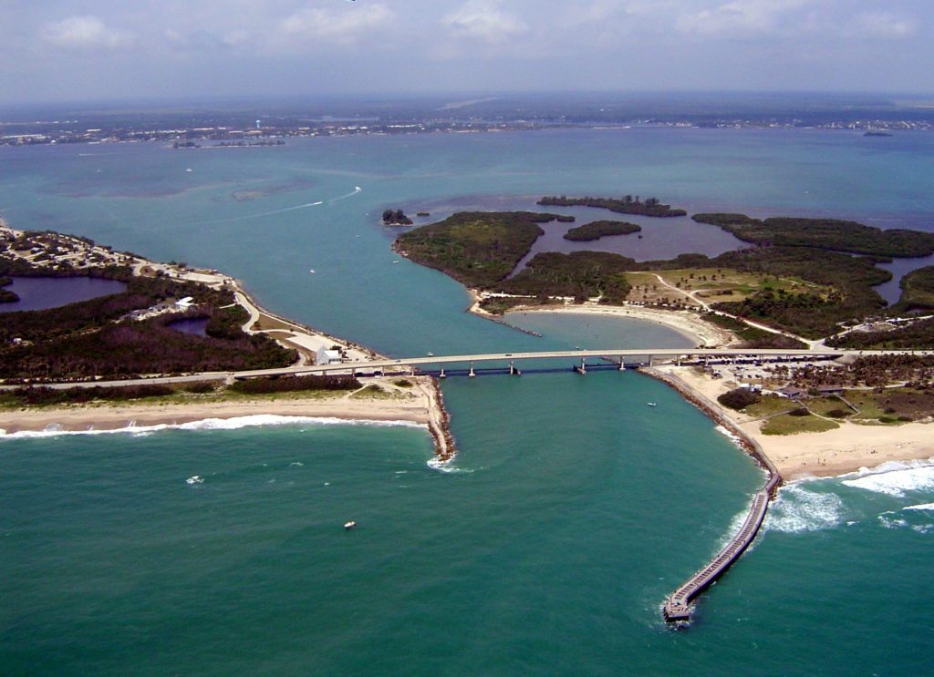
DAY FIVE (Thursday) The front bringing that rain will weaken as it shifts east through the mountains, and at long last, we can expect to be out of any threat for heavy precipitation. Some light showers and overcast will persist from Manchester through the remainder of our time in Tennessee, as well as much of the state of Georgia. We should finally emerge into dry conditions around Tifton, and it will probably even be sunny by the time we alight upon Sebastian.
Late in July, we assembled a forecast for Reno, which promised highs in the low 90s, and that’s what was delivered. Clear skies and dry air made lows in the 50s seem plausible, but it was not to be. The Weather Service had the perfect blend of high highs and still warm lows, claiming the victory. (Note: I have submitted the draft for my next book. The hope is that this will be a kick in the pants for the posting schedule. Fingers crossed!) Actuals: July 24th, High 93, Low 63 July 25th, High 93, Low 61
Hey gang, we’re almost at the weekend! At Victoria-Weather, we are planning on kicking things off with a 4 day trip out to Reno. We’ll cover 2,337 miles at a pace of 68.7 windswept miles per hour. The last day, which is often the case for us, will be a longer day, with about 550 miles passing by on the first three days. Road travel and camping are the way to live in this age, and perhaps this journey will provide just that opportunity.
DAY ONE (Saturday)
Gadsden, Alabama
Hey! Who is that in the Gulf of Mexico? Why, it’s Tropical Storm Hanna, already the 8th storm of the season, ready to soak south Texas. What that means for our journey is a reduction in the instability that filters north to our route from Gadsden to Blue Springs Missouri, the Kansas City suburb we intend to rest our heads. Instead of the threat for area showers and storms after noon throughout the day, I think that if we can make it past Hopkinsville, Kentucky by 1pm, we might be storm free all day. Hey, and Kansas City has a lot of spots to stop, including campgrounds. All around a pretty good day.
DAY TWO (Sunday) A cold front is going to move through the high Plains and Upper Midwest this weekend, and again, Hanna is going to play havoc with the storms’ intentions. Instead of heavy soaking rains, there will only be a few shpwers and storms on Saturday, but as Hanna deteriorates on land, the moisture will return to Nebraska and Iowa. Expect the best chance for thunderstorms to come around Lincoln, but with chances for more activity as far west as North Platte. We’ll reach Sidney, which is an oasis in the Nebraska Panhandle, and call it an ight.
DAY THREE (Monday) The summer monsoon is something of a moving target. Like, literally, the target moves every day, and truly, guidance isn’t a whole lot of help. Depending on your flavor of choice, you might get some storms in Nevada, or they might show up in Utah. Let’s plan for the worst and hope for the best. It should be dry through Wyoming, at least, even if we see a stray storm in Utah, where we will stop in Magna, on the west side of Salt Lake City.
DAY FOUR (Tuesday) The way it looks, our long drive on Tuesday will mostly be in the clear, though as the time hits the afternoon, there could be an isolated storm around Elko or Winnemucca. IT would be short lived, however, and we would almost certainly be in good shape when Reno comes to pass. It will be plenty hot though.
It’s opening day for baseball fans, at long, long last, so let’s go to a state that does not have any baseball whatsoever, because Victoria-Weather is excellent with timing, if nothing else.
At 755PM, MT, Reno was reporting a temperature of 79 degrees with winds of 35mph. There were some clouds over the Sierras around Lake Tahoe, and the end of showers and storms within that activity were leading to the localized gusts. The trend will continue to be towards clearing as the work week ends and the weekend arrives. Expect surface high pressure to continue to build across the Intermountain West, with sunny skies and warm temperatures for Reno. Tomorrow – Partly cloudy, High 92, Low 59 Saturday – Sunny, High 93, Low 57
TWC: Tomorrow – Sunshine and some clouds High 89, Low 56 Saturday – Generally sunny despite a few afternoon clouds High 92, Low 58
AW: Tomorrow – Mostly sunny High 90, Low 57, Saturday – Sunny to partly cloudy High 92, Low 59
NWS: Tomorrow – Widespread haze before 11am. Sunny High 91, Low 59 Saturday – Sunny High 92, Low 60
WB: Tomorrow – Sunny. Haze in the morning. Slight chance of showers and thunderstorms, High 87, Low 57 Saturday – Sunny, High 91, Low 59
WN: Tomorrow – Hazy, High 90, Low 59 Saturday – Mostly sunny, High 92, Low 60
FIO: Tomorrow – Clear throughout the day. High 87. Low 62 Saturday – Clear throughout the day. High 92, Low 64
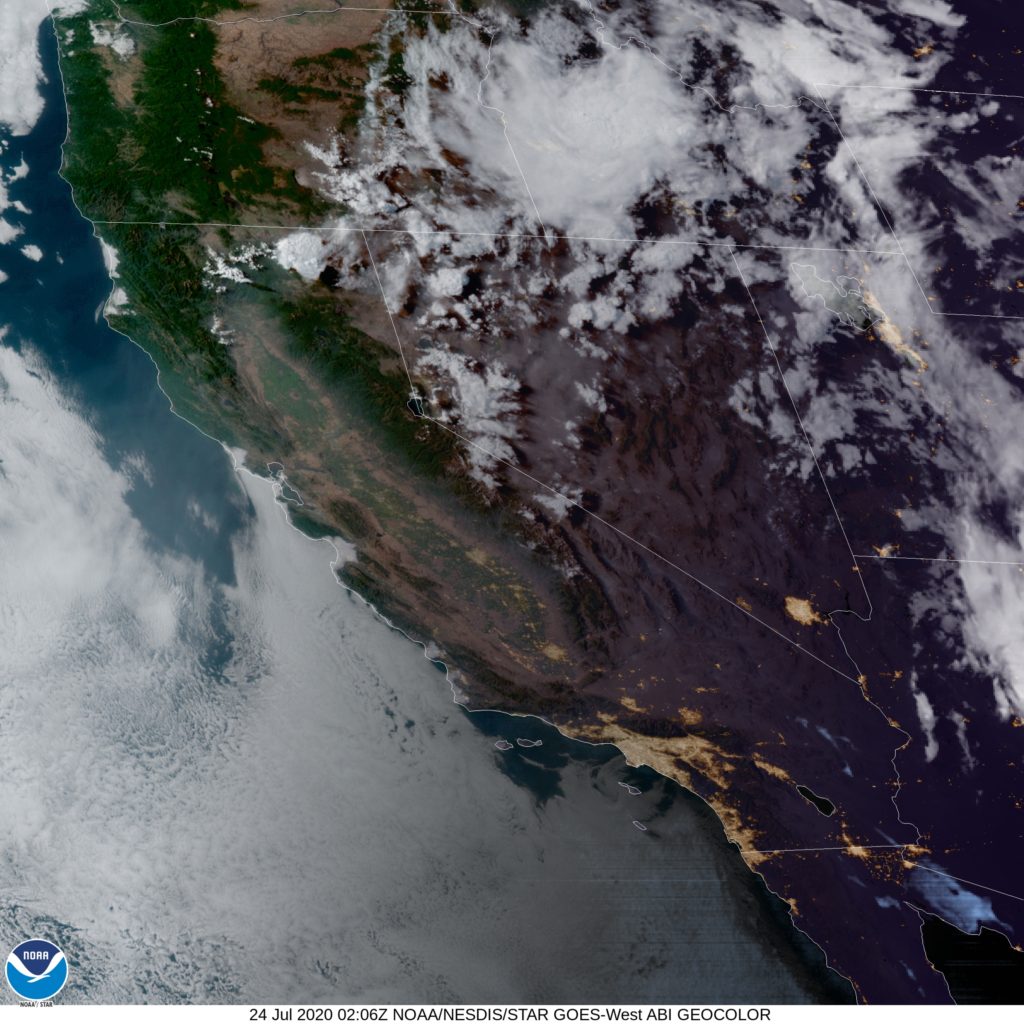
Here is a look at the satellite. Those diminishing clouds brought the breeze, but their diminishing will lead to a rapid cooldown tonight.
A trip through the Rockies and Plains as a vigorous system moves through the region… I see no reason to worry! Our three day trip will feature an extended third day, and 1,861 total miles covered. We’ll navigate the terrain of the Rockies in our shorter two days, which will conclude after 551miles of travel, all at an average pace of about 69mph. Nice.
DAY ONE (Thursday)
Reno, Nevada
There is a string of features extending from the northern Praries of Canada to the High Plains to the southwestern US. Epic rains are falling around Phoenix and in the southern Rockies, with snow falling at the highest peaks. By the time we get going tomorrow, the system will have weakened, with precipitation becoming limited to the upper elevations along our route. We may not see any precipitation on the roads, but there will be some nearby, in the Ruby Range in northeast Nevada, and by Park City, Utah. We’ll stop in Coalville, not too far beyond Park City.
DAY TWO (Friday) As high pressure filters back into the High Plains, moisture will be scoured out of the low lying terrain. We might see some mid level or high clouds as we trek through Wyoming, north of the snow falling in the peaks of Colorado. Wyoming has a lot of beautiful parts, but none of them are along I-80, so hustle through and get to the western part of Nebraska, where we will stop in Brule for the night.
DAY THREE (Saturday) The very same system that we saw on Thursday will be sweeping through the Lower Mississippi Valley, shuttling to the northeast. An inverted trough at the north end of the low will be pointed into Illinois, into some chilly air. Nebraska and Iowa should be sunny and dry, but the threat and intensity of snow will increase the closer we get to Decatur.