When forecasting temperatures in the upper 80s, you wouldn’t be surprised, I imagine, to see those show up in Iowa. You would, however, be surprised to have them show up on the cusp of October, as they did in Davenport on the 28th and 29th of the month. it wasn’t a true surprise, of course, as this was well handled by the meteorologists. In fact, the biggest area of error was in the low temperature forecasts. The skies were too clear, and temperatures fell off more than anyone had in the forecast. Accuweather had the top spot in the Quad Cities, Actuals: September 28th, High 88, Low 56 September 29th, High 89, Low 52
Wow. I’m not sure you could find a longer, flatter stretch of west to east driving in the country. We will see a great deal of prairie over the day and a half drive. We’ll cover 953 miles, which will be traversed over at a pace of 70.1mph, which might be the highest I’ve seen. That means day one will be through after 561 miles, or so.
DAY ONE (Sunday)
Pueblo, Colorado
There isn’t much to say for the day on Sunday. High pressure in the center of the country will keep things dry in the Plains, and unseasonably warm. There is going to be a bit of zonal flow across the Rockies, producing showers and overcast for the first stretch along the Front Range, but clear skies the rest of the way, where we will stop in Odessa, Nebraska, near Kearney, for the layover.
DAY TWO (Monday) It’s going to be a warm day for a late September drive, but otherwise uneventful, aside from maybe traffic and construction in Omaha and Des Moines. The directions should be pretty easy too. I-80 to the destination, and there it is.
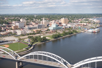
I had assumed that Davenport was named as such because it is on the Mississippi River, and a port. Nope, just named after a guy named Davenport.
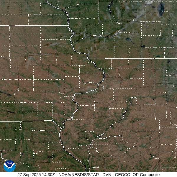
At 1052AM, CT, Davenport was reporting a temperature of 83 degrees with clear skies. It was fairly breezy across the area, especially just above the surface. This is because of the leading edge of lee troughing extending all the way into the Dakotas, and brisk southerlies across the Hawkeye State. The jet is zonal and well into Canada, indicating a dry, sunny and warm couple of days ahead. The high pressure centered over the Great Lakes is going to help squash the tropical features in the western Atlantic away from the coast and towards the central Atlantic. Tomorrow – Mostly sunny, High 86, Low 55 Monday – Sunny, High 87, Low 55
TWC – Tomorrow – A mainly sunny sky. High 88, Low 57 Monday – Mainly sunny High 90, Low 57
AW – Tomorrow – Very warm with plenty of sunshine High 87, Low 57 Monday – Very warm with plenty of sunshine High 88, Low 55
NWS – Tomorrow – Sunny, High 87, Low 59 Monday – Sunny, High 88, Low 59
WB – Tomorrow – Sunny, High 88, Low 58 Monday – Sunny, High 88, Low 58
WN: Tomorrow – Sunny, High 87, Low 59 Monday – Sunny, High 88, Low 59
CL: Tomorrow – Sunny, High 87, Low 57 Monday – Sunny, High 88, Low 57
That was a pretty easy forecast. With temperatures potentially reaching the 90s, I would say this qualifies as pretty toasty for late September. Satellite shows a bit of scud, stirred up the brisk winds, but there isn’t much moisture to make for a lot of clouds.
Weather information receivers, the general public, expects perfection for their specific spot every time. That said, everyone had forecast for rain in the Quad Cities on Saturday. We knew in spots it would be heavy, and nearly everyone called that out. The Upper Mississippi Valley indeed saw some showers, but it was only .06″ worth of rain in Davenport, though places around there saw more. Is it a problem, then, that they didn’t see more in Davenport, when most outlets suspected it? Probably for some people. Not for me, either. The Weather Channel had the top forecast. Actuals: Friday – High 65, Low 35 Saturday .06″ of rain, High 54, Low 41
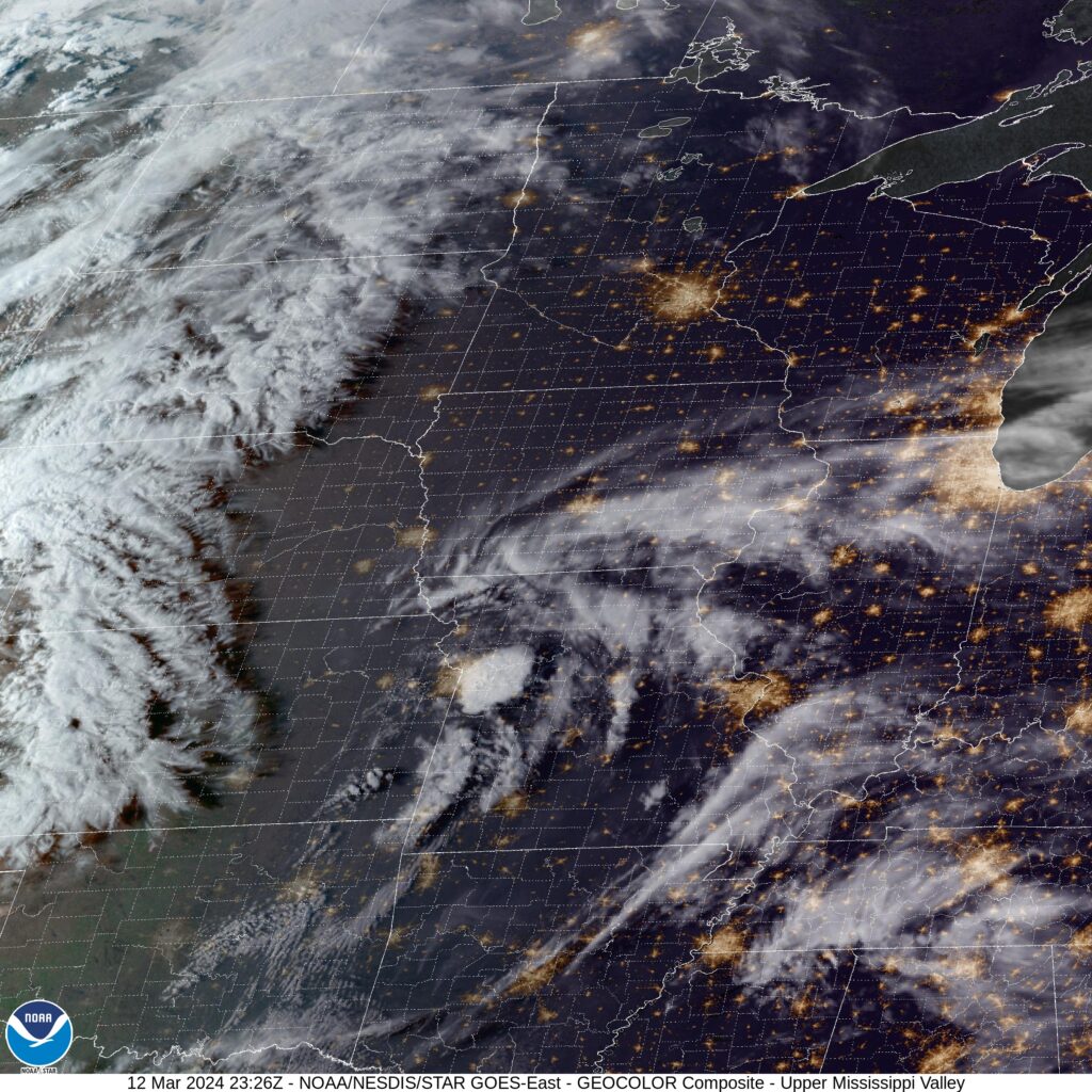
I wrote a couple days ago about the severe weather outbreak in the middle of the country last week. It occurred just to the south of of our forecast site in Davenport. There wasn’t quite the same level of impact as Iowa as there was at points to the south, but there was certainly some impact. Thunderstorms started on Wednesday night and kept rolling through Thursday, bringing 2/3″ of rain throughout the two days of the forecast. It brought about a cool down as well, reminding all of us that, even though there were thunderstorms and 70s, it’s still only March. Victoria-Weather got the victory, edging ahead because of a splash of rain falling before midnight on Wednesday. Actuals: Wednesday – .01″ of rain, High 71, Low 41 Thursday: .66″ of rain, High 55, Low 45
We’re going to be taking a trip through the northern High Plains. The beginning of spring in this part of the world is liable to be pretty gnarly this time of year, but with the winter we’ve had, that just doesn’t seem as likely. We’re on a 2 1/2 day trek that will cover 1434 miles at a blistering pace of 66mph, with day’s one and two finishing after 528 miles.
DAY ONE (Saturday)
Davenport, Iowa
Despite the most formidable severe weather outbreak in at least a couple of years occurring in the middle of the country over the last couple of days, there is an unassociated Alberta Clipper moving through the Canadian Prairies. This will lead to a trough of cool air in the Upper Midwest as we get going on Saturday, but crisp blue skies will emerge by the time we hit Sioux City. The blue skies continue west past Mitchell to Plankinton, South Dakota, our stop for the night.
DAY TWO (Sunday) Not much is going to change above ground as we continue westbound through South Dakota. We’ll take a jog north from the Black Hills and avoid Wyoming, but make it to the Canadian Plains southeast of Billings. The town we stop in will be Toluca, which is going to arrive about a half hour before we hit Billings.
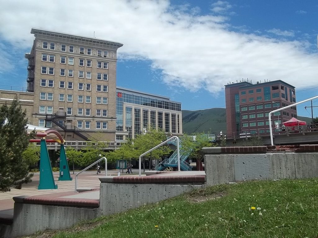
DAY THREE (Monday) Another clipper is going to sweep out of the Alberta Rockies overnight Sunday into Monday, and a lee trough will kick up some clouds in Montana as a result. There is a whole lot of Montana still left to drive through, and fortunately, it will all be dry. We’ll settle into Missoula and have a clear view of the scenery, because the weather will be quite cooperative.
We’re continuing a recent trend of forecasting in the western Great Lakes with a trip to the Quad Cities.
At 252PM, CT, Davenport was reporting a temperature of 71 degrees with a brisk south wind and clear skies, There appeared to be a vorticity maximum near St. Joseph, Missouri, and a whorl of clouds over the center of the United States was bringing a few of the clouds north to eastern Iowa, but the the real threat for deteriorating conditions is further to the southwest, where low pressure is going to continue developing over the next couple of days. By tomorrow evening, areas near an emerging warm front will start to feature show rain and thunderstorms across southeastern Iowa. The center of low pressure will start to shift northeastward, and what had been convective in nature at the beginning of the day will become cooler and more stratiform rain showers, ultimately giving way to cool cloudy skies in the evening. Tomorrow – Increasing clouds, late thunder possible, High 67, Low 47 Thursday – Rain with embedded thunderstorms. Ending late, then cooler, High 58, Low 43(Non standard)
TWC: Tomorrow – Partly cloudy skies during the morning hours will become overcast in the afternoon. High 72, Low 45 Thursday – Showers and thunderstorms. High 60, Low 48
AW: Tomorrow – Cloudy and warm with a shower in the area High 67, Low 47 Thursday – A thick cloud cover, breezy and mild with a couple of showers and a heavy thunderstorm; thunderstorms could bring damaging winds, flash flooding and hail High 63, Low 46
NWS: Tomorrow – Partly sunny, (late rain) High 70, Low 48 Thursday – Rain and possibly a thunderstorm. High 63, Low 47
WB: Tomorrow – Partly sunny, High 68, Low 51 Thursday – Rain with thunderstorms, High 55, Low 42
WN: Tomorrow – Partly cloudy, High 68, Low 50 Thursday – Mostly cloudy with showers and scattered storms, High 58, Low 51
CLI: Tomorrow – Light rain showers, High 68, Low 48 Thursday – Drizzle, High 63, Low 45
This forecast was interrupted quite a few times while I tried to put it together. That vort max I mentioned at the beginning actually produced a couple severe storms east of Kansas City. Still not too bad in Davenport tonight, but it will deteriorate through the week. We’ll see at what pace.