Have you heard about the heat dome? This has pushed hotter temperatures even further outside the typically warm parts of the middle and southern parts of the country, and nosing those warm temperatures up a couple of degrees. When we forecast for St. Joseph, however, the hot air wasn’t freakishly abnormal. It was in the low 90s in the afternoon, but surely there were complaints about low temperatures that remained in the mid to upper 70s. At least storms evaded the area, which meant temperatures were the only thing inhibiting sleep. Victoria-Weather picked up a victory in sultry St. Joe’s. Actuals: July 18th, High 93, Low 77 July 19th, High 96, Low 76
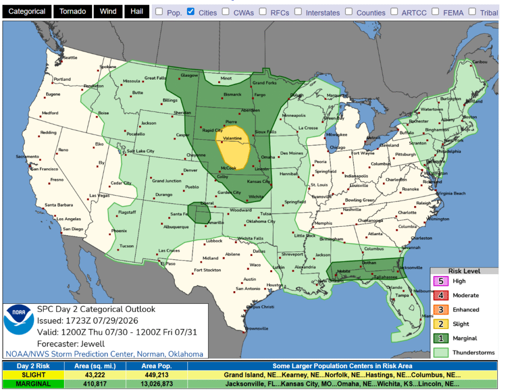
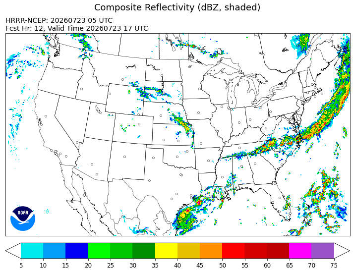
9:44PM The threat for thunderstorms in the dog days of summer are more generalized and far reaching. Severe storms, organized convection and outbreaks are just not common. This is reflected by a pretty green SPC outlook for tomorrow.
It seems as though life is going to get a bit more interesting in Michigan over the next 24 hours. Let’s see just how interesting it gets in Saginaw.
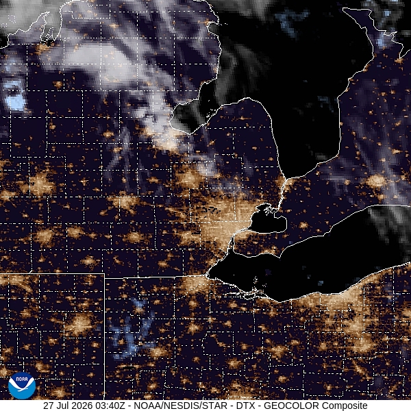
At 1215AM, ET, Saginaw was reporting clear skies and a temperature of 73 degrees. The dew point was 68, and it wouldn’t be surprising to see some fog overnight. While the SPC has hinted at thunderstorms, potentially strong, all day, the most recent model guidance has started to clarify two distinct batches of storms developing, and one is being seen over the Upper Peninsula, while the other is having a tougher time launching in eastern Wisconsin. A slow moving warm front moving through the area will provide the path for whatever develops to shift to the southeast. With the Wisconsin batch lagging behind, the UP area may take advantage, potentially leading to a higher threat for overnight or early morning severe weather. While the warm front is the main show, the occluded low pressure center will ensure a threat for a few scattered showers into the afternoon as well. Expect a hot beginning to the work week in Saginaw, even while dodging rain drops. The low pressure center will move towards New England, leaving high pressure to build back in over Michigan on Tuesday with cooler conditions. Tomorrow – Early morning storms, then mostly cloudy, High 87, Low 68 Tuesday – Mostly sunny, High 78, Low 65
TWC: Tomorrow – Scattered thunderstorms developing during the afternoon. Potential for severe thunderstorms High 84, Low 66 Tuesday – Cloudy early with partial sunshine expected late High 77, Low 66
AW: Tomorrow – Showers and a heavier thunderstorm in the morning; variable clouds, breezy, humid; thunderstorms can bring flooding downpours, hail and damaging wind gusts High 84, Low 68 Tuesday – Variable cloudiness, breezy and humid with widely separated thunderstorms High 80, Low 66
NWS: Tomorrow – A chance of showers and thunderstorms before 11am, then a chance of showers and thunderstorms after 2pm. Mostly sunny, High 87, Low 68 Tuesday – Partly sunny (early rain) High 79, Low 66
WB: Tomorrow – Partly cloudy with a chance of showers and thunderstorms. High 83, Low 71 Tuesday – Partly cloudy High 81, Low 67
WN: Tomorrow – Partly cloudy with showers and chance of storms, High 87, Low 68 Tuesday – Partly cloudy with showers, High 79, Low 67
CLI: Tomorrow – Thunderstorm, High 82, Low 67 Tuesday – Rain showers, High 76, Low 66
It’s looking more and more like the heavy storms are going to crop up and pass east of Saginaw. I imagine that will help temperatures sneak up fairly high. Nice work by us avoiding the heat dome!
This saintly journey is going to take us two days and cover 1188 miles. This trip will be about as mountainous as it can get, but will also be on fast freeways when we aren’t handling terrain. That said, expect a speed of 66.7mph, and to stop for the first night at approximately the 533 mile point.
DAY ONE (Sunday)
St. Joseph, Missouri
Our first day will contain none of that mountainous terrain I talked about in the introduction. We will run the length of Kansas and emerge through the prairies of eastern Colorado. We’ll land in Bennett, Colorado after a hot day of driving. Low pressure developing in the central Rockies means a warm front extended to the Upper Midwest and a reinforced heat dome through the Sunflower State. Steamy.
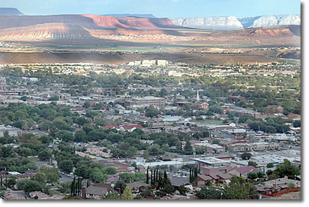
DAY TWO (Monday) Low pressure will continue to spin in the central Rockies, which is bad news for our hopes for a clear drive. Showers and storms will be possible on the western and southern exposures of the higher terrain until we hit about Eagle, Colorado. The rest of Colorado will be fine, with warm dry conditions. Some monsoonal showers and storms are going to be in the picture for the last leg, from about Richland on south, but it won’t be a major or long lived threat. St. George can get pretty hot too, but it’s a dry heat.
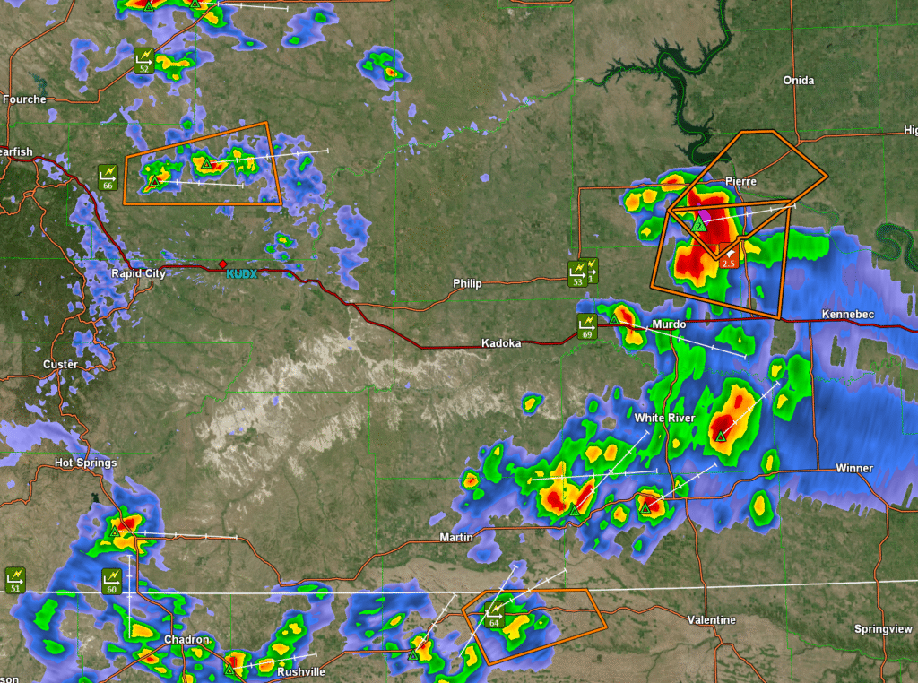
4:06PM: An interesting dynamic here, with three different clusters of sever storms in South Dakota and Nebraska. A couple of low precip, gusty storms, and one big monster hail producer in the middle of the state. This system will organize and turn into a good old fashioned squall, with an enhanced risk downstream in South Dakota.
This road trip seems like it might be popular. Ithaca is downwind of the fires burning along the US-Canadian border, near Lake Superior. This trip will run through the middle of the country and lasting two days. Total mileage will cover 1143 miles, at a pace of about 67.7mph. Our shorter day will be the first, and will conclude after 541.6 miles. We will start on Tuesday, because, well, it is early Monday morning back in the Continental US.
DAY ONE (Tuesday)
Ithaca, New York
By the time we get moving, a fairly decent area of low pressure will move into the Great Lakes. Eventually, this will help firefighters out, but in the immediate term, rain tends to bring particulates lower to the surface. IT will be especially smokey until it gets rainy. The rain should really set in between Erie and Cleveland, with the most intense thunderstorms somewhere near Columbus. It should conclude fairly quickly after that, but don’t be surprised if there is still rain in Englewood, northeast of Dayton.
DAY TWO (Wednesday) Our route will be clear of that system, though there may be a bit more smoke in western Ohio into Indiana, before flow becomes southerly. This should be a mostly pleasant afternoon of driving, however the next wave will have an active warm front, which will be lifting into northwest Missouri as we arrive. The last hour or so of our trip is liable to be wet.
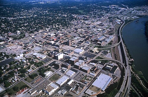
Kansas City has definitely been in the news lately, what with the World Cup playing several matches at Arrowhead Stadium. That’s but a couple hundred miles down river from St. Joseph! As life gets back to normal for western Missouri, what does the weather hold?
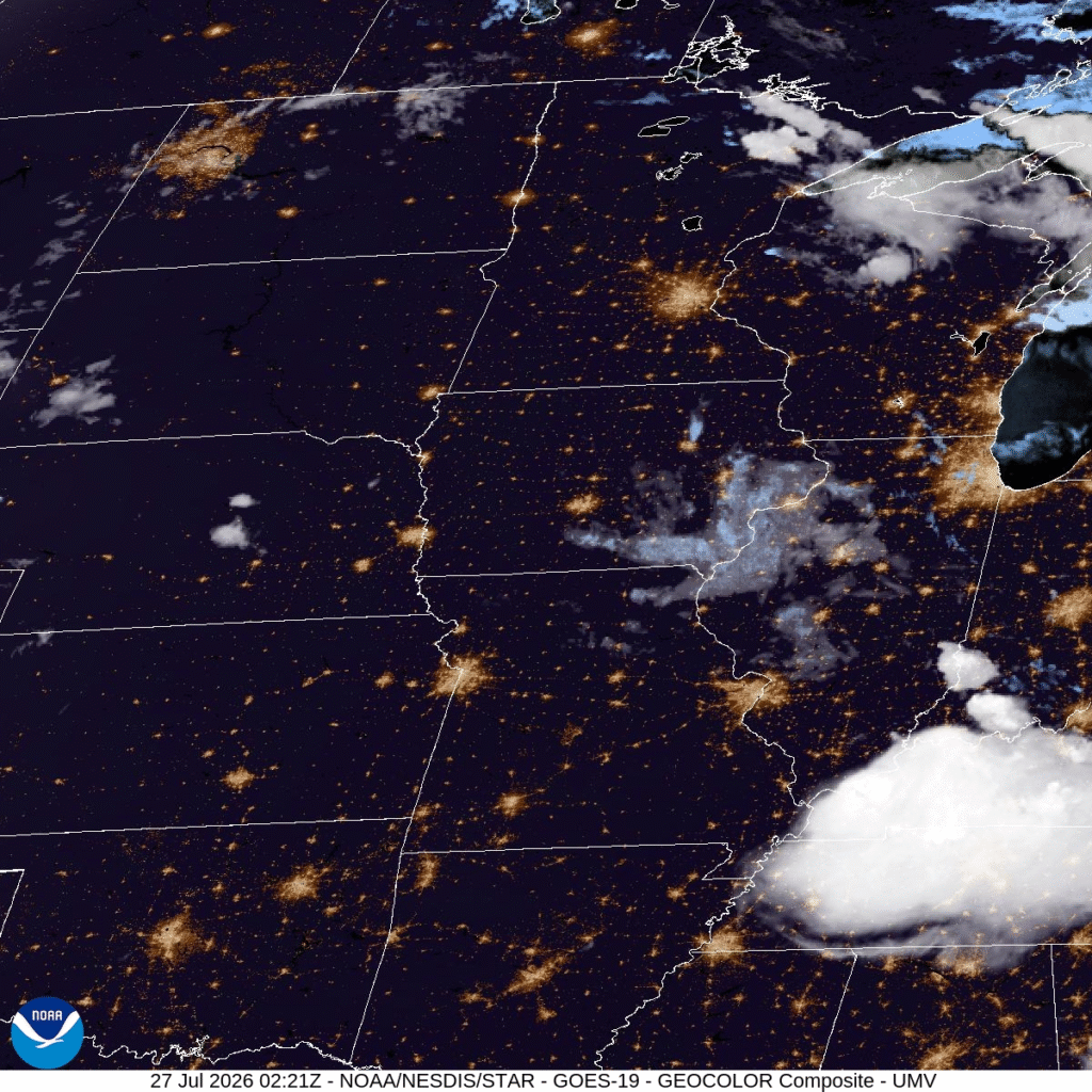
At 153AM, CT, St. Joseph was reporting a temperature of 76 with clear skies. Dew points were in the mid 70s as well, remnants of a humid day that may lead to some fog in valleys as dawn approaches. The prevailing flow is not only a ridge, but one that skirts the Canadian border, allowing the warm and moist air of the Gulf to continue wafting into the center of the country. There is a bit of a perturbation gently moving along the northern Great Lakes. There is a weak boundary toughing some storms off in southern Minnesota. The southward propogation of this system is expected to be slow, but eventually reach Missouri by mid-Sunday, but which point the airmass will be fully ready to pop. Some isolated pre-boundary air mass storms are possible in the afternoon on Sunday, with the cold front moving through the afternoon, brining only a modest change. Tomorrow (Today?) – Mostly sunny, High 92, Low 73 Sunday – Increasing humidity, chance of isolated showers and storms. Breezy, High 95, Low 74
TWS: Tomorrow – Partly cloudy. A stray shower or thunderstorm is possible. High 92, Low 73 Sunday – Mostly sunny skies. Hot. High 92, Low 73
AW: Tomorrow – Humid with plenty of sunshine High 91, Low 73 Sunday – Mostly sunny and humid High 92, Low 72
NWS: Tomorrow – A slight chance of showers between 2pm and 4pm, then a slight chance of showers and thunderstorms after 4pm. Sunny, High 93, Low 74 Sunday – Sunny, High 93, Low 73
WB: Tomorrow – Sunny. High 88, Low 77 Sunday – Sunny High 89, Low 74
WN: Tomorrow – Partly cloudy with showers and isolated storms, High 93, Low 74 Sunday – Mostly cloudy, High 93, Low 73
CLI: Tomorrow – Light rain showers High 92, Low 73 Sunday – Light rain showers High 92, Low 72
Apologies for the weird timing of this post. On vacation and I have adjusted to the time zone and the rest of the group has not. St. Joseph is fortunate, in that they can avoid the smoke from the Minnesota/Canada border.
With the ongoing heat across much of the country, it seems almost cruel to revisit our forecast for last month in Bremerton. Wet weather was rotating through, with low pressure that became hung up in the Canadian Rockies. The rain was done by Sunday, the 28th, but temperatures along the Puget Sound were unable to clamber out of the 60s. How refreshing! Temperatures were all fairly even, but the Weather Service and Weathernation were square there, and with the precipitation forecast to earn a forecast tie. Actuals: June 27th, .03″ of rain, High 65, Low 50 June 28th, High 65, Low 48