The weather in central Illinois last week was wonderful. Sunshine was in place, and our forecasts for Springfield were pretty tranquil. Highs in the 70s, and lows were comfortable, in the 40s. This typically leads to pretty good figures in the forecast department, and for the top spot and the consensus, this was definitely the case. For the rest of us though, we were all too warm (Weatherbug’s typically wonky low numbers helped course correct the consensus). That doesn’t typically happen when the sun is shining. Misses are usually on the cool side. Another sign that we have arrived in autumn, I suppose. Accuweather did not range as warm with their forecast as the rest of us, or as cool as Weatherbug, and settled in with a very solid win. Actuals: October 22nd, High 75, Low 43 October 23rd, High 75, Low 47
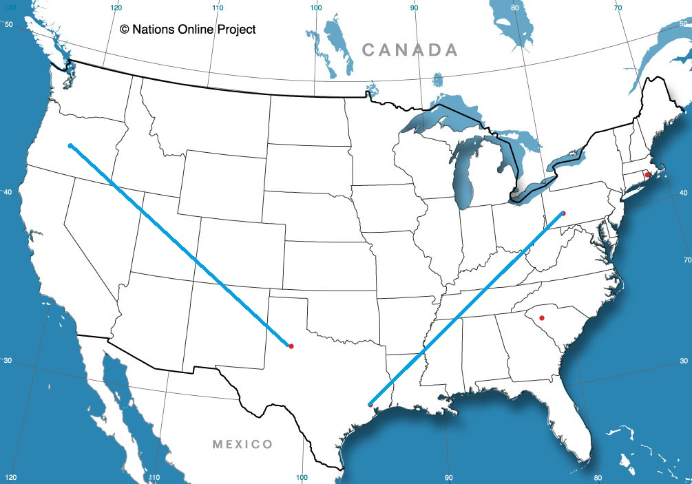
There are a lot of small to medium sized towns in Pennsylvania in our system, and Altoona happens to be one of them. Altoona is about as close as we get to right in the middle of the state.
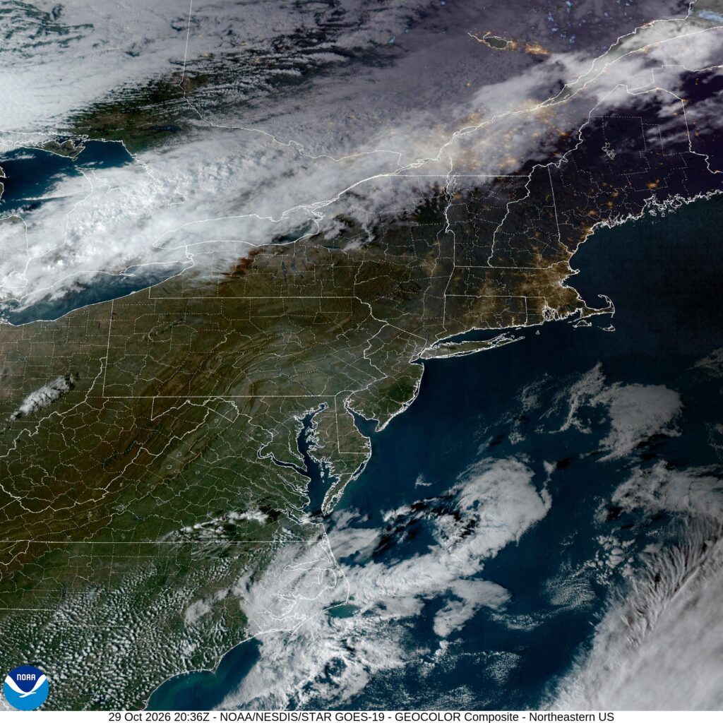
At 353PM, ET, Altoona was reporting clear skies with a temperature of 72. Altoona very clearly found itself on the warm side of a boundary that will bring much more autumnal temperatures to the region over the next few days. It was demarcated quite clearly on satellite, running through southern Ontario, just north of the eastern Great Lakes. The boundary is not laden with moisture, and the Appalachians and Eastern Seaboard aren’t moisture rich, so as the boundary passes, it will be without fanfare. High pressure will quickly return, along with another ridge. The cool down will continue through Halloween, but won’t last much longer than that. Tomorrow – Mostly cloudy, High 62, Low 46 Halloween – Clearer and cooler, High 57, Low 38
TWC: Tomorrow – Some clouds in the morning will give way to mainly sunny skies for the afternoon. Warm. High 62, Low 48 Halloween – Partly cloudy. High 60, Low 37
AW: Tomorrow – Sunny to partly cloudy, breezy and cooler; low humidity and dry brush will result in an elevated fire threat High 64, Low 46 Halloween – Some sunshine giving way to clouds; a beautiful start to the weekend High 60, Low 37
NWS: Tomorrow – Mostly sunny, High 67, Low 47 Halloween – Mostly sunny, High 62, Low 35
WB: Tomorrow – Mostly sunny. High 63, Low 47 Halloween – Mostly sunny. High 59, Low 38
WN: Tomorrow – Mostly cloudy, High 67, Low 49 Halloween – Partly cloudy, High 62, Low 35
CLI: Tomorrow – Sunny, High 61, Low 43 Halloween – Sunny, High 58, Low 36
Satellite is showing that thatch of clouds over Southern Ontario. It will bring “weather” to Altoona, but it will make things a bit chillier.
I don’t know what my algorithm is up to, but I’m seeing a lot of travel videos from the Pacific Northwest, lately. Was this fated?
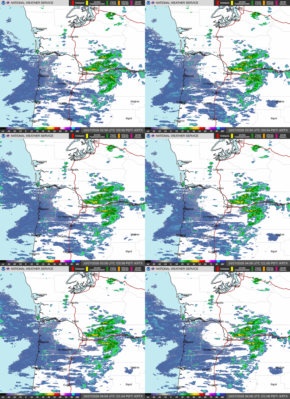
At 854PM, PT, Eugene was reporting a temperature of 52 with mostly cloudy skies. There was rain found in the Cascades, particularly with a new snowcap for Mount Hood. There is a trough in the Pacific Northwest, part of a long lasting pattern of activity in the west. The trough is tilted to run east to west through British Columbia and Washington, which is going to prevent much of a pattern shift. Following the upper pattern, a jet streak will arrive in the region tomorrow morning, bringing a greater chance for rain through much of the day Tuesday, and particularly in the morning. A more vigorous round of showers, which may include a stray stroke of lightning will arrive again in the predawn on Wednesday, with chances for rain continuing through the day. Tomorrow – Scattered showers, High 57, Low 43 Wednesday – Early morning rain, maybe a bit thunderstorm, High 54, Low 43
TWC: Tomorrow – Cloudy with occasional rain…mainly in the morning. High 58, Low 46 Wednesday – Cloudy early with partial sunshine expected late (early showers). High 55, Low 43
AW: Tomorrow – Variable cloudiness with a couple of showers High 58, Low 46 Wednesday – Mostly cloudy with a couple of showers High 56, Low 44
NWS: Tomorrow – Rain, mainly before 4pm. High 55, Low 44 Wednesday – Rain, High 54, Low 41
WB: Tomorrow – Rain. High 55, Low 43 Wednesday – Rain. High 55, Low 40
WN: Tomorrow – Mostly cloudy with rain, High 55, Low 44 Wednesday – Mostly cloudy with light rain, High 54, Low 40
CLI: Tomorrow – Light rain showers High 56Rain showers, Low 42 Wednesday – Rain showers High 56, Low 41
I do think the threat for rain all ovr this forecast promises to keep temperatures warmer overnight than what some of these other outlets are calling for. Less rain on radar right now.
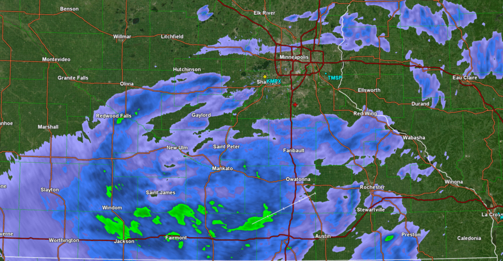
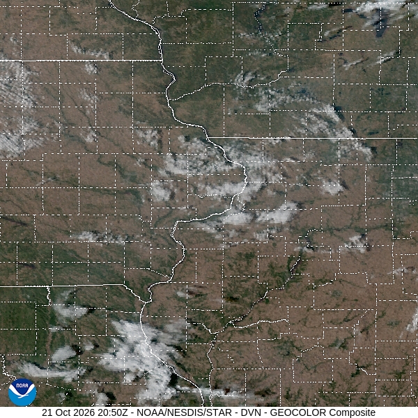
330PM: Just a wonderful day in southern Minnesota today.
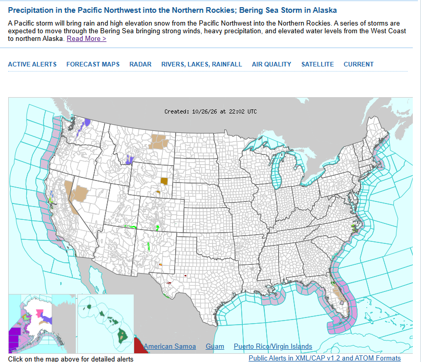
5:07PM There is certainly some weather out there today, but it isn’t often that the Bering Sea gets top of the page status on the NWS home page.
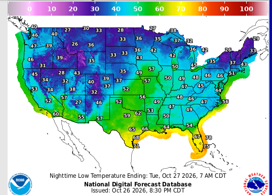
8:37PM: The system bringing a whole bunch of rain to the middle of the country today isn’t responsible for a lot of dynamic thundery storm activity, however it IS bringing a real change in fortunes on the temperature side.
Our forecast for Casper seemed simple enough. A town with the same name as a famous ghost right before Halloween, and high pressure firmly in place. Of course, it’s never that simple. Casper has nothing to do with the ghost, and is in the mountains, so even high pressure can lead to some tricky conditions! Winds were howling throughout the forecast period, which helped the daily delta in temperature grow beyond what most forecast outlets expected. Low temperatures even dipped below freezing on Monday! I’m not ready for that. The Weather Channel settled in with a comfortable victory. Actuals: Sunday – High 68, Low 46 Monday – High 70, Low 30
There are many Springfields in the United States, and I very strongly believe that this is one of them.
At 752PM, CT, Springfield was reporting clear skies and a temperature of 57 degrees. Clear skies and a low dew point suggest temperatures will be pretty chilly tomorrow morning. High pressure has settled into the eastern part of the country, stymied from eastward progress by Subtropical Storm Josephine. The high pressure is not going to move over the next couple of days, and sunny skies will continue unabated. To the west, low pressure presently over the Desert Southwest is going to start charging northeastward, bringing with it warmer air and a bit more humidity. Expect an end of the week that feels closer to summer than winter. Tomorrow – Sunny, High 76, Low 47 Friday – Sunshine continues, High 77, Low 44
TWC: Tomorrow – Sunny. Warm. High 78, Low 45 Friday – Mainly sunny. Warm. High 76, Low 46
AW: Tomorrow – Mostly sunny and warm; a nice day for outdoor activities, High 77, Low 44 Friday – Mostly sunny, nice and warm; great day to be outside High 75, Low 47
NWS: Tomorrow – Sunny, High 77, Low 48 Friday – Sunny, High 76, Low 49
WB: Tomorrow – Sunny. High 76, Low 49 Friday – Sunny. High 71, Low 49
WN: Tomorrow – Sunny, High 77, Low 48 Friday – Mostly sunny, High 76, Low 49
CLI: Tomorrow – Sunny, High 74, Low 45 Friday – Sunny, High 74, Low 46
I am not sure that it won’t be warmer on Friday than Thursday. Enough guidance disagrees that I am only putting an extra degree on the high Friday.
The Florida Panhandle, many people will tell you, is more reminiscent of the deep south than of the touristy peninsula most of us have visited before. That extends to the heat and humidity of summer, and temperatures in the winter that are surprisingly cool at times. Tallahassee does have seasons, and autumn showed up during our forecast last weekend. Temperatures dropped from the upper 80s on Friday to the mid 70s for highs after a dry but clearly strong cold front swept through. That’s sweater weather for Floridians. It was also a W for Accuweather. Actuals: Friday – High 88, Low 62 Saturday – High 76, Low 60
One of the after action reports I saw after Isaias made landfall was that Google’s AI based weather model performed better than most of the traditional numerical models that scientists use. After a moment of reflection on this news, I had one reaction.
Duh.
Discussions of AI are everywhere and are sure to enflame emotions the more you think about it. So let’s talk about what AI is, or at least what it comes from: advances in computer hardware, which in turn leads to faster computing. From a societal or economic standpoint, I’m not an expert on what that would mean. From a meteorology perspective, though, it’s a boon.
Numerical models have existed as long as meteorology has been around. They weren’t particularly useful until computers reduced the time it took to compute the equations that were plugged into the model. The first models were calculated by hand and took 6 weeks to put together. They were more diagnostic than prognostic.
Models have continued to get better and better as computing has gotten better and better. It makes logical sense that the Google AI model, using the best computing software available, should be even better. There are a few caveats to that, however.
First, meteorology will forever be held back by A) a lack of available observations. There simply aren’t enough observations at the surface and certainly not enough aloft to perfectly encompass the atmosphere and calculate it successfully. Even if we did, B) there aren’t enough known equations to solve for all the variables that go into a forecast. There will always be a bit of mystery.
Caveat number two, is that Google AI wasn’t the only one to accurately forecast a more eastward track than most other outlets indicated. For example, there was me. I’m not trying to brag (yes, I am) I am just trying to note that there will always be room for common sense assessments of the weather. There always needs to be someone to communicate, especially in dangerous situations, or situations that aren’t as dangerous as the unfamiliar might believe.
Having the ability to run many more calculations in a much faster time is the essence of building better weather model. I’m an AI skeptic about a lot of things, however meteorology is a perfect use case for it. The ability to run more equations in a shorter time will allow for better model resolution, which in turn can mean better forecasts and increased safety. The compute power of AI is a positive development.
I’m still not getting in a self driving car, though.
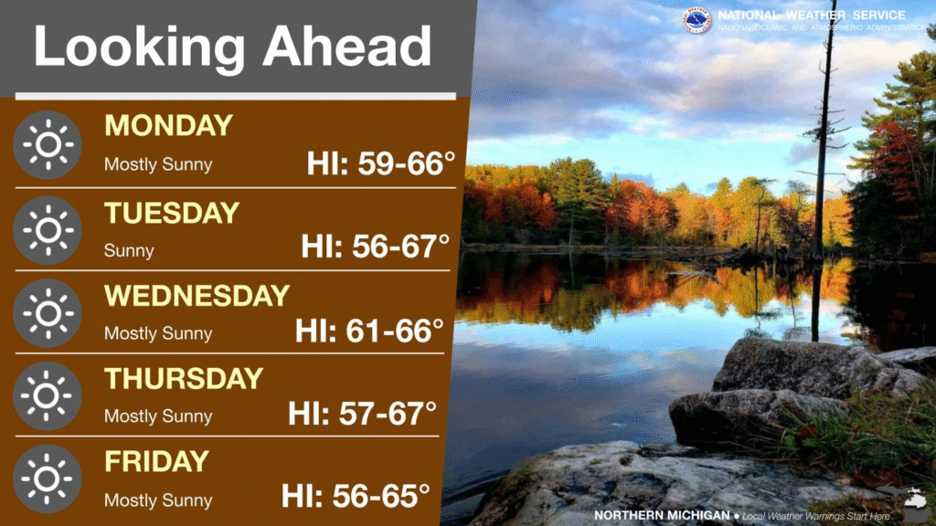
1:50PM: These are all suns, northern Michigan, not little snowflakes
4:49PM The wave of chilly air is getting pushed out of the country with a ridge building back into the center of the country. One last night of frost and freeze advisories, this time centered in Ohio and the surrounding areas. It’ll be warmer for a bit after that.
9:40PM It’s very quiet night across the country tonight. There is a churning area of low pressure in the Atlantic, but it looks meaner than it is. It’s going to hang out approximately where its currently at for the next couple of days, effectively keeping the east coast dry, as moisture cycles back into the low.