I don’t know what my algorithm is up to, but I’m seeing a lot of travel videos from the Pacific Northwest, lately. Was this fated?
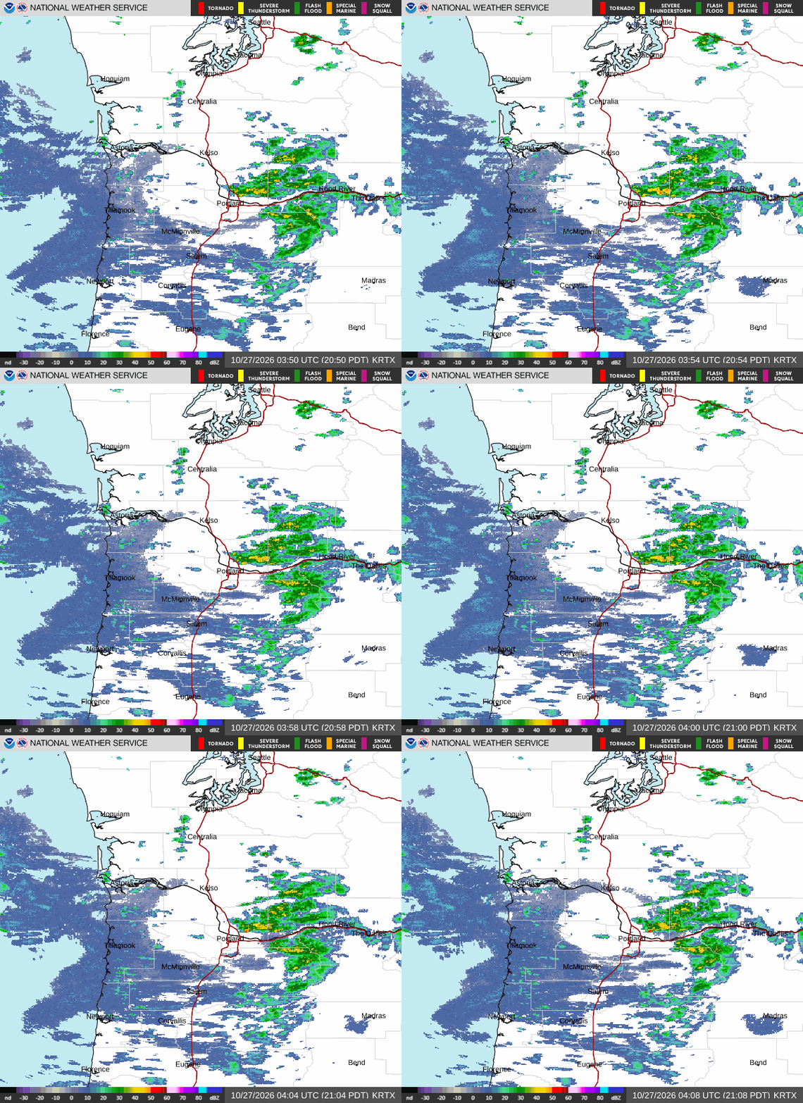
At 854PM, PT, Eugene was reporting a temperature of 52 with mostly cloudy skies. There was rain found in the Cascades, particularly with a new snowcap for Mount Hood. There is a trough in the Pacific Northwest, part of a long lasting pattern of activity in the west.
The trough is tilted to run east to west through British Columbia and Washington, which is going to prevent much of a pattern shift. Following the upper pattern, a jet streak will arrive in the region tomorrow morning, bringing a greater chance for rain through much of the day Tuesday, and particularly in the morning. A more vigorous round of showers, which may include a stray stroke of lightning will arrive again in the predawn on Wednesday, with chances for rain continuing through the day.
Tomorrow – Scattered showers, High 57, Low 43
Wednesday – Early morning rain, maybe a bit thunderstorm, High 54, Low 43
TWC: Tomorrow – Cloudy with occasional rain…mainly in the morning. High 58, Low 46
Wednesday – Cloudy early with partial sunshine expected late (early showers). High 55, Low 43
AW: Tomorrow – Variable cloudiness with a couple of showers High 58, Low 46
Wednesday – Mostly cloudy with a couple of showers High 56, Low 44
NWS: Tomorrow – Rain, mainly before 4pm. High 55, Low 44
Wednesday – Rain, High 54, Low 41
WB: Tomorrow – Rain. High 55, Low 43
Wednesday – Rain. High 55, Low 40
WN: Tomorrow – Mostly cloudy with rain, High 55, Low 44
Wednesday – Mostly cloudy with light rain, High 54, Low 40
CLI: Tomorrow – Light rain showers High 56Rain showers, Low 42
Wednesday – Rain showers High 56, Low 41
I do think the threat for rain all ovr this forecast promises to keep temperatures warmer overnight than what some of these other outlets are calling for. Less rain on radar right now.