Houston, Texas

I hope everyone is planning a wonderful time outside for Memorial Day Weekend. It’s the beginning of the warmth up north, and probably the last time it won’t be too hot down south.

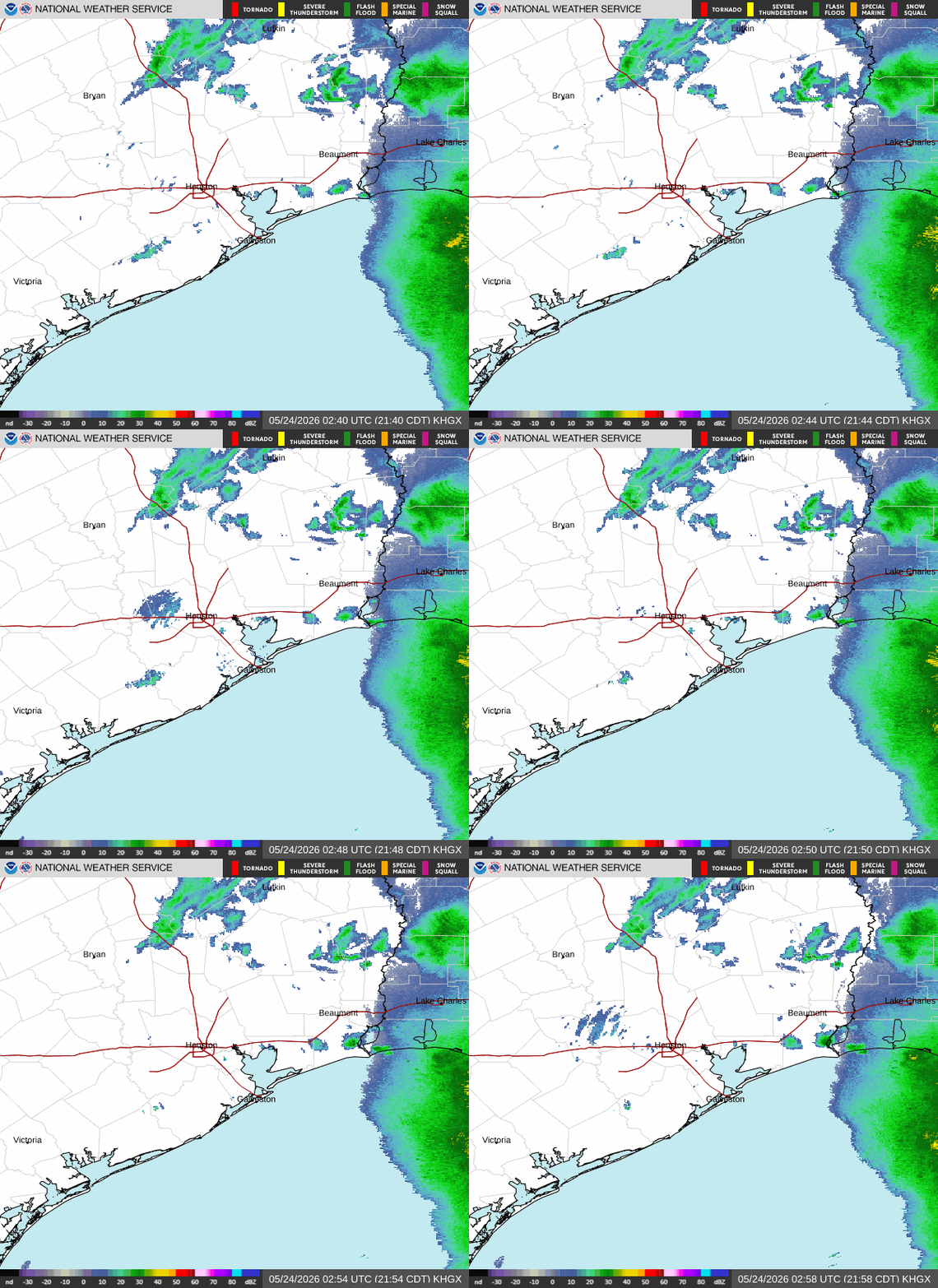
At 853PM, CT, Houston was reporting a temperature of 72 degrees. Moisture in the atmosphere was high, after rain this afternoon. There will likely be some fog and low clouds overnight. The bulk of the rainfall has shifted towards the Mississippi Delta, however a weak upper level trough remains over east Texas, which means that there won’t be any real clearing tomorrow.
With the trough hanging out in eastern Texas will continue to generate cyclonic flow in the western Gulf. Showers with some embedded thunderstorms will be more frequent and wider in coverage over Louisiana, on the east side of the circulation, but lingering moisture and scattered showers will remain a possibility throughout the remainder of the holiday weekend, with precipitation more likely Sunday than Monday.
Tomorrow – Mostly cloudy with a chance for showers and fog early, High 85, Low 69
Memorial Day – Partly cloudy with AM fog and afternoon showers, High 88, low 71

TWC: Tomorrow – Sunshine and clouds mixed. High 88, Low 68
Memorial Day – Partly cloudy skies High 89, Low 70

AW: Tomorrow – Mostly cloudy with a couple of showers and a heavy thunderstorm; watch for flash flooding High 83, Low 71
Memorial Day – Variable cloudiness with a thunderstorm High 88, Low 71

NWS: Tomorrow – A 20 percent chance of showers and thunderstorms after 10am. Partly sunny High 82, Low 70
Memorial Day – A 30 percent chance of showers and thunderstorms after 1pm. Mostly sunny, High 85, Low 71

WB: Tomorrow – thunderstorms in the afternoon. Some thunderstorms may produce heavy rainfall in the afternoon High 83, Low 69
Memorial Day – Mostly sunny. High 87, Low 72

WN: Tomorrow – Partly cloudy with showers and isolated storms, High 82, Low 70
Memorial Day – Partly cloudy with showers and a chance of storm, High 85, Low 71

CLI: Tomorrow – Light rain showers, High 84, Low 68
Memorial Day – Sunny, High 85, low 71

There is close correlation between precipitation and temperature forecasts the next couple of days. There will be some wild differences in our verification scores! Precipitation has moved all the way over the Louisiana.

Dry for a couple of days

Houston has had a wet spring. It’s either been raining or it’s been excessively humid. Wet. For a couple of days in June, though, temperatures were hot, but not oppressive. It was humid, but it has certainly been worse. Many outlets still thought rain would be on the way during our forecast period at the beginning of June. Among those was WeatherNation. It didn’t rain on the 3rd or 4th, but that didn’t set WeatherNation back far enough to fall out of first place, thanks to a top notch temperature forecast.
Actuals: Monday June 3rd, High 88, Low 79
Tuesday June 4th, High 90, Low 81

Grade: A-C

Houston, Texas

Most of Texas has seen rough weather this summer, including Houston and the Metroplex. Houston’s came early on in the season, when hundreds of thousands of local residents lost power, and 4 were killed when a squall line moved through the region on May 16th. Now, the heat is building in the south, and surely, that will be story moving forward. Right?

At 453PM, CT, Houston was reporting a temperature of 89 degrees with clear skies. Severe weather was forecast from border to border thanks to a broad lee trough sneaking into the Plains from the Rockies. This evening, there are showers and storms as far southeast as a line from Livingston to Hunstville, but these are fueled by moisture from the Gulf streaming into the area of low pressure.
The trough is going to inspire an array of individual short waved lows, including one in north Texas. Tomorrow, showers and storms will remain closely tied to the rotation in northern Texas, which will allow a dry day along the Gulf Coast. The vorticity maximum moving through the south central US won’t be enough to bring rain fall all the way to Houston on Tuesday, but the moisture will lead to morning for and haze before sunrise.
Tomorrow – Sunny and humid, High 92, Low 78
Tuesday – Morning fog and haze 93, Low 79

TWC: Tomorrow – Partly cloudy. A stray shower or thunderstorm is possible.  High 90, Low 78
Tuesday – Partly cloudy skies. High 91, Low 79

AW: Tomorrow – Partly sunny; patchy fog in the morning and humid, then becoming breezy High 91, Low 78
Tuesday – Partly sunny, windy and humid High 91, Low 77

NWS: Tomorrow – A slight chance of showers and thunderstorms between 10am and 11am. Mostly sunny, High 91, Low 78
Tuesday – Partly sunny, High 92, Low 79

WB: Tomorrow – Mostly sunny. A slight chance of showers and thunderstorms in the morning. High 91, Low 81
Tuesday – Partly sunny, High 92, Low 80

WN: Tomorrow – Partly cloudy with light rain showers and isolated storms, High 88, Low 79
Tuesday – Partly cloudy with light rain showers, High 89, Low 80

CLI: Tomorrow – Drizzle, High 90, Low 77
Tuesday – Light rain showers, High 90, Low 77

ABC news in Houston uses Accuweather. Let’s let them put some words behind their forecast, shall we?