The two threats of late summer

This time of year is one of the more active. There is the most heat load in the oceans, so we see the rise of hurricane season, which will peak, on average, around September 10th. Also this time of year, the heat allows more moisture at higher levels of the atmosphere, which allows it to drift inland and participate in the season monsoon across the Rockies and the Southwest.

Because of the scope, ferocity and impact on high population areas, hurricanes tend to get the most attention, not only this time of year, but even when they are out of season. This season is offering a different perspective.

Tropical Depression Five is lingering off the coast of Louisiana, but otherwise, we are going to get to September without an Atlantic hurricane this year. The NHC and Colorado State predicted that we would see a below normal season this winter, but this is particularly quiet, a welcome change over the last several years.

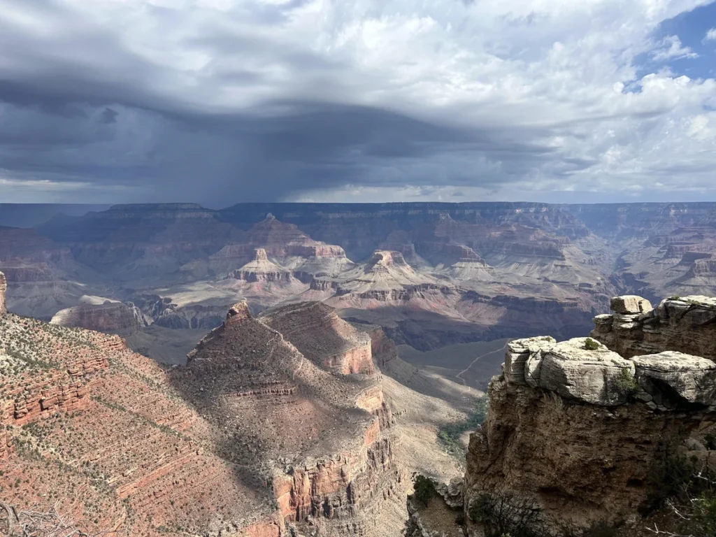
While the Caribbean and Gulf have been quiet, the Monsoon has been working on all cylinders. Monsoonal storms tend to crop up and hang out in place, thanks to a lack of motivational flow. Since they pop up, typically over a slope, and don’t move, there is a primary threat of flash flooding from these storms, as we have seen in the Grand Canyon.

Otherwise, Monsoonal storms fall on dry regions, and are famous for producing the haboobs and dust storms as the collapse under the weight of their own moisture content. Sandstorms are visually arresting, however this year looks to already be memorable for the torrential downpours. Flash flood watches and warnings are issued by the National Weather Service. Warnings in particular can be specific to individual valleys and riverways in their text, following the paths which floodwaters may take.
This is an akward spot

I’m not going to dance around things: Victoria-Weather smoked the competition in our forecast for Syracuse. Not even close. We picked up on something that nobody else seemed to pick up on: Flow behind a cold front was going to come right off the Great Lakes , which kept things nice and cool in Syracuse. Right off the Great Lakes. One them in particular.
Actuals: August 19th .02″ of rain High 82, Low 60
August 20th .01″ of rain, High 71, Low 57

Grade: C

Updates 8/31

10:14AM: There are two very similar, ongoing tragedies in the world right now that you may have been hearing about. The flash floods in both the Himalayas and the Grand Canyon have a couple of similarities. Notably, the flash flooding was enhanced greatly by the terrain, with water funneling into one course (the Trishuli and Colorado Rivers, respectively) and the suffering has been continued because in both areas, it is the monsoon season. The origins are different beyond that, including a seismic event and glacial collapse along the Nepalese border with China, and in Arizona, it has been a matter of persistent, torrential rains. The take away for me, for right now, is to respect flash flood warnings when they are issued for your area. They are very geographically specific, and as we have been reminded, flash floods can have devastating consequences.

1:50PM: Following up on an item from yesterday: It is presently 101 degrees in Wichita.

Updates 8/30

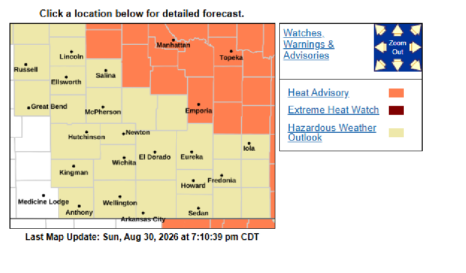
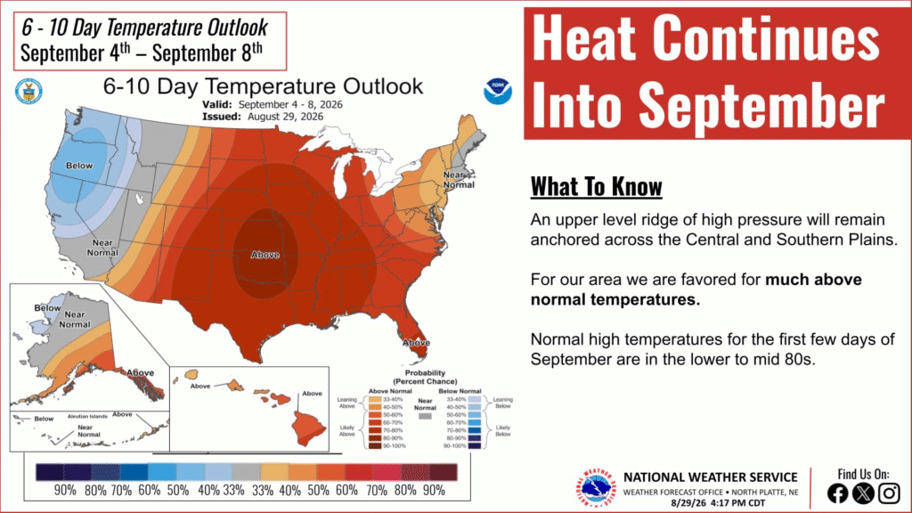
7:15: Heat will absolutely be building into the middle of the country this week. Wichita’s WFO isn’t scared though. They have a wedge on the map without a heat advisory in place

More accurately, it’s late August, and most folks in southern Kansas are pretty well acclimated to warm weather.

Updates 8/29

4:54PM: Do you remember going back to school, and it was still warm and wonderful out all day? Well, your kids will get to learn those hard lessons too, if they live in the middle of the country.

6:37: The smattering of showers that were expected in the northern Plains were fairly significant this morning, but the evening wet weather in the western Great Lakes is sparse. Just a lazy, late August weekend.

Brownsville, Texas to La Crosse, Wisconsin

This is going to be a three day, south to north adventure. We’ll be covering a stretch of 1533 miles, which, at a pace of 68.8mph, we will scream northward. That will be 550.7 miles a day, with a shade shorter day to conclude the trip. Here we go.

DAY ONE (Friday)

Brownsville, Texas

We have a broad, relatively weak area of low pressure in the Great Lakes, which is producing a similarly weak cold front sweeping from New England, through the Carolinas and west through the Gulf and into South Texas. There is going to be a smattering of showers between Brownsville and San Antonio, but north of the boundary, it will be clear and calm. We’ll make it to the Oklahoma border and stop in Thackerville for the night.

DAY TWO (Saturday)
The clear conditions will continue through Oklahoma and Kansas. The next wave will be coming into the Front Range, with a warm front across the northern tier of states. Like I said, clear conditions continue through our route, but it will be hot and humid on the way to Bonner Springs, on the outside of Kansas City, Kansas.

DAY THREE (Sunday)
The warm front will be lingering across the Upper Midwest, which may lead to a bit of shower or thunderstorm east of Des Moines. It won’t be a washout, and it is more likely to be pleasant in the Driftless area of southeast Wisconsin.

Hot forecasting

It was very warm in Jonesboro when we put together the local forecast. Temperatures were at or near the century mark both on the 12th and 13th, our forecast verification dates. Not only that, but 6/7 forecasters were able to keep their forecast to within 5 degrees of total error on the highs and lows for both days. The weather, and the forecasters were hot. Accuweather and Clime, even with these solid numbers, were able to separate themselves, and earned victory in northeast Arkansas.
Actuals: August 12th, High 99, Low 77
August 13th, High 100, Low 78

Grade: A

Updates 8/26

9:09AM: In a sign that the seasons are changing, the SPC outlook day over day is showing that risk areas are transitioning west to east over the course of the next few days. That is indicative of a wave pattern actually shifting, rather than a summertime, stagnant pattern, simply parked in the middle of the country. Congrats to those of you who enjoy fall. It’s coming!

Updates 8/25

2:00PM: We have the first enhanced risk I’ve seen in a while. It’s for the Texas Panhandle, and of the highest surprise, it is for hail and wind, and there isn’t even a 2% bound area for tornadoes.

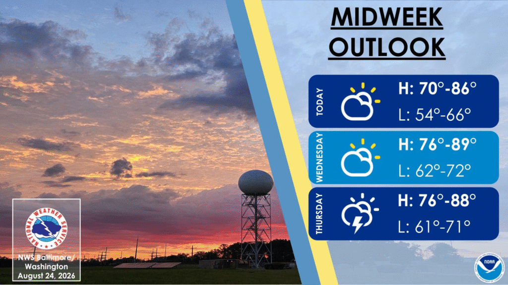
6:14PM: We had a pretty rainy weekend and beginning to the week, but can we live with this, Baltimore?