We put together a forecast for Phoenix in the middle of the month, and we were looking for a very hot couple of days in Arizona. Fortunately for local residents, it was colder than expected by all outlets on both the 14th and 15th! That’s right, it was only 106 on both days! The Weather Service won the day. Actuals: July 14th, High 106, Low 91 July 15th, High 106, Low 88
We aren’t yet to the peak of monsoon season in the southwest, but it is certainly summer. I expect some good numbers for our forecast outlets, and a toasty temperature read out.
At 1051AM, ET, Phoenix was already reporting a temperature of 98 degrees with clear skies. It would be a hot day again today. While the monsoon season hasn’t gotten fully cranked up, there are afternoon showers and storms erupting along the New Mexico border, with a threat for afternoon activity generally north of Tucson. The synoptic pattern is non existent, which means a persistence forecast is in order. Even if a stray storm wanders into Phoenix, the activity will erupt after peak heating has been achieved, so there won’t be much modification from being the model guidance. Tomorrow – Mostly sunny, High 111, Low 88 Tuesday – Hot, sunny, High 110, Low 85
TWC: Tomorrow – Mainly sunny. High 109, Low 88 Tuesday – Mostly sunny skies. High 107, Low 88
AW: Tomorrow – Hot with hazy sun; wildfire smoke will cause the sky to be hazy High 112, Low 89 Tuesday – Mostly sunny and very warm; wildfire smoke will cause the sky to be hazy High 109, Low 89
NWS: Tomorrow – Sunny, High 109, Low 88 Tuesday – Sunny, High 108, Low 87
WB: Tomorrow – Sunny and hot High 109, Low 87 Tuesday – Mostly sunny. High 109, Low 92
WN: Tomorrow – Mostly sunny, High 109, Low 88 Tuesday – Partly cloudy with isolated storms, High 108, Low 87
CLI: Tomorrow – Sunny, High 109, Low 88 Tuesday – Sunny, High 108, Low 88
I told you that it is monsoon season, but there isn’t anything to show for it on satellite.
It’s not often I get to put together a forecast for Phoenix and the high comes nowhere near double digits, but that was the cast this week. Temperatures rose only to the low 70s under a strong upper level trough, and the low were as cool as the low 50s. Each day was a near carbon copy of the other one, so that consistent Phoenix forecast strategy worked wonders, even as temperatures were much cooler than one would normally anticipate in the Arizona capital. It was Weatherbug who put together the top forecast for the day, and a good one it was. Actuals: Monday – High 72, Low 52 Tuesday – High 73, Low 51
It’s time for our second forecast of the day, and as luck would have it, things project to be quite different in the second forecast compared to the first.
At 451PM, MT, Phoenix was reporting a temperature of 66 degrees. Scattered showers were flowing through much of the Southwest, but right now, Phoenix was only reporting showers in the area, but not at the airport. At the upper levels, the base of a deep, autumnal trough as digging into the Four Corners, and cycling moisture through the region, leading to the showers in Phoenix, a band of thunderstorms south of the city near Casa Grande, and even some snow at elevation along the New Mexico border. Flow through the jet will weaken over the next 12 hours, as moisture also shifts to the northeast into the Plains. Still, with the upper level trough still in place, don’t expect a dramatic warm up, or even significant stretches of sunshine. Wind will pick up again on Tuesday evening, though expect conditions to remain mostly dry. Tomorrow – Mostly cloudy, High 71, Low 50 Tuesday – Partly cloudy, High 74, Low 47
TWC: Tomorrow – Sunny. High 73, Low 51 Tuesday – Generally sunny. High 74, Low 49
AW: Tomorrow – Cool with plenty of sunshine High 72, Low 50 Tuesday – Mostly sunny and cool; dry weather to get out and vote High 73, Low 50
NWS: Tomorrow – Sunny, High 72, Low 50 Tuesday – Sunny, High 73, Low 48
WB: Tomorrow – Sunny, High 71, Low 52 Tuesday – Sunny, High 73, Low 50
WN: Tomorrow – Sunny, High 72, Low 51 Tuesday – Mostly sunny, High 72, Low 49
CLI: Tomorrow – Sunny, High 73, Low 52 Tuesday – Sunny, High 74, Low 50
OK, so that doesn’t sound so bad for election day, but it sure sounds like a chilly way to spend a couple days for Arizonans. An active radar pattern appears in Arizona.
Hi! It’s been a while! After a bit of a hiatus, thanks to a move and a minor illness, I’m here to remind you of a forecast we issued on Mother’s Day. Phoenix is one of the few places where it is actually quite warm, and the Tuesday after Mom got her day, it hit 98 degrees. Nick Lachey might think that’s just right, but to me, it seems a bit toasty. In case you were curious, yes, Victoria-Weather was the furthest off on a forecast that was won by the tag team of Accuweather and Weatherbug. Actuals: Monday, May 13th, High 91, Low 655 Tuesday May 14th, High 98, Low 71
Anthony is on vacation, and I am in the process of moving, so our posting has become a admittedly sporadic. I’m here now, though, to take us through a lengthy spring trip, potentially through the teeth of some strong storms. IT will take us 3 1/2 days to cover 1873 miles, which means a surprisingly lackadaisical 66.9mph. We’ll net 535 miles on the first three days, with, well, about half that on Wednesday.
Phoenix, Arizona
DAY ONE (Sunday) We don’t usually think about the Desert Southwest when considering the threat for showers, thunderstorms and cold fronts, but a feature will be sliding into the west coast this weekend with a pretty sizeable cold front moving towards central California. It will eventually bring some rain to northern Arizona, but it looks like we will be sneaking into New Mexico with plenty of time to spare. It should be a seasonably warm day, except in the high reaches of the Rockies between Phoenix and Santa Rosa, New Mexico, the day one destination.
DAY TWO (Monday) Monday has caught the eye of the Storm Prediction Center already as a moderate risk day. In my eyes, this means that it will almost certainly translate to a high risk day, and the high risk will be right along our route, particularly in the western half of Oklahoma. We will see some showers potentially starting around Amarillo, with the severe threat starting around Shamrock, Texas. Storms will be most likely, as it appears right now, around Woodward and Watonga, north of our route, but we will be in the mix up to and through the Oklahoma City metro area. Tulsa doesn’t seem to be under the gun on Monday as much as other parts of the state, and we will call it a day in Claremore, hopefully able to rest easy as severe storms and tornadoes stay well to the west.
DAY THREE (Tuesday) The storm system will sit and spin over the High Plains along the Colorado/Kansas border Monday until Tuesday, which will cause dry air to cycle in from the southwest, and rope out the cold front. It will stall over eastern Oklahoma and western Missouri. There may be some showers and thunderstorms as we get started, however we should be through them by the time we get past Springfield, Missouri. The activity is likely to get stronger as the day goes on, but our trek towards St. Louis and Illinois will be hot, humid and free of rain. We’ll make it to Terre Haute, Indiana before we finish things off on Wednesday.
DAY FOUR (Wednesday) The cold front will get started again overnight Tuesday into Wednesday as the system spins north and loses it’s bearings. Showers and perhaps an embedded thunderstorm will be possible over Indiana and Ohio on Wednesday, but they won’t be nearly as intense as the storms we see on Tuesday.
I think a nice trip down to the desert would suit the winter much better. Instead, it seems like someone in the Midwest wishing summer would arrive is getting too much too fast. The drive will take 3+ days, and cover 1771 miles. The drive will be surprisingly slow, at only a bit more than 65mph, which means the first two days will be through after 524.7 miles traveled. Chicago and some time off interstates will contribute o our delayed transit, but also provide a chance for more scenery.
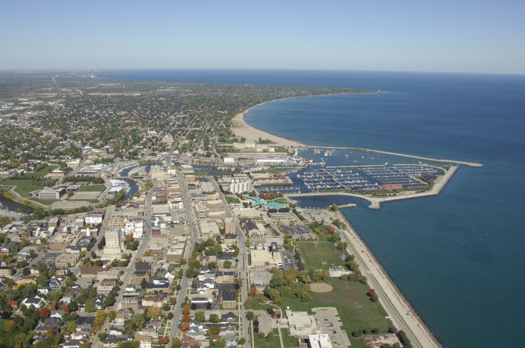
Racine, Wisconsin
DAY ONE (Thursday) All right, let’s go! Midwest driving is the best. Wide open spaces, but with enough towns so you can find a gas station, and won’t need to pee on the side of the road in case of emergency. There is a pretty small time cold front moving through the Upper Midwest, and it is more likely to touch off a few thunderstorms in Minnesota and northern Wisconsin tomorrow. There will be enough general instability in southern Wisconsin and Iowa that we will probably see quite a bit of puffy cumulus clouds during our day, but none that will give us any reason to turn on the wipers, We’ll turn south at Des Moines. and reach Lathrop, Missouri, northeast of Kansas City before the day’s end.
DAY TWO (Friday) A menacing batch of low pressure will develop through the day in the Colorado plains on Friday. Ultimately, it won’t produce a lot of thunderstorm activity but the activity that is generated will almost be entirely supercellular, with large hail and tornadoes the primary concern. These low precipitation, high rotation type of super cells are a chasers dream, so don’t be surprised by traffic in western Kansas as we head for the Panhandles. Of course, that added traffic will also probably indicate very nasty weather near by. The dry line will set up east of Guymon, Oklahoma, and we will make it to Stratford, Texas, in the far northern Panhandle, safe from the threat of a tornado outbreak on Friday night.
DAY THREE (Saturday) The thing about New Mexico and Arizona is that they are always (save for far eastern New Mexico) on the dry side of dry lines. Sun and heat are going to bear down on the lower lying terrain, while it will be a bit cooler in the higher elevations. Some light rain is possible up in Colorado, but by golly, we’re going to get to Phoenix hot, sunny and sweaty, just they way it’s supposed to be.
Happy Mother’s Day to all the Moms up on Sunday night reading weather blogs!
At 551PM, PT, Phoenix was reporting a temperature of 80 degrees with overcast skies. The overcast was a high overcast, and not indicative of any significant weather in the area. There was a it of instability in the southwestern United States in conjunction with an upper level wave, but the shower activity has steered clear from Phoenix. The tail of the jet providing the upper level instability for these showers and storms will pull west through Texas as the week begins. This will leave a weak upper level ridge in the desert Southwest, and Phoenix is in the clear to start the work week. Tomorrow – Increasingly sunny, High 91, Low 68 Tuesday – Sunny, High 95, Low 75
TWC: Tomorrow – A mainly sunny sky. High 94, Low 66 Tuesday – Partly cloudy skies. High 98, Low 70
AW: Tomorrow – Partly cloudy skies. High 92, Low 66 Tuesday – Mostly sunny; warm High 97, Low 71
NWS: Tomorrow – Sunny, High 94 Low 65 Tuesday – Sunny, High 97, Low 69
WB: Tomorrow – Sunny and warmer, High 92, Low 65 Tuesday – Sunny in the morning then becoming partly sunny, High 96, Low 71
WN: Tomorrow – Sunny, High 94, Low 65 Tuesday – Mostly Sunny, High 97, Low 69
FIO: Tomorrow – Clear throughout the day. High 95, Low 65 Tuesday – Clear throughout the day. High 98, Low 68
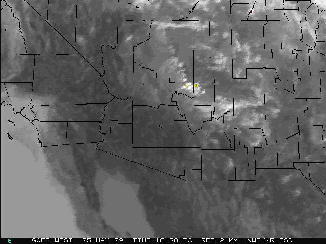
Looks like we are on the cool end. Hard to think warm thoughts when you are living a cool spring. Here is the satellite with a rogue thunderstorm closer to Yuma.