Casper, Wyoming

Casper is the 2nd largest town in the state of Wyoming. You may not be impressed by that, but it would be the largest town in Vermont!

At 853PM, MT, Casper was reporting a temperature of 59 degrees with clear skies. The clear skies would typically mean an overnight cooldown, however the winds were brisk and from the south, which should temper any radiative heat loss. The winds were gusting over 30mph.
Low pressure in the Canadian Rockies is the culprit for the brisk winds and warm temperatures. The trough to the north will pass to the east, with a surface area of high pressure and more stable conditions arriving by Monday morning, with rain staying entirely out of the forecast.
Tomorrow – Mostly sunny, High 67, Low 47
Monday – Sunny, High 67, Low 36

TWC: Tomorrow – Sunshine and some clouds.  High 68, Low 46
Monday – Sunny. High 69, Low 36

AW: Tomorrow – Partly sunny and pleasant High 67, Low 40
Monday – Plenty of sunshine High 70, Low 36

NWS: Tomorrow – Sunny, High 64, Low 44
Monday – Sunny High 66, Low 37

WB: Tomorrow – Mostly sunny. High 61, Low 44
Monday – Mostly sunny. High 66, Low 40

WN: Tomorrow – Mostly sunny, High 64, Low 43
Monday -Mostly sunny, High 66, Low 36

CLI: Tomorrow – Mostly cloudy, High 64, Low 40
Monday – Sunny, High 68, Low 35

Let’s do something different. The camera on the Wyoming Medical Center here is from Casper.
Updates 10/16

6:15PM

Pass.

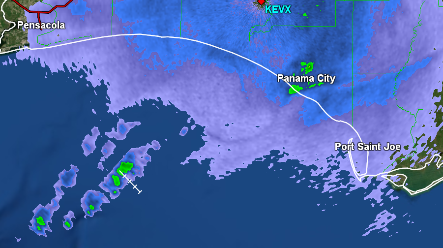
11:24PM: The coming cold front for Tallahassee is indeed producing a band of showers off the coast of Destin into the Gulf, but nothing on shore. Victoria-Weather had rain in the forecast, but it’s looking to stay offshore. Good news, Tallahassee!

11:58PM: Maaaaaybe a little something in Panama City, now?

Tallahassee, Florida

Tallahassee is in the process of recovering from Isaias, which brought torrential rains just to the west of the state capital.

At 853PM, ET, Tallahassee was reporting a temperature of 74 degrees with clear skies. An area of high pressure lay over the Florida Peninsula, but a deep digging autumnal trough over the Mississippi Valley is going to start churning up some southerly flow across the Gulf.
The boundary associated with the trough will arrive overnight Friday into Saturday morning. Far removed from the circulation of the surface flow, and coming after daylight, it will not bring much if any precipitation with it, but it will bring a taste of much cooler air to the Florida Panhandle to kick off the weekend.
Tomorrow – Mostly sunny, clouds late, High 89, Low 65
Saturday – Clouds early, with some predawn drizzle, High 73, Low 54

TWC: Tomorrow – Except for a few afternoon clouds, mainly sunny. Hot. High 89, Low 64
Saturday – Partly cloudy skies. Much cooler. High 74, Low 59

AW: Tomorrow – Warm with plenty of sunshine High 88, Low 60
Saturday – Breezy in the morning; otherwise, less humid with plenty of sunshine High 75, Low 60

NWS: Tomorrow – Areas of fog before 10am. Otherwise, sunny High 89, Low 66
Saturday – Sunny, High 73, Low 60

WB: Tomorrow – Areas of fog in the morning. Sunny. High 87, Low 67
Saturday – Sunny. Much cooler. High 74, Low 61

WN: Tomorrow – Mostly sunny, High 89, Low 66
Saturday – Mostly sunny, High 74, Low 62

CLI: Tomorrow – Sunny, High 89, Low 64
Saturday – Sunny, High 74, Low 58

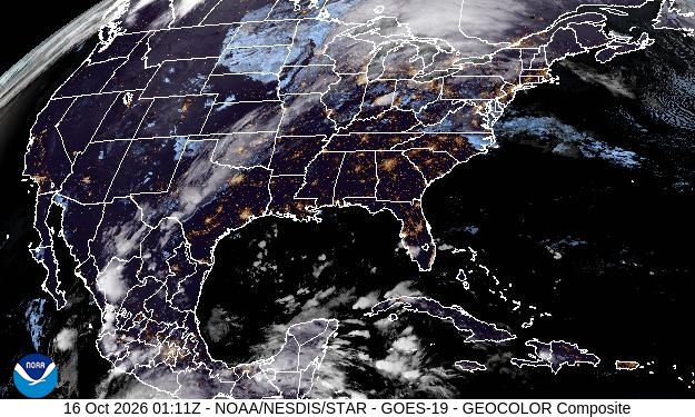
I’m the only one who has rain in the forecast, but we all see a big change coming to the weather in Tallahassee. You can see the band of clouds through the center of the country, separating winter and summer.

Big changes, but more of the same

Our forecast in Allentown oversaw clearing skies and a warmup, with high temperatures from Sunday the 4th climbing 7 degrees to Monday’s high. This coincided with more sunshine, and evacuation of the light showers they had in town. There was one consistency, however, in that The Weather Channel continued their hold on forecasting supremacy that guided them through September.
Actuals: Sunday October 4th, .01 inches of rain, High 61, Low 54
Monday, October 5th, High 68, Low 50

Grade: A

September Forecaster of the Month

After a lull in the late summer, The Weather Channel came storming back in September. They were the top outlet in 60% of the forecasts for the month, and manhandled the competition. They have a commanding lead in the forecast wins, but when they’ve been bad, they were really bad, so there is a lot to play for this year. If TWC keeps forecasting like they did in September, they will be hard to catch!

Outlet Forecast Wins (year)
The Weather Channel 8.5
Accuweather 5.66
Victoria-Weather 4.33
WeatherNation 3.66
Clime 3.66
National Weather Service 2.83
Weatherbug 0.33

Polo not to be found

Before Isaias grabbed headlines in Florida, we were eying Polo in the eastern Pacific. The storm was projected to slide into the Southwest and pump moisture into the southern Plains. A couple of outlets thought the threat was great enough to include rain throughout the forecast for Sherman. Instead, one of the outlets, The Weather Channel, who kept the forecast dry on the 29th, put together a nearly perfect forecast and won the last forecast of September.
Actuals: September 28th, .01″ of rain, High 90, Low 70
September 29th, High 93, Low 73

Grade: A

Updates 10/14

1:23PM

Fall storm systems are just dreary. Cold and rainy, without the strong thunderstorms or stacking of snow. Just unpleasant. Sorry that this is coming.

8:30PM

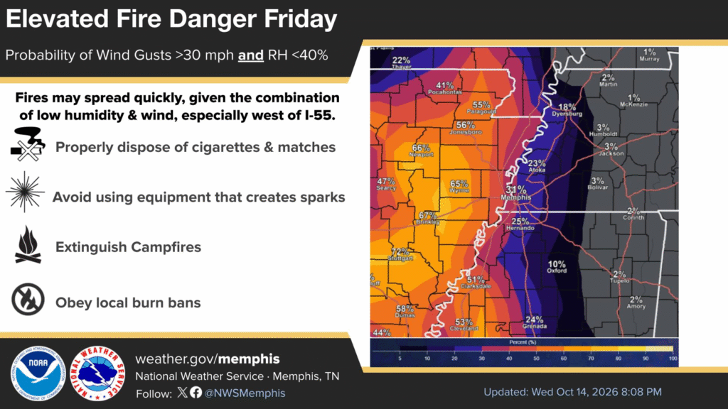
Flooding rains to the east, thanks to Isaias, the pending rain storm to the north this weekend, and yet, Arkansas is going to be looking at a fire risk over the next couple of days. The weather, at times, is on a razor’s edge.